This blog is designed to highlight the paddling opportunities within South Dakota, mainly within a 50-mile radius of Sioux Falls. While Sioux Falls is far from the adventure of coastal regions, there is a certain satisfaction in utilizing the available waterways to observe weather, water conditions, and the landscape along the shoreline. In addition, there is a wealth of animal life on the waters of small South Dakota lakes, rivers, and creeks, including geese, ducks, pelicans, great blue heron, egrets, hawks, owls, perching birds, deer, raccoons, and beaver. Eagles, fox, and coyote are also sometimes spotted.

The sites described are places where I have kayaked over the past few years, mostly in South Dakota but sometimes including locations in Iowa and Minnesota. One of the best sources of information on the accessibility of small lakes is the South Dakota Atlas and Gazetteer, the large map book of South Dakota. Lakes with a public access are generally identified by a boat symbol marking the location of a launching site on public land.

You will notice the menu of paddling locations on the right side of the blog. Each of the postings is linked to one of the areas, and my intention is to provide a continuing review of the places where I paddle. Perhaps these narratives will help readers select waterways of interest to them. Please feel free to offer a comment regarding any of my postings; I would welcome the dialog.

I also maintain a companion blog that describes hiking opportunities within the Sioux Falls area. You can access that blog at: http://hikingsiouxfalls.blogspot.com

Wednesday, May 28, 2008

Diamond Lake

IMG_2059.JPG
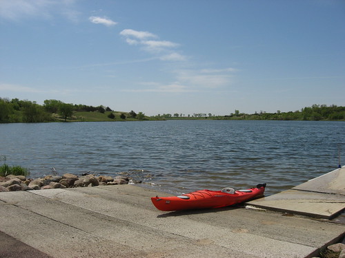
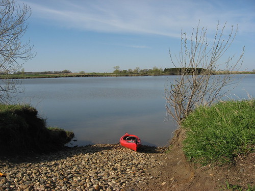
A week or so ago, I received a report from Ryan Schellpfeffer, one of our area paddlers, of a cruise on Diamond Lake. This was a new body of water for me so, in addition to his notes of the cruise, I accessed the South Dakota Statewide Fisheries Survey site to learn more about the lake. This lake is nearly three times as large as Lake Alvin and is located in the northwestern corner of Minnehaha County. To get there from Sioux Falls, a direct route would be to go west on Highway 42 (West 12th Street) to Highway 19 and turn north. Proceed on Highway 19 through Humboldt (there is a little jog through town) and continue north for about 14 miles to 244th Street, just on the Minnehaha/Lake counties line. Turn left (west) on 244th Street, a gravel road, and continue for about 1.5 miles. Just at the bottom of a rise, after going a little over a mile, there is a sign reading “Road Closed.” The road continues, however, for maybe 100 yards from the top of the rise and ends at a state provided access point. This access point has a good graveled parking area, a dock, and a vault toilet. As is the case nearly always, there are no directing signs to the lake nor an identification sign at the site.
IMG_2035.JPG
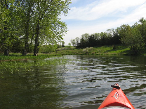
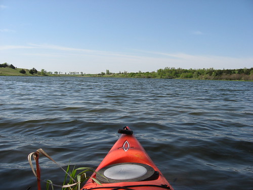
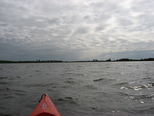
The sky was overcast as I arrived about 9:00 a.m., the temperature was in the low 50s, and the winds were light out of the east. At first I thought that my hands were going to be cold on the paddle, but that passed as I began moving. By the time I finished my circuit of the entire shoreline, the overcast had broken and there was intermittent sun. The winds had freshened, however, to what I would call moderate. There was a nice lee along the southern and western shores, but as I crossed over to the north side and continued east, the wind was creating enough wave action to require attentive paddling. The lake is pretty wide at the western end, and I was conscious of how difficult it would be to have to swim for it in that cold water with waves at about 8 inches or so. The bottom was visible at about 4 feet along most of the lake. The state reports that the maximum depth in Diamond Lake is 12 feet, and the mean depth is 6 feet.
IMG_2053.JPG
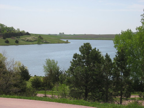
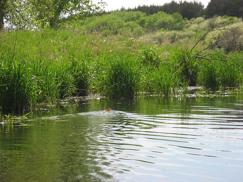
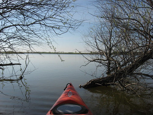
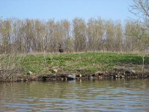
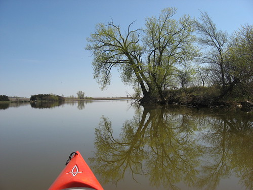
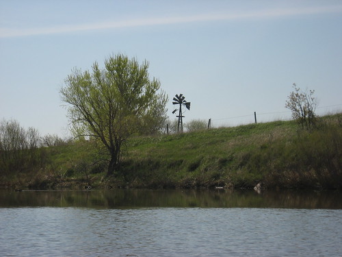
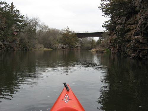
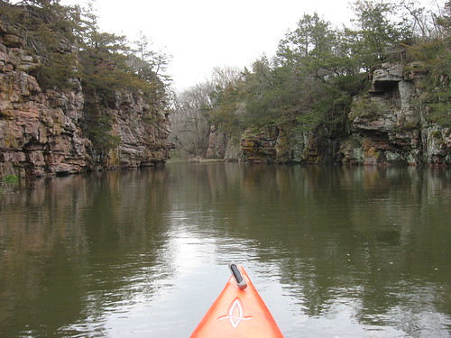
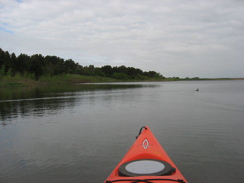
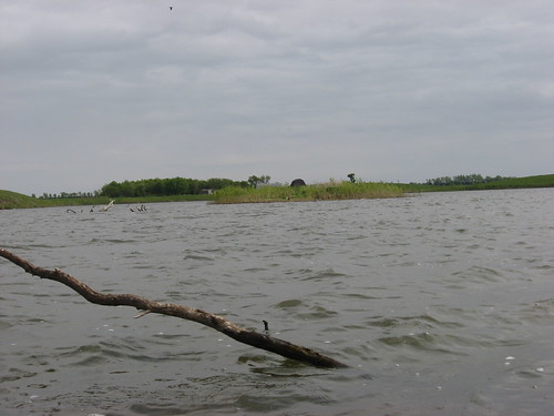
The dock is on the northeast side of the lake. To the right, north, the lake ends in a marshy area. To the left, south, the shore is owned by the SD GFP and is used as a wildlife production area. The east side of the lake has trees and brush cover all along the shore for perhaps a mile. A map of the lake seems sort of like a jumping dog to me. It extends west and south for over a mile. This is the most scenic part of the lake. The western and northern shore is more open with high banks but not many trees.
IMG_2051.JPG
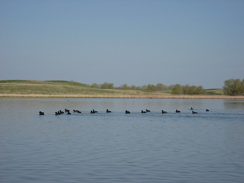
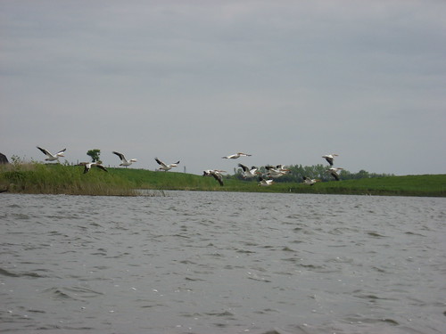
On the northwestern part of the lake, there is a small island covered with willow brush and shelving from a high bank of about four feet on the eastern side down to the water’s edge on the western side. There was a flock of pelicans hanging out along the western side of the island, and I was able to watch them take off upon my approach.
IMG_2046.JPG
IMG_2048.JPG
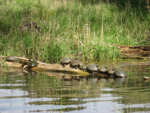
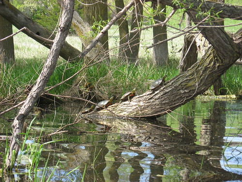
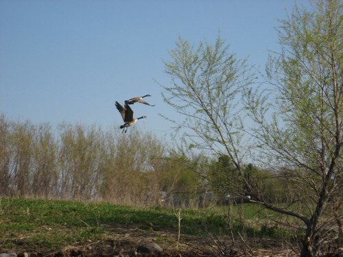
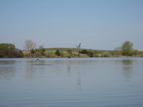
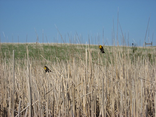
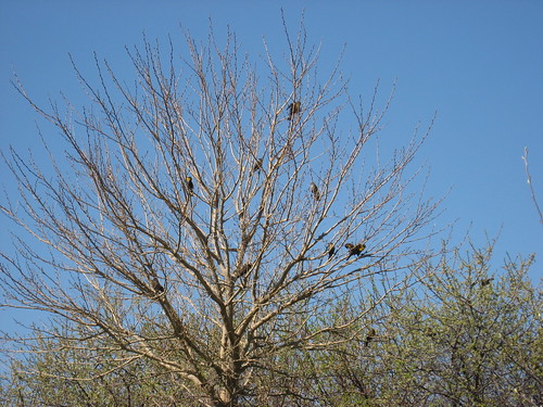
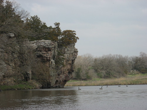
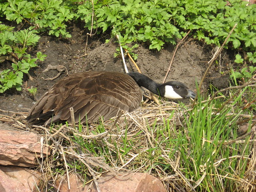
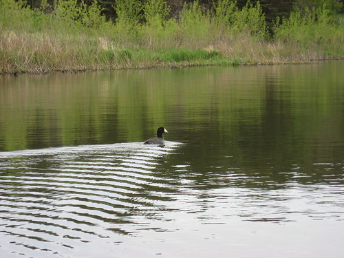
There were lots of ducks nesting in reeds along the shoreline in most parts of the lake. I saw a few great blue heron and a number of geese as well. Redwing and yellowhead blackbirds were plentiful, along with smaller swallow type birds. On two occasions, I saw muskrat swimming nearby from their lodges in the shallows.
IMG_2032.JPG
Diamond Lake is another of those seldom visited bodies of water around Sioux Falls. It is an interesting lake to visit. I mostly enjoyed seeing a lake in Minnehaha County that I did not know existed, even though I thought I had become an authority on area waters. Any lake with a resident flock of pelicans is interesting. It is pretty wide, and I would think that it might be a little tricky with a stiff wind, particularly if it were coming out of the north. On this day, the lake was deserted: just the breeze, the birds, the landscape, and me. The lake is 46 miles from my eastside Sioux Falls home, and that means that a person will spend nearly as much time on the roundtrip drive as on the lake.
IMG_2054.JPG
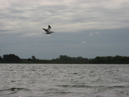
Still, it is a real privilege to be sharing a deserted lake on a weekday morning with such graceful pelicans. This is one of the benefits of being retired and living according to a personalized agenda.

Monday, May 19, 2008

Lake Lakota: A Weekday Spring Cruise

IMG_2027.JPG
Today, I decided to take my kayak out to Lake Lakota, part of Newton Hills State Park and 28 miles from my eastside Sioux Falls home. It was a great morning: mostly sunny with a few clouds in the sky, temperature about 55 or so, and a moderate wind out of the south. The water today was clear to about four feet: nice clarity for a South Dakota lake. Lake Lakota is a "no wake" lake, and that adds to the serenity of this body of water.
IMG_2026.JPG
There were no boats on the lake, although there were a couple of guys fishing at the public access spot on the southwest side of the lake and a guy in waders in the shallow weeds near the dock in the park area. Essentially, though, I was alone on the lake and was able to move around the perimeter poking into the inlets, coves, and among the weedy shallows without running into anyone.
IMG_1989.JPG
On this occasion, I wanted to go up into the several inlets that are scattered along both shores of the main body and also up into the creek that feeds Lake Lakota at the extreme northwestern end, up the west extension of the lake. This lake is about the same area as Lake Alvin, but the shape is markedly different. The shoreline is especially interesting, in part because the entire lake is within the Newton Hills State Park; there are no houses to be seen and no indication of agriculture. It is truly a nature area with plenty of green vegetation around the shoreline and in the hills surrounding the lake.
IMG_2011.JPG
Up in the inlets, I came across beaver a number of times. One was along the shore as I approached in my kayak and startled me as he shot off the bank, into the water alongside me, and moved like a torpedo under my kayak.
IMG_2022.JPG
The aquatic vegetation that so captured my attention last spring when I visited the lake was not present today. Also, last year there were lots of lilies on the surface within the western extension of the lake; but this year, all that was missing. I wonder if the late spring this year has caused some slowdown in plant growth. Last year I also saw lots of frogs on the lilies, but this year I saw no frogs at all.
IMG_1986.JPG
There were lots of turtles, however, mostly in that western arm of the lake. I did not see the huge turtles that I remember from last year, but I saw dozens of small and medium size turtles sunning themselves on downed trees in the shallow and marshy water. Sometimes the turtles were all lined up in a group of six or more along one especially sunny semi-submerged small tree trunk. The largest ones I saw were dinner-plate size, while the smallest were about the size of orange half. I feel something like a safari hunter in my kayak as I approach with camera ready to capture the turtles on disc before they jump back into the water. I have assumed that turtles have poor eyesight, but they must have sharper vision than I thought. They are able to carefully gauge the approach of a kayak, even a silent kayak, and jump off into the safety of depth. So, it now seems obvious that the turtles with their neck stretched out somehow are able to know when it would be wise to depart the log. I felt a little guilty in causing them to jump back into the water when it must be very laborious to climb out and up a log or horizontal tree stump.
IMG_2016.JPG
IMG_2009.JPG
There was a moderate level of bird life, mostly redwing blackbirds and flocks of a swallow-type of bird swooping over the surface of the lake on the search for insect prey. Ducks flew up and away upon the approach of my kayak on several occasions, but there were no geese or pelicans.
IMG_1982.JPG
Lake Lakota is a very tranquil spot for a contemplative paddle. It is also a great place if people have to wait for you. The dock area is alongside a swimming beach and changing building, picnic shelter, toilet, and a great view over the lake. There are a couple of other narratives about this lake from visits in past years, and you can access these from the menu of area waterways on the right side of the blog.

Wednesday, May 14, 2008

Grass Lake: A Spring Cruise on a Quiet Morning

IMG_1943.JPG
This morning began clear, calm, with a temperature of 47 degrees. The day followed a series of cold, windy, and rainy days that characterized the past week or more here in Sioux Falls. It was impossible to resist the opportunity for an early morning cruise on Grass Lake. I set out from Sioux Falls about 8:00 a.m. and arrived at the lake about 8:40 or so. Grass Lake is west of Sioux Falls, along Highway 42 (12th Street), past the turn-off to Wall Lake, to 459th Avenue. There is a big microwave antenna on the south side of Highway 42 just at the turn north on 459th Ave. Grass Lake is located less than three miles north, past 263rd Street, on the left (west) side of the road. There is a small sign designating the public access area just a hundred yards or so down a dirt road. There is a rough launching ramp for trailers, and it seems to have been improved some since my last trip there. Ample parking is available in this grassy access point, although there is no toilet facility (other than the woods, of course).
IMG_1953.JPG
The lake was deserted, as usual, when I arrived. The waters were calm, the skies clear, and just a slight chill in the air. My fingers were a little stiff on the paddles at first, but that all faded as the paddling began and the sun became a bit warmer. The shoreline along the lake is in transition from winter brown to summer green. The progression of change varies among the types of bushes and trees, but there is an overall “greening up” all around the lake.
IMG_1949.JPG
IMG_1947.JPG
There was a constant chatter of bird life as I cruised past the islands and along the shore. Geese were the loudest, but ducks and coots outnumbered the geese today. As I passed the island off the north shore, a group of a dozen or so geese flew off with loud “honking.” One stayed on the shore, however, stretched its neck high and gave me a stern look, perhaps a warning to stay off the island. The pelicans that normally inhabit the western end of the lake were absent; instead, the gulls had taken over that station for now.
IMG_1956.JPG
IMG_1961.JPG
There were lots of yellow-headed blackbirds out today, perching on reeds or in trees. Grass Lake extends west until it ends in a marshy area nearly in the yard of a farm. This is where I first saw the yellow-headed blackbirds, but then I came across another spot along the southern shore where there seemed to be dozens of them in a couple of trees. These birds have a harsh voice, and there seemed no end of them once I became conscious of their presence.
IMG_1970.JPG
IMG_1979.JPG
I did not see any mammals today on the cruise, although I did see a fox scampering along a field on the return south on 459th Avenue. As the sun began to warm the water, a few turtles came out to bask and soak up some rays.
IMG_1981.JPG
It was good to see that the windmill on the southwestern shore made it through the winter okay; from its condition, it must have graced this shoreline for decades. I always enjoy looking at the silhouette of that structure from various angles and in different lighting conditions.
IMG_1977.JPG
Grass Lake is about 1.5 miles long, so a cruise along the shoreline and up into the few bays and by the islands may be 4.5 miles or so. This is about a 90-minute cruise with plenty of time to search for “critters” along the shore, to check out the abundant bird life, and to appreciate the changing landscape. Around 10: 45, I was off the lake and home by 11:25. By then, the temperature had risen to 55 degrees, and I felt like a heat wave had fallen upon the land!

This is one of my favorite lakes in the area, and I have written several posts about it over the past three years. You can check out narratives of earlier cruises on Grass Lake by activating the button on the right side of the home page.

Thursday, May 01, 2008

Split Rock Creek and Up Devil's Gulch

The weather forecast is gloomy for the next few days here in South Dakota. Today has been predicted as the last nice day for the next week or so, with snow again possible this weekend. So, this morning, nearly on the spur of the moment, I decided to take advantage of the still decent weather and go out with my kayak for a short cruise. The skies were partly sunny this morning, the temperature was about 50, and the winds were moderate. I set out about 8:30 to drive to the Garretson City Park and head upstream on Split Rock Creek through the palisades.

IMG_1905.JPG

The dam at the city park is a demarcation point. Downstream, Split Rock Creek descends through rapids and moves through Split Rock State Park. Kayakers in the area use this portion of the waterway for white water thrills early in the spring as the snow melts. Above the dam, the creek continues for a couple of miles to a set of rapids which effectively ends the extended backed up water and limits further passage with a canoe or kayak.

IMG_1918.JPG

The high palisades on both sides of the creek are spectacular in the way they loom over the waterway. Trees grow improbably out of cracks in the high cliffs and on ledges. There is a wide variety of bird life on this waterway, including a very large colony of cliff swallows during much of the summer. The swallows have not returned yet, but I saw many ducks and geese and a turkey today. The waterfowl seem to be nesting now and present an interesting sight as a kayak approaches. Most of the time, the ducks swim or take off for a short distance. Groups of geese began honking at the sight of my kayak, but those nesting geese seemed almost docile at my approach.

IMG_1907.JPG

IMG_1926.JPG

Whenever I go up Split Rock Creek at this location, I almost always head up into Devil’s Gulch to check out that especially secluded little pond community. Departing from the launching point in the park, almost immediately the paddler comes to a four-arch bridge on the right side that leads into the camping part of the park. Passage through one of the arches is easy for a kayak. I usually just approach the arch, lean down, and push off the top of the tunnel until I am through.
IMG_1928.JPG
On the other side, the water is deep and wide enough to permit passage for a half mile or so. Moving up this feeder stream, the paddler passes under a railroad bridge and into a new set of palisades on a somewhat smaller scale than those on the main body of Split Rock Creek.

IMG_1937.JPG

This is a very quiet spot, and I suppose that it is not frequently visited. The palisades, the shoreline, the slowly moving water presents their own attraction. I like to get into the corner of a set of high rock cliffs and just sit there quietly to observe the life in this tranquil spot. I think of the passage of seasons and the flow of events within this secret set of connected pools. Two beaver kept me company up in the gulch today.

IMG_1931.JPG

This is a fairly short cruise on Split Rock Creek. Today, I was on the water for about 75 minutes. But, I was alone and able to focus upon the landscape, the birds, and the sky. I like being alone in such surroundings. Garretson is about 22 miles from my eastside Sioux Falls home, so this was a 30 minute drive each way, and it fit one of my basic rules: more time on the water than on the drive. By the time I got home, the skies had become completely overcast and rain seemed likely.