This blog is designed to highlight the paddling opportunities within South Dakota, mainly within a 50-mile radius of Sioux Falls. While Sioux Falls is far from the adventure of coastal regions, there is a certain satisfaction in utilizing the available waterways to observe weather, water conditions, and the landscape along the shoreline. In addition, there is a wealth of animal life on the waters of small South Dakota lakes, rivers, and creeks, including geese, ducks, pelicans, great blue heron, egrets, hawks, owls, perching birds, deer, raccoons, and beaver. Eagles, fox, and coyote are also sometimes spotted.

The sites described are places where I have kayaked over the past few years, mostly in South Dakota but sometimes including locations in Iowa and Minnesota. One of the best sources of information on the accessibility of small lakes is the South Dakota Atlas and Gazetteer, the large map book of South Dakota. Lakes with a public access are generally identified by a boat symbol marking the location of a launching site on public land.

You will notice the menu of paddling locations on the right side of the blog. Each of the postings is linked to one of the areas, and my intention is to provide a continuing review of the places where I paddle. Perhaps these narratives will help readers select waterways of interest to them. Please feel free to offer a comment regarding any of my postings; I would welcome the dialog.

I also maintain a companion blog that describes hiking opportunities within the Sioux Falls area. You can access that blog at: http://hikingsiouxfalls.blogspot.com

Sunday, July 27, 2008

A Guest in Town

A Guest in Town and an Introduction to Kayaking
L1020685.JPG
This past week we have hosted a group of people who were here in association with a reunion of my wife’s family and also a celebration of our son’s marriage last summer in Hawaii. Among the guests was our daughter in law’s father, an outdoors kind of guy in his 50s who lives in New Mexico, a serious hiker and former surfer. He was interested and even eager to try out a kayak for the first time. So, the question for me was where to take him out for a first cruise and in which of my three kayaks.
IMG_2439.JPG
IMG_2421.JPG
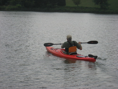
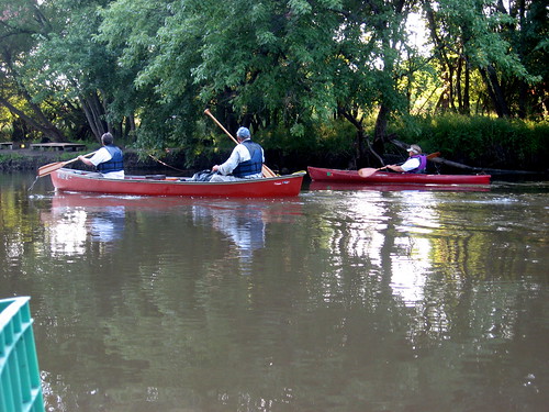
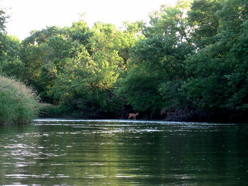
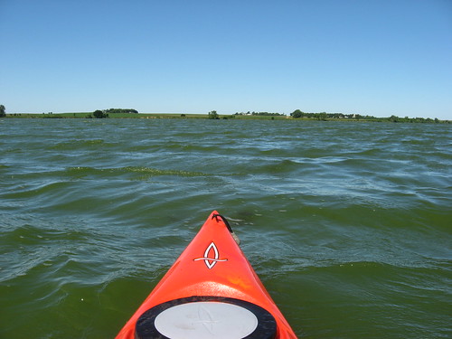
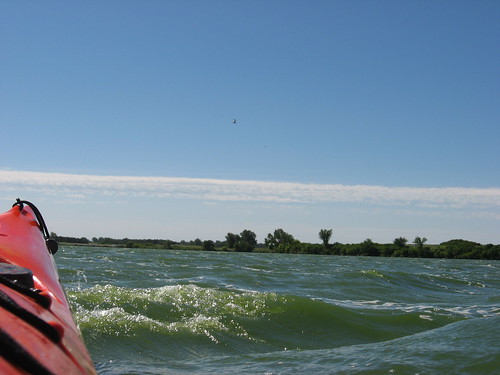
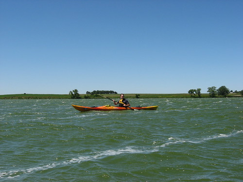
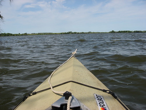
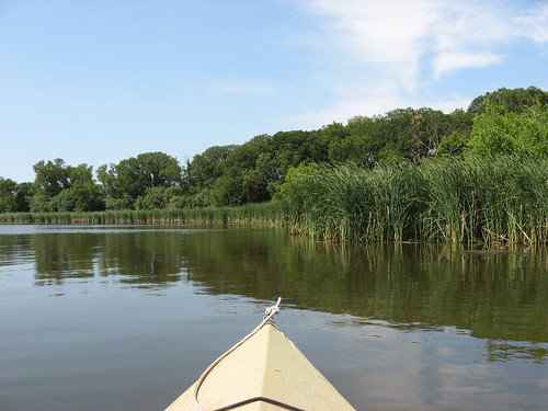
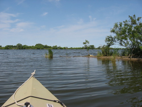
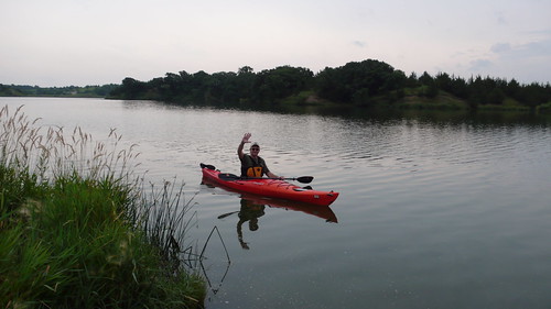
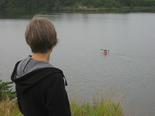
I decided to take him out to Lake Alvin on a weekday morning for his first experience in a kayak. We went to the public access area on the northwestern end of the lake. This site offers an easy launch, a fairly narrow width, and a likelihood of being deserted. There is also likely to be a sheltered area along one of the shorelines. The setting of Lake Alvin tends to reduce the chances of wind sweeping either along or across the surface creating uncomfortable wave action. I decided that a first cruise would be best if he were alone on the water, free to move about on his own volition. Being the captain of your own craft and making your own decisions about speed and course seems one of the attractions of a kayak to me. So, I coached from shore as he practiced the fundamentals and then left him to his own experimentation on his first cruise across and then down the lake.
IMG_2434.JPG
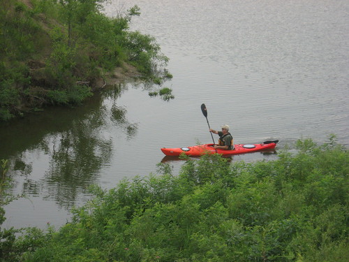
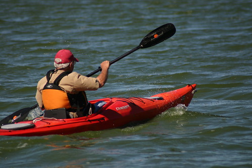
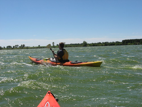
My 13-foot Dagger was the boat of choice, and John set out, easily finding a paddling rhythm that suited him. He found that the pedals for the rudder did not fit his lanky frame, so he just didn’t use them and instead practiced different strokes and leans to help in tracking and turning. Quickly, he seemed to feel confident with the boat and continued first across the lake and then down to the eastern end. He kayaked along the shoreline, into the outlet by the spillway, and back to the dock within the Recreation Area. This first cruise took about an hour, and he felt exhilarated by the experience. After we returned home, he began reading through old copies of Sea Kayaking magazine and thinking of how kayaking would fit into his outdoors life in the desert of New Mexico. Soon, he began talking about a lake that wasn’t too far from his home and how that setting offered great opportunity for exploration.
IMG_2431.JPG
IMG_2436.JPG
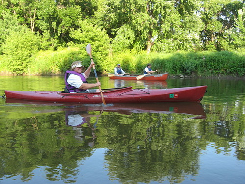
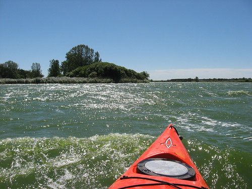
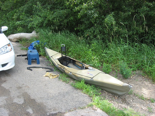
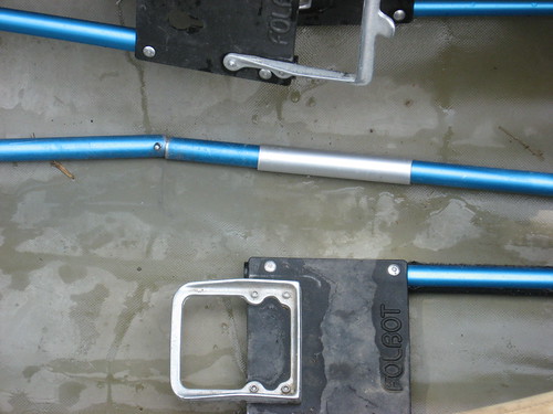
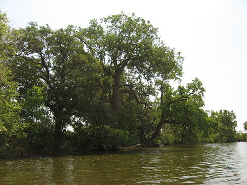
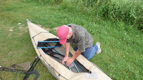
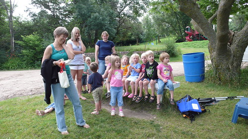
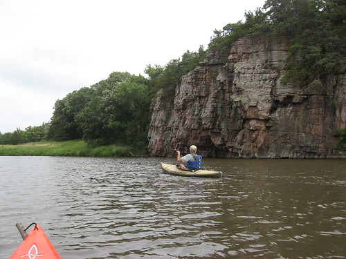
The next day, I took him out to Split Rock Creek to explore the palisades of that waterway extending upstream from the city park in Garretson. This time, I decided to accompany him on his second cruise. He wanted to try out my Folbot, so he assisted me in assembling it. Just as we began the process, a group of about a dozen young children in an organized group led by an adult showed up and gathered around to watch. Remembering my last effort with the Folbot, I regretted not being able to demonstrate irritation with any assembly difficulty. As the object of their attention, I would be inhibited from cursing and expressing frustration with the sleeves that hold the bow and stern assemblies together This time, however, the boat went together without any difficulty and seemed almost a demonstration of ease in assembly.
L1020754.JPG
L1020749.JPG
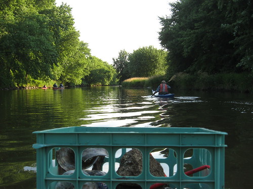
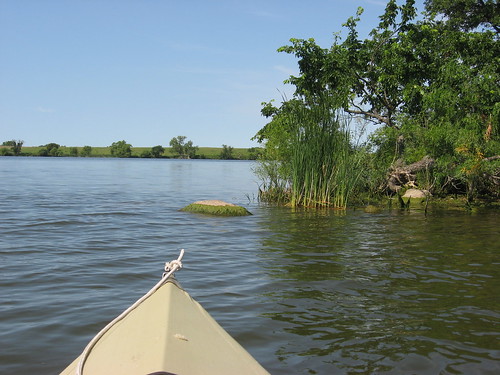
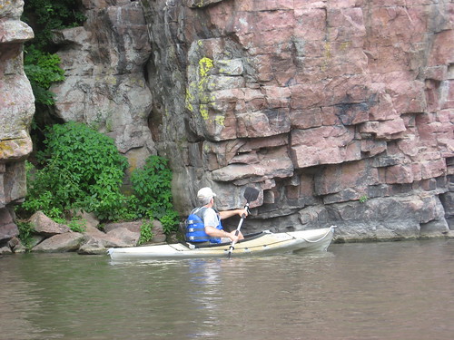
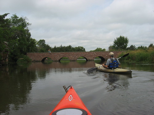
John took the Folbot and I used my Dagger. We set out heading upstream the 1.5 miles or so to the set of rapids that provides a good return point. The cliffs of the palisades are just spectacular, and the scenery of this waterway is perhaps incomparable within the area. He cruised along the rock formations in the Folbot and seemed a veteran paddler on this second cruise for him. On the way back, we went through the arches of the bridge just beyond the launching point and explored Devil’s Gulch.
IMG_2455.JPG
IMG_2449.JPG
This experience provided John varied paddling opportunities, first within a lake and then along a moving waterway. He tried out a rigid kayak of a popular size and then a Folbot.
IMG_2465.JPG
When he left, he had copies of Canoe and Kayaking and Sea Kayaking magazines. He also had lots of photos of him in both crafts and website addresses that could provide tantalizing visions of further exploration on the waterways of New Mexico. His wife was there to observe him as he set off both times. I think that John will begin finding ways to rationalize the purchase of a kayak – maybe even a tandem Folbot to take his wife and/or young son out with him on family adventures! After all, kayaking can save fitness club membership fees, build family relations, prevent heart attacks through tranquility, offer a platform for photography, and provide a means of exploring seldom visited treasures of nature. If he weren’t flying back to New Mexico, perhaps we would have gone out to one of the retail outlets to purchase his first kayak! After all, why delay any further!

Friday, July 18, 2008

Clean-Up Cruise on the Big Sioux River

The South Dakota Canoe Association tries to engage in public service projects each year. Last week, the group participated in a water quality monitoring project centered on Grass Lake. Yesterday, the group spent an evening in a clean-up project along the Big Sioux River between the 26th Street Bridge and the bicycle trail bridge in Sioux Falls. This short stretch of the river is one of the most used within the city by area canoes and kayaks, parallels the bike trail, and includes the shoreline of Camp Leif Erickson, the YMCA camp off 26th Street.
IMG_2412.JPG
This project was managed by Mary Finck, the conservation officer for the SDCA. Paddlers assembled at Rotary Park at 6:00 p.m., and a fleet of one canoe and three kayaks set out with plastic garbage bags. The task was to cruise along the shoreline picking up litter that was either floating or caught up in the deadwood.
IMG_2403.JPG
Generally, the canoe served as the “mother ship” of the fleet. The kayaks were able to get in close to the shoreline or within the deadwood caught up along the river bottom. The kayaks would load up with debris and transfer it to the canoe. Two of the kayaks collected the debris and contained it within plastic garbage bags. In anticipation of this event, one of the paddlers at the Grass Lake event advised me that a plastic “milk crate” would fit on the forward deck of a kayak and could be secured by a bungee cord; so that is what I did. I just grabbed items and tossed them into the milk crate. When it filled, I pulled up alongside the canoe and transferred my cargo of trash into a big plastic bag.
IMG_2418.JPG
IMG_2415.JPG
There was plenty of flow in the river, perhaps helped along by the one-inch rain that fell the day before. The depth was generally about three to four feet. This sort of cruise is not planned for sightseeing or a way to appreciate the landscape. On the other hand, it was a good opportunity to practice paddling technique as we moved in to score a point with a particularly challenging plastic bottle. We pulled out about four large plastic bags of litter in this 2.2 mile cruise (1.1 miles each way). The litter collected included many plastic bottles, styrofoam beverage cups and packing materials, sheets of plastic, and several arrows, apparently from the YMCA archery range within Camp Leif Erickson.
IMG_2416.JPG
A deer crossed the river ahead of us and presented a great view, one that I have not seen on that stretch of the river. There were also several families of ducks that included lots of little ones that swam along with us for a while. But, there were also more than the usual number of bugs and spiders within the deadwood that we had to move through in search of litter. This was a dirty job. My kayak was covered in mud, I had mud on my clothing and face, and even my glasses were smeared. When I got home, I placed all my clothing in the wash, jumped in the shower, and then went out for a late dinner with my wife.
IMG_2410.JPG
The cruise took a couple of hours, and it was a collegial project with good cheer felt by all, pleasant conversation, and a feeling of doing a good job for the environment. As Jarett Bies would say, “this was a good op.”

Saturday, July 12, 2008

Grass Lake Water Monitoring Project - July 2008

This morning, Saturday, July 12, a group of SDCA members gathered at the public access area of Grass Lake to take part in a collection of water samples to determine base line data regarding water quality. Jeanne Fromm of Dakota Water Watch provided an orientation to the process, including the collection of water samples and the recording of observational data regarding water depth, clarity, temperature, and weather conditions on the water.
IMG_2374.JPG
IMG_2372.JPG
The SDCA fleet consisted of eight kayaks and three canoes. Weather conditions at the beginning were moderate winds, clear skies, and a temperature in the 70s. It looked like a perfect day on the upper Great Plains, following a couple of days with temperatures into the 90s. Shortly after setting off, however, the wind freshened out of the west and swept, at about 30 mph, down the length of Grass Lake. The operation began at the eastern end of the lake, and that meant that the boats had to paddle into the wind down toward the western end. Crossing from the north side of the lake to the south meant going across the wind into mounting waves. Both directions meant hard paddling into wind and increasing waves.
IMG_2375.JPG
IMG_4890.JPG
Each of the boats was given two locations on the lake from which to secure water samples and observational data. We all had several pages of data sheets and a clipboard as well as equipment to measure depth, temperature, and clarity. We also had sample envelopes and bottles to fill with lake water from our assigned spots. My assignment was the far western end of the lake where a creek flows in as well as a spot in the middle of the western end of the main body. Since mine was the most distant station, I set off on the trek into the wind ahead of most other boats. Steady hard paddling was required, and my boat crashed into the on-coming waves sending spray into the boat and my face. My glasses were soon covered with lake water. I tried, with limited success, to keep the monitoring paperwork dry.
IMG_2382.JPG
Most of us managed to gather the assigned data, but the paperwork got wet and it was impossible to gather some information, especially water depth, because of the high winds, waves, and drift. I was concerned that I would lose my paddle over the side while fiddling with the sampling and observation paperwork and equipment.
IMG_2398.JPG
One of the canoes overturned in the winds, but assistance was provided by Ed Hoffman and the paddlers were able to make it back to shore without injury. Another canoe was windblown onto the southern shore where the paddlers wisely decided that the conditions were too tough to continue, especially after taking on water. Larry Braaten took his truck over the opposite shore to assist the paddlers and transport their canoe back to the launching area.
IMG_2396.JPG
Returning from the western end of the lake, I joined Steven Dahlmeier in riding a following sea with the wind at our back and the waves heading in our direction of travel while surfing waves up to three feet high. It was an exhilarating ride back, although there was always the possibility of slipping into the trough and rolling. Alone, I would probably have kept closer to the shore and looked for less active water. In the company of Steven, however, I didn’t want to “wimp out” and take the easier route. It was fun, and I enjoyed riding up on the leading edge of the wave and then plunging down. Keeping some momentum on the kayak while being careful not to drift across the waves was the key, it seems.
IMG_2394.JPG
So, the trip was a little rougher than planned. There were some difficult moments because of increasing wind, but most of the observations were made and samples collected. The SDCA was able to make a contribution to the water-monitoring project, and participants also learned more about data collection and analysis. Hopefully our efforts will provide baseline data regarding Grass Lake to help ensure that this body of water continues to provide a safe and healthful environment for multiple recreational uses.
SDCA Logo
Check out the SDCA web site for more information and photos regarding the monitoring project.
------------------------------------------------------------------------------------------------------
Note on The Big Sioux River accident last week: The guys who lost their kayaks when caught up in a “sweeper” below the Klondike had their boats returned. Larry Braaten, again the “man of the hour” located one of the boats, and another guy found the other. The owner has been reunited with the drifting kayaks. More details can be found on the SDCA web site.

Also, the blog readers are reminded of the Big Sioux River clean-up project planned for Thursday evening, July 17, at 6:00 p.m. The group, under the leadership of Mary Finck, will gather at the 26th Street canoe access point near the intersection of 26th and Southeastern Drive, across from the YMCA camp. See the SDCKA web site for additional details.

Tuesday, July 08, 2008

Revisiting Oakwood Lakes

Oakwood Lakes – July 8, 2008

This morning began with calm winds and a clear sky with temperatures in the 70s: a perfect day for my annual trip 82 miles northwest to Oakwood State Park and a cruise on the West Oakwood collection of three connecting lakes. I set off from my eastside Sioux Falls home and headed north on I 29 to the Bruce intersection, just north of Brookings. As I drove on Brookings County Highway 6, following the signs to the park, I rocked along with the oldies radio station out of Pipestone, Minnesota. Traveling through the corn, I was reminded of the old adage: knee high by the 4th of July.
IMG_2361.JPG

I decided to save gas and take my Folbot out for the first time since last September. With no kayak on top of the car, I figured that I would gain 10 mph and not have to worry about the boat blowing off when passed by an 18-wheeler.

As usual, there was very little action in the park on this weekday morning; there were a couple of boats that I saw during my time there, but they were distant and had no effect on my paddling nor did they intrude upon my tranquility: there was not even engine noise heard.

Unaccountably, I had a difficult time assembling my Folbot today. The most trying part of putting the boat together is connecting the bow and stern sections with an aluminum cylindrical sleeve; there are two such sleeves required, and I was surprised to find that I had lost one them on my last trip. Fortunately, I had a spare within my repair kit. But then, I couldn’t seem to get the sleeves over the two parts of the frame. I spent 20 minutes or so working on that problem and nearly gave up in frustration. I had begun to curse myself for not bringing my Dagger kayak instead. I would have been out on the water laughing in the waves if I had just not been so cheep about gas usage. Instead, I found myself sweating blood over the aluminum sleeves. Finally, though I got the frame fastened enough so that I thought it would hold together and cast off from the launching area.
IMG_2369.JPG
IMG_2368.JPG
I made the crossing from the state park dock and went west around Scout Island, then around Arlington Point into Johnson Lake. Arlington Point presents a shallow habitat where waterfowl gather. I saw several pelicans, an egret, a great blue heron, and ducks.
IMG_2335.JPG
IMG_2348.JPG
The north side of Johnson Lake is fringed with high cattails and tree cover just beyond the reeds. Elsewhere, the lake has nearly continuous tree growth along the shore.
IMG_2364.JPG
There was a moderate wind out of the northwest creating wave action enough to splash over the bow when heading into it. After kayaking into the wind and waves along the southern shore of Johnson Lake, I was able to drift with the wind along the north and east shore listening to the breeze through the foliage, hearing a great variety of bird calls, and checking out the landscape of trees and shoreline. Sometimes, I was able to exchange glances with jumping fish.
IMG_2353.JPG
IMG_2360.JPG
On the return, I went up the main body of West Oakwood along the east side of Scout Island where I verified that this is no longer an island, but rather a long narrow peninsular dividing the northern parts of Johnson and West Oakwood Lakes.
IMG_2338.JPG
As I observed last year, this is a really fine lake for paddling. The majority of shoreline in the three lakes seems to be undeveloped parkland. The lake is large (1200 acres), and there is a great variety of wildlife to see. This is really the primer lake for kayaking in the area. The only drawback for me is the 164-mile round trip distance from my home in Sioux Falls. People living in the Brookings area are lucky to have this set of lakes available so close to home. Incidentally, nearly adjoining West Oakwood Lakes is East Oakwood Lake, a large (1000 acres) body of water with charm of its own. East Oakwood, however, is wider with the potential for big waves. In fact, as I drove past it after my cruise, I observed white caps on the water. There is also a much less developed launching point. Still, on a calm day, I would like to try that waterway as well.

More on Oakwood Lakes can be found in an earlier entry accessible through the directory of area waterways on the right side of the blog.

Monday, July 07, 2008

Last Call for Grass Lake Monitoring Saturday, July 12

Monitoring Water Resources

The following is a reprint of my call for water monitoring volunteers this Saturday, July 12, 2008, at 9:00 a.m. at the public access site at Grass Lake.
Monitoar Grass Lake.jpg

The SDCA in association with Dakota Water Watch, a water resource monitoring program of the East Dakota Water Development District, will participate in a bacteria monitoring project at Grass Lake on July 12, 2008. This will be a single event carried out to establish a base line of water bacteria levels linked to fecal material and disease-causing organisms. This event will involve collecting samples from 20 points around the lake for analysis in a “mini-lab.”

SDCA volunteers will gather at 9:00 a.m. at the Grass Lake public access point and receive training in the collection process and be provided some basic background information on the project. The training will last an hour or so, and the SDCA participants will then set out in their boats to collect samples from assigned points around the lake. The training, collection, and preparation of the samples will be lead by Jeanne Fromm, project manager for Dakota Water Watch.

After training, the SDCA participants will set out and collect their water samples. There will be enough time for kayaks to take a circuit of the lake if desired before returning with the samples. A complete circuit of the lake takes about an hour, although it is possible to spend a couple of hours checking out the islands, shoreline, and bird life. The participants will have their samples back at the “put-in” site sometime around 11:00 a.m. Jeanne Fromm will collect the samples as the boats return, and the SDCA participants will be able to help prepare the samples for analysis. That process takes only five minutes or so. The lab preparation will be done as boats return, so it should be possible for participants to finish their lap around the lake, drop off the samples, and have their assignment completed between 11:00 and 11:30 a.m.

The SDCA is participating in this project as a public service. It is also a good opportunity for members to get a closer look at how water analysis is completed. So, this project ought to offer a nice morning on Grass Lake, a chance to network with other SDCA members, and provide a feeling of contribution to environmental management.

Grass Lake is a wonderful and secluded body of water in close proximity to Sioux Falls. There is a lot of bird life to observe, especially pelicans, great blue herons, geese, and ducks. Other wildlife is often seen along the shores, including muskrat, raccoon, and deer. From Sioux Falls, the lake is reached by going west on Highway 42 (12th Street) past the Wall Lake turnoff, on to 459th Street. At 459th Street, turn right and go north about 2.5 miles. The road enters into a curve around the east end of the lake after about two miles. On the left, there is a small white sign that identifies a gravel road leading into the public access area, located just a short distance along that entrance. The public access point is on the northeastern end of the lake. There is a “turn around” area and a very primitive launching point. No SD parks sticker is needed to use this site.

For this event, there are 20 samples to be collected, and there is activity for about 10 volunteers. We would like for people to “register” in advance so that we know that there will be enough, and that there will be an assignment for each boat. If you would like to participate on this 9:00 – 11:30 a.m. event on Saturday, July 12, please e-mail or call Jay Heath at jheath@sio.midco.net or 371-3622 by July 5. If there is any need to cancel the event, calls will be made to those registering.