This blog is designed to highlight the paddling opportunities within South Dakota, mainly within a 50-mile radius of Sioux Falls. While Sioux Falls is far from the adventure of coastal regions, there is a certain satisfaction in utilizing the available waterways to observe weather, water conditions, and the landscape along the shoreline. In addition, there is a wealth of animal life on the waters of small South Dakota lakes, rivers, and creeks, including geese, ducks, pelicans, great blue heron, egrets, hawks, owls, perching birds, deer, raccoons, and beaver. Eagles, fox, and coyote are also sometimes spotted.

The sites described are places where I have kayaked over the past few years, mostly in South Dakota but sometimes including locations in Iowa and Minnesota. One of the best sources of information on the accessibility of small lakes is the South Dakota Atlas and Gazetteer, the large map book of South Dakota. Lakes with a public access are generally identified by a boat symbol marking the location of a launching site on public land.

You will notice the menu of paddling locations on the right side of the blog. Each of the postings is linked to one of the areas, and my intention is to provide a continuing review of the places where I paddle. Perhaps these narratives will help readers select waterways of interest to them. Please feel free to offer a comment regarding any of my postings; I would welcome the dialog.

I also maintain a companion blog that describes hiking opportunities within the Sioux Falls area. You can access that blog at: http://hikingsiouxfalls.blogspot.com

Thursday, April 28, 2011

Lake Vermillion - the west end, up the creek

IMG_6006.JPG
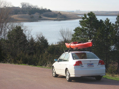
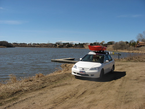
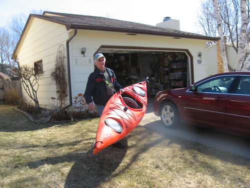
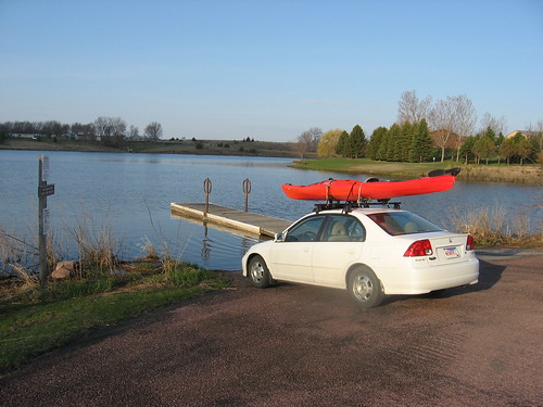
After a long set of dreary days, the forecast for today promised a brief return to spring weather: partly sunny, a temperature up to perhaps 70 degrees, winds from 10-20 mph, and NO RAIN. I got up this morning shortly after 5:00 a.m., loaded up my kayak, and set out in the dawn for my morning read, coffee, and a bagel at my habitual breakfast spot before heading west to Lake Vermillion.

As the highway was full of people commuting to their jobs, I headed west out of town along Interstate 90 to the turnoff to the Lake Vermillion State Recreation Area. I turned south at the Montrose exit; there is a sculpture garden on the south side of this exit featuring large metal sculpture works visible from the Interstate, a Hittite-like bull with curved horns prominent among them.
IMG_6008.JPG
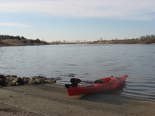
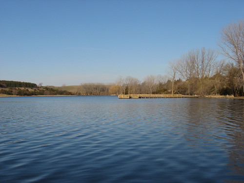
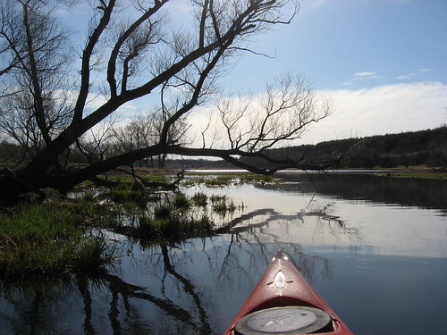
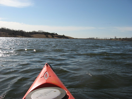
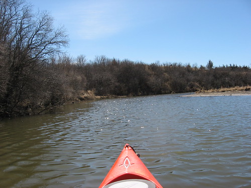
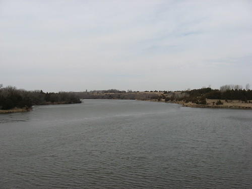
The Recreation Area was deserted as I arrived, as is nearly always the case on these early (7:45 a.m.) morning mid-week cruises. The temperature was in the 30s, and I had to wear a jacket and gloves. My pfd functioned sort of like a vest to keep me warm. I had decided to cruise down the west arm of the lake to the feeder creek coming out of the northwest wetlands.
IMG_6010.JPG
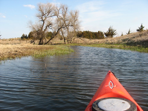
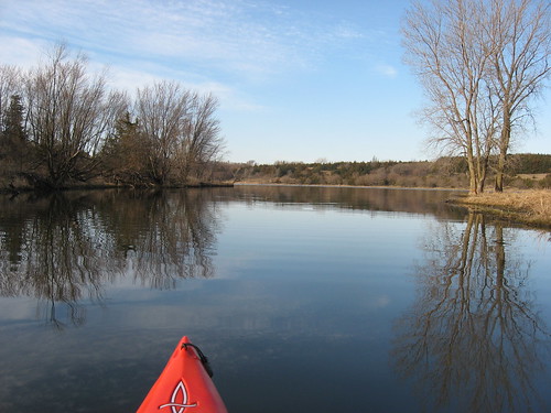
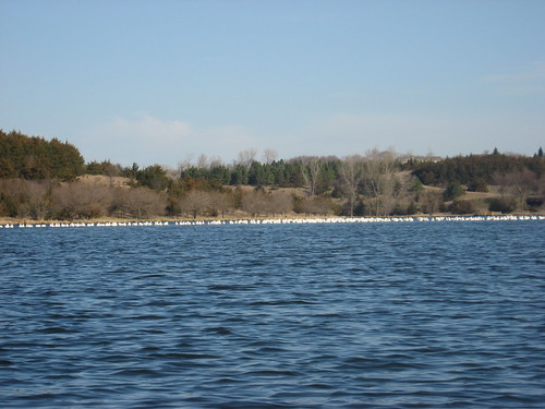
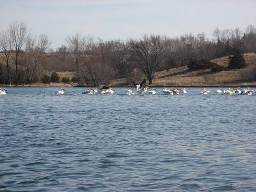
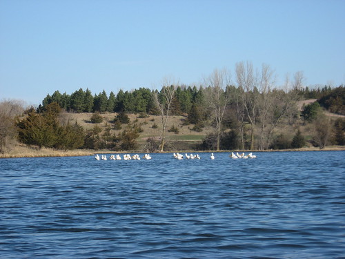
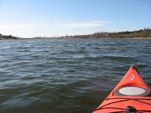
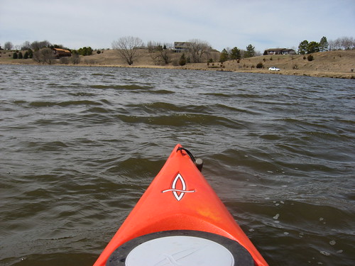
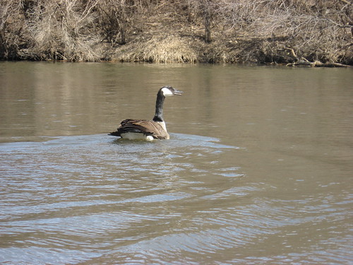
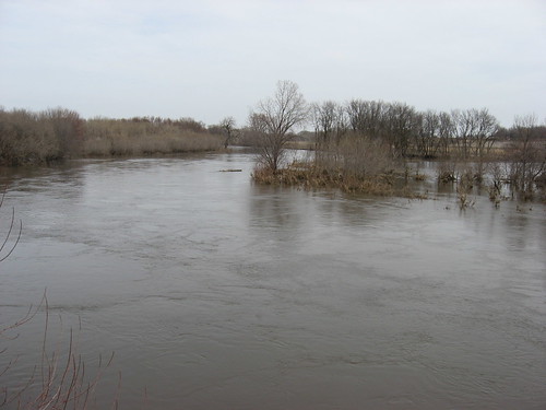
I headed into choppy waters on the way down the western arm to the northern feeder creek. Toward the end of the western arm, I came across a flock of about eight pelicans. This is the end of the lake that is surrounded by deep reeds, some elevation along the banks, and lots of vegetation. There are a couple of feeder creeks that lead back into the wetlands.
IMG_6019.JPG
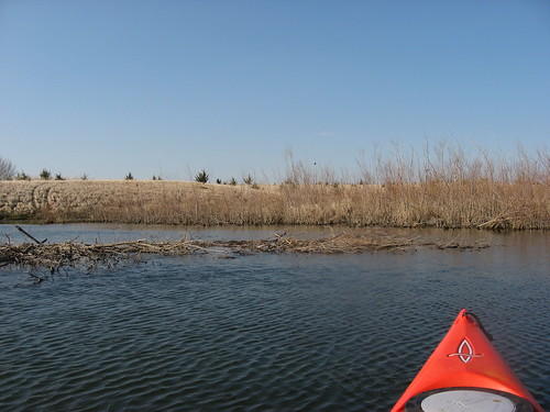
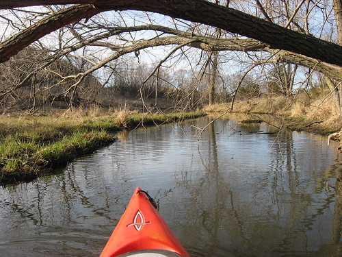
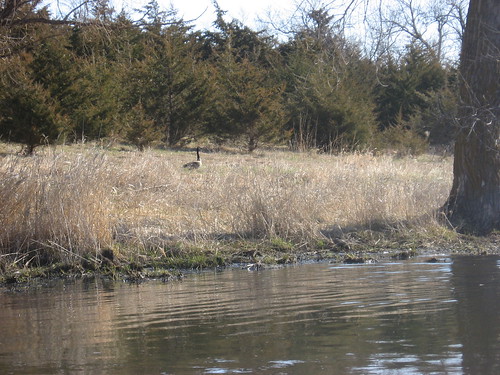
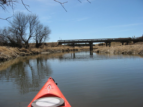
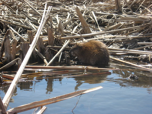
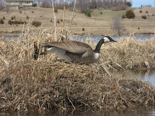
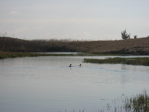
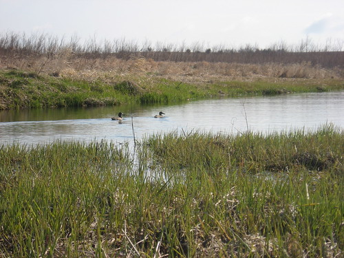
Once into the creek, the higher banks tended to provide a lee to the winds. I saw lots of nesting ducks of several varieties. The feeder creek started out at about 25 feet in width and progressively narrowed down as I continued north. The depth ranged from five to about three feet.
IMG_6039.JPG
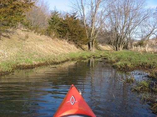
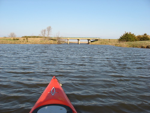
I continued north, much as I have done before, until reaching a set of rocky rapids that did not permit further passage. By this point, the creek was much narrower than my kayak, and the biggest challenge was finding a spot wide enough to turn around.
IMG_6038.JPG
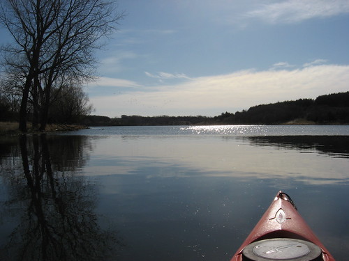
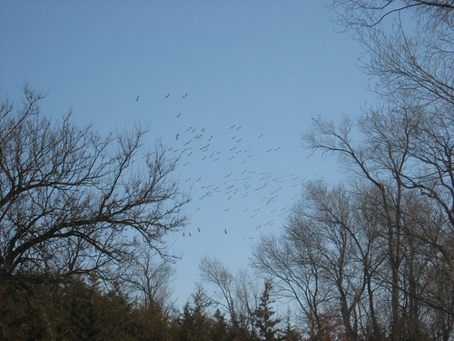
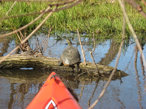
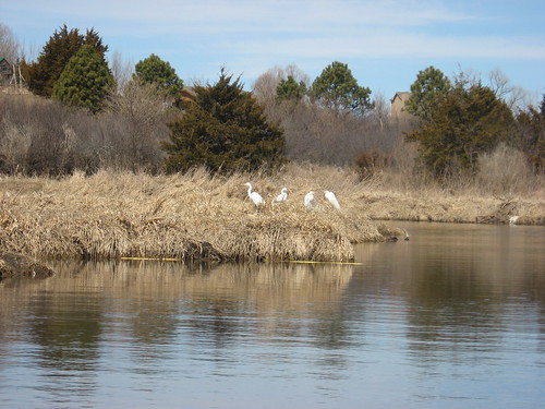
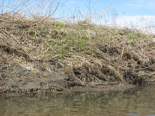
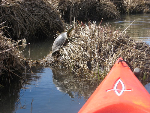
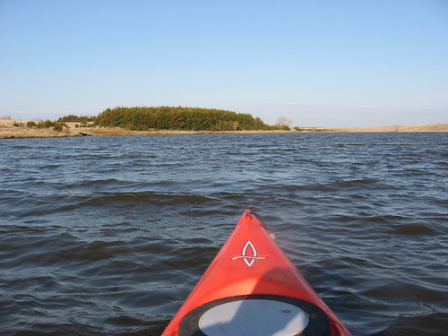
Coming back down the creek was especially tranquil. The wind was blowing softly through the bare trees and brush and the sound of birds was constant. The trees had perching birds, such as redwing blackbirds, there were many ducks that darted about, pelicans overhead, and seagulls. I just used my rudder to steer and floated quietly along the waterway observing the spring bird life and the changing landscape. Winter brown is being replaced by budding bushes and green grass.
IMG_6032.JPG
IMG_6035.JPG
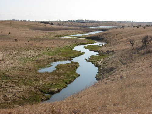
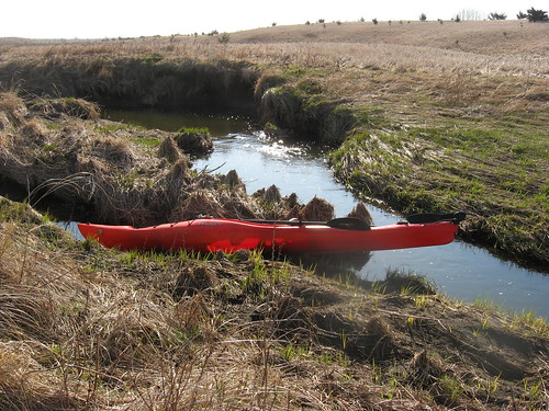
On this trip, I got out of the kayak and traveled along a deer trail through the high brown grass to an elevation offering a view of the course of the creek. This was the first time that I have done this. I’m afraid that a little later in the season would have left me with a full compliment of ticks to deal with. I remember bringing my Folbot to the shore on the Vermillion River that feeds into Lake Vermillion on the northeaster end and finding a dozen or so ticks on the fabric of the boat. I try to avoid ticks as best as I can.
IMG_6042.JPG
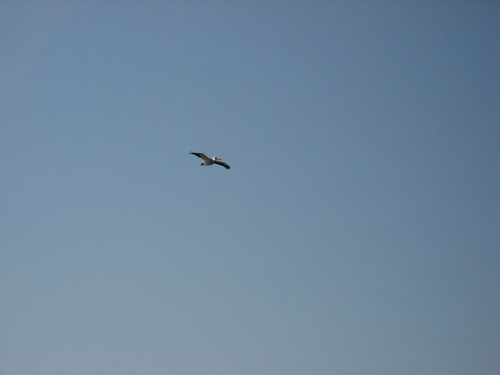
Coming back to the launch area, I rode along with wind-driven waves that were perhaps six to eight inches in height. I passed the pelicans again. Arriving at the dock, I was still the only person in the area. It was a pleasant beginning to the day, and I really like these morning cruises.
IMG_6012.JPG

Saturday, April 23, 2011

Roz Savage - Ocean Rower

For the past year and a half or so, I have been following the rowing adventures of Roz Savage, a remarkable woman from the UK as she has been rowing single-handed first across the Atlantic, then from California to Hawaii, on to Tarawa in the Gilbert Islands, and continuing her Pacific journey to New Guinea. Recently, she set out from Australia to cross the Indian Ocean to India. She has a blog, which I check into daily at http://www.rozsavage.com/ One of her colleagues in Norway does a weekly podcast interview with her that can be found at Roz Roams on i-Tunes, and I listen to their conversation on my morning walks. There are a number of links on her blog that illustrate aspects of her travels, including her departure last week from Fremantle, Australia.

Roz Savage has a terrific personal narrative, a compelling story of what led her to take up oars and tackle the Atlantic, Pacific, and Indian Oceans alone in a customized rowboat. One of my sons alerted me to her as she began her crossing from California to Hawaii, and I have vicariously followed along on her voyages since then. Her daily accounts of the voyage have become a part of my routine, and I recommend checking out Roz and her amazing travels. This latest element to her crossings is expected to last about four months.

Tuesday, April 12, 2011

Lake Lakota - April 2011

IMG_5954.JPG
Here in Sioux Falls, the weather has been wonderful today. Upon learning of the probable weather for this week, it was clear that a kayaking cruise had to be on my agenda today. This seems likely to be the last such day for the week; there is even snow forecast for this week in southeastern South Dakota. North of here, in the Watertown area and further north, there is still ice on lakes.
IMG_5956.JPG
This morning, I left town about 8:00 a.m., and the temperature on a bank I passed read 46 degrees. The forecast called for a high today of nearly 70 degrees.
IMG_5996.JPG
Lake Lakota is part of the Newton Hills State Park and located just south of Canton. It is about a 25-minute drive from our eastside Sioux Falls home. The lake is set within the boundaries of the park and is a protected nature area. This is a very tranquil spot, surrounded by trees – mostly coniferous trees that provide nice color regardless of the season.
IMG_5955.JPG
The public areas of the lake are set in a hollow among low hills. The launching area is on the north central part of the lake and includes picnic areas, a swimming beach, a boat ramp, toilets, and new this year is a fishing pier just to the west of the swimming beach.
IMG_5963.JPG
The wind was light when I launched my kayak. There was a flat calm on some sheltered parts of the lake and light waves elsewhere: a wonderful surface for my kind of nature-watching contemplative paddles.
IMG_5962.JPG
I set out on my usual circle around the shoreline, heading southeast from the launching area to the first of the bays or inlets. I like to move into these inlets and look for wildlife as well as observe the vegetation along the shoreline and into the trees. These are the areas where I am most likely to see interesting animal life.
IMG_5960.JPG
Inevitably, I seem compelled to proceed into these inlets as far as I can go in my kayak, then usually having to back out because of the narrowing course of the waterway.
IMG_5971.JPG
As I moved south on the lake toward the dam on the southeastern end, I saw the largest flock of pelicans that I can recall. There were several dozen of them clustered like a floating white island across the southwestern part of the lake.
IMG_5973.JPG
As I began my return trip north on this main body of the lake, the flock began slowly moving away from me. I would paddle toward them, and the flock just didn’t seem to close much.
IMG_5985.JPG
When the flock began to sense that my kayak was close enough, it first split into two parts and then the pelicans began to fly off to circle nearby.
IMG_6000.JPG
I wondered what would bring so many pelicans to this small (90 acres) lake. Then, I thought about the large number of fish that I saw. In the bay along the northwestern end, I came across large schools of fish that were four or five inches in length. These fish flashed by my kayak. I also saw very large numbers of small fish – fingerlings. It occurred to me that perhaps the SD Game Fish and Parks staff had “stocked” the lake this spring and that the pelicans were having a feast of these small fish.
IMG_5990.JPG
My favorite part of the lake is the northwestern arm that extends up to the entrance of Pattee Creek. This is the area where I tend see the greatest variety of wildlife. In the summer, there are large lily pads and lots of aquatic grasses on and just below the surface. Big frogs are frequently seen sitting on the lily pads, and turtles of all sizes are seen.
IMG_5997.JPG
Today, I came across a great blue heron, ducks, geese, and one turtle.
IMG_5995.JPG
The water conditions and the lay of the trees, bushes, and grasses are always interesting to me along this shoreline.
IMG_6004.JPG
I thought that I was alone on the lake, a condition that I usually enjoy in these small prairie lakes on a spring weekday. But then, I came across a guy fishing from the southwest shoreline in that western arm of the lake. We exchanged pleasantries while he was casting his line out into the lake.
IMG_6001.JPG
The circle of the lake shoreline and my meandering up into bays took me about an hour and fifteen minutes. By the time I began making my way back to the launching area, the wind had increased in strength and the lake had developed a noticeable chop. The lesson for kayaking the lakes of South Dakota: start early in the morning!
IMG_5965.JPG

Tuesday, April 05, 2011

The First Cruise of 2011: Lake Alvin

IMG_5919.JPG
This was the day I have been waiting for since last November! Although the lakes 100 miles north of Sioux Falls are still ice covered, the paddling season has returned to lakes in this part of the state. The ice is out on Lake Alvin, and the Department of Game, Fish, and Parks has installed the docks. With the forecast of a glorious day and temperatures into the high 50s, I could not resist the opportunity to take my first cruise of the season.
IMG_5915.JPG
I loaded up my kayak about noon and drove the fifteen minutes to Lake Alvin. The skies were partly sunny and there was a moderate wind out of the northeast. As I passed a digital bank thermometer near East 26th Street and Sycamore, the temperature was 58 degrees.
IMG_5920.JPG
A few weeks ago, I saw an ad in Canoe/Kayak Magazine for a kayak-carrying strap; I ordered the strap and today used it for the first time. This strap makes it easier for a geezer like me to carry the kayak, and I think that it will reduce the strain of moving the kayak from the car to the waterway.
IMG_5923.JPG
There was a moderate wind blowing down the lake, so I headed southwest and into Nine Mile Creek. For those who would like to explore this creek, you must move down the southern shore, keeping close to the left bank. There is a shallow area that extends over about two-thirds of the southern end of the lake leading up to the entrance to Nine Mile Creek, and failure to keep to the left bank will probably lead to grounding in the mud and gravel shallows.
IMG_5930.JPG
Nine Mile Creek is the most promising area for spotting wildlife in the Lake Alvin system. The creek winds along, moving steadily south, under the bridge, and into a game production area. The waterway narrows down as it moves further south; still, the depth is generally sufficient throughout the year to continue for a little more than a mile. The width of the creek ranges from about 10 to 20 feet.
IMG_5927.JPG
Along Nine Mile Creek, I came across a group of four egrets, and they allowed me to approach to about 30 feet or so. I also saw a great blue heron, lots of ducks, nesting geese, a muskrat, and my first turtle of the year.
IMG_5946.JPG
IMG_5949.JPG
A close examination of the vegetation revealed the first signs of new growth in the shoreline grasses.
IMG_5934.JPG
IMG_5940.JPG
Coming back into the main body of Lake Alvin, I found that the wind strength had increased, and I decided that I had been out on the water long enough for this first cruise.
IMG_5953.JPG
As usual, I was alone on the water. I saw no one along the shoreline either. I really like this time to cruise along in silence, listening to the water along the shore, the constant chatter of birds, and the sound of the wind moving through the trees.
IMG_5950.JPG

Sunday, April 03, 2011

Ice Almost Out - Rivers Flooded

IMG_5906.JPG
This afternoon I took a drive out to Lake Alvin and the Big Sioux River access point nearby. The first stop was at the public access along the northwest shore, just off of Highway 11,west along County Road 110, to 479th Ave. This is my usual entry point to Lake Alvin, and it does not require a state park sticker. The ice has melted in this part of the lake and the way seems clear to paddle across and up into Nine Mile Creek. Then, I drove up to the Lake Alvin Recreation Area to check out the ice in the wider part, up at the northeastern end. A park sticker is required for entry into the Recreation Area. Standing up on the hill overlooking the main body of the lake, I could see a large ice floe extending from the center of the lake over to the southern shore. I would think that this remaining ice will disappear within days. The docks have not been installed as yet at either launching ramp.

Since the weather forecast projects temperatures into the mid 50s later in the week, I think that I will put the rack on my Honda Civic and venture out onto the lake from the public access point and check out any signs of spring. I am anxious to move out onto the water, and that moment is only days off now.
IMG_5908.JPG
After looking over the lake, I headed over to the public access point for the Big Sioux River near Lake Alvin, to the bridge just off 272nd Street.
IMG_5907.JPG
This is a well-used canoe/kayak access to the river for cruises from Brandon and then on to Canton. I have used it several times for these BSR trips. The governor has issued an order prohibiting all travel along the BSR during the spring flooding – until further notice. So, I just wanted to check out the extent of flooding along this familiar section of the river. The water is moving fast, the river is quite wide, and I am sure that there are strainer hazards from downed trees and debris flowing downstream.
IMG_5910.JPG
Also, it might be tough to get on and off the river. The prohibition of all travel is a wise move; the river is dangerous at this stage. The penalties for disregarding the order are substantial.
IMG_5909.JPG