 |
| Public Access Area on Eastern Shore of Mud Lake |
At last spring seems to have come to the Northern Plains, at
least in the Sioux Falls area.
Just a few days ago snow covered the landscape and the notion of
approaching spring seemed elusive.
It seemed like we were in an endless winter.
 |
| Game Production Area on East Side of Mud Lake |
Today, however, the temperature was forecast to rise to the
high 60s or even 70 degrees. This
is the warmest day since last fall, and people are walking around in
shirtsleeves and heading outside.
This was the first reasonable day for an initial canoe/kayak cruise of
the season, although some hardy people have ventured out a little earlier.
 |
| Marker for the Shaeffer Game Production Area at Mud Lake |
Dave Finck and I decided to explore Mud Lake, a little known
body of water located in Turner County, just a few miles northeast of Hurley, SD. We took one of Dave’s Wenonah 17-foot
Kevlar canoes atop his van and drove south on Interstate 29 out of Sioux Falls
to Highway 44 and then west to the highway that continues south out of
Chancellor to Hurley. There is a
public access point on the east side of Mud Lake, along 458th
Avenue.
 |
| Dave Finck Coming Ashore at Mud Lake |
The public access point on the east side of the lake is also
known as the Shaeffer Game Production Area. There is a parking area and a very primitive boat launch,
although the lake has receded so much over this drought that it would not be
feasible to launch a boat from that point. In fact, it is difficult enough to launch a canoe through
the shallow water and mud.
 |
| On Mud Lake, Turner County, SD |
We shoved off into the lake from this public access area,
but it was difficult to make our way through the mud and water that was only a
few inches deep, even out several feet from the receded shoreline.
 |
| Along Northeastern Shoreline of Mud Lake |
We scrapped along through the shallow water until we got a
foot or more of depth and then headed south along the eastern shoreline. We saw large segments of the normal
lake bed where the only sign of water was extended mud flats. The lake is down at least two feet,
maybe more. The exposed shoreline
is up to 20 feet from the existing surface of the lake.
 |
| Pelicans on Mud Lake, SD |
Still, we made it around the northern end and then along the
western side heading south. There
are large sections that include bays and channels into the marshland that are
dry now. The lake is described as
being about 180 surface acres, nearly twice the size of Lake Alvin, but the
reduced body is perhaps half of what it might be in times of normal moisture.
 |
| This is probably a group of Wilson's Phalarope on Mud Lake, SD |
Mud Lake seems like a wonderful environment for birding. Today, we saw a large flock of pelicans, many geese and ducks, lots of shore birds, hawks, and perching birds. There are large trees along parts of the shoreline and many nesting areas among reeds.
 |
| Pelicans on Western Shore of Mud Lake |
Moving down into the southern portion of the lake, we found
more depth to the water. Still,
depth ranged from only a few inches along some parts of the lake to perhaps a
little less than three feet in other spots. We sometimes glided into water too
shallow to float the canoe and had to pole our way out. The mud was deep enough to sink the
paddle for 18 inches or so in most spots.
The bottom seemed to be mud throughout, and thus, I suppose, the name of
the lake!
 |
| Abandoned Rowboat on Western Shore of Mud Lake |
It took about 45 minutes to slowly make our way around the
perimeter of the lake. We decided
to come ashore in a place that seemed a bit more solid; still, I sunk into the
mud for 8-9 inches just getting up onto the beach.
 |
| Receding Waters on Mud Lake |
Because of the receding lake surface, there is a beach about
20 feet wide extending down the shoreline. This beach varies from sand to stones to packed and dried
vegetation on top of the dried mud.
We walked half a mile or so down the shoreline to soak in some sunshine
and watch the bird life out on the water.
 |
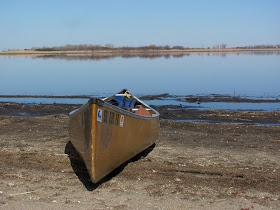
| Wenonah Canoe on Mud Lake |
Mud Lake would be a very nice cruise if the water rose a
couple of feet. The area is
isolated, hard to find, and rich in birdlife. The SDGFP area on the eastern side is fine for parking and
then launching a canoe or kayak.
As it is, though, the water is just too shallow for a relaxing
cruise. It reminds me of a cruise
we made on Silver Lake last fall.
It is interesting to me that some area bodies of water seem almost
unaffected by the drought, Lake Alvin and Split Rock Creek above the Garretson
City Park dam being two of them.
Others, such as Silver Lake, Lake Lakota, and Mud Lake are very
negatively affected by reduced rainfall.
 |
| Pelicans on Western Shore of Mud Lake |


No comments:
Post a Comment