This blog is designed to highlight the paddling opportunities within South Dakota, mainly within a 50-mile radius of Sioux Falls. While Sioux Falls is far from the adventure of coastal regions, there is a certain satisfaction in utilizing the available waterways to observe weather, water conditions, and the landscape along the shoreline. In addition, there is a wealth of animal life on the waters of small South Dakota lakes, rivers, and creeks, including geese, ducks, pelicans, great blue heron, egrets, hawks, owls, perching birds, deer, raccoons, and beaver. Eagles, fox, and coyote are also sometimes spotted.

The sites described are places where I have kayaked over the past few years, mostly in South Dakota but sometimes including locations in Iowa and Minnesota. One of the best sources of information on the accessibility of small lakes is the South Dakota Atlas and Gazetteer, the large map book of South Dakota. Lakes with a public access are generally identified by a boat symbol marking the location of a launching site on public land.

You will notice the menu of paddling locations on the right side of the blog. Each of the postings is linked to one of the areas, and my intention is to provide a continuing review of the places where I paddle. Perhaps these narratives will help readers select waterways of interest to them. Please feel free to offer a comment regarding any of my postings; I would welcome the dialog.

I also maintain a companion blog that describes hiking opportunities within the Sioux Falls area. You can access that blog at: http://hikingsiouxfalls.blogspot.com

Showing posts with label Loss Lake. Show all posts

Friday, October 11, 2013

Windblown on Loss Lake


After cruising with the pelicans yesterday on Grass Lake, Dave Finck and I headed a few miles west to visit Loss Lake.  This is another of the area lakes that I have tried to visit once a year, but it had now been two years since my last cruise there.
Upon arrival at the nicely developed launching area, I walked out onto the fishing dock to look over the state of the water on this windy day.  While the surface was riffled with wind, it didn’t look too bad, and we felt no real concern about conditions.
So, we pushed off and moved west down the south shoreline.  Looking out into the main body of the lake, we noticed white caps and wind powered rollers moving down the lake.  Still, those conditions seemed offshore and unlikely to cause us difficulty.  We just continued paddling west with the wind and following waves behind us. 
Before long, we found ourselves racing west with the wind and two-foot waves chasing us.  The wind was driving us down toward the western shore, and in the distance we could see an electric fence along the western shoreline. The wind was too strong and the waves too big to turn away from the shore, and soon we found ourselves onto the shore and jumping out of the canoe to hold it while avoiding the electric fence.
We were unsuccessful in launching the canoe to return into the wind through the waves.  The only reasonable option at that point was to carry the canoe along the shoreline for a couple hundred feet and make another attempt in slightly less windblown conditions.
Dave Finck - windblown on Loss Lake
With great effort, we were able to make slow headway east, back toward the launching area.  This was one of those situations where I would count 100 strokes, check for progress, groan, and paddle another 100 strokes.  It was a challenging trip back, and we were beat with the effort.  It took us about 20 minutes to make it to the west end and over an hour to get back
A few years ago, my paddling pal Jarett Bies told me about he and his wife, Laura, getting windblown on Loss Lake and finding it very difficult to return to the put-in.  I was incredulous and just could not envision that this small lake could become a challenge.  It has always been a slow, tranquil, and contemplative cruise for me, often with a flat calm on the surface.  I am no longer incredulous!  All lakes can turn savage, and paddlers just have to be aware of how current conditions do not always mirror our recollection of past cruises..
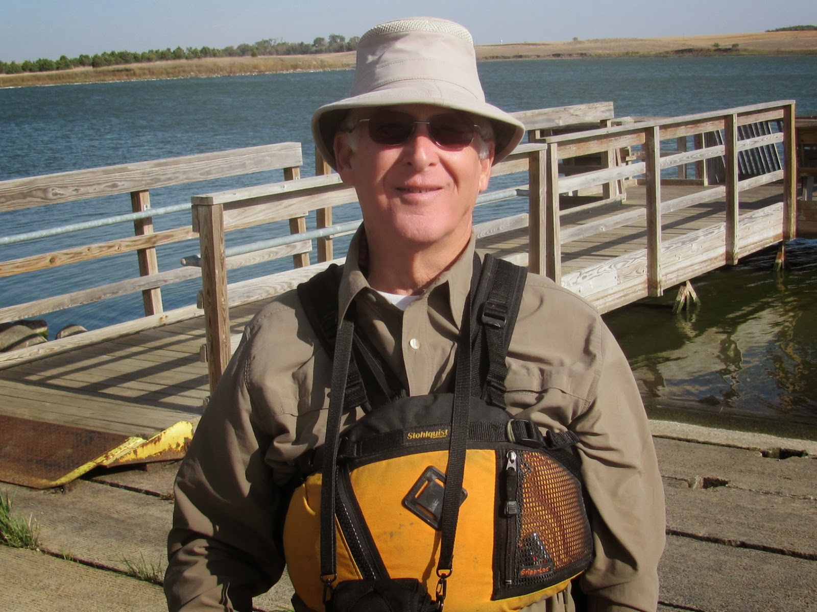
Jay Heath at Loss Lake
For a description of past cruises on Loss Lake, the reader can access the appropriate link on the right side of the blog in the area waterways section.

Photographs of this cruise can be found on my Flickr page at the following URL:

Tuesday, August 09, 2011

Loss Lake - August 2011

IMG_6494.JPG
The heat wave seems to have passed for now here in Sioux Falls. As I looked at the weather forecast over the next few days, I knew that now is the time to get out on the water again. So, this morning I got back into my morning paddling routine and stopped by my bagel spot for a bagel, coffee, and an hour-long read before heading out to Loss Lake, a small lake west of Sioux Falls (west on SD 42 to SD 19, north 2.5 miles, back east along a dirt road for about .5 miles to the lakeside).
IMG_6495.JPG
Like most of these small lakes, there is very limited signage and no location identification. Because of an error in one publication, there has been some confusion about the name of this lake. Some people call it Lost Lake, but that is not correct. The South Dakota Game Fish and Parks identifies it as Loss Lake, and that is the agency that owns the access area – parking, dock, fishing pier, vault toilet. The data about the lake can be found on the SDGFP web site at the following URL: http://gfp.sd.gov/fishing-boating/fishing-access.aspx Loss Lake is south of I 90, Lost Lake is north several miles, near Humboldt.
IMG_6491.JPG
The lake was deserted when I arrived at 7:30 a.m., and no one appeared during my 90 minutes at the location. The skies were sunny and the winds seemed light when I arrived but steadily build to a moderate breeze by the time I finished my one-hour cruise around the perimeter.
IMG_6478.JPG
The shoreline around Loss Lake is generally grasses, with some tree cover limited to the southern shore. The banks are high, so that even with a wind there is a lee to be found under the shelter of the bank, at least along the shore from where the wind is blowing.
IMG_6482.JPG
There is one home on the western side of the lake, and there is an old structure on the eastern shore that was the official’s station for hydroplane races that were held on the lake many years ago. I have often speculated about the atmosphere that might have characterized this lake years ago when the hydroplanes were roaring across the surface and the crowds were cheering on their favorite. The official’s station seems to just be a little bit more weathered each year.
IMG_6480.JPG
Sometimes I have seen pelicans on the lake. Today, though, wildlife was scarce; I came across a muskrat, an egret, a few duck-like waterfowl, some jumping fish, and the occasional turtle’s head poking above the water to check out the passing kayak. My favorite time to visit the lake is in early spring when ducks and geese are nesting. I waited too long this year for my annual visit.
IMG_6487.JPG
While the water was pretty smooth when I set out this morning on the west side, by the time I got around to the east side the wind had increased. There were enough waves by then to provide a little bounce to the ride, and one wave slopped over the cockpit coaming to douse me. From the water stains on the dock, it would seem that the lake level is between one and two feet lower than when the dock was installed this spring.
IMG_6488.JPG
Loss Lake is not an exciting lake to explore. It is pretty small and includes only the main body and one bay that extends off into the northeast. What seems to be the feeder creek is fenced off with an electric wire. It does, however, provide the opportunity for a quiet and contemplative one-hour paddle. I have been informed by those fishing the lake that the water is deep and seems to provide good habitat for the fish. The distance from my eastside Sioux Falls home to the lakeshore is about 25 miles. Further details of earlier cruises on Loss Lake can be found in the "Area Waterways" inventory on the right side of the blog.
IMG_6484.JPG

Tuesday, May 18, 2010

Loss Lake - May 2010

IMG_4858.JPG
We are having a string of beautiful days here on the northern plains, days not to be wasted with my part-time job of editing school accreditation reports. After returning yesterday from a trip out to Grass Lake, I just left the kayak on the car in anticipation of another excursion today.
IMG_4860.JPG
By 8:00 this morning, I had arrived at the public access point at Loss Lake, a small and secluded body of water located west of Sioux Falls, about 15 miles west on Highway 42 and then 2.5 miles north on Highway 19. There is an inconspicuous sign along the east side of Highway 19 pointing down a dirt road; about .5 miles on, there is a well developed lake access area with a dock, boat ramp, fishing pier, vault toilet, and ample parking.
IMG_4859.JPG
When I arrived, the lake was deserted, as is almost always the case when I arrive at area waterways, especially on weekday mornings. There was just a light wind blowing, the skies were clear, and the temp. was about 70 degrees.
IMG_4863.JPG
Loss Lake is really a small prairie lake that is surrounded by low hills. The shoreline is elevated a few feet along most of the perimeter, with some banks extending up 10 or 12 feet and other banks only 2-3 feet. There are trees along a segment of the southern shore; but for the most part, the shoreline has only an occasional tree to break the landscape. On one part of the lake, a bay extends back for a few hundred feet and normally is ringed by marsh reeds and nesting ducks and geese. The water is quite high now, however, and those reeds have yet to emerge.
IMG_4869.JPG
I did not see any mammal wildlife today. There were quite a few pelicans out on the water, and the sound of them taking off and landing was the dominant sound that I heard. Otherwise, there were some ducks and geese about and some perching birds on the bushes and reeds along the shoreline.
IMG_4864.JPG
The water was as clear as it seems to get on this type of lake, and I could see detail on the bottom at 4 feet. I looked over the side of the kayak at one point and saw a big turtle swimming along about 2 feet under the surface. There were several schools of small, minnow-like fish that flashed by me as I slid along in clear and shallow water. The presence of these schools of little fish probably account for the pelicans that were hanging around together.
IMG_4867.JPG
There are high cut banks to look at, large boulders along the eastern shore, and the old hydroplane racing booth slowly deteriorating, also on the eastern shore, directly across the lake from the public access area. After about an hour, I had finished my paddle around the shoreline of the lake and had arrived back at the “put-in.” To my astonishment, two large pick-up trucks arrived with an older guy in each one ready to do some fishing off the pier. After I had my kayak on the car, I strolled over to the pier for a chat with these guys, and asked them what they knew about the history of the lake. One of the guys was from the area, and he told me what he remembered about the hydroplane races that took place on Loss Lake back in the 1940s and 50s. I was glad to have that story confirmed. As I paddled past the old command booth this morning, I thought about what it must have been like 50 or 60 years ago with all the excitement and noise of racing hydroplanes and spectators yelling out their encouragement to the drivers.
IMG_4873.JPG
The guy from the area told me that the attraction of Loss Lake was the depth of water and that there was very little “winter-kill” among the fish species. I saw a speckled fish swimming very near me off the southern shore, so close that I think that I could have caught it in a net. I asked the guy what types of fish were in the lake, and he rattled off half a dozen names. I have no idea what type of fish I was looking at, just that it was a speckled fish that wasn’t moving too fast.
IMG_4877.JPG
Loss Lake is not the greatest body of water in the area for checking out the wildlife. Also, the only shade is under the banks when the sun is low on the horizon. It is a place that I like to revisit each year, but once a year is enough for me.
IMG_4879.JPG

Monday, July 06, 2009

Loss Lake - or maybe Lost Lake - July 2009

IMG_3552.JPG
Until this morning, I had not been to Loss Lake for about two years. One of the blog readers alerted me to improvements that have been made to the public access area, so I wanted to go out and see how the setting had changed. First off, however, there seems to be some confusion regarding the name of the lake. I first saw this body of water on the South Dakota Atlas & Gazetteer located in western Minnehaha County, 2½ miles north of Highway 42 along Highway 19. The atlas clearly identifies this body of water as Loss Lake. There is a Lost Lake, also along Highway 19 but about 4 miles north of Humboldt. The South Dakota Statewide Fisheries Survey also describes Loss Lake in the same location as the atlas. But, there is a web site called Fishing Works that describes Lost Lake, actually located north of Humboldt, as the site known through the atlas and the South Dakota Survey as Loss Lake. Then, I ran into a fisherman on the water today, and I asked him the name of the lake. He said it was called Lost Lake, and he learned of the name through friends who had been there before. Of course, there is no name listed in the signage located at the waterway. My take on this is that the lake is really Loss Lake, and this Fishing Works website has mislabeled the body of water. That website has misplaced Lost Lake on the map and even included GPS coordinates for Loss Lake in the description. For now, I will continue identifying this body of water as Loss Lake.
IMG_3548.JPG
So with that said, I arrived at the lake this morning about 7:20 to find it, as usual, deserted. As I had been informed, there have been major improvements to the site since my last visit in 2007. The access road is improved; there is now a large parking area, a fishing dock, a boat dock, a concrete boat launch, and a vault toilet. The difference since my last visit is marked, but I expect that the isolation I felt earlier has now been diminished. Easy access and improved facilities probably equals increased usage.
IMG_0090

Before Renovation of Launch Area

IMG_3544.JPG

After Renovation of Launch Area

The temperature this morning was in the 70s, heading toward a predicted 90 degrees. There was no wind and the lake was flat calm. With no wind noise, the only sounds were a distant occasional vehicle moving along Highway 19 and birds calling to each other. The sky was nearly cloudless with only a few high thin cirrus clouds and the contrail of a passing jet.
IMG_3545.JPG
Loss Lake is only 86 acres in surface area, just a little smaller than Lake Alvin. The lake is irregular in shape and offers a few bays to explore. Generally, though, the lake is unremarkable. There are some high banks, but the shoreline cover is mostly tall grass and a few trees. The lake is posted as “no wake.” There was quite a bit of algae on the water, with more located on the west bank. The fisherman I talked with told me that this algae had developed recently. The southern part of the lake has a bay that extends into a cow pasture. On most of my trips to this lake, there have been cows in the water behind a barbed wire fence in this southeastern section, and they are still there.
IMG_3547.JPG
There was not a lot of wildlife visible this morning. I came across an egret, a great blue heron, and a couple of ducks. There were also a few jumping fish that I assume were carp. The lake seemed to mirror the environmental conditions: still, quite, and sleepy.
IMG_3550.JPG
There are a few large rocks lurking just below the surface, especially on the eastern side of the lake. This morning, there was a little welcome shade under the high banks also on the eastern side.
IMG_3554.JPG
My cruise along the perimeter of the lake took just over an hour. As I was finishing the tour, a pickup arrived with a fishing boat in tow. The boat presented an unusual form, and I saw that the sole occupant of the boat had rigged a picnic table umbrella in the center to keep him somewhat sheltered from the sun. With another person on the lake, the area met my definition of crowded, and I thought that it was just as well that my circuit of the lake was over. By 8:45, a little breeze had come up and it was getting hotter. It was time to drift off.
IMG_3551.JPG
Loss Lake has little to recommend it except for being only 25 miles from my eastside Sioux Falls home and fine launch facilities. It may be okay for fishing, but a cruise on this body of water once every couple of years is sufficient.

Cruise Note:

The South Dakota Canoe Association is sponsoring a cruise on Sunday, July 12, on the Big Sioux River from the Klondike Dam to Canton. This three-hour cruise departs from the South Dakota side of the Klondike at 9:00 a.m. For more information on the cruise, check out the SDCA website at http://sdcka.blogspot.com. The cruise is under the direction of Mr. Larry Braaten, the cruise director for the SDCA.

Thursday, July 05, 2007

Loss Lake - July 2007

Loss Lake - July 2007

This morning I headed west on Highway 42 to Loss Lake, just north off of Highway 19 a couple of miles. Like many of the area lakes, it would be difficult to find this spot without some detailed directions or a good map. Just north of 263rd Street, there is a small sign off to the right, heading north, that indicates a public access area to an unnamed lake. There is a minimally maintained gravel leading up into a stand of trees where a launching area is provided by the SD GFP. There is a decent parking area and a primitive boat ramp; no toilet facilities are provided.

IMG_1111

IMG_1129

This was a pleasant morning in the midst of a hot July; at 8:30 a.m., the temperature was in the 70s, there was a light breeze, and the skies were clear. As always on this lake, I was alone for my contemplative paddle around the circumference. Today, I took about 70 minutes to paddle along the entire shoreline. There was plenty of depth to the water, although there was considerable algae growth along some of the shoreline.

IMG_1112

IMG_1115

I did not see any waterfowl today, unlike most other times on this lake. I did run across a beaver, and a pair of large owls flew up out of some trees on the south end of the lake as I approached them.

There are swaths of the lake with a dense growth of cattails. I tucked the bow of the kayak into the reeds to sit quietly and observe the bird life. While the initial approach tends to spook them off, birds tend to return if the paddler sits quietly waiting. Also, I saw clusters of little black fish often. One of the attractions of Loss Lake is the opportunity to move slowly along the shoreline and closely observe details of the life forms that inhabit the lake community.

IMG_1118

IMG_1116

IMG_1122

At the north end of the lake, where I believe the feeder creek must enter, there is an electric fence line stretched across the outlet where cows seem to stand around to escape the heat. I saw this herd of cattle on my trip to Loss Lake last year as well. Such a sight is not uncommon on these prarie lakes where the shoreline joins farm land. It is a sight often seen along the Big Sioux or Split Rock Creek. The cows only gaze at the paddler, however, and they keep to themselves.

IMG_1114

I looked again at the old dilapidated structure that I was told had been the reviewing stand for officials when small hydroplanes used to race on Loss Lake.

IMG_1125

While taking a cruise on Loss Lake is not exactly high adventure, it is a tranquil time to mull over events, to observe life within and alongside the lake, and just to enjoy a little time alone on the water. As I drove west and then back east on Highway 42, I had the windows down, enjoyed the green scenery, and had Bruce Springsteen cranked up loud as I sang along with him and the E-Street Band about “Glory Days.”

Friday, August 04, 2006

Loss Lake

Loss Lake is a little gem of a prairie lake located in a secluded area a few miles south of Humboldt, SD. From Sioux Falls, the best route is along Highway 42 heading west to the intersection of Highway 19. From there, the lake is about two and a-half miles north, to a dirt road heading east just north of 263rd Street. There is a very small white “Lake Access” sign at the entrance to the dirt road; the lake is located about a quarter of a mile down the road. There is a turn around area with parking for a few vehicles and a primitive gravel launching ramp. This is a minimum facilities area provided by the state: parking and the launching ramp. The lake is posted as “no wake,” and I have never seen another boat on the water in my three trips to the lake. The lake is irregularly shaped but oriented roughly north and south. The access point is on the west side at the widest point of the lake.

IMG_0094

The east bank of the lake has a set of high embankments, some up to 20 feet in height. Some large rocks protrude from the high banks, and I am reminded of how Paleolithic era remains are sometimes found in such conditions. The lake is surrounded by low hills that affect the wind flow, and the banks have either high embankments or regular high banks covered with tall grass, rushes, and cat tail plants. These banks and vegetation provide a nice lee along the edge of the lake. There was plenty of water in the lake, and the depth was just fine for kayaking.


IMG_0095


As usual in lakes of this sort, I like to kayak along the shore line to peek into the grasses and along the banks to observe wildlife and the growth of vegetation. On this trip, I came across two great blue heron that flew off as I approached and seemed to settle down again somewhere ahead of me to repeat the cycle along the entire trip. When I arrived, there was a flock of 20 geese out on the lake, but once they spotted me they flew off. In past trips to this lake, I always saw a flock of white pelicans. This time, I caught sight of one large white bird, but it was too distant to verify as a pelican. There was an abundance of other bird life. I came across several large turtles out in the water. This was a hot day on the lake, and I suspect they were keeping cool in the water; I did not observe any turtles sunning themselves along the shore line. There were lots of tunnels in the embankments and pathways through the tall grasses along the shore, but I did not see any actual animals in these settings. I would suppose that 1:00 p.m. in August is not the greatest time for viewing wildlife.


Loss Lake 013

As I cruised along the north end of the lake, I came around a corner and saw a herd of cattle standing in the lake behind a single strand fence that separated off this backwater spot. I suspect that the fence was electrified, but I did not get close to it. Among the 16 cows standing there knee deep in the water, there were several large full-grown cows and several calves. As I was departing the area, something spooked the cows, and they started running through the water creating an interesting sound. I would not have wanted to be in the way of these cows as they decided to move on.


IMG_0093

As I was ready to depart the lake, a car came into the access area, and a couple got out an inflatable boat. The guy told me that Loss Lake was an area center for small hydrofoil racing boats until sometime in the 1970s. There is a structure on the east side of the lake that I thought was probably a duck blind for hunting that he told me was actually the officials’ area for the boat races.

This a quiet little lake that offers a tranquil spot for observing bird life and presents a good potential for observing other wildlife. It is infrequently used, so an hour of so of solitude is pretty likely during a circuit around the lake. The lake is 14 miles west of Sioux Falls and about 21 miles from my eastside home in Sioux Falls. It takes about 45 minutes to paddle the circumference of the lake.