This blog is designed to highlight the paddling opportunities within South Dakota, mainly within a 50-mile radius of Sioux Falls. While Sioux Falls is far from the adventure of coastal regions, there is a certain satisfaction in utilizing the available waterways to observe weather, water conditions, and the landscape along the shoreline. In addition, there is a wealth of animal life on the waters of small South Dakota lakes, rivers, and creeks, including geese, ducks, pelicans, great blue heron, egrets, hawks, owls, perching birds, deer, raccoons, and beaver. Eagles, fox, and coyote are also sometimes spotted.

The sites described are places where I have kayaked over the past few years, mostly in South Dakota but sometimes including locations in Iowa and Minnesota. One of the best sources of information on the accessibility of small lakes is the South Dakota Atlas and Gazetteer, the large map book of South Dakota. Lakes with a public access are generally identified by a boat symbol marking the location of a launching site on public land.

You will notice the menu of paddling locations on the right side of the blog. Each of the postings is linked to one of the areas, and my intention is to provide a continuing review of the places where I paddle. Perhaps these narratives will help readers select waterways of interest to them. Please feel free to offer a comment regarding any of my postings; I would welcome the dialog.

I also maintain a companion blog that describes hiking opportunities within the Sioux Falls area. You can access that blog at: http://hikingsiouxfalls.blogspot.com

Thursday, June 29, 2006

Lake Lakota

Lake Lakota is part of but detached from Newton Hills State Park, about six miles south of Canton, SD, on Highway 11. The lake is within a “fee area,” requiring a park sticker. The entrance is just south of the entry into Newton Hills State Park, just east along the first road past the park. The lake area has all the amenities of most well equipped state parks: a good launching point for boats, a swimming beach, a changing room for swimmers, restroom facilities, and shaded picnic tables on a grassy area just behind the swimming beach. Lake Lakota is designated as “no wake,” so the only craft to be seen on the water are trolling fishing boats – unless another kayak or canoe should appear.

The lake is generally oriented north to south and is in an oval shape with an arm extending out to the west. Lakota is small; it takes only about 15 minutes to paddle the north – south length of the lake, even at a leisurely pace. The setting is beautiful: some rolling hills, more trees than usual and in great variety including evergreens, and grasses and bushes along the shore line.


A unique quality to this lake is the extent of aquatic grass and other water plants. While the aquatic grass is extensive along the shore, it is also easy to kayak over the top of it. The water is exceptionally clear, and through breaks in the aquatic grass a person can see bottom details at four feet or more. I especially liked moving over the aquatic grass up the western arm of the lake. The water was pretty deep: I often could not touch bottom with a double bladed kayak paddle. Traveling through the grass seemed to me like a polar setting where a kayaker might seek out leads in the ice – clear pathways through the ice. It was much like that with the grasses in Lake Lakota. In deep water, the grass would extend like the vegetation of a jungle. There were clearings where I could look deep in the water. Paddling on top of the grass was easy, as long as I kept the rudder up.
I can not imagine wind waves gathering on Lake Lakota, at least while the grass is thick on large parts of the water.

As always, I found the shore line the most interesting part of the lake. I saw a muskrat swimming and scampering along the edge of the water, several large turtles, a number of big frogs sitting on the vegetation even in deep water while helping keep the insect population down, ducks and geese up in the western arm of the lake, and a lot of small fish flitting through the clear spots within the “Sargasso Sea” of Lake Lakota.

On a Wednesday morning, the park was deserted, and there were two boats with fishermen moving slowly around the middle of the lake. This would be a good spot to bring a family or group of people who wanted to have a day in a beautiful setting – a little swimming, a little kayaking, some sitting around in the shade, a picnic lunch. Lake Lakota would be a very nice spot for beginners in a kayak. For more seasoned paddlers, the scenery and the search for wildlife would have to be the major attractions of this lake. It is right next door to Newton Hills State Park; so, it would be possible to go for a paddle at the lake and then take in a nice hike along the trails in the park.

Saturday, June 24, 2006

Lake Vermillion

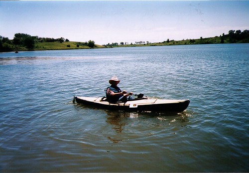
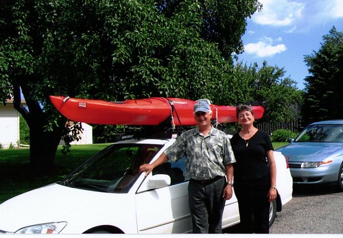
On Thursday of last week, I bought a new kayak to celebrate my retirement from university teaching. After considering many options, I decided to buy a Dagger 13 foot recreational/touring kayak. This boat has a rudder, two watertight compartments with hatches, and thigh braces. It weighs 51 pounds. In the end, I just really wanted to work with a rudder to have that experience. I didn't think that I had storage space in my garage or in the back yard for a longer boat.

I took the new kayak out to Lake Vermillion today for its maiden voyage. This lake is located west of Sioux Falls and south of Montrose. From Sioux Falls, most people would just go west on Highway 42 and then north to the lake. There is good signage to the SD Recreation Area located about four miles north of the highway along a paved road. A good share of the park is within the Lake Vermillion Recreation Area and requires a park sticker for entrance. There are two boat ramps, and I used the west ramp within the main part of the park. Lake Vermillion is a pretty heavily used recreation area, especially on weekends. There are two ramps at the launching point, and they were both busy when I arrived. There were also about a dozen cars or trucks with attached trailers in the parking lot. The lake is shaped sort of like the letter J. The boat ramp is at the low end of the J, and most of the power boats are out in the longer side of the lake. There are ski boats, jet skis, fishing boats, and people just cruising about in all sorts of boats. The power boat action is along this longer side of the lake. Those of us in kayaks can just put in at the ramp and then move out and turn right (west) onto the lower part of the J. This direction leads under the bridge of the north/south road running from Highway 42 north to Montrose. This is a portion of the lake which power boats seem to ignore. The first hurdle for them would be going under the bridge itself. The waters are narrower than the main part of the lake, and there are shallow points along the banks. But, this is just fine for the kayak.


I moved up the west arm of the lake for a mile and a-half or so. There are backwaters to explore along the western end of the lake, and this is where wildlife from the area is more likely to be seen. On my paddle up the arm, I saw numerous geese and a few great blue heron. I also saw a few turtles and jumping fish, but I didn’t run into any other boats.

I don’t think that this is the greatest body of water for the kayak boater. The main part of the lake is crisscrossed with power boats and their wakes. There is little to see along the shore other than a swimming beach, housing development on the south side of the lake, and an ordinary body of water. It may be just great for sailing and motorboats, but it is not especially attractive to the kayaker. The western arm of the lake is okay, and there is some interesting landform and bird life. The shoreline seems made up of a succession of low rolling hills. There is a lot of tall grass and willows, and some trees. The cruise up this arm is likely to take only half-an-hour, and then it is just the return trip. The attraction of Lake Vermillion to me is that my wife can go walking with our little dog while I go out in the kayak. This is not usually an option at the more under used lakes that I visit that have no real park facilities or hiking trails, such as Grass or Beaver Lakes. I think that this would also be a good lake to go to with a group of people who wanted to take turns going out in the kayaks. There is opportunity for those waiting to walk around the park rather than just sitting. So, there are certainly good reasons to go to Lake Vermillion. There are better choices, however, for those who want to check out the wildlife and to experience some isolation and solitude.

Wednesday, June 21, 2006

Beaver Lake

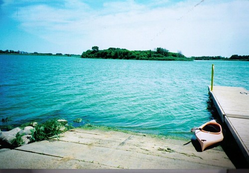
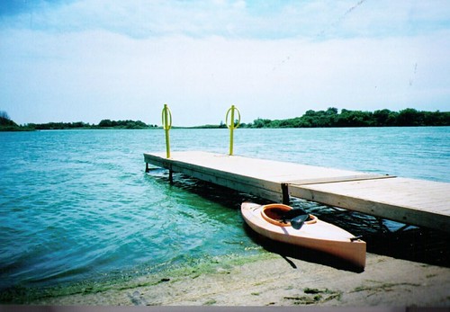
Beaver Lake is a fairly large body of water located near Humboldt, SD, about 25 miles east of Sioux Falls. The lake is located just to the north of Interstate 90, and it is accessed by exiting the Interstate at Humboldt, going through the main part of town to the eastern edge of the community, turning south on Ford Street and continuing south past the cemetery to the first gravel road running east (259th Street). The lake is about ¾ of a mile east from the intersection. There is a clearly marked public lake access area on the left with a large graveled parking area, a restroom, and a pier extending into the lake. A water tower located along the Interstate to the south of 259th is a good landmark. The tower nearly marks the public lake access area.


The lake is a large irregularly shaped body of water that is quite wide in places. The southern and western shores are generally wooded, and there is a large island at the eastern end of the lake that is heavily wooded. Because the lake is so open and wide, a wind can easily kick up quite a chop, especially in the center part. Still, like in most of the prairie lakes, there is nearly always a sheltered side on the lake.

Today I took my kayak out on Beaver Lake, and like when I have gone before, there was a stiff wind out of the west. It was easy to launch the kayak from the boat ramp, but I decided to immediately head out around the island located a fair distance offshore from the launching point. As I got out of the shelter of vegetation along the pier, I quickly found myself in waves up to 2 feet high. Still, the allure of the island kept me going until I reached its shore. From there, I found the waters sheltered in the lee of the island and was able to paddle around most of it. I then headed east and found myself in a following sea with the waves chasing me to the shore. Once I was 10 or 15 feet off the shore, it was much easier to kayak, even with the waves continuing to roll in on the beam of the kayak. I saw a few pelicans, but I think that the wind was too strong for them to hang around on the lake; they flew off, and I did not see them again. I continued to follow the shoreline of the lake around the southern end and on to the western part. These waters were quite sheltered, and I did not experience any serious wave action.


As I approached the western end of the lake, I saw a deer ahead of me eating the tall grass right at the waters edge. Since I was downwind, it is not likely that the deer either heard my paddles or caught my scent. When I came within about 100 feet, the deer started watching me, and when I got to within about 40 feet, he simply turned and strolled off into the tall grass. Soon, a great blue heron flew up from a perch along the shore and passed in front of me. There were plenty of birds in the grasses, reeds, and trees along the shore, including a number of yellow headed blackbirds.

From the western end of the lake, I began a paddle back toward the launching point. This is where the fun – or anxiety – began. Suddenly, I was without any lee from the trees, with the wind whipping up waves that were two and a-half feet in height while I followed the march of these waves over a large open body of water. The waves were breaking on the bow of the kayak, and they were higher than the cockpit of the boat. I was a little apprehensive about broaching the boat in these waves, but I had a fairly long distance to paddle before reaching the lee of the island and the eastern end of the lake. So, I just continued paddling and expecting to make it okay. I was aware that my kayak has no internal flotation, I was alone on the lake, and it would be a long swim if something went wrong. The smart thing to do when the wind is high, especially for people in a recreational kayak, is to stay close to the shore and within the lee of land as much as possible. There is something about an island, however, that seems to draw all of us on. I think that we are just determined to visit the island and kayak around it, regardless of the wind conditions. It would be best to suppress such ambition, however, and play it safer. High waves do not produce such anxiety while moving along the shore. After all, the kayak skirting the shoreline is only 10 to 15 feet out. In the middle of a large open lake, however, it is a little more challenging when a mishap would mean a long swim. My advice is to stick to the shoreline and leave the open water crossings for a calm day. And, of course, it is along the shoreline where we can see land forms, vegetation, and animals native to this environment. There really isn’t a lot to see on an open crossing expect the water itself.

So, Beaver Lake is another good area for the local kayaker. As long as the kayak route is chosen with care, this should be a good paddle. Because of the irregular shape of the lake and the open country, there is a great variety in water and wind conditions. Remember, though, there is rarely anyone else on the lake or in the area, so it is important to be careful and to always wear a life jacket. It also helps to paddle a kayak with internal floatation compartments.