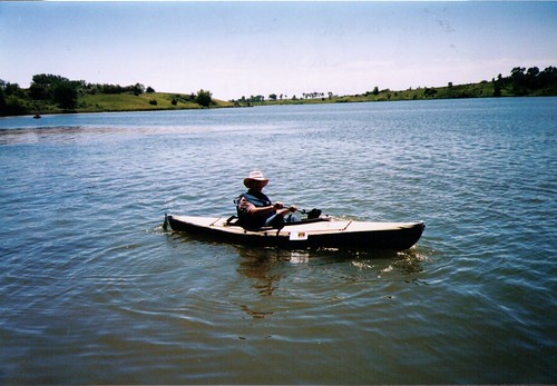
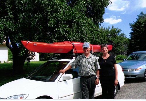
This blog is designed to highlight the paddling opportunities within South Dakota, mainly within a 50-mile radius of Sioux Falls. While Sioux Falls is far from the adventure of coastal regions, there is a certain satisfaction in utilizing the available waterways to observe weather, water conditions, and the landscape along the shoreline. In addition, there is a wealth of animal life on the waters of small South Dakota lakes, rivers, and creeks, including geese, ducks, pelicans, great blue heron, egrets, hawks, owls, perching birds, deer, raccoons, and beaver. Eagles, fox, and coyote are also sometimes spotted.

The sites described are places where I have kayaked over the past few years, mostly in South Dakota but sometimes including locations in Iowa and Minnesota. One of the best sources of information on the accessibility of small lakes is the South Dakota Atlas and Gazetteer, the large map book of South Dakota. Lakes with a public access are generally identified by a boat symbol marking the location of a launching site on public land.

You will notice the menu of paddling locations on the right side of the blog. Each of the postings is linked to one of the areas, and my intention is to provide a continuing review of the places where I paddle. Perhaps these narratives will help readers select waterways of interest to them. Please feel free to offer a comment regarding any of my postings; I would welcome the dialog.

I also maintain a companion blog that describes hiking opportunities within the Sioux Falls area. You can access that blog at: http://hikingsiouxfalls.blogspot.com

Wednesday, July 05, 2006

Wall Lake

Wall Lake is located just west of Sioux Falls and is a heavily used area waterway. There is a good deal of development along much of the shoreline with lake homes that range from cottages to what seem like mansions to me. The lake is about twice the area of Lake Alvin, but it is pretty much an oval shape, which makes it look smaller. Minnehaha County has a park along the southern end of the lake with a swimming beach, shelter, and lots of picnic tables. The Girl Scouts have their area camp located just to the east of the park, still on county owned land. The state owned boat launching area is along the southwestern end of the lake, and this area is well developed and maintained. There are double launching ramps provided along with a dock and restroom facilities.

IMG_0432

There is an undeveloped area of the lake along the west side, and scattered undeveloped spots along other parts. From the launching point, it took me only about an hour to kayak around the entire perimeter of the lake, including a narrow arm of the lake extending from the western shore in about a quarter of a mile.

As you approach the launching point, a clue to the nature of the lake is prominently posted by the dock in the form of a sign advising boat traffic to proceed in a counter clockwise direction. I saw this sign elsewhere on the lake as well. The need for a defined traffic pattern for a lake is a telling point regarding boat use. Since I arrived on a mid-week morning, I did not feel the need to adhere to that rotation: I took the clockwise route. There were only three other boats active on the lake during my cruise, but one of them was a ski boat that passed me three times with a resulting wake to navigate. I think that a wise kayaker will keep to the perimeter of the lake rather than risk a crossing in the middle; there are just too many possibilities of being either run down or caught up in a serious wake from ski boats. As I kayaked around the shoreline, I saw a great variety of boats, ranging from canoes to motorboats with powerful outboard motors. These motor boats can only zoom up and down this pretty small lake, so it is best to keep out of their way.

IMG_0433

As I moved along the shoreline, I felt a bit like I was slumming, taking in the lifestyle of lake people. People who I came across didn’t seem especially friendly. I could pass within feet of people working in their yard or boat and not receive even a nod of acknowledgement. I felt like kind of an intruder upon the tranquility that these people must crave in their lake life style.

The attraction of Wall Lake for the kayaker, it seems to me, is primarily location; it is quite close to Sioux Falls. From my east side home, it was less than 20 miles, and much of that was just driving west along 57th Street. The waters are sheltered, and the Minnehaha County park is nice – or it was at mid-week with a deserted beach and no one around other than park employees. So, it is an easy body of water to access, and it is interesting to see the variety of lake properties enjoyed by people who have the opportunity to live that life style. It is also a suitable body of water for just paddling for technique or for exercise.

There are a number of features that do not place Wall Lake high on my list of area lakes. First, the high level of development seems to work in opposition to opportunities to observe wildlife. I did see a muskrat, but there were no waterfowl in sight during my cruise: no ducks, no geese, no egrets, and no great blue heron. There are lots of power boats using the lake, and this takes away from a tranquil paddle. The counter clockwise suggested rotation of boats just presents a negative notion to me. The lake is generally just a big oval which does not present a very interesting landform.

IMG_0431

My recommendation is to restrict a visit to Wall Lake to mid-week mornings. I would think that weekends, holidays, and afternoons would be unattractive times for kayaking on this lake. Lake Alvin offers a better body of water for the kayaker who is interested in a location close to Sioux Falls.

Thursday, June 29, 2006

Lake Lakota

Lake Lakota is part of but detached from Newton Hills State Park, about six miles south of Canton, SD, on Highway 11. The lake is within a “fee area,” requiring a park sticker. The entrance is just south of the entry into Newton Hills State Park, just east along the first road past the park. The lake area has all the amenities of most well equipped state parks: a good launching point for boats, a swimming beach, a changing room for swimmers, restroom facilities, and shaded picnic tables on a grassy area just behind the swimming beach. Lake Lakota is designated as “no wake,” so the only craft to be seen on the water are trolling fishing boats – unless another kayak or canoe should appear.

The lake is generally oriented north to south and is in an oval shape with an arm extending out to the west. Lakota is small; it takes only about 15 minutes to paddle the north – south length of the lake, even at a leisurely pace. The setting is beautiful: some rolling hills, more trees than usual and in great variety including evergreens, and grasses and bushes along the shore line.


A unique quality to this lake is the extent of aquatic grass and other water plants. While the aquatic grass is extensive along the shore, it is also easy to kayak over the top of it. The water is exceptionally clear, and through breaks in the aquatic grass a person can see bottom details at four feet or more. I especially liked moving over the aquatic grass up the western arm of the lake. The water was pretty deep: I often could not touch bottom with a double bladed kayak paddle. Traveling through the grass seemed to me like a polar setting where a kayaker might seek out leads in the ice – clear pathways through the ice. It was much like that with the grasses in Lake Lakota. In deep water, the grass would extend like the vegetation of a jungle. There were clearings where I could look deep in the water. Paddling on top of the grass was easy, as long as I kept the rudder up.
I can not imagine wind waves gathering on Lake Lakota, at least while the grass is thick on large parts of the water.

As always, I found the shore line the most interesting part of the lake. I saw a muskrat swimming and scampering along the edge of the water, several large turtles, a number of big frogs sitting on the vegetation even in deep water while helping keep the insect population down, ducks and geese up in the western arm of the lake, and a lot of small fish flitting through the clear spots within the “Sargasso Sea” of Lake Lakota.

On a Wednesday morning, the park was deserted, and there were two boats with fishermen moving slowly around the middle of the lake. This would be a good spot to bring a family or group of people who wanted to have a day in a beautiful setting – a little swimming, a little kayaking, some sitting around in the shade, a picnic lunch. Lake Lakota would be a very nice spot for beginners in a kayak. For more seasoned paddlers, the scenery and the search for wildlife would have to be the major attractions of this lake. It is right next door to Newton Hills State Park; so, it would be possible to go for a paddle at the lake and then take in a nice hike along the trails in the park.

Saturday, June 24, 2006

Lake Vermillion

On Thursday of last week, I bought a new kayak to celebrate my retirement from university teaching. After considering many options, I decided to buy a Dagger 13 foot recreational/touring kayak. This boat has a rudder, two watertight compartments with hatches, and thigh braces. It weighs 51 pounds. In the end, I just really wanted to work with a rudder to have that experience. I didn't think that I had storage space in my garage or in the back yard for a longer boat.

I took the new kayak out to Lake Vermillion today for its maiden voyage. This lake is located west of Sioux Falls and south of Montrose. From Sioux Falls, most people would just go west on Highway 42 and then north to the lake. There is good signage to the SD Recreation Area located about four miles north of the highway along a paved road. A good share of the park is within the Lake Vermillion Recreation Area and requires a park sticker for entrance. There are two boat ramps, and I used the west ramp within the main part of the park. Lake Vermillion is a pretty heavily used recreation area, especially on weekends. There are two ramps at the launching point, and they were both busy when I arrived. There were also about a dozen cars or trucks with attached trailers in the parking lot. The lake is shaped sort of like the letter J. The boat ramp is at the low end of the J, and most of the power boats are out in the longer side of the lake. There are ski boats, jet skis, fishing boats, and people just cruising about in all sorts of boats. The power boat action is along this longer side of the lake. Those of us in kayaks can just put in at the ramp and then move out and turn right (west) onto the lower part of the J. This direction leads under the bridge of the north/south road running from Highway 42 north to Montrose. This is a portion of the lake which power boats seem to ignore. The first hurdle for them would be going under the bridge itself. The waters are narrower than the main part of the lake, and there are shallow points along the banks. But, this is just fine for the kayak.


I moved up the west arm of the lake for a mile and a-half or so. There are backwaters to explore along the western end of the lake, and this is where wildlife from the area is more likely to be seen. On my paddle up the arm, I saw numerous geese and a few great blue heron. I also saw a few turtles and jumping fish, but I didn’t run into any other boats.

I don’t think that this is the greatest body of water for the kayak boater. The main part of the lake is crisscrossed with power boats and their wakes. There is little to see along the shore other than a swimming beach, housing development on the south side of the lake, and an ordinary body of water. It may be just great for sailing and motorboats, but it is not especially attractive to the kayaker. The western arm of the lake is okay, and there is some interesting landform and bird life. The shoreline seems made up of a succession of low rolling hills. There is a lot of tall grass and willows, and some trees. The cruise up this arm is likely to take only half-an-hour, and then it is just the return trip. The attraction of Lake Vermillion to me is that my wife can go walking with our little dog while I go out in the kayak. This is not usually an option at the more under used lakes that I visit that have no real park facilities or hiking trails, such as Grass or Beaver Lakes. I think that this would also be a good lake to go to with a group of people who wanted to take turns going out in the kayaks. There is opportunity for those waiting to walk around the park rather than just sitting. So, there are certainly good reasons to go to Lake Vermillion. There are better choices, however, for those who want to check out the wildlife and to experience some isolation and solitude.