This blog is designed to highlight the paddling opportunities within South Dakota, mainly within a 50-mile radius of Sioux Falls. While Sioux Falls is far from the adventure of coastal regions, there is a certain satisfaction in utilizing the available waterways to observe weather, water conditions, and the landscape along the shoreline. In addition, there is a wealth of animal life on the waters of small South Dakota lakes, rivers, and creeks, including geese, ducks, pelicans, great blue heron, egrets, hawks, owls, perching birds, deer, raccoons, and beaver. Eagles, fox, and coyote are also sometimes spotted.

The sites described are places where I have kayaked over the past few years, mostly in South Dakota but sometimes including locations in Iowa and Minnesota. One of the best sources of information on the accessibility of small lakes is the South Dakota Atlas and Gazetteer, the large map book of South Dakota. Lakes with a public access are generally identified by a boat symbol marking the location of a launching site on public land.

You will notice the menu of paddling locations on the right side of the blog. Each of the postings is linked to one of the areas, and my intention is to provide a continuing review of the places where I paddle. Perhaps these narratives will help readers select waterways of interest to them. Please feel free to offer a comment regarding any of my postings; I would welcome the dialog.

I also maintain a companion blog that describes hiking opportunities within the Sioux Falls area. You can access that blog at: http://hikingsiouxfalls.blogspot.com

Monday, June 10, 2013

Lake Lakota - Late Spring 2013


When I last visited Lake Lakota in March of 2012, the water had receded so far that the paddling opportunity was just not worth the drive from Sioux Falls.  As the spring and summer wore on, the condition of the lake only worsened.  But, I received a report from a paddler just yesterday that the lake had filled during the rains of this spring and had even more surface area than normal.
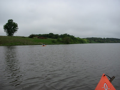
So, Dave Finck and I decided to visit the lake this morning.  Overnight, a dense fog descended over southeastern South Dakota and I drove the 28 miles south through limited visibility.  We met at the lake at 8:30 a.m. as the fog started lifting over the lake.  With the fog just beginning to dissipate, the landscape had an ethereal look and the surface of the lake was mirror smooth with no wind.
The dock has not been installed at the launching ramp, and there are warnings about debris in the water.  The site was deserted, as usual at that time of a weekday.
We set off a clockwise circuit around the lake, moving along the southeast shoreline. 
 Very quickly, we moved into one of my favorite inlets just southeast of the launching point.  This is a drainage area for streams flowing from the north into the lake.  At first, it looks like a bay extending east, but soon the bay narrows as feeder creeks enter the main body of water.
A kayak can move up this inlet for a few hundred yards through interesting landscape.
 Today, we came across some large raptors flying about us from their perch high above in a tall tree.
Exiting the inlet, we continued our movement south toward the dam and spillway.  As the fog disappeared, a light breeze came up and hastened the disappearance of the fog.  Soon, the sun was peeking through the clouds.
We continued past the dam and began our return trip along the western side of the lake to the public access area – a public access area that has closed for now because of a road washout. 
 The lake has an upside down “L” shape, and after passing along the western shoreline of the main body of the lake, we made the turn west into an arm that leads to the inlet of Pattee Creek.  Normally, this arm of the lake is filled with aquatic growth, especially reeds growing in the shallower water. While this arm has always been passable during my previous visits to the lake, today the depth was such that a kayak could easily cruise through to the inlet of Pattee Creek.
As we moved down toward the road that crosses the creek and normally forms the end of passage for a kayak, we saw that the bridge had washed out.  There had been large culverts under the road, but the culverts and the road have washed out. 
We entered Pattee Creek to explore the western flow, but there was a barbed wire fence across the creek preventing further passage.
Returning down the northern shoreline toward the launching ramp, we came across a lone fisherman with his dog out in a motorboat.  We shared pleasantries and enjoyed the moment of the guy with his dog.  I always like the sight of a person out in nature with his dog; what better friend that a trusting and loving dog!
 We spent about an hour and forty-five minutes on the water this morning.  It was a good contemplative cruise under ideal conditions.  I am so glad that Lake Lakota has been restored.  I always enjoy my cruises on this lake.
 For those who would like additional information about Lake Lakota, please be sure and check out the previous narratives located on the area waterways menu on the right side of the blog.
The complete set of photographs that I took this morning at Lake Lakota can be seen on my Flickr account at the following URL: http://www.flickr.com/photos/jayheath/sets/72157634050282959/

1 comment:

Jarett C. Bies said...

FYI, those raptors are turkey vultures, Jay. Be careful, they can spit poison. Great report and images as usual, sir. Have a good weekend!