This blog is designed to highlight the paddling opportunities within South Dakota, mainly within a 50-mile radius of Sioux Falls. While Sioux Falls is far from the adventure of coastal regions, there is a certain satisfaction in utilizing the available waterways to observe weather, water conditions, and the landscape along the shoreline. In addition, there is a wealth of animal life on the waters of small South Dakota lakes, rivers, and creeks, including geese, ducks, pelicans, great blue heron, egrets, hawks, owls, perching birds, deer, raccoons, and beaver. Eagles, fox, and coyote are also sometimes spotted.

The sites described are places where I have kayaked over the past few years, mostly in South Dakota but sometimes including locations in Iowa and Minnesota. One of the best sources of information on the accessibility of small lakes is the South Dakota Atlas and Gazetteer, the large map book of South Dakota. Lakes with a public access are generally identified by a boat symbol marking the location of a launching site on public land.

You will notice the menu of paddling locations on the right side of the blog. Each of the postings is linked to one of the areas, and my intention is to provide a continuing review of the places where I paddle. Perhaps these narratives will help readers select waterways of interest to them. Please feel free to offer a comment regarding any of my postings; I would welcome the dialog.

I also maintain a companion blog that describes hiking opportunities within the Sioux Falls area. You can access that blog at: http://hikingsiouxfalls.blogspot.com

Thursday, June 29, 2006

Lake Lakota

Lake Lakota is part of but detached from Newton Hills State Park, about six miles south of Canton, SD, on Highway 11. The lake is within a “fee area,” requiring a park sticker. The entrance is just south of the entry into Newton Hills State Park, just east along the first road past the park. The lake area has all the amenities of most well equipped state parks: a good launching point for boats, a swimming beach, a changing room for swimmers, restroom facilities, and shaded picnic tables on a grassy area just behind the swimming beach. Lake Lakota is designated as “no wake,” so the only craft to be seen on the water are trolling fishing boats – unless another kayak or canoe should appear.

The lake is generally oriented north to south and is in an oval shape with an arm extending out to the west. Lakota is small; it takes only about 15 minutes to paddle the north – south length of the lake, even at a leisurely pace. The setting is beautiful: some rolling hills, more trees than usual and in great variety including evergreens, and grasses and bushes along the shore line.


A unique quality to this lake is the extent of aquatic grass and other water plants. While the aquatic grass is extensive along the shore, it is also easy to kayak over the top of it. The water is exceptionally clear, and through breaks in the aquatic grass a person can see bottom details at four feet or more. I especially liked moving over the aquatic grass up the western arm of the lake. The water was pretty deep: I often could not touch bottom with a double bladed kayak paddle. Traveling through the grass seemed to me like a polar setting where a kayaker might seek out leads in the ice – clear pathways through the ice. It was much like that with the grasses in Lake Lakota. In deep water, the grass would extend like the vegetation of a jungle. There were clearings where I could look deep in the water. Paddling on top of the grass was easy, as long as I kept the rudder up.
I can not imagine wind waves gathering on Lake Lakota, at least while the grass is thick on large parts of the water.

As always, I found the shore line the most interesting part of the lake. I saw a muskrat swimming and scampering along the edge of the water, several large turtles, a number of big frogs sitting on the vegetation even in deep water while helping keep the insect population down, ducks and geese up in the western arm of the lake, and a lot of small fish flitting through the clear spots within the “Sargasso Sea” of Lake Lakota.

On a Wednesday morning, the park was deserted, and there were two boats with fishermen moving slowly around the middle of the lake. This would be a good spot to bring a family or group of people who wanted to have a day in a beautiful setting – a little swimming, a little kayaking, some sitting around in the shade, a picnic lunch. Lake Lakota would be a very nice spot for beginners in a kayak. For more seasoned paddlers, the scenery and the search for wildlife would have to be the major attractions of this lake. It is right next door to Newton Hills State Park; so, it would be possible to go for a paddle at the lake and then take in a nice hike along the trails in the park.

Saturday, June 24, 2006

Lake Vermillion

On Thursday of last week, I bought a new kayak to celebrate my retirement from university teaching. After considering many options, I decided to buy a Dagger 13 foot recreational/touring kayak. This boat has a rudder, two watertight compartments with hatches, and thigh braces. It weighs 51 pounds. In the end, I just really wanted to work with a rudder to have that experience. I didn't think that I had storage space in my garage or in the back yard for a longer boat.

I took the new kayak out to Lake Vermillion today for its maiden voyage. This lake is located west of Sioux Falls and south of Montrose. From Sioux Falls, most people would just go west on Highway 42 and then north to the lake. There is good signage to the SD Recreation Area located about four miles north of the highway along a paved road. A good share of the park is within the Lake Vermillion Recreation Area and requires a park sticker for entrance. There are two boat ramps, and I used the west ramp within the main part of the park. Lake Vermillion is a pretty heavily used recreation area, especially on weekends. There are two ramps at the launching point, and they were both busy when I arrived. There were also about a dozen cars or trucks with attached trailers in the parking lot. The lake is shaped sort of like the letter J. The boat ramp is at the low end of the J, and most of the power boats are out in the longer side of the lake. There are ski boats, jet skis, fishing boats, and people just cruising about in all sorts of boats. The power boat action is along this longer side of the lake. Those of us in kayaks can just put in at the ramp and then move out and turn right (west) onto the lower part of the J. This direction leads under the bridge of the north/south road running from Highway 42 north to Montrose. This is a portion of the lake which power boats seem to ignore. The first hurdle for them would be going under the bridge itself. The waters are narrower than the main part of the lake, and there are shallow points along the banks. But, this is just fine for the kayak.


I moved up the west arm of the lake for a mile and a-half or so. There are backwaters to explore along the western end of the lake, and this is where wildlife from the area is more likely to be seen. On my paddle up the arm, I saw numerous geese and a few great blue heron. I also saw a few turtles and jumping fish, but I didn’t run into any other boats.

I don’t think that this is the greatest body of water for the kayak boater. The main part of the lake is crisscrossed with power boats and their wakes. There is little to see along the shore other than a swimming beach, housing development on the south side of the lake, and an ordinary body of water. It may be just great for sailing and motorboats, but it is not especially attractive to the kayaker. The western arm of the lake is okay, and there is some interesting landform and bird life. The shoreline seems made up of a succession of low rolling hills. There is a lot of tall grass and willows, and some trees. The cruise up this arm is likely to take only half-an-hour, and then it is just the return trip. The attraction of Lake Vermillion to me is that my wife can go walking with our little dog while I go out in the kayak. This is not usually an option at the more under used lakes that I visit that have no real park facilities or hiking trails, such as Grass or Beaver Lakes. I think that this would also be a good lake to go to with a group of people who wanted to take turns going out in the kayaks. There is opportunity for those waiting to walk around the park rather than just sitting. So, there are certainly good reasons to go to Lake Vermillion. There are better choices, however, for those who want to check out the wildlife and to experience some isolation and solitude.

Wednesday, June 21, 2006

Beaver Lake

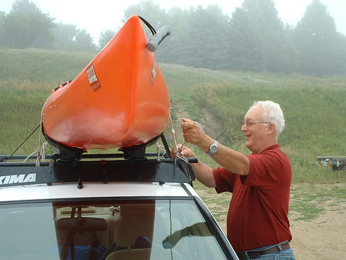
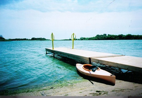
Beaver Lake is a fairly large body of water located near Humboldt, SD, about 25 miles east of Sioux Falls. The lake is located just to the north of Interstate 90, and it is accessed by exiting the Interstate at Humboldt, going through the main part of town to the eastern edge of the community, turning south on Ford Street and continuing south past the cemetery to the first gravel road running east (259th Street). The lake is about ¾ of a mile east from the intersection. There is a clearly marked public lake access area on the left with a large graveled parking area, a restroom, and a pier extending into the lake. A water tower located along the Interstate to the south of 259th is a good landmark. The tower nearly marks the public lake access area.


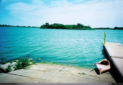
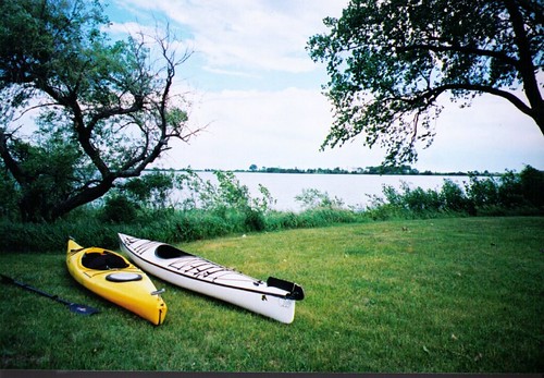
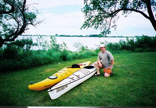
The lake is a large irregularly shaped body of water that is quite wide in places. The southern and western shores are generally wooded, and there is a large island at the eastern end of the lake that is heavily wooded. Because the lake is so open and wide, a wind can easily kick up quite a chop, especially in the center part. Still, like in most of the prairie lakes, there is nearly always a sheltered side on the lake.

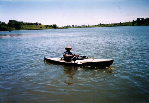
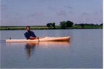
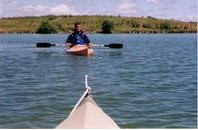
Today I took my kayak out on Beaver Lake, and like when I have gone before, there was a stiff wind out of the west. It was easy to launch the kayak from the boat ramp, but I decided to immediately head out around the island located a fair distance offshore from the launching point. As I got out of the shelter of vegetation along the pier, I quickly found myself in waves up to 2 feet high. Still, the allure of the island kept me going until I reached its shore. From there, I found the waters sheltered in the lee of the island and was able to paddle around most of it. I then headed east and found myself in a following sea with the waves chasing me to the shore. Once I was 10 or 15 feet off the shore, it was much easier to kayak, even with the waves continuing to roll in on the beam of the kayak. I saw a few pelicans, but I think that the wind was too strong for them to hang around on the lake; they flew off, and I did not see them again. I continued to follow the shoreline of the lake around the southern end and on to the western part. These waters were quite sheltered, and I did not experience any serious wave action.


As I approached the western end of the lake, I saw a deer ahead of me eating the tall grass right at the waters edge. Since I was downwind, it is not likely that the deer either heard my paddles or caught my scent. When I came within about 100 feet, the deer started watching me, and when I got to within about 40 feet, he simply turned and strolled off into the tall grass. Soon, a great blue heron flew up from a perch along the shore and passed in front of me. There were plenty of birds in the grasses, reeds, and trees along the shore, including a number of yellow headed blackbirds.

From the western end of the lake, I began a paddle back toward the launching point. This is where the fun – or anxiety – began. Suddenly, I was without any lee from the trees, with the wind whipping up waves that were two and a-half feet in height while I followed the march of these waves over a large open body of water. The waves were breaking on the bow of the kayak, and they were higher than the cockpit of the boat. I was a little apprehensive about broaching the boat in these waves, but I had a fairly long distance to paddle before reaching the lee of the island and the eastern end of the lake. So, I just continued paddling and expecting to make it okay. I was aware that my kayak has no internal flotation, I was alone on the lake, and it would be a long swim if something went wrong. The smart thing to do when the wind is high, especially for people in a recreational kayak, is to stay close to the shore and within the lee of land as much as possible. There is something about an island, however, that seems to draw all of us on. I think that we are just determined to visit the island and kayak around it, regardless of the wind conditions. It would be best to suppress such ambition, however, and play it safer. High waves do not produce such anxiety while moving along the shore. After all, the kayak skirting the shoreline is only 10 to 15 feet out. In the middle of a large open lake, however, it is a little more challenging when a mishap would mean a long swim. My advice is to stick to the shoreline and leave the open water crossings for a calm day. And, of course, it is along the shoreline where we can see land forms, vegetation, and animals native to this environment. There really isn’t a lot to see on an open crossing expect the water itself.

So, Beaver Lake is another good area for the local kayaker. As long as the kayak route is chosen with care, this should be a good paddle. Because of the irregular shape of the lake and the open country, there is a great variety in water and wind conditions. Remember, though, there is rarely anyone else on the lake or in the area, so it is important to be careful and to always wear a life jacket. It also helps to paddle a kayak with internal floatation compartments.

Tuesday, June 20, 2006

Lake Alvin

Lake Alvin is certainly one of the most accessible and well-used bodies of water in the Sioux Falls area. The lake is southeast of Sioux Falls along Highway 11, just east of Harrisburg. There are two access points to the lake; one is within the State Recreation Area located at the northeastern edge of the lake and the other is a public lake access point on the northwestern part of the lake. Within the Recreation Area, there is a well-developed launch area including a concrete ramp, a pier extending into the lake, and restroom facilities. A park sticker or a daily fee is required to enter the Recreation Area. The public access area does not require an entry permit, and the facility is also quite good with a boat ramp, a pier, and restroom facilities. Parking space in the Recreation Area is paved; in the public access area, parking is on a dirt road and on the grass.


The lake is long and narrow, feeding out of Nine Mile Creek at the southwestern end of the lake. The Recreation Area extends around the northern portion of the lake, and this includes a public swimming beach, a spillway, the launch area for boats, and a fishing dock. This is also the deepest portion of the lake and a popular part of the lake for fishing. There are high banks along this portion of the lake, so there seems to always be a lee side with calm water, even if there is a good breeze blowing. The southern portion of the lake includes a fishing area near the public access point, but the lake becomes shallower at this end.


Nine Mile Creek enters into Lake Alvin at the extreme southwestern point; when water is high, it is fairly easy to kayak quite a distance up the creek. This is one of my favorite parts of the lake. Going up Nine Mile Creek, the kayaker moves into a swampy waterway with cattails and other aquatic plants as well as waterfowl, particularly ducks. There is a current down the center of the creek, and the water is adequate to move up for half-a-mile or more. Generally, when I go up Nine Mile Creek, I go until it becomes too narrow to turn the kayak around. This is a trip that I take a couple of times a year.


I like to go on a moonlight cruise on Lake Alvin. I have usually taken off at twilight from the public access point and headed northeast up into the main body of the lake. For me, it is especially relaxing to arrive up at the northern portion of the lake as the sun is setting. Coming back, I like to see the sun set and the moon rise. This is a magical time along the lake when the birds are settling down for the night. Then, I approach the public access area as dark descends upon the lake. The biggest challenge may be hauling the kayak out and securing it to the car top carrier in the dark.


Lake Alvin is not a secluded spot for observing wildlife. The lake is quite popular with area fishermen, it is a well used state recreation area, and there is increasing residential development just outside the boundary of the recreational area as well as along the southern end of the lake near the public access area. But, the lake is an attractive site, there is generally shelter from the wind on one or more sides of the lake, and it is very accessible to people who live in the Sioux Falls area. When I want a quick paddling trip out on some nearby water or want to try out a new boat or piece of equipment, this is the place I generally head to first. The South Dakota Canoe Association has hosted an annual event at the public access area for people to try out various kayaks or canoes. I usually take my first and last kayak trip of the year on Lake Alvin, and I revisit it several times a year.

Monday, June 19, 2006

Silver Lake

Yesterday, Jarett Bies, a Sioux Falls kayaker of far greater skill and experience than me, and I spent an afternoon kayaking Silver Lake, located near Freeman, SD. This fairly large open lake is located along Highway 81, just north of Freeman and is generally circular in shape. There is a public access area on the eastern side of the lake with a concrete launching ramp and a highway rest area on the western side. A fringe of trees borders the lake, and there is an island roughly in the center. It would be fairly easy to land on the island to stroll around a bit, although we did not do that. Wildlife observed on this trip included waterfowl (geese, ducks, and cormorant) and a variety of other bird life.


We first considered launching our touring kayaks at the public access boat ramp, but it was a very windy day with the wind coming out of the west creating two foot high waves rolling into the ramp. There were also large rocks underwater on either side of the ramp. The launch looked a little dicey to me, especially since I was using one of Jarett's touring kayaks for the first time. Instead, we drove over to the rest area along Highway 81, parked the car and carried our kayaks the short distance down to a sandy shore where we could launch out of the wind. Moving out of the launching area, we encountered a pretty good chop just on the verge of forming whitecaps. The wind, however, was blowing out into the lake, and the launch was easy. After getting used to the water conditions, we headed out to the island in the center part of the lake. Throughout the outward part of this trip, we continued to experience choppy conditions. After cruising around the island, we headed over to the southern shore and found ourselves in placid waters where we could just cruise along in the lee of the trees and the higher bank. As so often happens on the prarie lakes, there always seems to be a lee side to the lake where a kayak can cruise along in tranquility.


Silver lake is clearly in agricultural country, and there is not extensive vegetation as might be seen at Grass Lake or along Split Rock Creek. It would seem that birds are the most likely wildlife to be seen on or around this body of water. Since the lake is pretty large, open, and circular, wind is more of a challenge than on some of the other area lakes. Still, Silver Lake offers an opportunity to experience a variety of water conditions and is a pretty easy spot to find. It is only a half hour or so drive from the western edge of Sioux Falls. We did not see any other boats on the lake, even though our trip was on a Sunday afternoon.

I took a couple of photographs of the lauch area at Silver Lake and the kayaks on the shore , and I will insert those photos when I have them developed.

Monday, June 12, 2006

Grass Lake

Grass Lake is one of my favorite small lakes in the Sioux Falls area. The lake is located west of Sioux Falls, north of Highway 42 between Hartford and Humbolt. Going west on Highway 42, you would go north on 459th Avenue, a paved highway, for about three miles to near 262nd Street. There is a public lake access point with a primative boat launch area, but also a good place to launch a canoe or kayak.

A person entering the lake at this point is unlikely to encounter anyone on the lake. There are two islands in the lake, and pelicans and great blue herons along with egrets are likely to be seen in large numbers. I have also seen racoons and muskrat in this lake. Once while cruising along, I heard a buzzing and looked up to see some guy in a powered parachute sort of flying craft moving slowly across the sky.

Like most prairie lakes, Grass Lake has varied banks with generally enough trees and bank height to provide shelter from the wind, at least on parts of the lake. It generally takes me about 90 minutes to cruise along the perimeter of the lake. This is a very tranquile cruise, and it provides a great opportunity for bird watching, looking a cloud formations, and checking out the shore life along the banks.

Update: Today, June 14, I took a cruise on Grass Lake. As I kayaked along the shore line, I came across a family of five racoons. They were moving through pathways that they had created through the tall grass and willows along a high bank. The racoons seemed unconcerned about me. I was able to come up to within three feet of them, and I just hung around that spot for about ten minutes observing them. There were adult racoons and several younger ones in the group. I saw one of them gnawing on a fish. The racoons were chattering among themselves as I sat there in my kayak caught up in the pleasure of observing this rare sight. After a time, I just moved off down the lake.

As I came around a point, a great blue heron that had been sitting on a rock took off and flew low to the water, passing the bow of my kayak within about five feet. As I made my way down the lake, I came to another rocky point that provided a resting spot for a flock of 12 big white pelicans. As I approached the point, first one and then all the pelicans took off and circled over the kayak - gliding along with big wings outstretched. It was a delightful sight to see these great birds soaring above and around me.

Water in the lake was just fine today. It was a little windy, but a good portion of the lake was in a lee because of the high banks and direction of wind. The only sounds on the lake were birds, the lap of waves on the bow of the kayak, and the dip of paddles as I slowly cruised along.

Sunday, June 11, 2006

Split Rock Creek

Split Rock Creek is one of the most scenic cruises in the Sioux Falls area. It can be accessed at the Garretson city park. A dam in the park backs up the water so that a kayak can cruise upstream among overhanging cliffs of quartzite. It takes about 30 minutes to kayak upstream and about 20 minutes to paddle/float back downstream, and the water is deep enough to ensure easy paddling throughout the summer. Large colonies of swallows inhabit cliffs along the waterway.


A paddler may also see a family of beavers or a lone muskrat swimming alongside. A deer might be seen bounding through the woods as a kayak passes. Since the creek runs along agricultural land on one side, it is not uncommon to find a cow standing in shallow water. A large pontoon boat, the SS Jessie James, provides tours for those who don't want to paddle. On the return trip down the creek, a kayak can go through an arched bridge into the gulch where Jesse James is said to have escaped a posse while fleeing a bank robbery in Minnesota. The city of Garretson maintains a visitor center in the park where the returning kayaker might slake his thirst with a cold beverage. In my first trip up Split Rock in May of this year, there was a backlog of driftwood caught up in the arches into the gulch, and it was a little tricky to pass through one of the arches. Taking the kayak into the gulch offers a chance to visit a magical and undisturbed world of rock faces, interesting vegitation, and sleeping turtles.


In my view, if a person is taking a guest out for a first kayak ride, this is a wonderful place to introduce kayaking. I go to this site several times each year, sometimes alone and sometimes with a friend or one of my sons. I sometimes also go with my wife and dog. While I am out in the kayak, they stroll about the park and camp grounds.