This blog is designed to highlight the paddling opportunities within South Dakota, mainly within a 50-mile radius of Sioux Falls. While Sioux Falls is far from the adventure of coastal regions, there is a certain satisfaction in utilizing the available waterways to observe weather, water conditions, and the landscape along the shoreline. In addition, there is a wealth of animal life on the waters of small South Dakota lakes, rivers, and creeks, including geese, ducks, pelicans, great blue heron, egrets, hawks, owls, perching birds, deer, raccoons, and beaver. Eagles, fox, and coyote are also sometimes spotted.

The sites described are places where I have kayaked over the past few years, mostly in South Dakota but sometimes including locations in Iowa and Minnesota. One of the best sources of information on the accessibility of small lakes is the South Dakota Atlas and Gazetteer, the large map book of South Dakota. Lakes with a public access are generally identified by a boat symbol marking the location of a launching site on public land.

You will notice the menu of paddling locations on the right side of the blog. Each of the postings is linked to one of the areas, and my intention is to provide a continuing review of the places where I paddle. Perhaps these narratives will help readers select waterways of interest to them. Please feel free to offer a comment regarding any of my postings; I would welcome the dialog.

I also maintain a companion blog that describes hiking opportunities within the Sioux Falls area. You can access that blog at: http://hikingsiouxfalls.blogspot.com

Thursday, May 31, 2007

Lake Vermillion - The East Side - May 2007

Lake Vermillion – May 2007

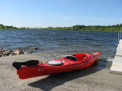
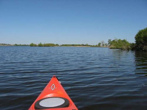
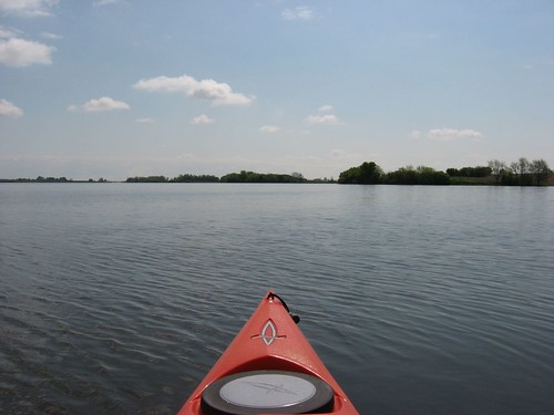
Today I cruised up the east side of Lake Vermillion from the east site of the Lake Vermillion State Recreation Area well into the East Fork Vermillion River.

IMG_0880

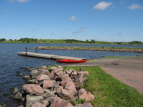
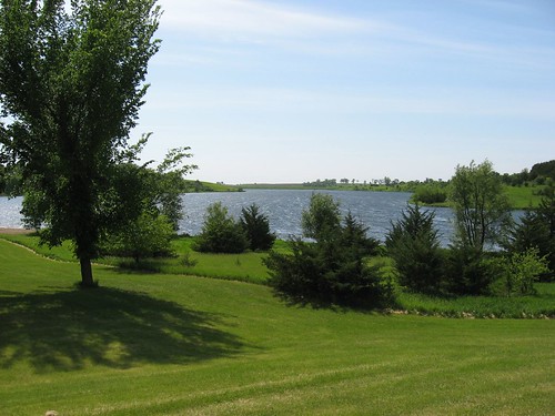
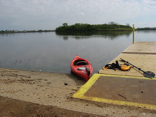
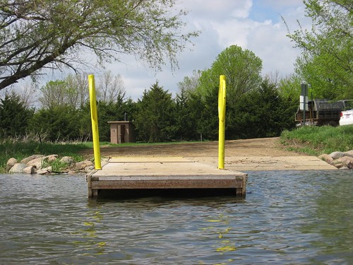
The east site of the recreation area is a public access and no park sticker is necessary to use that launching area. There is a spacious paved approach and parking area, a dock, and a toilet at this site. This part of the lake is very close to the dam at the southern end, and it is across from the main part of the recreation area. As I have mentioned in earlier Lake Vermillion posts, the lake is in the form of an “L” with the lower arm extending west back up into Battle Creek. This arm is an area that is popular with kayaks and canoes because there are few boats that venture up that way. The main part of the lake is oriented north and south and extends north for a couple of miles from the dam where it narrows down as it transitions into the East Fork Vermillion River.

IMG_0881

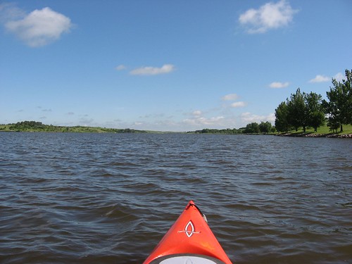
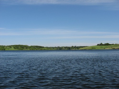
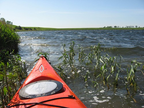
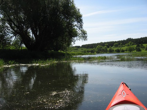
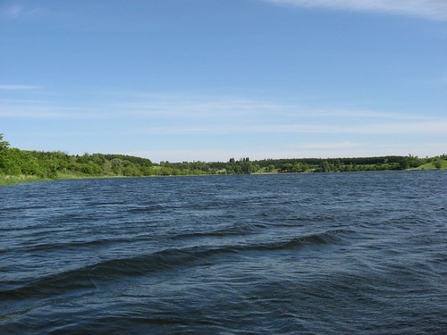
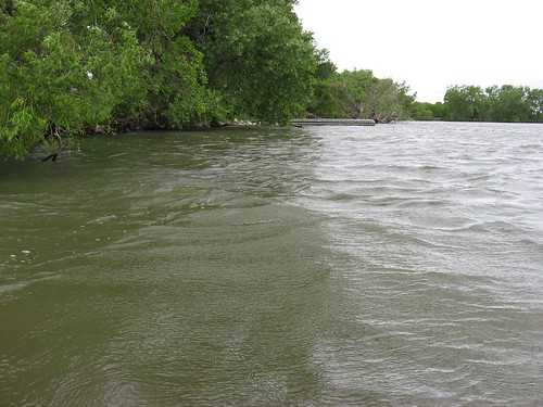
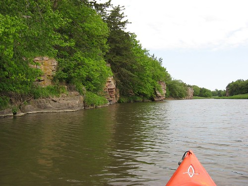
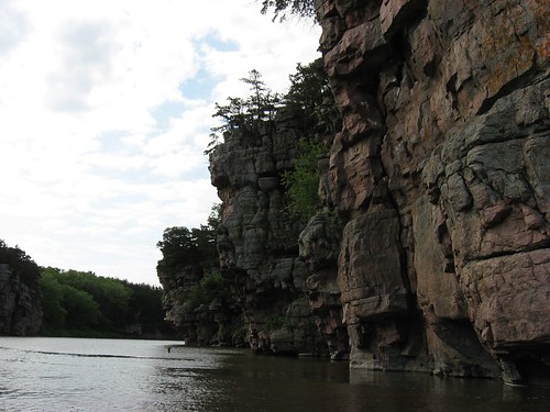
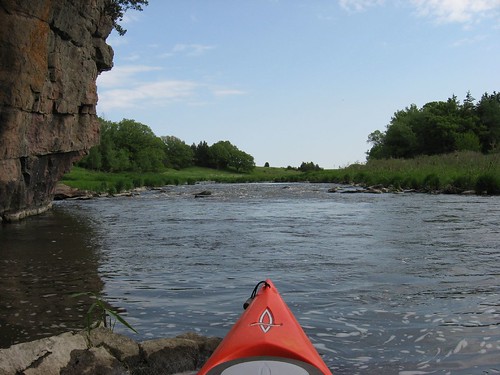
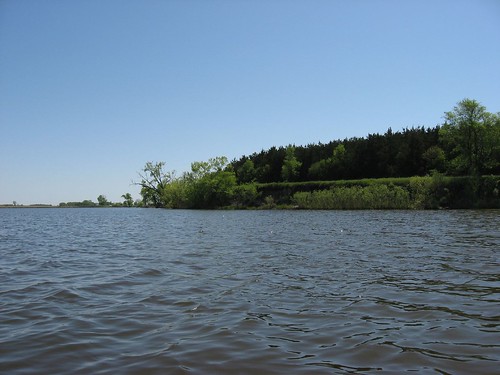
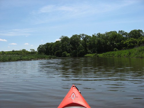
Today there was a moderate wind out of the south, which created a following sea condition going north on the main body of the lake. There are enough coves along the lake so that wave conditions and wind strength varied as I moved north. I moved close to the eastern shoreline so that I could check out conditions for wildlife. Also, I tried to move into calmer waters when possible. At the northern end of the lake, the waterway narrowed considerably as it transformed into a river. I continued upstream on the river for another mile or so until I checked the time and saw that I had been out for 70 minutes. I was aware of the conditions likely on the way back, so I turned and made my way back south toward the launching point.

IMG_0901

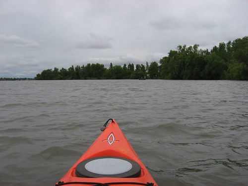
The wind on the way back had increased in strength and the waves had become noticeably larger. The return trip required constant paddling and no slow cruising along the banks. Instead, I began to focus upon the next point or tree to mark progress; sometimes I counted strokes to validate that I was moving from point to point. As I picked up speed, the kayak took waves over the bow and spray was coming back at me. It was not especially risky, just a steady slogging ahead trying to get back. While it took me only 70 leisurely minutes to make the run north, it also took 70 minutes to get back – 70 minutes of vigorous paddling along the shortest distance between points.

IMG_0896

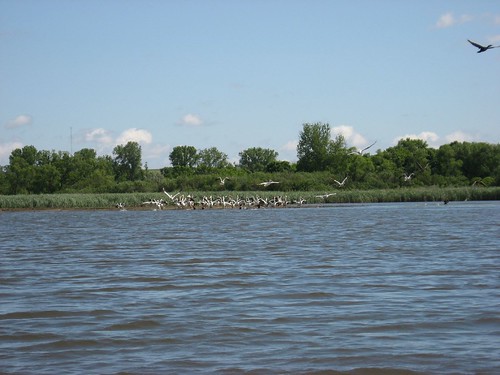
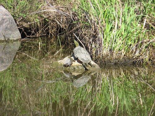
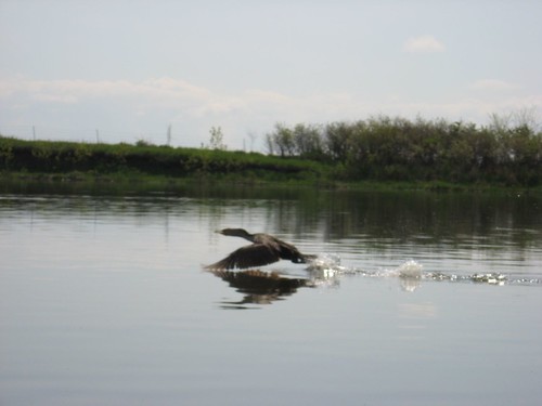
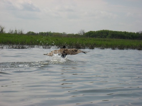
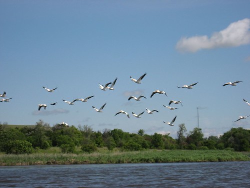
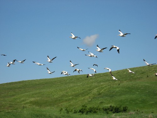
There were lots of pelicans on the lake today. I came across two large flocks at different points; one group was up on the river portion of the cruise. I find these birds beautiful as they wheel overhead. In addition, I saw several great blue herons and lots of ducks. On the way back along the shallower east side of the lake, I came across several gigantic carp just below and alongside the kayak. Occasionally, they would jump out of the water – snapping at bugs, I guess.

IMG_0899

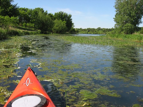
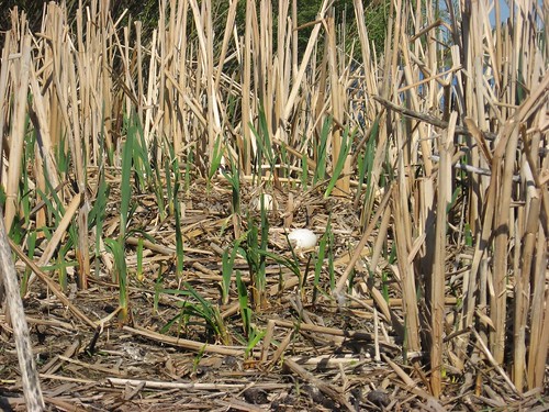
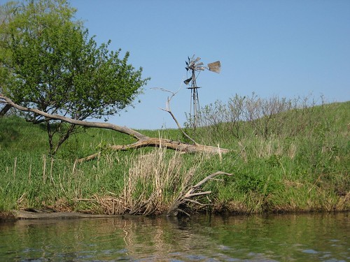
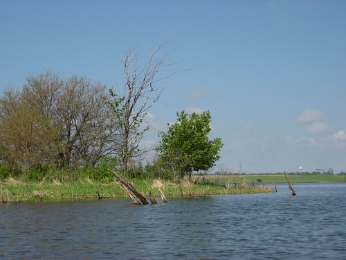
The last time I cruised up the main body of the lake (November), I thought that the east side looked more interesting. As I was moving up the east side today, I thought that the west side looked more interesting. It seems like the east side is shallower with more aquatic grasses growing. For that reason, perhaps, there also seems to be less boat traffic on the east side. I guess that either side has its positive points. Once you get far up into the northern part of the lake, the water narrows down as it becomes a river. At that point, you can move from side to side easily.

On this Thursday morning, I saw a couple of fishing boats out on the water, and there were a couple of guys fishing at the dock at the launching point when I returned. As I have noted before, Lake Vermillion seems best on a weekday when there aren’t speed boats racing up and down. If I were to go there on a weekend day, I would be sure and start off from the east launching point and stick to the eastern side on the cruise up the lake.

IMG_0900

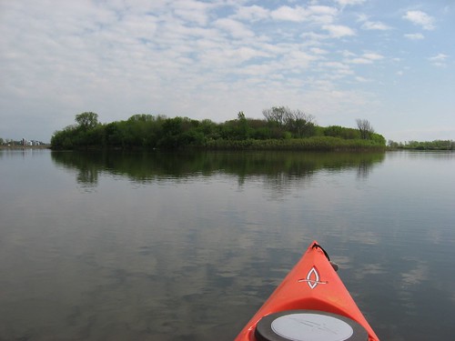
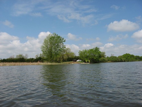
Lake Vermillion is pretty close to Sioux Falls and offers the closest larger body of water. There is limited development along the shoreline, so there is the feeling of being in an isolated waterway. There is also plenty of birdlife and probably other wildlife to observe, especially as you move north on the water.

Saturday, May 26, 2007

Canoe and Kayak Festival - Sunday, June 3

SDCA Logo

The annual canoe and kayak festival sponsored by the SDCA will be held at Lake Alvin on Sunday, June 3, 2007, beginning at 1:00 p.m. The gathering point for this event is the public access area located at the northwestern part of the lake. The entrance to this point is off Highway 11 and not in the state park. This is not a "fee" area, so no park sticker is required.

The purpose of this gathering is for people interested in the sport to try out different types of boats. There is generally a wide range of boat types available: a variety of kayaks and canoes. There will also be five canoes available for people who do not have a boat. In addition, most of the boats at the event can be tried out by those attending. There will be some demonstrations put on by SDCA members as well.

This is a great opportunity for people who have questions regarding the sport or the type of boat that is most appropriate for them. It is also a time of networking and relationship building with area paddlers. The event is open to the public.

I will be there with at least one of my kayaks, and I look forward to meeting readers of this blog at Lake Alvin on Sunday afternoon, June 3.

Friday, May 25, 2007

Lake Lakota - May 2007

Lake Lakota – May 2007

Lake Lakota is part of the Newton Hills State Park and is about 28 miles from my eastside Sioux Falls home. This is my second narrative regarding this lake, and the reader is advised to check out both posts.

IMG_0879

Lakota is about the same size in area as Lake Alvin (about 100 acres) but is shaped a bit differently. The launching point is within a fee area and is very nicely developed for family use. There is a covered picnic shelter, plenty of tables out under trees, a vault toilet, a swimming beach with a changing building, a well designed launching ramp, and a dock.

IMG_0865

On a weekday morning (Friday, May 25), the area was nearly deserted. The wind was pretty brisk creating white caps in unsheltered parts of the lake, the temperature was about 60 degrees, and it was partly cloudy with plenty of sun. I thought that my 90 minute cruise was especially tranquil and contemplative. The only sounds were the wind blowing through the trees, waves rolling in on the shore, and lots of bird calls. I was able to paddle along lost in my thoughts and able to enjoy the beauty of this wonderful setting.

IMG_0870

The lake is a creation of the impoundment of Pattee Creek. The creek enters the lake on the extreme northwest side through a culvert. This part of the lake is a narrow arm that leads out into the main body of water that runs generally north and south. The spillway for the lake is located just in front of the dam located at the southern end, from which Pattee Creek continues. The spillway is a rectangle concrete drain with grates on it which directs excess water down under the dam. You can actually rest a kayak along the spillway and watch the water go down the drain.

IMG_0868

There are trees along most of the lake, some high banks on the southeastern part, several little coves which have quiet waters and lots of aquatic grasses in the lake. The waters are very clear; you can see the bottom clearly at six feet, and this is an especially interesting sight through the water vegetation. There was plenty of water in the lake; even where there was significant aquatic grass, the depth was at least four to five feet along the shore line. My kayak has a rudder, and I really like the way I don’t have to use corrective strokes, especially on windy days. Also, the rudder helps direct the kayak when I want to take photos or gaze quietly at some wild creature. On Lake Lakota, the thick aquatic grasses can cause plenty of practice in raising and lowering the rudder, especially in the shallower coves. Despite all the grasses, my rudder was never tangled.

IMG_0867

As I was kayaking up the western arm of the lake, I came across the largest turtles that I have ever seen in these lakes. The water in this arm was calm and there was significant aquatic grass growing. I saw giant turtles sleeping with just their head showing. They must have not been spooked by my kayak, because I could see their nostrils showing, but they just hung there in the water. On a couple of occasions, I thought that I had come across rocks in the lake. The water was too deep for that, however, and these were actually very large turtles. I reached over and tapped one of them on the shell, but it did not cause any reaction. The shell on the largest of them must have been at least 18 inches wide and even longer in body.

IMG_0876

There were very few waterfowl to be seen today and no mammals that I saw. I would think that this would be a good place to see animals because of the park land surrounding the lake and extending inland. But, I didn’t see any on this trip.

IMG_0871

Kayaking the circumference of the lake and peeking into nearly all of the coves and the western arm takes a little over an hour – maybe 75 minutes. I think that this would be a good place to bring a friend or family member who just wants to hang out reading a book or kicking back while you are out in the kayak. The setting is just great for a mini-cruise in a beautiful setting.

Thursday, May 24, 2007

Lake Madison 2007

Walker Recreation Area - Lake Madison - May 2007

Yesterday I decided that I would go out for a kayak cruise today. The weather has been marginal for the past week with strong winds or rain predicted, and I felt the need to get out on the water again. I put the kayak on top of the car last night reasoning that an equipped car ready to go would ensure that I did not put it off again. When I got ready this morning, rain had started and the skies were overcast. Still, I thought that conditions would get better, and I headed for Island Lake, located 10 miles north and 3 miles west of Humbolt. When I got there, I found conditions much as they were the last time I attempted this lake: windy with big waves crashing on the shore. This is a natural lake and the banks are low with virtually no tree cover. With the wind out of the NW, there was no lee to the lake. It just looked like a rough ride with nothing to protect my kayak from the wind and large waves. So, I went on to Long Lake, just south of Lake Madison. There is a very rough road leading down to the lake shore (see my description of that Lake in the menu), and that road has been severely eroded – really nearly washed out with big ruts. I took a chance and navigated the terrible road down to the lake shore, but I was consumed with thoughts of what might happen if my car got hung up on the ruts, and I knew that there was a strong possibility of that happening. When I got to the lake shore, I saw a trail filled with mud. With the wind blowing pretty strong, the possibility of getting my car stranded on the terrible road, and the mud I would have to wade through with the kayak, I decided to move on to somewhere else.

IMG_0854


Walker’s Point at Lake Madison is a state recreation area only three or four miles from the entrance to Long Lake, and I had passed the sign to that spot on my way in. I wasn’t too keen on kayaking on Lake Madison, but I also didn’t want to have driven all that way only to turn around and go home. So, I unloaded my kayak there in the recreation area. There is a very nice parking lot, toilets, and a dock in the lake. This is a “fee” area, so a park sticker is required to enter the site. I put my kayak into the lake at the dock and moved out into big waves.

IMG_0859

The wind was blowing pretty strong by this time in the morning, but it had stopped raining. The sky was still very overcast: it was a grey day in many ways. I moved off the launch area and headed east on the lake around the recreation area land. As I moved out from the lee created by trees, the waves built up into white caps and swells of maybe 18 inches. My kayak is certainly able to handle this sort of water, and I rather enjoyed bobbing around in the waves. I moved along the southern shore of the lake both east and then back west for about an hour.

IMG_0853

The lake is heavily settled by “lake people” with pretty swank homes. These look to me like “year around” homes, and most have docks out into the lake. Kayaking on this lake, at least in the area around Walker’s Point, reminds me of a big Wall Lake. There seems little habitat for wildlife, and I saw only a few geese. This is certainly not a good area to observe wildlife and shoreline vegetation. About the only attraction to the lake for a kayak is a broad area for paddling exercise and perhaps an opportunity to ride the waves. I should have wadded through the mud and gone on Long Lake, I guess. There are other smaller lakes in this area that might be explored: Brant Lake and Lake Herman, for instance. From what I have observed, though, Long Lake is the preferred spot for my kind of kayaking, and I need to scout out the area for a better launching point. If I ever return to Lake Madison, I think that I will try the far western part called the Payne Access Area, where Silver Creek flows into the lake.

IMG_0862

Wednesday, May 16, 2007

Split Rock Creek - May 2007

Split Rock Creek – May 2007

Today, Wednesday, May 16, I took my kayak to Split Rock Creek for a first cruise of the season on that body of water. As I have many times before, I went to the Garretson (SD) city park to put in just upstream of the dam located within the park. The day was party sunny with a moderate breeze and about 50 degrees at 9:00 a.m.

IMG_0830

The park was pretty busy for a mid-week morning. The “SS Jesse James,” a pontoon boat based there, arrived while I was on the water and took on a compliment of elementary school passengers for a cruise up the creek. The Minnehaha Sheriff inmate van also arrived with prisoners who were put to work painting park tables and benches. City workers from Garretson were also sprucing up the park in anticipation of the approaching summer season. Then there were also a couple of people fishing below the dam.

IMG_0834

The city park on Split Rock Creek is well maintained by the City of Garretson. There is a camping area, a quartzite building used to house the concession operation, playground equipment, toilets, a shelter for picnic tables, and a launching area for canoes or kayaks. The launching area is just a sand ramp; there is no dock on this body of water. The pontoon boat mentioned above uses this ramp for loading passengers for cruises up to the rapids about a mile upstream.

IMG_0832

This waterway is characterized by high quartzite palisades towering above the water. Spruce trees have grown out of some of the cracks and along ledges. Cliff swallows are found by the hundreds along the high rock cliffs. These fast flying birds build gourd shaped mud nests along the cliff walls. The skipper of the SS Jesse James told me that the birds had just returned to the area within the last couple of days. They have been pretty busy in that time, and their work can be seen while cruising along the cliffs.

IMG_0836

Just upstream of the launching ramp is a stone bridge over Devil’s Gulch, a waterway that winds its way up among the palisades, under a railroad bridge, to a tributary of Split Rock. On this trip, as often before, I made my way through a stone culvert under the bridge and moved on into the gulch. This is a very quiet area of high cliffs, intense vegetation, and very calm water. This is a very peaceful area for contemplation of nature and a time of silence while marveling at the types of vegetation and the magic nature of this sanctuary in the midst of a well-used park.

IMG_0848

IMG_0846

This waterway does not have any spots for easy exit from the water other than the launching ramp. Furthermore, it is just upstream of a dam. On this trip, both the wind and the current were against me, and I thought about how a loose kayak would quickly go over the dam. The launching area does not seem dangerous to me, but a novice kayaker might experience some anxiety about being swept over the dam. I think that I would recommend that first-time kayakers or canoeists find a lake for that experience rather than being concerned about current and a nearby downstream dam. For experienced paddlers, however, this is a very scenic area for a 60-90 minute cruise. When my sons are home in the summer, this is a spot that I always take them for a kayak cruise.

Thursday, May 10, 2007

Grass Lake - May 2007

Grass Lake – May 10, 2007

IMG_0814

This morning I returned to Grass Lake for the first time this year. This jewel of a lake is located 22.5 miles from my eastside Sioux Falls home. I headed out on 10th Street, which turns into Highway 42 to 459th Avenue. There is a big microwave tower on the south side of Highway 42 at this point marking the turn north on 459th. Grass Lake is located about 3 miles north along this paved road of many curves. The lake is just past a big curve in the road and visible on the left past 263rd Street. There is a small white SDGFP public access sign on the left side of 459th which leads into the launching point. This is an unimproved area with just a very primitive launching ramp and parking area.

As usual, this lake was deserted at mid-morning on Thursday. I unloaded the kayak and dragged it over to the launching point and left it with the bow on the shore and the stern two thirds of the boat in the water. I moved my car to a clear area, changed into sandals, and walked back to the launching point only to discover that my kayak had disappeared. This is a situation that I have read about often in canoe and kayak literature: don’t leave the boat without securing it first. Well, somehow the wind or wave action had lifted the kayak off and it had floated away. I ran down the shore line and saw it down the lake and about 15 feet off shore. Without much forethought, I ran into the lake and chased after the boat. I wadded out with the water getting progressively deeper. When I reached the boat, the water was up nearly to my waist. I grabbed the end of the kayak and dragged it back to the launch area. This has never happened to me before, and I felt relatively lucky to have been able to get the boat without swimming after it or running to another point in the lake where the wind might have blown it. I will remember this incident and ensure that I am more careful in the future. This is a potentially serious situation for the lone paddler.

IMG_0823

On this morning, there was a light wind with varying effects upon the lake surface. In the windward area, there were small waves from 2-4 inches. It was warm, with the temperature about 80 degrees and sunny.

As I set off down the northern shore line headed west, I came first to the large wooded island fairly near to the launching point. There were lots of geese and ducks about, especially geese. As I approached the island, geese stalked me and flew about honking. I came across goose eggs in the grassy area of the island shore line. As I continued along the northern shore I chanced upon a large raccoon at the water’s edge. I came back around that point trying to get my camera out, but he had moved on ahead of me. Then a couple of deer leaped out of the grass and took off. The only wildlife that I was able to photograph today was a couple of turtles sunning themselves on a rock.

IMG_0815

IMG_0818

This is a lake where I have nearly always seen great blue heron and pelicans. On this cruise, however, these birds were absent. There were loads of geese and ducks nesting, and perhaps this is a little too early for the pelicans – although I did see one on Beaver Lake a couple of days ago.

IMG_0821

This was a quiet and peaceful cruise. The only sounds were the continuing bird calls, the lap of waves on rocks along the shore, and the light splash of paddles as I slowly moved along. It took me about an hour to cruise the circumference of the lake. I like peering into the growth looking for animals and observing the varying vegetation. As always, I enjoyed my cruise on Grass Lake and continue to recommend it for people who want a tranquil hour or two and like being in this sort of environment to look at the bird life and scout out other wildlife.

IMG_0820

Tuesday, May 08, 2007

Beaver Lake - May 2007

Beaver Lake – May 8, 2007

This morning I returned to Beaver Lake, located just off Interstate 90 on the edge of Humbolt. Readers should refer to the preceding Beaver Lake narrative for exact directions. It is on 259th Street, just east of the Humbolt School and is 32 miles from my eastside Sioux Falls home. My preferred route to the lake is west on Highway 42 to Highway 19, and then north to Humbolt.

IMG_0791

Unlike previous ventures on Beaver Lake, the surface this morning when I arrived at 10:30 a.m. was nearly mirror calm. Later on there was a light wind, but the paddling was easy and there were only small waves at times. This is a large open lake, and wind conditions vary a great deal across the water. A decent launching area is maintained by the SD Game, Fish, and Parks: a vault toilet, a good approach and parking area, and a dock.

IMG_0793


It was very quiet this morning on the lake, and a cacophony of bird calls was constant. There was virtually no wind to diminish the sounds of the birds.

IMG_0799


The southern shore line of the lake is generally wooded, along with the large island in the eastern part of the lake. Even though the lake is quite full from recent rains, there are high banks along much of the lake.

IMG_0802

I came across lots of nesting ducks and geese. In addition, I saw great blue herons and pelicans. Often ducks would fly up out of the reeds along the shore as my kayak approached. One large goose flew out across the water at me and then went back ashore and paced me until stopped by a fence. The goose wanted to ensure that I got the message that human presence was unwanted.

IMG_0807

With the calm water, I was able to easily cruise around the large wooded island to observe more bird life. I did not see any mammals out today along the shore line. The spring vegetation was lush and presented a pleasing view as I moved along the shore line.

IMG_0810

It took me about 90 minutes to cruise the circumference of the lake. Sometimes I would put some muscle into the paddle, but I would also just drift along at times trying to get a photograph of a large bird. The lake was deserted this morning until the end of my cruise; as I approached the dock, a guy in a canoe with an electric motor silently passed by.

IMG_0811

This was my first cruise of the year. I have been out of the country for the past several weeks, and I was anxious to get out on the water. With all the rain we have experienced lately, rivers are running a bit fast and deep. Lakes, however, always provide a great opportunity for the lone paddler to enjoy a cruise without having to arrange for a shuttle or worry about swollen rivers. When the winds are relatively calm, Beaver Lake is a great nearby place for a nice cruise. Readers should be aware, however, that this can be a very windy lake with big waves.

IMG_0812