This blog is designed to highlight the paddling opportunities within South Dakota, mainly within a 50-mile radius of Sioux Falls. While Sioux Falls is far from the adventure of coastal regions, there is a certain satisfaction in utilizing the available waterways to observe weather, water conditions, and the landscape along the shoreline. In addition, there is a wealth of animal life on the waters of small South Dakota lakes, rivers, and creeks, including geese, ducks, pelicans, great blue heron, egrets, hawks, owls, perching birds, deer, raccoons, and beaver. Eagles, fox, and coyote are also sometimes spotted.

The sites described are places where I have kayaked over the past few years, mostly in South Dakota but sometimes including locations in Iowa and Minnesota. One of the best sources of information on the accessibility of small lakes is the South Dakota Atlas and Gazetteer, the large map book of South Dakota. Lakes with a public access are generally identified by a boat symbol marking the location of a launching site on public land.

You will notice the menu of paddling locations on the right side of the blog. Each of the postings is linked to one of the areas, and my intention is to provide a continuing review of the places where I paddle. Perhaps these narratives will help readers select waterways of interest to them. Please feel free to offer a comment regarding any of my postings; I would welcome the dialog.

I also maintain a companion blog that describes hiking opportunities within the Sioux Falls area. You can access that blog at: http://hikingsiouxfalls.blogspot.com

Tuesday, June 29, 2010

Lake Vermillion - Early Summer 2010

IMG_5049.JPG
I last visited Lake Vermillion in early April, nearly three months ago. At that time the landscape was still cast in the brown shades of early spring and there was a bit of snow still on the north-facing banks. My cruise then was up into the western arm of the lake and into the feeder creeks draining the watershed of the area.
IMG_5050.JPG
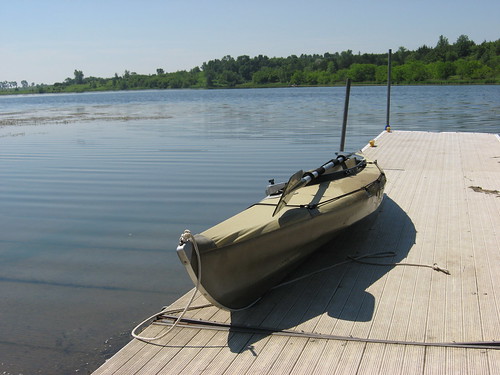
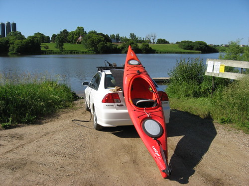
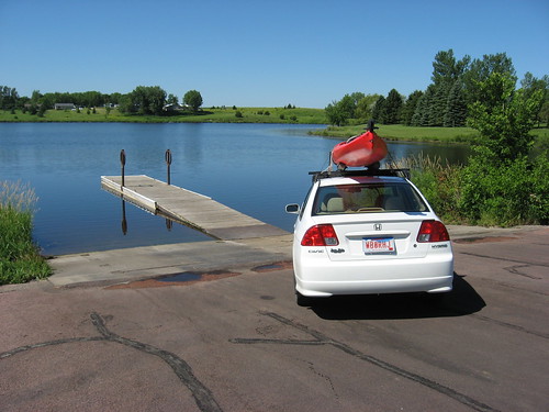
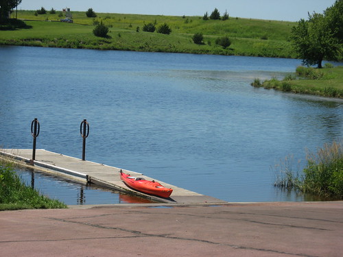
Today, I decided to check out the changes that have taken place over the past three months along the same route I traveled then. The Lake Vermillion Recreation Area is located west of Sioux Falls. One route there is to go west on Highway 42 out of Sioux Falls, a few miles past Highway 19 and then north. The direction is indicated by a sign along Highway 42, and the LVRA is five miles north. Another route is along Interstate 90, west out of Sioux Falls to the turn-off south about six miles west of Highway 19 and then south about five miles. Today, I traveled along the Interstate going out to LVRA and then came back on Highway 42.
IMG_5081.JPG
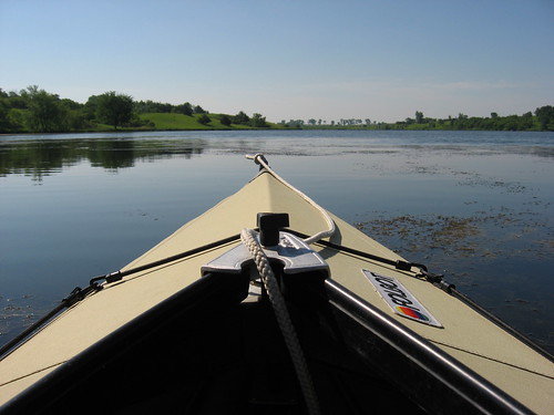
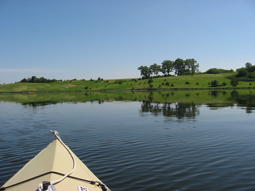
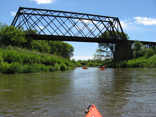
There were a few trailers for fishing boats out on the lake, but since I was going along the western arm, I did not see anyone else. The western arm is the more peaceful route for a kayak because it is largely unused. I have never seen another boat on that section of the lake, and today was no exception.
IMG_5055.JPG
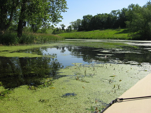
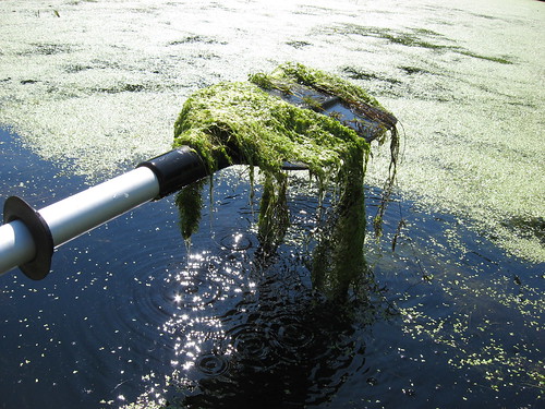
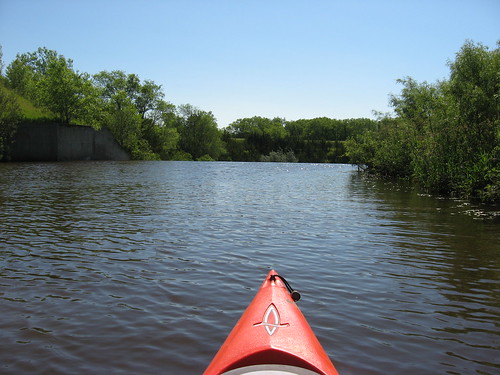
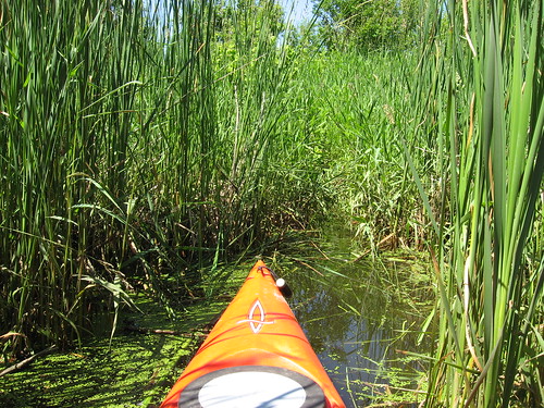
I suppose that motorboats are reluctant to use the western arm because of the grasses in the lake that may become caught up in the propeller. The water is deep in the main channel of this western arm, but there is also a good deal of aquatic grasses growing throughout, particularly along the shores and in the inlets flowing from the watershed. That might suggest difficulty for fishermen using outboard motors.
IMG_5064.JPG
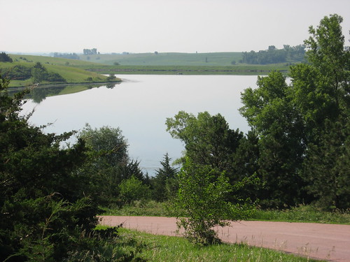
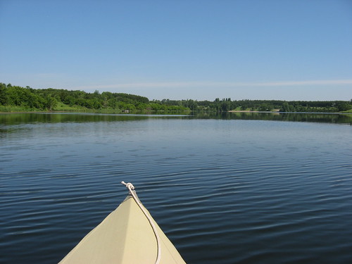
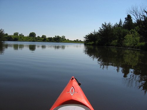
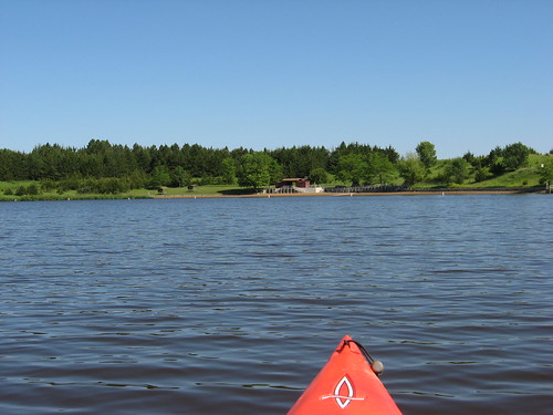
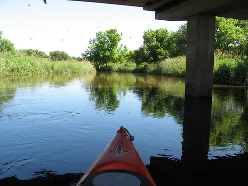
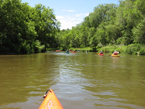
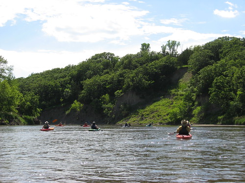
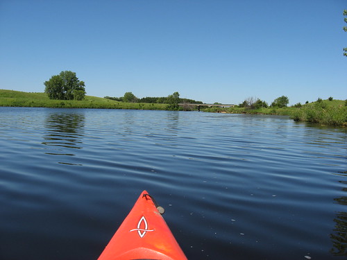
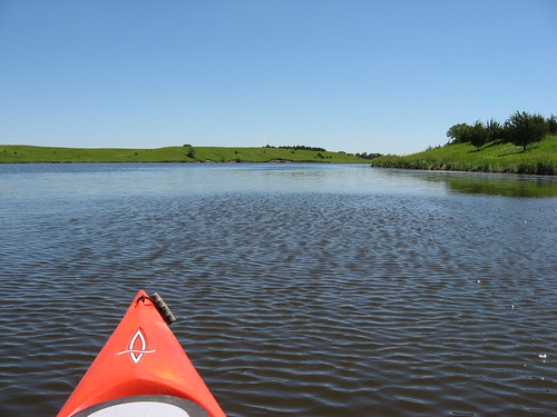
The main body of the lake is just a large body of water oriented north and south and does not offer much in the way of bays for exploration. The most interesting aspect of the main body of the lake is the Vermillion River at the northern end that feeds into the lake. The trouble, however, is that it takes about an hour to kayak up to that end. If the wind is in a contrary direction, it can be a long slog up or down the lake. Sticking to the western arm eliminates the long paddle north to the river and still offers the opportunity to poke around in the weeds.
IMG_5067.JPG
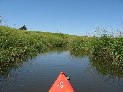
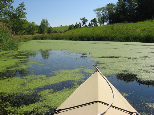
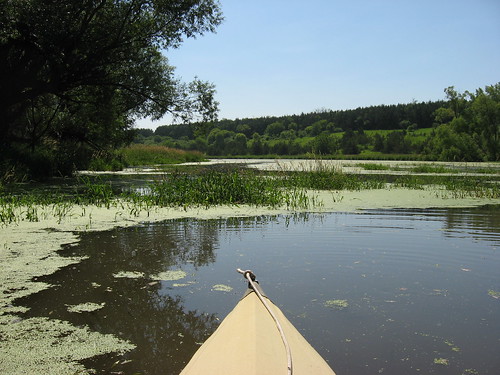
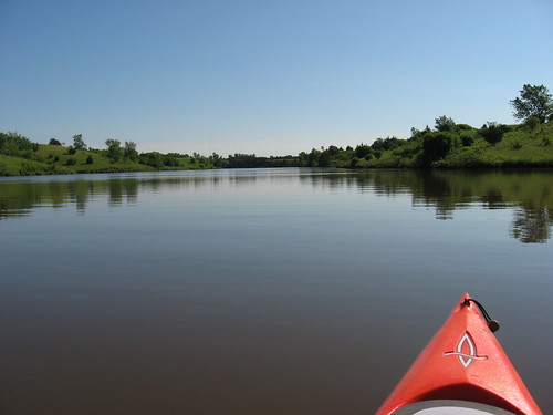
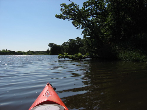
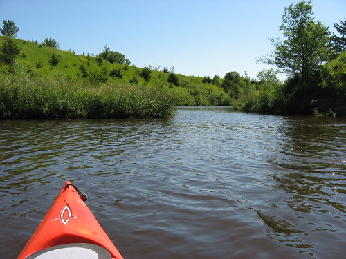
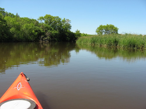
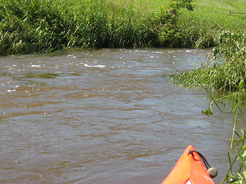
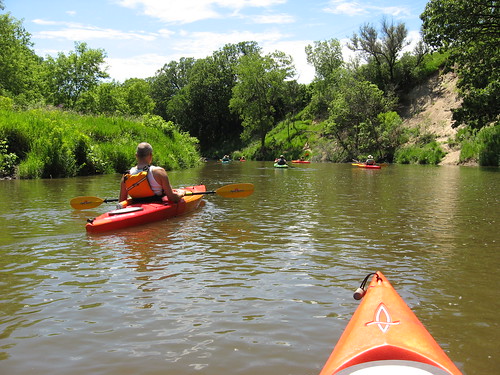
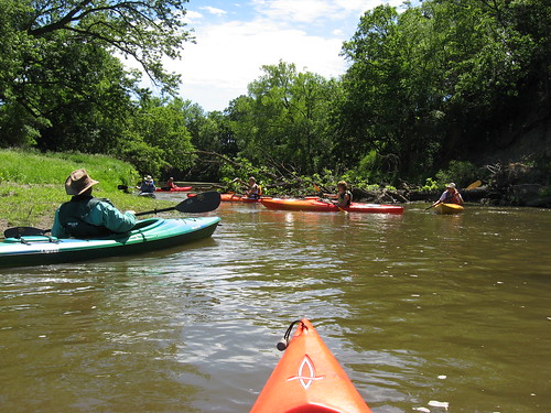
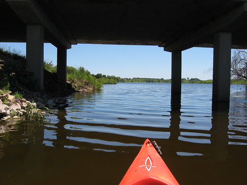
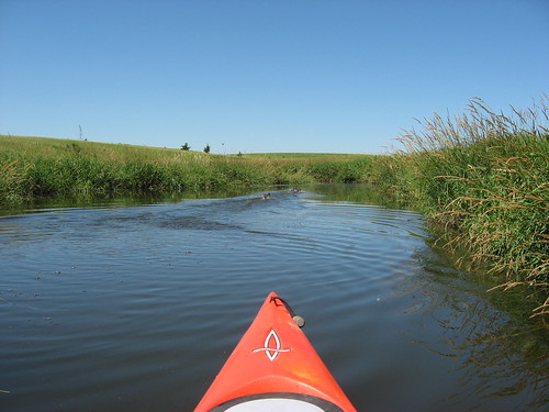
There are a couple of inlets to this western arm, and I really like to go up these waterways until it becomes impossible to proceed further. The inlets are my favorite aspect of cruising on Lake Vermillion. The western arm extends from the LVRA docking area up into the mouths of a couple of creeks entering the main body of the lake. The mouth of these creeks lead into gradually narrowing waterways that extend nearly a mile into the watershed.
IMG_5068.JPG
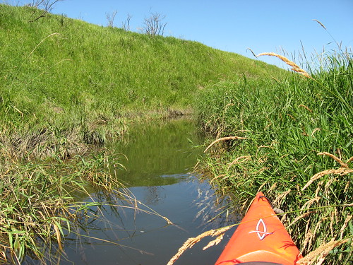
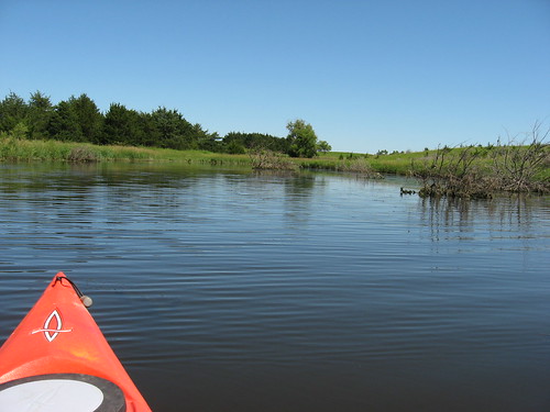
I like to enter these areas because they seem like seldom visited places – secret waterways within a unique ecological setting. There are two waterways that extend deep into the landscape, and they are both at the western end of the arm. The northwestern entry begins almost as a river and gradually narrows deep into the watershed to a width of about two feet. I like to go as far as possible in my kayak, right up to whatever blocks further passage. The water in these inlets, even in the narrowest portion, was no less than three feet, and often four or five feet deep.
IMG_5070.JPG
A problem in going so far into the inlet is the difficulty of turning around. Today, as well as on my last trip to LVRA, I got deep into the weeds and could not turn the kayak around. An exit required a few hundred yards of moving backward down the channel.
IMG_5078.JPG
IMG_5076.JPG
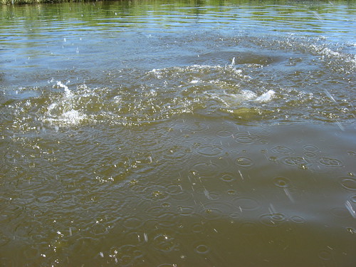
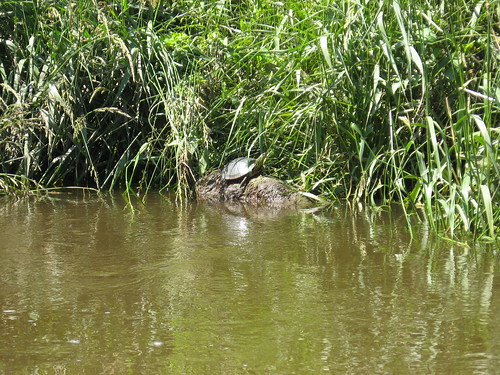
I saw some ducks today, a couple of beaver, a deer, and lots of jumping carp. The carp were very large, and they made quite an impact as they jumped up out of the water. I could see them resting or moving slowly just below the surface, sometimes alongside the kayak. Their jumping can be startling if unexpected. I was not bothered by bugs on this cruise: no mosquitoes, no gnats, no flies. My wife remarks about how unaffected I seem to be by mosquitoes, but I didn't even see any on the cruise today - even though I was deep in the marsh of the western arm.
IMG_5080.JPG
Today, the landscape was green, in contrast to the drab brown of my last trip. I had enough time to enjoy the setting and felt privileged to be a guest in this secret area, this special part of the lake environment that is seldom seen by people. My cruise lasted about 90 minutes today.
IMG_5082.JPG
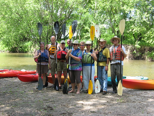
Interested readers can check out other narratives and photos of the LVRA in earlier posts found in the menu along the right side of the blog.

Thursday, June 24, 2010

Folbot on Lake Lakota - June 2010

Shaking Out the Folbot
IMG_5024.JPG
After sitting in the backyard storage shed for the past two years, I decided to load up my Aleut Folbot and see if it still floated; I wondered if perhaps the mice had gotten to it over the past two winters. Lake Lakota, in Newton Hills State Park, seemed like a good spot to assemble the boat and take a morning cruise, so I headed there about 9:00 a.m. today, a sunny day with no hint of rain. We have had day after day here in the Sioux Falls area of rain over the past couple of weeks, so I felt a pressing need to take advantage of a clear, sunny day with only a mild wind. Currently, the rivers and creeks are swollen with rain and running deep and fast in this area, and there are cautions issued by safety authorities about canoeing/kayaking on the Big Sioux River and Skunk Creek. Lakes are a better bet in these conditions.
IMG_5025.JPG
The Folbot is stored in two bags, one for the framework and the other for the hull. I put one of the bags into the trunk and the other in the back seat. The trunk of my Honda Civic hybrid is smaller than most cars due to the placement of the large battery used for the engine assist function. Because of the two-year gap in my use of the craft, assembling it took a little longer – maybe 20 minutes. The parts seemed to fit together okay, and soon I was ready to head out into the lake.
IMG_5027.JPG
I have a rudder for the Aleut, but attaching it seems to take as much time as assembling the boat, so I have stopped using it. Whenever using a kayak without a rudder, I am reminded of the extra control and ease of directional paddling offered by a rudder-controlled boat.
IMG_5028.JPG
Lake Lakota has undergone quite a change since I last visited in March. The area is covered in green vegetation, but then so is much of the surface area of the lake. The lake is in two parts, much like the letter “L.” The major section is oriented north and south, and an arm extends off to the west. Water in the center portion of the lake is generally clear of aquatic vegetation, but there is extensive algae growth and heavy growth of aquatic plant life along the shores, out perhaps 10 to 15 feet on either side of both portions of the lake.
IMG_5030.JPG
Cruising up into the little bays along the shoreline means coasting over heavy plant life extending from the bottom to just below the surface, often plants that exceed five or six feet in length. Navigating through this growth reminded me of ships following leads in ice-covered waters in the polar regions of the world. There are leads that allow a kayak to get in close to the shore through narrow passageways.
IMG_5033.JPG
A kayak can also coast over the plant life as long as the paddler uses short and shallow dips of the paddle. Such passage seems more akin to poling than paddling. But, this sort of travel also takes a paddler to areas where others cannot easily visit. Motorboats would just not be able to negotiate such a passage through the surface plant growth. I like to spend a few moments in such nearly inaccessible places observing the landscape and looking for animal life.
IMG_5036.JPG
IMG_5035.JPG
On past visits to Lake Lakota, I have found many turtles sunning themselves on logs. Sometimes I have found frogs sitting on pads, especially within the western arm of the lake. In the early spring, there have usually been large numbers of nesting waterfowl on the lake, particularly in the bays and into the western arm. Today, I saw almost no wild life. There were no turtles or frogs visible, and no waterfowl either. The only wildlife I saw were shore birds and some fish. While the water plant life is extensive, the water is also deep. In the “holes” and “valleys” of the underwater plant jungle, I could clearly see many fish, both large fish and minnow types. The water along the shoreline and in the western arm was usually four to seven feet deep, measured by plunging my paddle into the lake. Still, the water was clear enough to see these fish at a couple of feet below the surface.
IMG_5042.JPG
IMG_5046.JPG
For me, the lake was crowded. By the time I launched, there were two fishing boats on the lake; and when I returned, there were several people on the swimming beach as well. It felt like a mob had descended upon the lake.
IMG_5043.JPG
I have visited Lake Lakota both in the early spring and in the late fall. I think that those are the best times to paddle this body of water. While I like sneaking into bays that are largely inaccessible to most boaters, I don’t like paddling over the thick plant life and sitting in a bay covered with green algae. Also, there is little to see in such conditions. I will return to Lake Lakota after we have had the first hard frost and the water has cleared. Early spring and late fall seem to me the best time of year for Lake Lakota.
IMG_5047.JPG
I was happy to see that my Folbot is still in good shape. I have had it for about 12 years and originally got it so that I could avoid the hassle of car-topping a canoe. Assembling the boat normally takes about 15 minutes, and then when I get home the hull has to dry thoroughly before folding it back into the bag. I like the rigid kayak better for cruising and for quick entry into the water. Still, there is time required to lash it to the rack on my car and move it about. Maybe the time for preparing and securing the boat for a cruise is about equal for the Folbot and my rigid kayak. Assembling the Folbot, however, generally has me in a sweat before even launching into the water.
IMG_5048.JPG
Past narratives of my cruises on Lake Lakota can be accessed from the menu of area waterways along the right side of the blog.

Wednesday, June 16, 2010

Lake Alvin – Late Spring 2010

IMG_4990.JPG
The past week here on the northern plains has been characterized by strong winds and heavy rains, a seemingly endless series of wet days, thunderstorms, day-long drizzle, flooding, and cool weather. Today was forecast as a break in this pattern: a one-day respite before more rain and storms arrive tonight or tomorrow. So, last night I decided to take advantage of the predicted good conditions and loaded up my kayak for a cruise this morning.
IMG_4995.JPG
About 9:00 a.m., I left my eastside home and headed to Lake Alvin, a quick trip of about 13 minutes south on Highway 11. My last cruise on Lake Alvin was in March, just after the ice went out and the first hint of spring was apparent. On that cruise, I looked for evidence of new growth in the grass along the banks and observed many waterfowl getting ready for the nesting season. The dominate color around the lake in March was brown, still the drab colors of the long winter.
IMG_4997.JPG
Today, a great transformation has taken place. The two and a-half months has turned the lakeshore into a lush green setting, almost a poster for the beauty of South Dakota in the summer. The temperature this morning was in the high 60s as I set out, and the predicted high today is about 80 degrees. The skies were clear, and there was only a light wind on the water.
IMG_5000.JPG
As I set out, there was a fishing boat in sight, but the guy must have been wrapping up his trip; I passed it right away off the launching area but did not see it again. I headed north from the public access area and skirted the shoreline up to the northern end of the lake.
IMG_5004.JPG
On my way back south, I stopped in at the spillway to check out conditions and found plenty of depth to enter the channel leading to the spillway. The spillway on Lake Alvin does not have any kind of warning signage nor a restraint across it. While it is difficult to imagine anyone foolish enough to approach the edge, it still is something to be aware of for the paddler. The spillway edge is a danger point for a boat, and any kayak or canoe should stand well clear of the edge. It is a long way down into turbulent water.
IMG_5002.JPG
The lake was nearly deserted, as I usually find most waterways in the area, especially during the week. The swimming beach was empty. I did see a guy who seemed to be preparing a canoe for launch at the recreation area dock and ramp, but I did not see him again.
IMG_5005.JPG
Paddling up to the northern end of the lake and back was a good first step, and that gave me an hour of sustained paddling. Then, I decided to head into Nine Mile Creek to see how it had changed over the past 10 or 11 weeks. The lake gradually narrows down from north to south until it reaches the entrance to Nine Mile Creek. The flow was strong going up the creek, and it got stronger as I continued upstream for a mile or so.
IMG_5007.JPG
The channel in the middle of the creek was generally around four feet in depth, sometimes up to five feet. I did not see any waterfowl along the creek today, in marked contrast to the many ducks and geese that I saw in March. There were lots of perching birds, such as swallows and redwing blackbirds, that I could see and hear. Birds were calling continuously as I paddled past. There is a colony of cliff swallows nesting under the bridge along the creek course, and they flew about in large numbers as I passed.
IMG_5021.JPG
I have kayaked Nine Mile Creek many times, always continuing until I have run out of water. Today, after so much rain, I continued upstream until the current was too strong to go any further. I had powered my way upstream as the creek narrowed to only five or six feet, and I was concerned as I tried to back out into the quick flowing current. The creek was too narrow at that point to turn, so I drifted backwards for several yards until I could turn around. The depth of water in this narrow, fast flowing stream was four or five feet. I did not want to get sideways in this stream, unable to turn and subject to being rolled over.
IMG_5017.JPG
On my fast float back down the creek toward the lake, I was able to just steer and listen to the sounds of birds and the rustling of critters in the weeds along the shoreline. As the current slowed, I decided to check out the marsh on the edge. I like to poke into areas where visitors seldom venture. I went into the marshes about 30 feet, among the cattails and aquatic grasses. I found it easier to bull my way into the marshes than to go backwards out of them. It would be uncomfortable to get stuck in the marsh among the weeds and have to get out of the boat into water up to my knees.
IMG_5023.JPGI spent about two hours on my cruise up to the northern end of the lake and then back into Nine Mile Creek. A chief advantage of going to Lake Alvin is the short time needed for the drive. This lake is a wonderful paddling opportunity for people living on the east side of Sioux Falls. Thirteen minutes from driveway to the dock!
IMG_5006.JPG
Readers can go to the waterways index on the right side of the blog and check out many narratives about Lake Alvin in all of its seasons.
IMG_5015.JPG

Monday, June 07, 2010

Split Rock Creek - McHardy Park to Highway 42 Bridge

IMG_4952.JPG
Yesterday, I happened to notice an invitation to paddle posted by David Finck on the South Dakota Canoe/Kayak Association Facebook page. He and his wife Mary and Larry Braaten, all directors of the SDCKA, invited paddlers to join them on a cruise along Split Rock Creek from McHardy Park in Brandon to the Highway 42 Bridge at the developing arboretum near the Perry Nature Area on the eastern edge of Sioux Falls.
IMG_4954.JPG
Ten paddlers gathered with their kayaks at McHardy Park by 1:00 p.m. on Sunday. We moved our boats over to a launching point just below a set of rapids in the park. David and Mary used their van to organize a shuttle to move the cars down to the take-out point at the arboretum.
IMG_4957.JPG
IMG_4958.JPG
By about 1:30, we were ready to shove off from the park and head downstream. I have been on this stretch of Split Rock Creek three times, but those trips were always in September or October, and the water was always low. Today, the stream was flowing quite nicely and there was plenty of water. Shallow areas that required paddlers on past trips to claw their way across gravel bars had enough depth on this trip to allow a fast passage. I did not find it necessary to get out of my boat because of running aground at all on this trip. My last passage down Split Rock Creek two years ago took five hours: five hours of clawing along the bottom and getting out and dragging the kayak across sand and gravel bars. Today, we made the 8.65-mile trip in just over three hours, including a 20-minute break midway along the route.
IMG_4966.JPG
Split Rock Creek is a hidden treasure. People traveling between Brandon and Sioux Falls are generally unaware of this waterway, moving sort of parallel to Highway 11. The course of the creek is obscured by tree growth along the high banks, banks that also shelter the waterway from wind.
IMG_4964.JPG
The creek is usually 25-50 yards wide and has recurring sets of riffles that keep the paddler alert. Moving down this waterway requires a steady “reading” of the flow to make good choices regarding deepest channels for passage. The water is usually 3-4 feet deep, although there are shallow areas along bars and deep water along cut bank shorelines. As the route passes the confluence with the Big Sioux River, the width and depth increases markedly.
IMG_4970.JPG
Today, we came upon a tree down across most of the creek; there was an open slot between the tree and the left bank through which we were all able to proceed without any problem. A tree across the stream is usually called a “strainer,” and such a situation is potentially hazardous to paddlers. The current across a strainer can be quite strong and can capture a boat, keeping it pressed into the branches and unable to escape. Small streams like Split Rock Creek are especially difficult, because a tree can easily fall across the entire stream. Larger streams like the Big Sioux River can also be subject to strainers and cause danger to boats. It is critical that strainers be approached with caution and afforded a wide berth. It might be better to get out and portage around a strainer rather than take a chance. Today, however, we were able to get past the tree without any difficulty. If the water were to be a bit lower, it would probably be necessary to portage around it. This strainer is on Split Rock Creek, perhaps a mile or so upstream of the confluence with the Big Sioux River.
IMG_4983.JPG
The ten kayaks today tended to move in a group down the waterway. Sometimes large groups of paddlers spread out over time, but today the paddlers seemed to remain in sight of each other during the entire trip. There is an advantage in group paddling like this: the lead kayakers make choices regarding a bank to follow, especially in shelving water, and those following can evaluate the choice made by the leading boats. If the lead kayaks began to drag along in the shallows, those following can move to the other bank and just cruise past them, waving.
IMG_4975.JPG
IMG_4979.JPG
We stopped about halfway along the route to take a stretch break. Those farsighted enough to bring along a snack enjoyed the moment to nibble their treats. Those of us who are more shortsighted were able to vicariously enjoy their snacks.
IMG_4974.JPG
A group of paddlers seldom is able to see much in the way of wildlife. There is too much conversation going on, and most animals steer clear of a flotilla of ten boats moving down the waterway. Today, though, a deer crashed through the brush and across the creek in front of us. Other than the deer, there was the usual variety of bird life to see along out passage.
IMG_4987.JPG
Getting out of kayaks just before the Highway 42 bridge is a little tricky. The current today was pretty fast, and there is not anything like a beach or sandbar to use when getting off the water. The water is still rather deep at the shoreline, and there are large rocks along the shore. There is also a barbed wire fence to negotiate and a long and steep path up the shore to the parking area at the arboretum. This is not an easy exit point off the river, although it could be worse. It all depends upon whether you are a “glass half full” or a “glass half empty” sort of person.
IMG_4988.JPG
This is a trip that is best made with the support of a shuttle and someone to help carry the boat up off the river to the parking area. I am really enthusiastic about making this trip now in the spring rather than the fall.
IMG_4989.JPG
The ten kayakers enjoyed the opportunity to spend Sunday afternoon on Split Rock Creek with a group of like-minded paddlers, and I think that we all enjoyed the trip and the fellowship. Most of my kayaking is alone, observing nature on deserted lakes. I think that it is good to have a mix of paddling experiences. Alone is good, but so is the experience of traveling down a waterway with a group of friends and fellow kayakers.