This blog is designed to highlight the paddling opportunities within South Dakota, mainly within a 50-mile radius of Sioux Falls. While Sioux Falls is far from the adventure of coastal regions, there is a certain satisfaction in utilizing the available waterways to observe weather, water conditions, and the landscape along the shoreline. In addition, there is a wealth of animal life on the waters of small South Dakota lakes, rivers, and creeks, including geese, ducks, pelicans, great blue heron, egrets, hawks, owls, perching birds, deer, raccoons, and beaver. Eagles, fox, and coyote are also sometimes spotted.

The sites described are places where I have kayaked over the past few years, mostly in South Dakota but sometimes including locations in Iowa and Minnesota. One of the best sources of information on the accessibility of small lakes is the South Dakota Atlas and Gazetteer, the large map book of South Dakota. Lakes with a public access are generally identified by a boat symbol marking the location of a launching site on public land.

You will notice the menu of paddling locations on the right side of the blog. Each of the postings is linked to one of the areas, and my intention is to provide a continuing review of the places where I paddle. Perhaps these narratives will help readers select waterways of interest to them. Please feel free to offer a comment regarding any of my postings; I would welcome the dialog.

I also maintain a companion blog that describes hiking opportunities within the Sioux Falls area. You can access that blog at: http://hikingsiouxfalls.blogspot.com

Tuesday, July 28, 2009

Lake Vermillion - up the west side into the east fork of the Vermillion River

IMG_3623.JPG
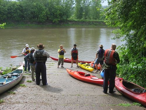
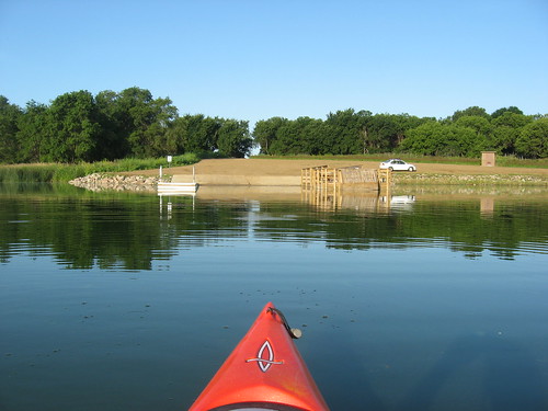
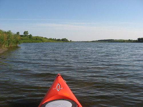
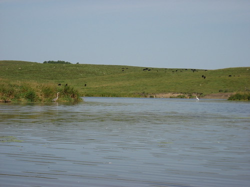
Taking advantage of a cooler day with light winds, I decided to go out to the Lake Vermillion State Recreation Area for a cruise up the west side of the main body into the east fork of the Vermillion River. Lake Vermillion is shaped rather like the letter “J” with the main part of the lake running north and south. At the south end of the lake is a dam along with an arm that extends to the west up into the marshes of the Battle Creek area. The main part of the lake extends north about three miles from the dock in the park to the entrance into the east fork of the Vermillion River. As a paddler travels north on the lake, the body narrows at the northern end where it runs into the river. There is little current in the river because of the impoundment, but there is good depth for at least a couple of miles, and perhaps further. The surface area of the lake is 513 acres, nearly six times as large as Lake Alvin.
IMG_3630.JPG
IMG_3620.JPG
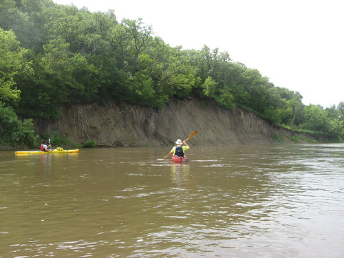
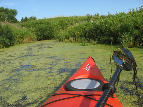
There are three bays along the west side of the lake that extend inland. I like moving up these waterways to check out the wildlife and flora. In one of the bays, I found both the underwater and surface plant growth to be so heavy that I just glided along on top of the plant material using the flat surface of my paddle. In the largest bay, there is a feeder creek coming into the lake, but there was a barbed wire fence a little way in that closed off further entry.
IMG_3621.JPG
IMG_3636.JPG
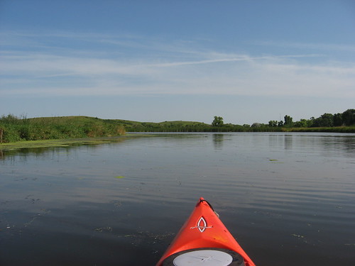
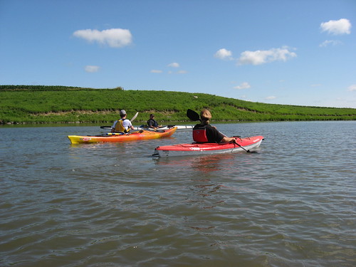
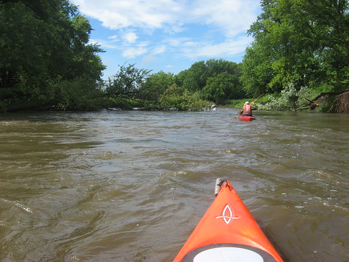
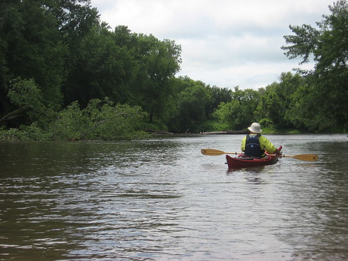
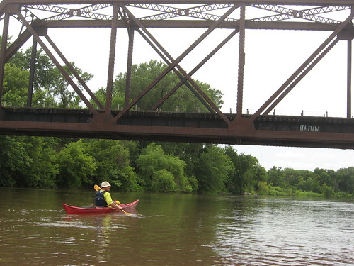
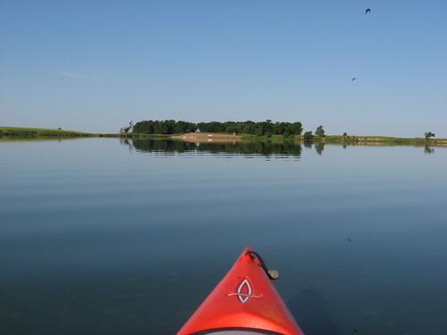
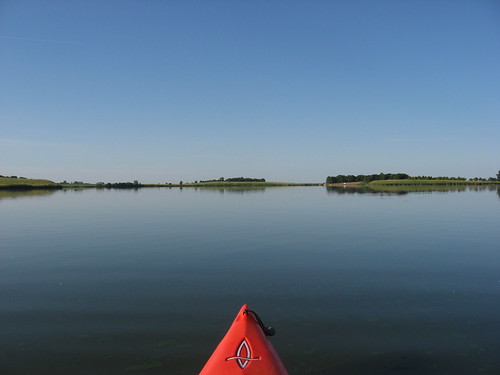
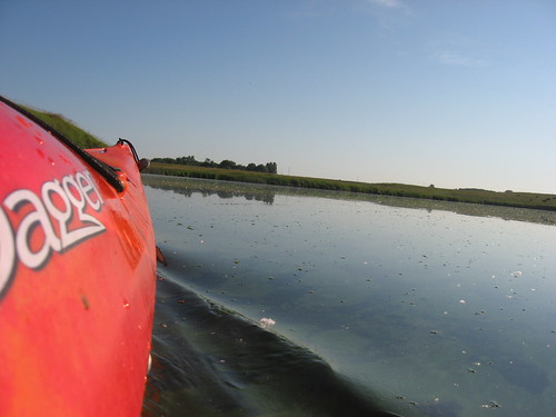
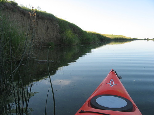
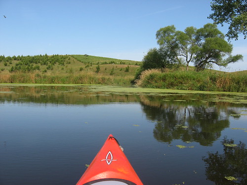
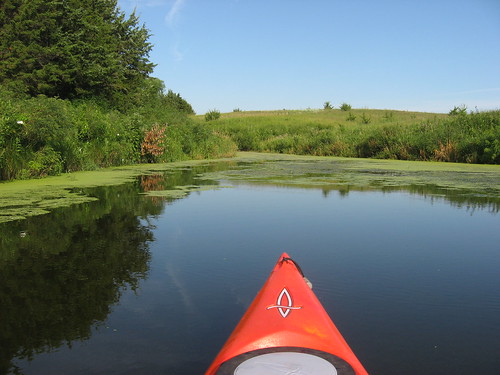
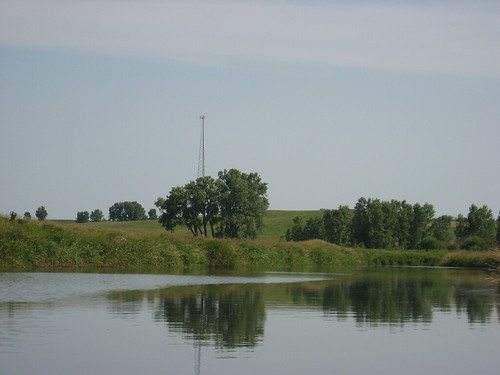
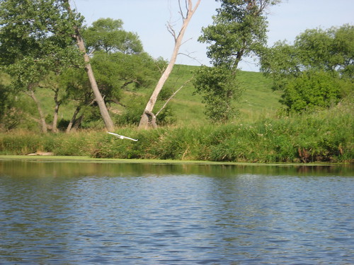
I was particularly interested in moving up into the Vermillion River, and arrived at that point about an hour and fifteen minutes into the cruise. There was a wind out of the north at about 15 mph, and I thought that the return trip back to the dock would be easy. I brought along my sail, and the plan was to continue up into the river for a couple of miles and then to use the sail to ease my paddling back to the dock. So, I continued up the river until I reached a light tower that was visible way back on the main body of the lake. This tower, I think, must be a signal used by the airport to keep aircraft on a glide path to the runway further east. At least, there is a white beacon light flashing from the top and no other obvious function for the tower. The river was full and the water was deep across the entire channel. After about two hours of paddling, I wanted to get out of the boat and walk around a bit. Unfortunately, however, there was no place to easily get ashore. The water was deep right up to a vertical bank, and then big marsh plants were thick alongside. This situation makes getting out of a kayak a little tricky. There were no shelving areas along the course of the river for that entire two miles or so.
IMG_3655.JPG
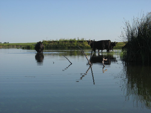
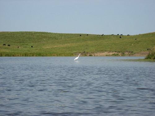
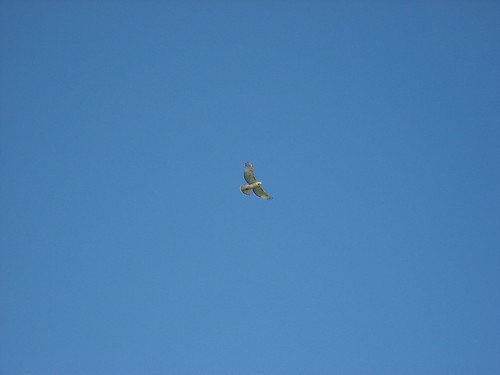
There was lots of bird life along the marshes and in the river, including great blue heron, egrets, and hawks. I did not see any pelicans today, nor were there any geese. While not present in overwhelming numbers, there were a few jumping carp; in fact, my kayak was struck a couple of times by surfacing carp.
IMG_3647.JPG
IMG_3638.JPG
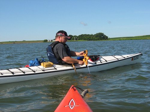
When I got as far up the river as I wanted to go, I got my sail ready and anticipated a leisurely ride back to the dock with a nice assist from the steady 15 mph breeze out of the north. To my chagrin, however, I found that I had left the mast step to hold the sail onto the boat in the trunk of my car. So, I had the sail but no step to secure it to the hull. The plan for a five-mile ride in the shade back to the dock was shattered. I was also pooping out from the long paddle into the wind. The long slog back down the lake and over to the dock was tedious: 100 driving strokes, 100 easy strokes, a few minutes of holding the sail up like an umbrella – a routine that kept me moving. I just churned down the middle of the lake trying to cut corners and keep into the following wind.
IMG_3628.JPG
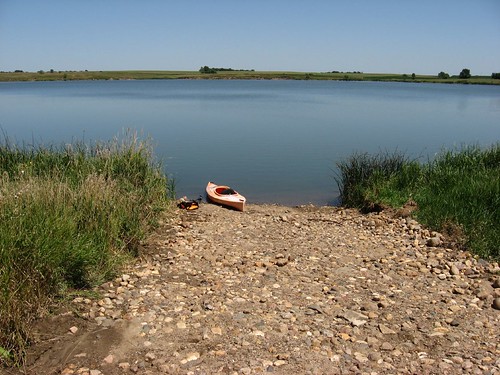
Finally, I arrived back at the dock after my three-hour paddle with no stop. Fortunately, there is a toilet situated just at the head of the dock within the recreation area.
IMG_3631.JPG
Heading up the west side of the lake and into the river is a very nice cruise. I especially like moving up into the river and all the wildlife that offers. It is also a very isolated area with no powerboats nor anybody fishing. I like this sort of environment, and it is too bad that such a long paddle up the lake seems to always be associated with this cruise. There must be an access point further north, but I haven’t found it as yet. Of course, the cruise would have been a lot easier if I had carefully checked all my gear to ensure that everything was set. It was disappointing not to be able to sail back as I had envisioned.
IMG_3654.JPG
Interested readers can check out other observations of my cruises on Lake Vermillion by accessing the link on the right side of the blog.

Saturday, July 18, 2009

Water Sampling at Diamond Lake 2009

IMG_3595.JPG
This year, as it did last year, the South Dakota Canoe Association took part in monitoring an area waterway through the collection of water samples and making observations under the direction of Dakota Water Watch. A fleet of seven kayaks and three canoes gathered at the public access area for Diamond Lake for an orientation to the mission. In teams, the boats set out to designated spots on the lake to collect samples, determine water depth, clarity of the water, weather conditions, and make other observations of the lake. The data will be analyzed by Dakota Water Watch to provide baseline information that should facilitate the ongoing monitoring of water conditions on the lake.
IMG_3597.JPG
IMG_3598.JPG
Each team was equipped with a depth-sounding device to determine both depth and clarity of the water. Each team also collected samples of water at assigned positions on the lake.
IMG_3600.JPG
This lake is fed by a creek at the northern end and ends in a dam at the south end. The dam is wide enough to handle vehicle traffic including farm equipment. Diamond Lake is a popular spot in the area for fishing, and there were fishermen on the dam as well as in boats.
IMG_3601.JPG
As always in an event of this nature, solitude is replaced with camaraderie, and there was a sense of fellowship among the paddlers as they moved about the lake.
IMG_3603.JPG
When I set out from Sioux Falls this morning, the winds were calm and the temperature was in the high 50s. On the lake, the wind came up a little and was blowing about 10 miles an hour – just enough to produce some small waves. Such a large crowd on the water must have discouraged the pelicans. The island at the south end of the lake where they tend to hang out was deserted.
IMG_3605.JPG
This was a pleasant morning, a good time to laugh it up with paddling pals. It was also a good public service project that keeps the SDCA engaged in doing good works.

Upcoming Service Project: This Wednesday, July 22, in the late afternoon, the SDCA will be engaged in a river “clean-up” project along the Big Sioux River in Sioux Falls. Details of this project can be found on the SDCA web site: http://sdcka.blogspot.com. For those who can get away for an hour or so, this is a good opportunity to contribute toward this public service event.

Sunday, July 12, 2009

The Big Sioux River: Klondike Dam to Canton

IMG_3555.JPG
This morning I stood alone on the foot bridge on the downside of the Klondike dam on the Big Sioux River in a heavy downpour. The rain had been falling for an hour or so and rain-laden clouds were still rolling in from the west. The planned South Dakota Canoe Association (SDCA) cruise on the Big Sioux River for today seemed unlikely to take place. Then another car arrived on the scene, and then another. The cruise was planned to get underway at 9:00 a.m. sharp this Sunday. By about 9:20 or so, the rain had largely stopped and SDCA members had arrived. The cruise director, Larry Braaten, organized a shuttle plan in which most cars would be driven to the river access point on the south side of Canton. Shortly after 10:00 a.m., a fleet of nine kayaks and one canoe set out from the public access area on the South Dakota side of the Big Sioux just below the dam. As we launched, the sun came out, and the paddlers began removing rain gear in favor of short-sleeved shirts.
IMG_3558.JPG
IMG_3562.JPG
The trip downstream for this segment is 12 miles, and a three-hour cruise was anticipated. There has been a great deal of rain this summer, which has kept the river at a high level. Along with good depth, there was a strong current flowing. It seems that the river flowing south from Sioux Falls is made up of 12 mile segments: Lien Park in Sioux Falls to the Big Sioux Recreation Area, The BSRA to Lake Alvin, Lake Alvin to the Klondike, and the Klondike to Canton. Each of these segments takes about three hours to paddle. The river gets a little deeper and wider as it flows south. This segment from Klondike to Canton is scenic with some very high banks, especially on the Iowa side, and a set of rolling hills, also largely on the Iowa side. The banks are heavily forested. Some exceptionally tall Cottonwood trees are found close to the banks along the way.
IMG_3561.JPG
IMG_3564.JPG
The river was free of “strainers” or any other obstruction. We passed through the remains of a set of two serious strainers from last year that blocked the river. That is the site where two Sioux Falls kayakers had an upset that landed them in the water scrambling to hang on to branches of a strainer while their kayaks were swept downstream.
IMG_3559.JPG
IMG_3584.JPG
We were accompanied for quite a way by a pair of large great blue heron who would sweep up ahead of us and just move on downstream until we again spooked them. They kept just ahead of us for miles. In addition, we saw an eagle, many hawks, and several large owls. Some of the party observed beaver, but I did not see any myself.
IMG_3575.JPG
This segment of the river is characterized by a pretty straight course for several miles. There was a south wind that cooled us off but did not markedly inhibit our progress.
IMG_3594.JPG
There is a spot about 8 miles from the put-in at the bridge over Highway 18 with a concrete launching ramp that provides a good stretch spot along the route. While we were shaking it out at this point about two-thirds of the way along our route, a pickup approached with two canoes in the back. Six people piled into the canoes and set off downstream. We passed them very quickly after setting off. The access points along this segment of the river offers a good paddling opportunity for causal boating, and these young people seemed to be having a fine time.
IMG_3571.JPG
The cruise this morning and early afternoon really turned out well in spite of the rain that nearly derailed the trip. SDCA cruises are always a time for fellowship and cooperation. The conversation is easy and the pace pretty steady. Arranging a shuttle is one of the best aspects of a group cruise, and this one worked exceptionally well. One of the paddlers on this cruise was in a kayak for the first time. Others have expedition quality skills and stamina. As is nearly always the case now, I was the oldest paddler on the cruise – older by four years than the next in line.
IMG_3588.JPG

Monday, July 06, 2009

Loss Lake - or maybe Lost Lake - July 2009

IMG_3552.JPG
Until this morning, I had not been to Loss Lake for about two years. One of the blog readers alerted me to improvements that have been made to the public access area, so I wanted to go out and see how the setting had changed. First off, however, there seems to be some confusion regarding the name of the lake. I first saw this body of water on the South Dakota Atlas & Gazetteer located in western Minnehaha County, 2½ miles north of Highway 42 along Highway 19. The atlas clearly identifies this body of water as Loss Lake. There is a Lost Lake, also along Highway 19 but about 4 miles north of Humboldt. The South Dakota Statewide Fisheries Survey also describes Loss Lake in the same location as the atlas. But, there is a web site called Fishing Works that describes Lost Lake, actually located north of Humboldt, as the site known through the atlas and the South Dakota Survey as Loss Lake. Then, I ran into a fisherman on the water today, and I asked him the name of the lake. He said it was called Lost Lake, and he learned of the name through friends who had been there before. Of course, there is no name listed in the signage located at the waterway. My take on this is that the lake is really Loss Lake, and this Fishing Works website has mislabeled the body of water. That website has misplaced Lost Lake on the map and even included GPS coordinates for Loss Lake in the description. For now, I will continue identifying this body of water as Loss Lake.
IMG_3548.JPG
So with that said, I arrived at the lake this morning about 7:20 to find it, as usual, deserted. As I had been informed, there have been major improvements to the site since my last visit in 2007. The access road is improved; there is now a large parking area, a fishing dock, a boat dock, a concrete boat launch, and a vault toilet. The difference since my last visit is marked, but I expect that the isolation I felt earlier has now been diminished. Easy access and improved facilities probably equals increased usage.
IMG_0090

Before Renovation of Launch Area

IMG_3544.JPG

After Renovation of Launch Area

The temperature this morning was in the 70s, heading toward a predicted 90 degrees. There was no wind and the lake was flat calm. With no wind noise, the only sounds were a distant occasional vehicle moving along Highway 19 and birds calling to each other. The sky was nearly cloudless with only a few high thin cirrus clouds and the contrail of a passing jet.
IMG_3545.JPG
Loss Lake is only 86 acres in surface area, just a little smaller than Lake Alvin. The lake is irregular in shape and offers a few bays to explore. Generally, though, the lake is unremarkable. There are some high banks, but the shoreline cover is mostly tall grass and a few trees. The lake is posted as “no wake.” There was quite a bit of algae on the water, with more located on the west bank. The fisherman I talked with told me that this algae had developed recently. The southern part of the lake has a bay that extends into a cow pasture. On most of my trips to this lake, there have been cows in the water behind a barbed wire fence in this southeastern section, and they are still there.
IMG_3547.JPG
There was not a lot of wildlife visible this morning. I came across an egret, a great blue heron, and a couple of ducks. There were also a few jumping fish that I assume were carp. The lake seemed to mirror the environmental conditions: still, quite, and sleepy.
IMG_3550.JPG
There are a few large rocks lurking just below the surface, especially on the eastern side of the lake. This morning, there was a little welcome shade under the high banks also on the eastern side.
IMG_3554.JPG
My cruise along the perimeter of the lake took just over an hour. As I was finishing the tour, a pickup arrived with a fishing boat in tow. The boat presented an unusual form, and I saw that the sole occupant of the boat had rigged a picnic table umbrella in the center to keep him somewhat sheltered from the sun. With another person on the lake, the area met my definition of crowded, and I thought that it was just as well that my circuit of the lake was over. By 8:45, a little breeze had come up and it was getting hotter. It was time to drift off.
IMG_3551.JPG
Loss Lake has little to recommend it except for being only 25 miles from my eastside Sioux Falls home and fine launch facilities. It may be okay for fishing, but a cruise on this body of water once every couple of years is sufficient.

Cruise Note:

The South Dakota Canoe Association is sponsoring a cruise on Sunday, July 12, on the Big Sioux River from the Klondike Dam to Canton. This three-hour cruise departs from the South Dakota side of the Klondike at 9:00 a.m. For more information on the cruise, check out the SDCA website at http://sdcka.blogspot.com. The cruise is under the direction of Mr. Larry Braaten, the cruise director for the SDCA.