This blog is designed to highlight the paddling opportunities within South Dakota, mainly within a 50-mile radius of Sioux Falls. While Sioux Falls is far from the adventure of coastal regions, there is a certain satisfaction in utilizing the available waterways to observe weather, water conditions, and the landscape along the shoreline. In addition, there is a wealth of animal life on the waters of small South Dakota lakes, rivers, and creeks, including geese, ducks, pelicans, great blue heron, egrets, hawks, owls, perching birds, deer, raccoons, and beaver. Eagles, fox, and coyote are also sometimes spotted.

The sites described are places where I have kayaked over the past few years, mostly in South Dakota but sometimes including locations in Iowa and Minnesota. One of the best sources of information on the accessibility of small lakes is the South Dakota Atlas and Gazetteer, the large map book of South Dakota. Lakes with a public access are generally identified by a boat symbol marking the location of a launching site on public land.

You will notice the menu of paddling locations on the right side of the blog. Each of the postings is linked to one of the areas, and my intention is to provide a continuing review of the places where I paddle. Perhaps these narratives will help readers select waterways of interest to them. Please feel free to offer a comment regarding any of my postings; I would welcome the dialog.

I also maintain a companion blog that describes hiking opportunities within the Sioux Falls area. You can access that blog at: http://hikingsiouxfalls.blogspot.com

Thursday, April 15, 2010

Beaver Lake - April 2010

IMG_4597.JPG
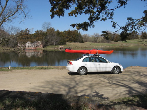
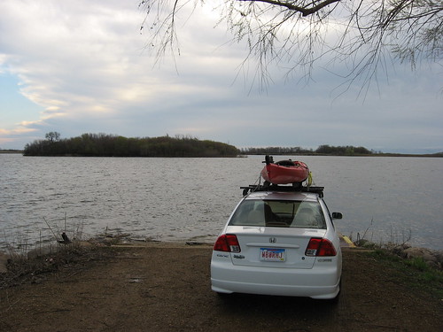
This was a windy cruise on Beaver Lake! Yesterday afternoon, the forecast looked good for paddling, so I loaded up my kayak on the Honda Civic and planned to get an early start on one of the area lakes. Last night, though, it began raining, and this morning did not look very promising. As I left my home about 6:30 a.m., the rain had stopped and there was a hint of clearing in the western skies. So, off I went for my morning bagel, a mug of coffee, and 45 minutes to read my latest novel. I was underway and headed to Beaver Lake about 7:20 and arrived at the dock about 8:00 a.m. As usual, the lake was deserted.
IMG_4600.JPG
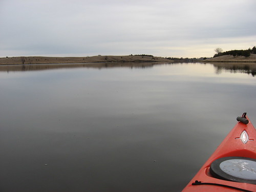
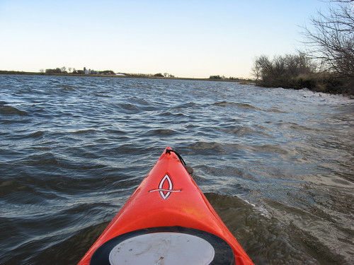
The skies to the east were still overcast, but there was blue sky in the west. A stiff breeze was blowing out of the northwest, and the lake was covered with waves; there were white caps out on the more exposed areas. Conditions today reminded me of other times I’ve been out on this wide, open, and exposed prairie lake. The prevailing winds in this area are out of the west, and this lake does not have a sheltering depth of trees along the northern and western shores.
IMG_4605.JPG
Beaver Lake is just on the outskirts of Humboldt, and Interstate 90 runs parallel to the shoreline. A small water tower on the southern edge of Humboldt is a good landmark to the access point. The road toward the lake runs alongside the school and the cemetery up to a bridge over the Interstate. There is no sign, of course, but there is a turn to the east (left) just before the bridge over the Interstate. The lake is down that road a mile or so and visible off to the north. There is a “public access” sign just before turning off the gravel road into a lake access site, complete with a dock and a ramp, a good parking area, and a vault toilet.

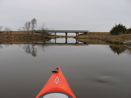
As I stood on the dock looking to my left toward the north, I saw row after row of waves rolling in toward the southeast. The temperature was about 50 degrees and there was a strong wind blowing. It was chilly enough for me to put on a light parka before heading out.
IMG_4609.JPG
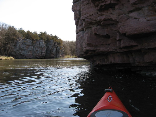
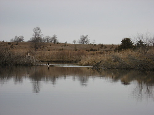
From the dock, a large island is situated about 200 yards off shore. The wind direction and strength meant that I would have to head across the wind through rolling waves to approach the irresistible island. There is something about islands that seems to lure paddlers toward them. In this case, I could see the sheltered waters in the lee of the island, and I wanted to cruise along the shore looking for wildlife and to observe the budding bushes and trees.
IMG_4603.JPG
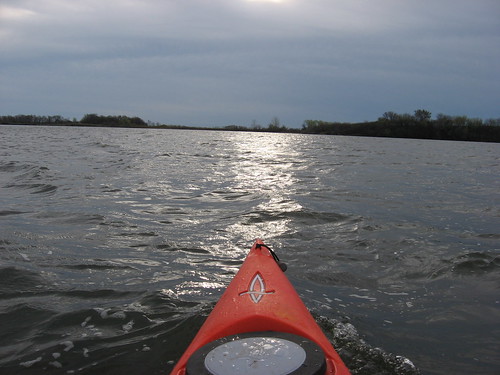
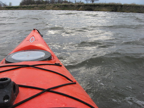
As I got into the waves heading toward the island, I began to feel some apprehension. The waves were breaking over the bow of the kayak, and I had to paddle with concentration to navigate these roiled waters. I thought about the consequences of capsizing the kayak that far from shore – alone on the lake in very cold water!
IMG_4604.JPG
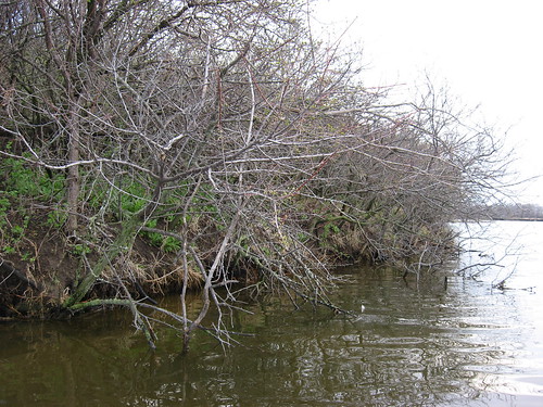
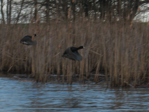
Still, I made it to the island and did cruise along the shoreline. While in the past I have seen egrets and great blue heron on the island, today I saw only clouds of blackbirds flying around the trees.
IMG_4608.JPG
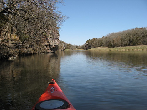
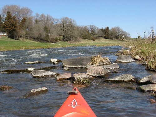
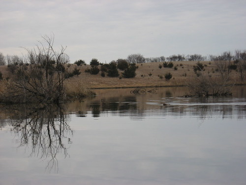
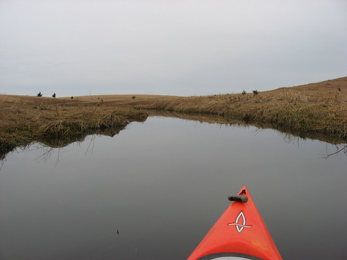
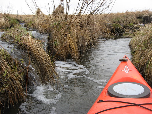
I headed around the southern end of the island and moved over to the southeastern shoreline. I was heading into the wind and waves on this part of the lake, but I just continued powering on until I could turn with the wind and head down into the eastern bay. After the turn, I was going with the wind, and the waves were not much of a problem. I wanted to locate a waterway that leads into the wetlands, a channel that I found last year. The landmark for the turn south into the waterway is an old windmill. There is a narrow passage through deep water and lots of old cattails and other aquatic vegetation that winds south to a large pond.
IMG_4611.JPG
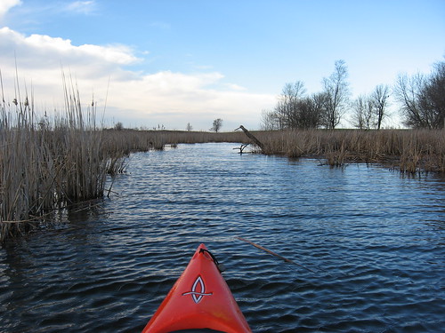
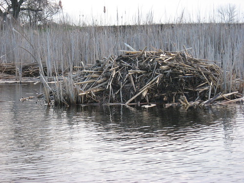
Along the passage, there are several beaver lodges, and I did see two beaver swimming along. One was swimming directly toward me, but by the time I fumbled my camera out with my cold hands, he had dived under the kayak. The water in the passage was calm, in contrast to the whitecaps out on the main body of the lake.
IMG_4620.JPG
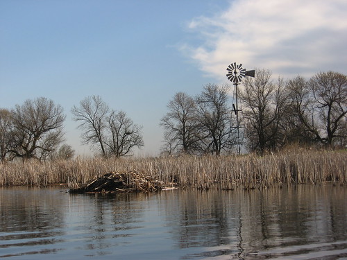
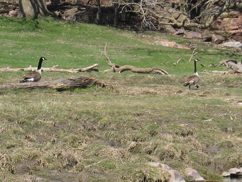
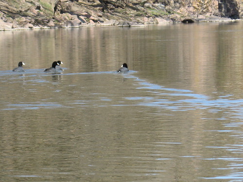
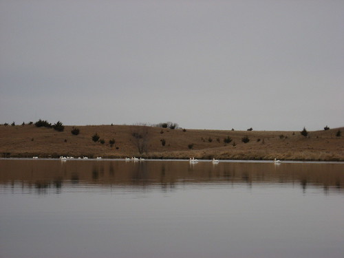
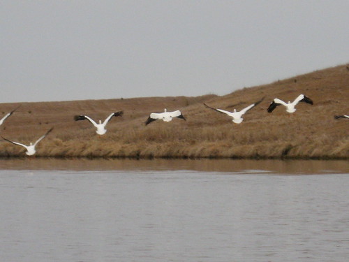
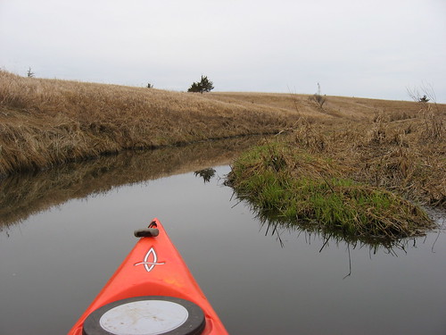
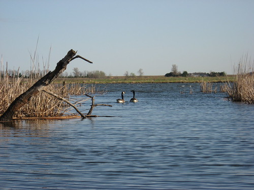
I cruised down the passage to a large pond that was filled with ducks and geese as well as several more beaver lodges. This is one of my favorite parts of the lake, and I very much enjoy cruising down this isolated passage looking at the wildlife and plants. The calm waters were also a relief after the rough time getting to the passageway.
IMG_4613.JPG
On the way back to the dock, I had to move back into the wind-whipped waters, this time padding first right into the wind and then moving across the wind through the rollers again. Moving into the wind, I was reminded of the advice of my paddling pal Jarett Bies. The trick, he said, is in pushing the paddle rather than pulling it. Then I remembered also the advice of Pete Larson who taught me the importance of grasping the paddle toward the blades to get maximum power from the stroke. Using these lessons, I paddled into the stiff wind and through the waves back to the eastern shore and then around the southern end of the lake to the dock. By the time I got back, I had some water in the bottom of the kayak, my pants were soaked from the spray, and my glasses had become spotted from the water blowing in my face.
IMG_4625.JPG
Again, I thought of how I prefer to paddle Beaver Lake when the water is warm and the wind is gentle. I guess that it is good to practice paddling in rough water, but the tranquility that I love about kayaking is a little more difficult to maintain in such conditions. Beaver Lake does not have high banks that tend to provide an area of shelter from the wind. Still, any day on the water is better than going to the gym!
IMG_4615.JPG

Saturday, April 10, 2010

Split Rock Creek - Garretson City Park - April 2010

IMG_4556.JPG
Saturday is a day that I usually avoid for kayaking, biking, or hiking. On weekends, people are out in their boats or gathered along beaches, the city bike trail is crowded, and people take their dogs out for a run in the area nature areas. During the week, I am almost always alone or nearly alone in most of my outdoor activities. Today, though, our routine was a bit different for a Saturday, and there was an opportunity to slip away for a cruise. I decided to continue with my early spring review of area paddling opportunities, and today I went to Split Rock Creek, beginning at the Garretson City Park and paddling upstream from the dam to the end of easily navigated waters.
IMG_4565.JPG
When I take guests or one of my sons out for a paddle, this is the waterway that is always among the first choices. Paddling through the quartzite palisades with their towering height and the interesting range of bushes and trees growing on top or in cracks is just a delightful visual scene.
IMG_4561.JPG
As nearly always, I was alone on the water as I moved along in about 60 degree temperatures under mostly sunny skies. The grass and some of the bushes are “greening up,” but the trees are still bare. The wind varies as it blows across the impounded waters of Split Rock Creek and through the sheer cliffs of the palisades, creating visual displays of flat calm areas interwoven with areas of ripples from the breeze.
IMG_4579.JPG
I found myself lingering in the shadow of overhanging cliffs of the palisades, gazing at details of the rock face and looking at the struggling vegetation growing out of cracks and along ledges.
IMG_4577.JPG
Sounds along this stretch of Split Rock Creek are an interesting blend of modern life and the eternal flow of water. There is a large railroad yard in Garretson, and today a very long fast moving freight train sped along on tracks that parallel the shoreline. Then, a light plane flew alongside the creek for a while. There is a well-used park maintained by the city of Garretson that provides opportunity for nature walks, fishing, picnicking, and camping. So, especially on weekends and in the summer, the sounds of children playing rings out over the water for a few hundred yards along the main part of the park. Also in the summer and fall months, a sightseeing pontoon boat takes passengers for a cruise up the main body of Split Rock Creek, the same route that I use for my kayaking. Mostly, however, after leaving the launch area, there are no people heard or seen, especially after the first hundred yards or so.
IMG_4564.JPG
IMG_4570.JPG
Today, there were lots of geese out along the shore. They must be getting ready for nesting. The pattern seemed to be for a pair of geese to hang out together along a spot on the shoreline or hover in the water just offshore. As I cruised by, the geese tended to rush over to the water’s edge and honk loudly at me until it was clear that I was moving on. There were lots of ducks out on the water today as well, including some small ones that swam in groups and did not seem very spooked by me and the kayak.
IMG_4587.JPG
IMG_4596.JPG
As usual, I slipped through the arches of the bridge into Devil’s Gulch. This is a very secluded waterway, and it is one of my favorite spots on this part of the creek. The gulch moves along under a railroad bridge and extends deep into the rock formations.
IMG_4595.JPG
I was on the water for a little over an hour, but this included lingering for photography and looking at the change in seasons. As usual, I picked up a bag full of plastic bottles that I fished out of the water.
IMG_4584.JPG

Monday, April 05, 2010

Lake Vermillion - Up the West End - April 2010

IMG_4528.JPG
Continuing to take advantage of this streak of beautiful early spring days here on the northern plains, I decided to go to Lake Vermillion State Park this morning. In the spring, with waters so cold and my isolation as the only boat on the water, I try to stick to area waterways that are easily accessible and have a shoreline that extends deep into shallow parts of the watershed. I don’t have much interest in heading out across the wide parts of isolated lakes when a capsize would present a life-threatening situation.
IMG_4530.JPG
Lake Vermillion State Park is west of Sioux Falls along Highway 42 (West 12th Street), and then north about four miles. The turn-off from Highway 42 is clearly marked. I arrived at 8:00 a.m. under partly cloudy skies and a temperature of about 42 degrees. As nearly always, the area was completely deserted. The lake surface was mirror smooth; the shoreline was encircled by reflections of the bare trees and bushes. There was some snow still visible under the trees in deep shadow.
IMG_4531.JPG
I headed out from the launching area and turned right into the southern pass, headed west under the bridge, and entered that portion of the lake seldom visited by power boats. This is the shallow area with fingers extending deep into the watershed.
IMG_4532.JPG
As I moved into the west end, I came across a big group of pelicans spread across the lake. They moved west as I paddled toward them, but eventually the distance closed until they flew off, circled around as I passed, and then landed again on the surface to continue their activities as before
IMG_4536.JPG
I continued on into the first of the bays that open to the north of this western arm of the lake. Soon, I spotted the first of several beaver that were crossing from the northern side of the arm. They were too crafty for me to get very close. When they spotted or sensed me, they tended to dive out of sight. Since the morning was so chilly, I was wearing gloves to paddle. By the time I could get the gloves off and my camera out of its case, the beaver would typically be vanishing.
IMG_4542.JPG
There were a good many geese and ducks about, all seemingly calling to each other. I passed them along the shoreline, and they seldom remained in place long enough for me to get my camera out.
IMG_4538.JPG
With the abundance of water at this time of the year, this western arm of the lake has many creeks, both permanent and temporary, flowing into the main body. I like to move deep into the watershed to follow these creeks until I can’t navigate any further. This takes me very far from the main body, up gradually narrowing streams, sometimes for half-a-mile or more. This deep into the narrow waterways, large waterfowl disappear, although perching birds remain plentiful.
IMG_4547.JPG
IMG_4548.JPG
The waterway tends to get so narrow that it is not possible to turn the kayak around, and it becomes necessary to paddle backwards for a hundred yards or so. There was plenty of depth to the water in these waterways, usually from two to four feet.
IMG_4551.JPG
After wandering around in the waterways for 45 minutes or so, I headed back to the dock. Altogether, my cruise this morning was nearly two hours.
IMG_4553.JPG
A few days ago, my wife and I were out hiking in the Perry Nature Center east of Sioux Falls with our dog. We happened across a birdwatcher who had several plastic containers and some rusted out junk in his hands that he had picked up to discard in a trash container or carry home and place in his own garbage. I have often thought that each of us ought to make some minor effort on our hikes or paddles to pick up some trash, to leave the site a little bit better than we found it. So, I have begun carrying a plastic bag in my kayak and have been filling it up on each cruise. Usually, I pick up five or six plastic bottles and a few beer cans. I feel a little righteous about making this even minor contribution to a cleaner outdoors environment.
IMG_4555.JPG