This blog is designed to highlight the paddling opportunities within South Dakota, mainly within a 50-mile radius of Sioux Falls. While Sioux Falls is far from the adventure of coastal regions, there is a certain satisfaction in utilizing the available waterways to observe weather, water conditions, and the landscape along the shoreline. In addition, there is a wealth of animal life on the waters of small South Dakota lakes, rivers, and creeks, including geese, ducks, pelicans, great blue heron, egrets, hawks, owls, perching birds, deer, raccoons, and beaver. Eagles, fox, and coyote are also sometimes spotted.

The sites described are places where I have kayaked over the past few years, mostly in South Dakota but sometimes including locations in Iowa and Minnesota. One of the best sources of information on the accessibility of small lakes is the South Dakota Atlas and Gazetteer, the large map book of South Dakota. Lakes with a public access are generally identified by a boat symbol marking the location of a launching site on public land.

You will notice the menu of paddling locations on the right side of the blog. Each of the postings is linked to one of the areas, and my intention is to provide a continuing review of the places where I paddle. Perhaps these narratives will help readers select waterways of interest to them. Please feel free to offer a comment regarding any of my postings; I would welcome the dialog.

I also maintain a companion blog that describes hiking opportunities within the Sioux Falls area. You can access that blog at: http://hikingsiouxfalls.blogspot.com

Sunday, November 14, 2010

Split Rock Creek: from McHardy Park to the Confluence with Beaver Creek

IMG_5830.JPG
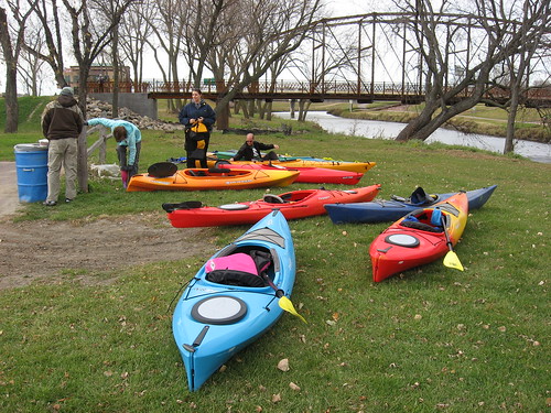
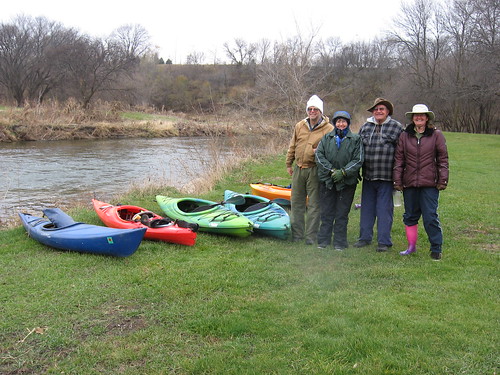
It was 34 degrees under cloudy skies with a brisk wind this morning as five of us gathered at McHardy Park in Brandon for a late season cruise down Split Rock Creek. I received an invitation to join the group yesterday and accepted the opportunity in spite of the weather conditions. This cruise was organized, as so many over this summer, by David and Mary Finck and Larry Brtaaten, all directors of the South Dakota Canoe and Kayak Association (SDCKA).
IMG_5832.JPG
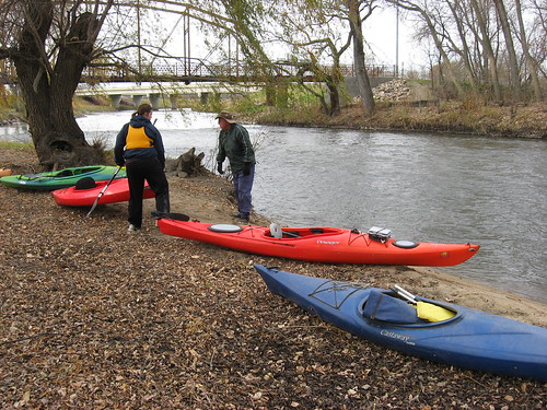
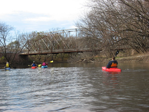
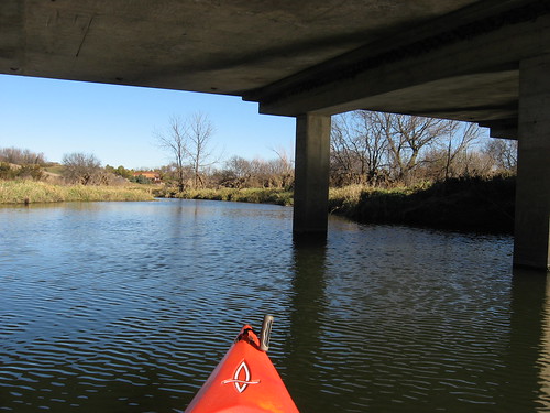
We first shuttled cars down to the bridge over Split Rock Creek at the confluence with Beaver Creek, a river distance of about six miles.
IMG_5837.JPG
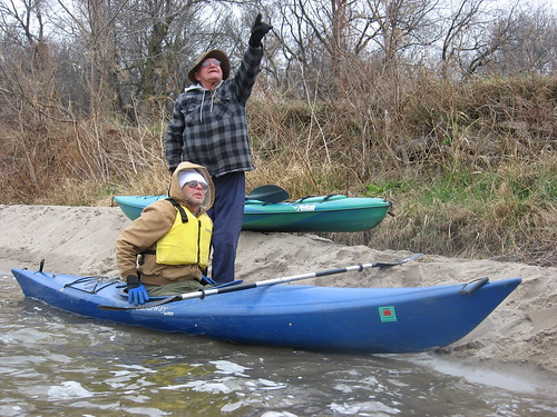
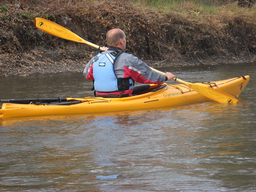
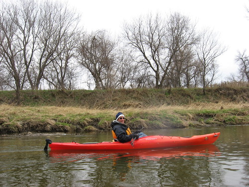
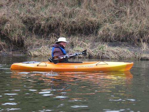
All of us were dressed in layers with heavy jackets, appropriate shoes or boots, water resistant gloves, and winter hats. I had a change of clothing and towels in the hatch-covered compartments of my kayak, and I am sure that others did as well.
IMG_5843.JPG
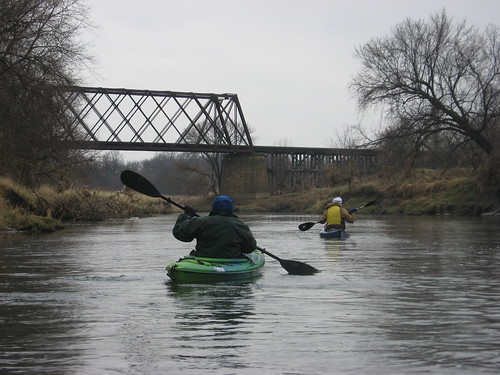
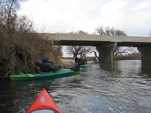
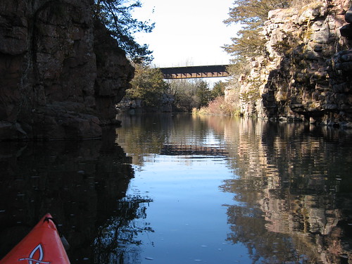
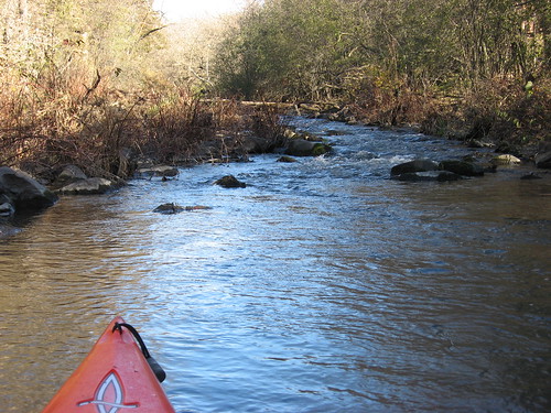
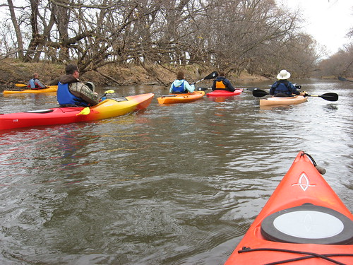
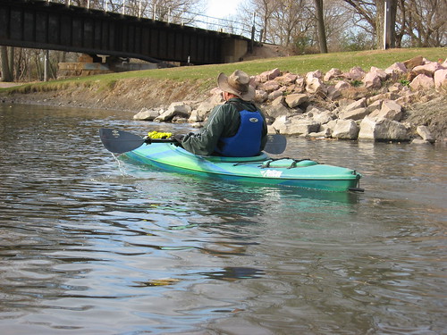
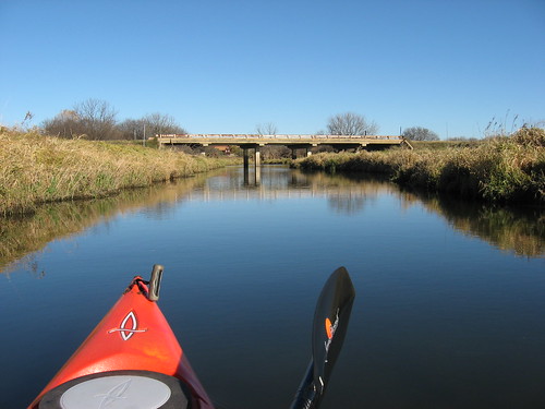
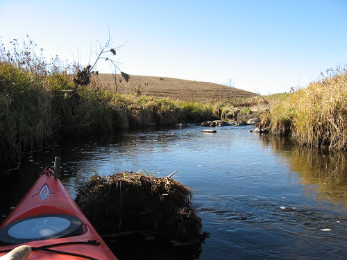
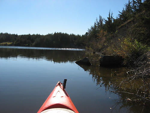
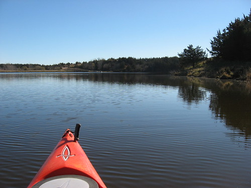
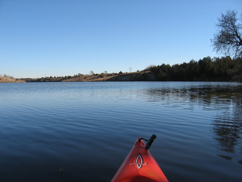
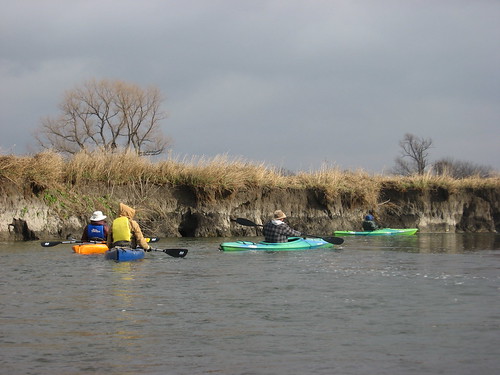
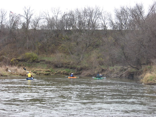
A few snowflakes were drifting in the air as we set off from McHardy Park, but that faded quickly. The water level was high, so we were fairly confident that we would make it down the creek without having to get out of the kayaks. The flow was fast as well, and we were able to make it down the six miles in an hour and a-half. There are a few minor rapids along the way, but all of us slipped through without incident. While there were a couple of times where kayaks ran aground on shelving bottom, those that got hung up were able to quickly back off or shift direction and return to the deepest channel. Overall, the creek flow was smooth, the channel was three or four feet deep in most places, and there were no obstacles to our passage.
IMG_5860.JPG
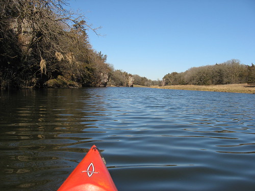
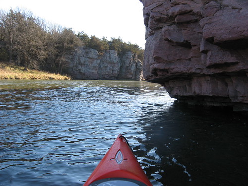
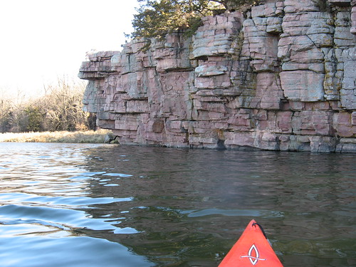
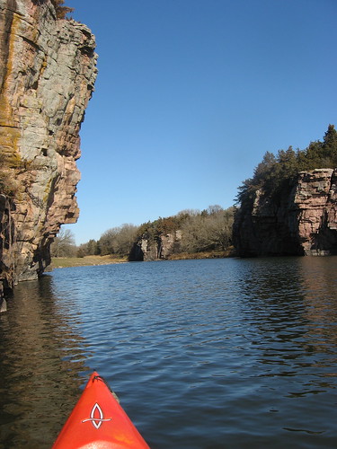
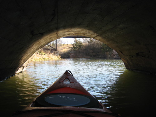
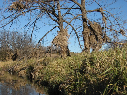
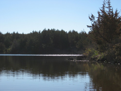
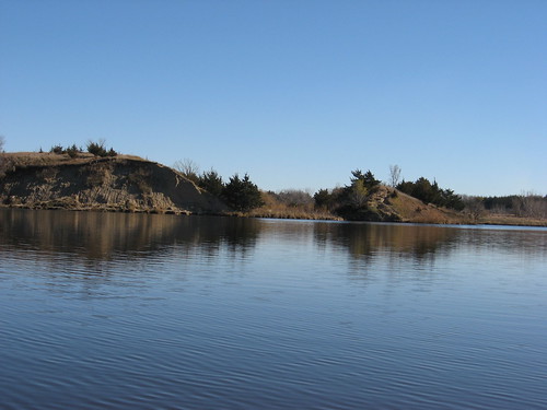
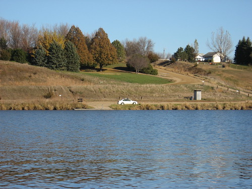
This section of Split Rock Creek flows along high banks that roughly parallel Highway 11 that runs from Sioux Falls to Brandon. The banks are sometimes 30 or more feet high along one side and five or six feet on the other. So, the creek is quite sheltered from the wind along most of its course. Very soon after our “take-out,” Split Rock Creek enters into the Big Sioux River.
IMG_5855.JPG
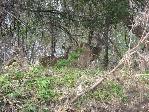
Soon after beginning our cruise, we came across the first of three deer sightings of the cruise. The deer were up on the bank in the trees, and my cold fingers would not work fast enough to get the camera out for a photograph.
IMG_5870.JPG
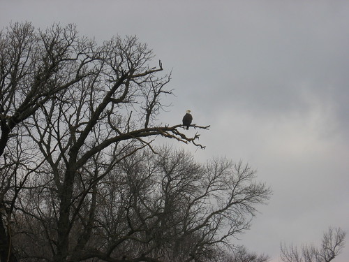
We also came across a bald eagle sitting high in a tree over the creek. The eagle seemingly just sat on a branch and watched us approach.
IMG_5878.JPG
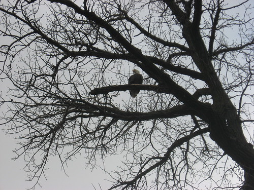
As we passed, he took off and alighted in another tree, again on a branch over the creek, and waited until we reached his new perch. He did this three times, and we all felt a special moment in company with this eagle. Following an eagle down the river from tree to tree is an uncommon pleasure.
IMG_5859.JPG
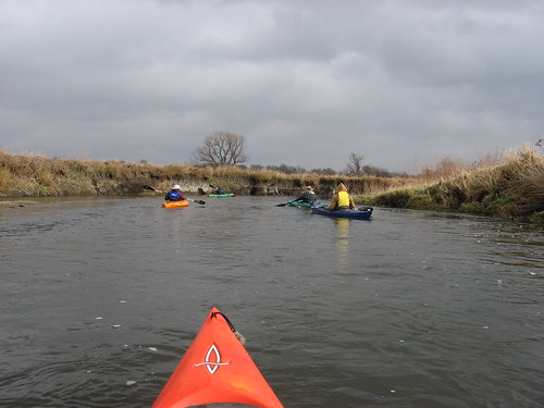
The five kayaks keep pretty close company down the creek. I think that we all recognized the risk of paddling in very cold water with an air temperature just above freezing, and we wanted to stick close in the event that a kayak should capsize. In these circumstances, it is best to have assistance available. After all, becoming immersed in such water with a few miles yet to travel could be uncomfortable or dangerous.
IMG_5846.JPG
Throughout the trip today, the light conditions changed rapidly. Sometimes it was heavily overcast, and then the sun would peak out through the clouds, some blue would appear, and the visible specter of light would be markedly changed. The, the darkness would come again and shadows would disappear.
IMG_5841.JPG
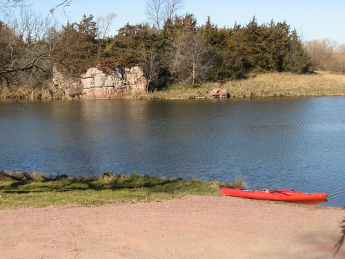
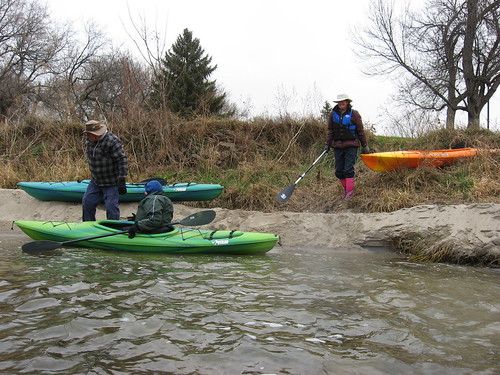
The “take-out” at the bridge was in an area of fast current and a steep sandy bank. We clamored out of our kayaks and dragged them up on the bank. From there, we had to make a path through dense brush to the road.
IMG_5861.JPG
We loaded up the kayaks, bid a tentative farewell to the paddling season, and wished each other well until we gather again in late January at the Outdoor Campus in Sioux Falls for the winter canoe/kayak conference.
IMG_5884.JPG

Monday, November 08, 2010

Split Rock Creek – Upstream from Garretson City Park

IMG_5790.JPG
This was another gorgeous day, and I am so glad that I have left the kayak on the car. I decided to visit Split Rock Creek, beginning at the Garretson City Park and continuing upstream through the palisades to the rapids. This is a cruise that I have taken many times, and it is also the cruise of choice when taking visitors in the area out for a kayak ride.
IMG_5801.JPG
I rolled into Garretson about 10:30 a.m., and the temperature was 53 degrees under sunny skies with only a light breeze. As nearly always, I was alone in the park and alone on the water.
IMG_5808.JPG
The palisades are always spectacular with cliffs of quartzite rising a hundred feet or more out of the creek bed. Quartzite is a hard stone that was used in the construction of many early public buildings in Sioux Falls. The Old Courthouse Museum is a prime example in Sioux Falls, and the city park building along Split Rock Creek is another – a building constructed in 1936, probably as a WPA project.
IMG_5797.JPG
The waterway was very quiet this morning. I did not see even a bird as I made my way up the couple of miles to the set of rapids that makes further upstream paddling a little rough, especially at this time of the year.
IMG_5805.JPG
Instead, I concentrated on the landscape, the coniferous trees along the cliffs, the browning growth along the shore, and debris left high up in the trees and along the rock faces from the extremely high water earlier in the season.
IMG_5816.JPG
As always, the play of shadow upon the water and the rock face of the palisades from the morning sun was a pleasure to watch. Moving along the cliff wall, a kayak moves from bright light to deep shadow and back into the light.
IMG_5814.JPG
There are some caves on the cliff walls that extend deep into the rock, sometimes 15 feet or so. At some points, there are crevices that wind up from the creek level to the top of a cliff wall. Trees and bushes grow out of cracks or on small ledges of the cliff – brave plants that survive in the most trying circumstances.
IMG_5812.JPG
On the way back downstream, I skirted the left bank and ran into some large, barely submerged rocks. My kayak became unbalanced as I hung up momentarily on one large rock that was hiding just a few inches underwater.
IMG_5801.JPG
As usual, I went through the arched bridge near the “put-in” and entered that secluded world of Devil’s Gulch. I really like the flat calm, the overhanging cliff faces, the railroad bridge overhead, and the short ride up to a set of rapids. I saw a turtle in this section of the cruise, probably the last turtle that I will see until the return of spring.
IMG_5819.JPG
There were no waterfowl visible on the water today, nor really much in the way of bird life at all. On the cruise back downstream, a large owl flew across the creek ahead of my kayak.
IMG_5825.JPG
Split Rock Creek, through this section from the dam at the Garretson City Park, is always a nice cruise. This is the section cruised by the large pontoon boat, Jessie James, that takes groups on a ride through the palisades. I have passed that pontoon boat filled with cruise customers several times, and the skipper never fails to holler out, “I say, have you any Grey Poupon!”
IMG_5821.JPG
As I drove through Garretson on my way home at 12:30 p.m., the temperature had risen to 66 degrees.
IMG_5804.JPG
Who is to say how long this wonderful weather will hold out. Most of us here on the northern plains have our snow blowers gassed up and shovels ready. Winter is overdue now, and each day like today is just a marvelous gift – a gift to remember over the coming months.

Saturday, November 06, 2010

Big Sioux River: A late fall cruise through Sioux Falls

IMG_5751.JPG
In yet another cruise led by Dave and Mary Finck and Larry Braatan (all SDCKA Board Members), ten paddlers and their kayaks assembled at the launch area near 57th and Western Avenue to head down the Big Sioux River through Sioux Falls. A November cruise is a delight that we can’t count on here on the northern plains, especially on rivers other than the Missouri River.
IMG_5752.JPG
I dithered with a decision on whether or not to join the cruise today; there were lots of other things on my “to do” list, and this was a trip that I had taken several times over the years. But, I suspected that I would regret letting this opportunity slip by. As it happens, this was a wonderful day with a temperature of about 60 degrees, sunny, and with a wind at our back much of the trip. It was a great day for a paddle, and a good day for fellowship on the river.
IMG_5762.JPG
We gathered at the put-in and arranged a shuttle. Actually, most of us drove our cars to the “take-out” at Fawick Park and rode back in Dave’s van. By 1:50 p.m. we had all launched and were underway down the river. One of the cruise participants brought a big container of homemade chocolate chip cookies and offered them around to us: I took three and then had another one at the take-out!
IMG_5764.JPG
As we moved down the river, the group kept together, although people tended to move along chatting with a person alongside. The trees have lost nearly all their leaves, and visibility through the vegetation along the banks was good. Surprisingly, we came across three groups of deer at various points along the cruise. The first one was a large buck with a full set of antlers. We were moving fast on the stream, and by the time I fumbled my camera out, he had slipped away. Still, we all got a good look at him. Then, we came across a group of three more deer, and I was able to capture them with my camera. There were a few ducks along the way, ducks that may not have gotten the memo about departure from these northern climes.
IMG_5771.JPG
There are two sets of rapids along the seven-mile stretch from 57th Street to Fawick Park, and we slipped through each of them without incident. The first is under the bridge connecting the bike trail, just downstream from Cliff Avenue. There were plenty of bicyclists out on the trail today, and a few watched us pass through this first set of rapids. The second set is near 26th Street; that one is a little less of a challenge, and again we made it through without incident.
IMG_5777.JPG
We passed under several bridges as we made our way downstream. There were no navigation hazards along the route, apart from the two sets of rapids.
IMG_5782.JPG
Many people were out on the bike trail, walking, riding, laughing in the sunshine. Lots of geese are still hanging out in the area between the 18th Street bridge and Fawick Park. The geese, at any rate, can just slip over to Arrowhead Park as the ice develops on the Big Sioux River.
IMG_5779.JPG
We ended our cruise at Fawick Park, in sight of the statue of David. We had left our cars parked on the street at the park, and it was only a short “carry” from the river to the street. Our trip was about seven miles and took us just under two hours.
IMG_5787.JPG
This was a fine trip, a great cruise in the fading days of fall. We just have to take advantage of opportunities for trips like this, and I am so glad that I overcame my lethargy: I could not in good conscience spend the day reading or doing home chores when a cruise down the river was offered.
IMG_5786.JPG

Friday, November 05, 2010

Lake Alvin: A Late Fall Cruise on Familiar Waters

IMG_5711.JPG
I have kept the kayak on top of the Honda Civic since my trip to Lake Lakota last week, just waiting for a nice day for perhaps a final cruise of the season. The past few days have been cold and very windy. This morning the dawn temperature was in the 20s, but the winds were light and this seemed the day I had been anticipating.
IMG_5733.JPG
About 10:30 a.m., I set out for Lake Alvin. The temperature had climbed to about 34 degrees and the sun was bright as I arrived at the public access area on the southwest shore; the dock was still in, and the lake was deserted. The water temperature was 45 degrees, marking a steady decrease over the past couple of weeks.
IMG_5724.JPG
I managed to get in the kayak with my shoes still on, and I was wearing a jacket under my life jacket. I also had on a winter hat and gloves. Even so, I was cold for the first hour of paddling, especially my face and hands.
IMG_5718.JPG
As has come to be my normal path, I set out across the lake to the eastern shore and made my way south into Nine Mile Creek. The water in the creek was as clear as it ever gets in that waterway; I could clearly see bottom at four feet, and that made it relatively easy to follow the channel south. I passed debris caught in the trees along the shoreline from the floods of this sumer. It is amazing how the creek rose so high above the banks of this seemingly placid stream
IMG_5721.JPG
The depth along the creek was sufficient to move up to the rapids located about 20 minutes upstream. Clods of earth along the route were encrusted with frost and seemed frozen to the touch.
IMG_5727.JPG
There was little life seen along my route today. I came across a couple of muskrats, a very few duck-like birds, and very few perching birds. The brown landscape and the apparent absence of wildlife seem to highlight the advancing season. Winter is near, and the lake community is shutting down for a long sleep.
IMG_5738.JPG
Coming back out of Nine Mile Creek, I continued north up the main body of the lake keeping close to the shoreline. There was an interesting play of colors on the water and about the land, and I enjoyed watching the changing face of the water: cats paws racing along and wind shifts on the surface as the lake flows along the old creek bed in a roughly “S” shape through the surrounding hills.
IMG_5734.JPG
Overhead, I could see passenger jets streaking along in various directions, their contrails sweeping out behind them as they passed seven miles or so above me. I thought of the expression “fly-over states” as the jets moved generally east and west so far above. The passengers in those jets are in their own self-contained world, unconnected to the places they are passing far below.
IMG_5736.JPG
I looked over the familiar shoreline, thinking that this might well be the last time I visit Lake Alvin for many long cold months. A guy was out fishing, and we had a brief chat. He told me that he was at work and couldn’t stand the thought of letting this day pass without taking advantage of the last days of lake access. So, he took off work and was casting his line and smiling in the sunshine. He had entered the lake from the Recreation Area along the northwestern shore.
IMG_5735.JPG
I eased into the spillway channel to look over the landscape and came across another muskrat.
IMG_5712.JPG
So, I spent a couple of hours on the lake and paddled the length: from the fishing pier at the north end to the end of Nine Mile Creek in the south. Last year I went out to Lake Alvin on December 1, but the dock was pulled and most of the lake was ice covered. Still I foolishly paddled around the edge of the ice for a hundred yards or so.
IMG_5713.JPG
I am leaving the kayak on the car for another week or so in the event that I decide to go out again. Paddling cold waters alone is probably not the best idea though, so I may call it a season with the cruise today.