In 1930, Eric Sevareid, who would go on to become one of the top CBS radio and television reporters and commentators of the 1940s -1970s, graduated from high school in Minneapolis and, with a pal, set off in a canoe for Hudson Bay. He wrote about this expedition in a book entitled Canoeing With the Cree in 1935, a book still available and one of the classics in canoe wilderness travel. I read this book many years ago and remember it still. Eric Sevareid was paired up with Walter Cronkite for many years, and I remember him well during that period when CBS news was the dominate broadcast voice on television.
This year, two young women who are just now graduating from St. Olaf Collage in Northfield, Minnesota, are setting out on June 2 from Fort Snelling in Minneapolis to recreate the Sevareid journey. Their website at http://hudsonbaybound.com gives details of their plan, and they are documenting the voyage on a blog at http://www.hudsonbaybound.blogspot.com/. I plan to vicariously follow along on this 2,250 mile trip that begins on the Mississippi River, into the Minnesota River, on to Big Stone Lake, down the north flowing Red River of the North, to Lake Winnipeg, into the Hayes River, then to York Factory on Hudson Bay.
Although a few others have recreated this journey over the years, these two young grads hope to become the first women to follow Sevareid’s path. I try to tag along on expeditions like this, much as I do with Roz Savage’s row around the world. Expeditions like this are inspiring to me. I like to follow people who set out on their own path to challenge themselves and nature rather than follow a more traditional route to career, financial entanglements, and conformity. So, I will be checking in regularly to see how their trip is going.

Tuesday, May 31, 2011
Tuesday, May 24, 2011
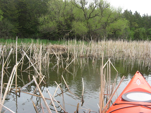
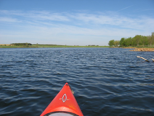
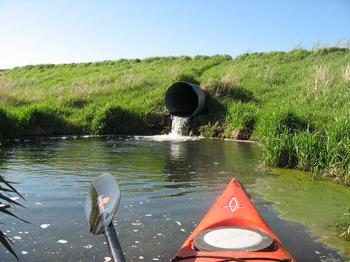
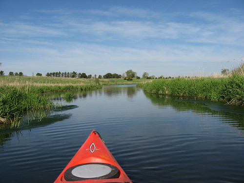
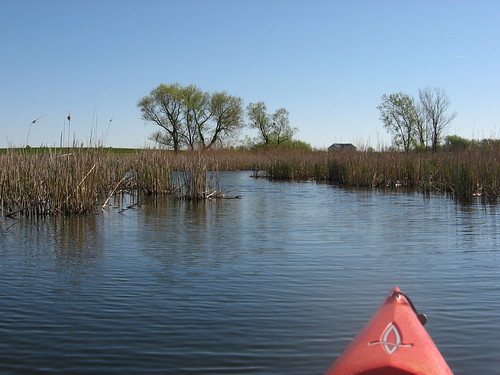
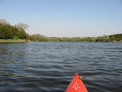
Grass Lake - May 2011
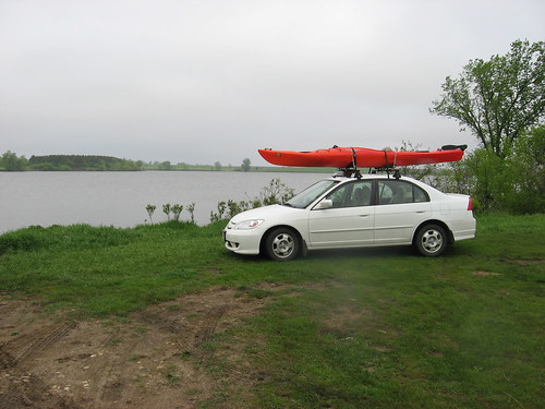
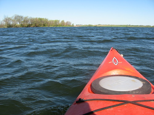
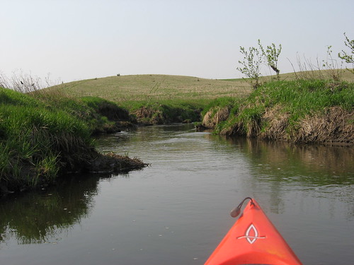
Looking ahead at the forecast yesterday, I assumed that today would be the best day for a kayak cruise this week. With that mind set, I loaded up the kayak last night and headed out this morning for Grass Lake. As I left the house at 5:45 a.m. for my customary stop at the local bagel shop for coffee and a little novel reading, it was still dark. When I headed west along Highway 42 (12th Street), I saw that the sky was totally overcast, there was a moderate wind, and the temperature was in the mid 50s. I thought that I saw sprinkles on the windshield as I drove on; still, a decision to head out with the kayak lashed to the car top had been made, so on I drove.
Locating Grass Lake requires specific directions, and earlier narratives (see the menu to the right side of the blog) provide turn-by-turn directions. On most of the isolated prairie lakes in the region, signage for public access areas is not a strength of the Department of Game, Fish, and Parks, and anyone heading out to this lake really should check out the specific directions.
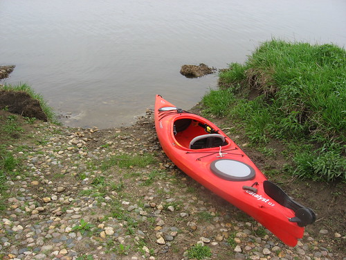
The lake was deserted when I arrived at 7:20 a.m., as it is has always been on my weekday morning cruises over the years. The launching area is just a rock pathway, and even that has markedly deteriorated over the winter. While a kayak or canoe can be muscled down the pathway and into the water, I don’t see how anything larger could be launched, especially a boat on a trailer.
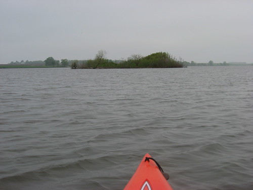
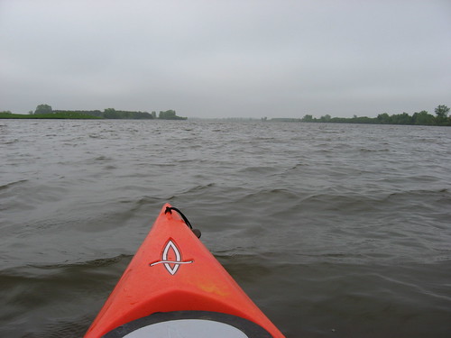
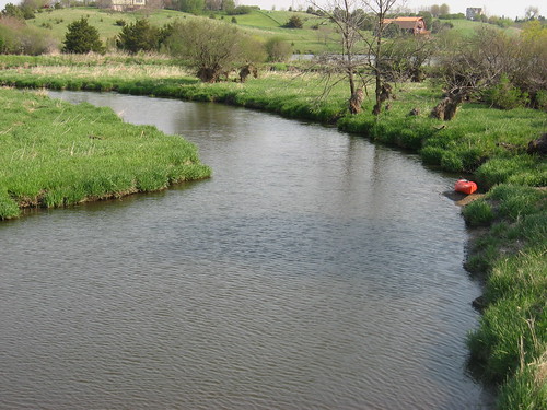
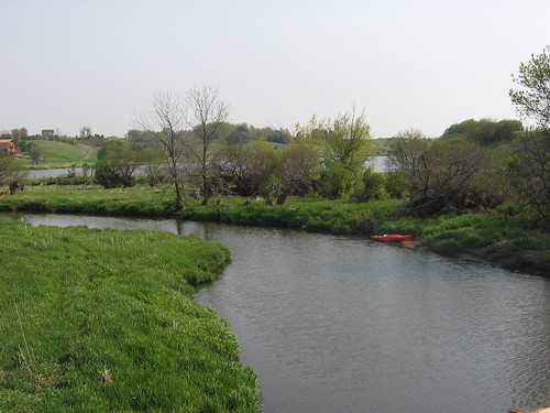
The wind was blowing briskly through the trees as I launched from the southeastern shore, but there was a lee side sheltered from the wind by the banks and tree cover for about 25 feet offshore. The wind was blowing out of the south, down the lake. My normal route for this cruise is counter clockwise, heading northwest down the lake, past the first of two islands.

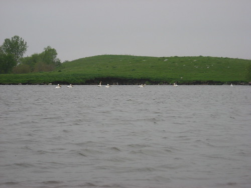
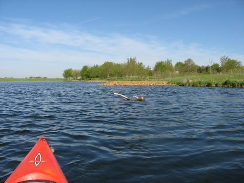
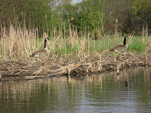
As I moved away from the lee side of the lake, the waves built up until they were crashing over the bow. Still, I continued down my normal route looking for “critters” in the brush of the shoreline and watching the many birds fleeing my presence: great blue heron, pelicans, geese, ducks, and egrets.
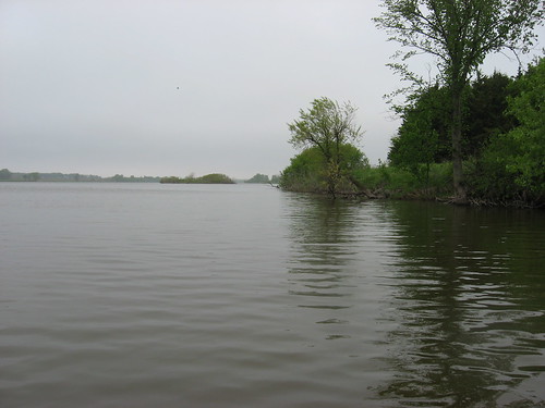
As I continued down the northeastern shoreline heading west, everything was smooth. If I got out too far, the waves would send my kayak rocking up and down with spray drenching my pants, shirt, and glasses.
After arrival at the northwestern end of the lake, I continued my route over on the western side, heading back south, continuing the counter clockwise pattern. As the lake widened out on the return, it became apparent that kayaking on the western side would be a battle all the way back, and I would have to cross the lake again at its widest point.
Most of my paddling is alone on these out-of-the way lakes. At this time of the year, I sometimes feel a little anxious about wave action when I am pretty far out in the lake, far out enough that swimming to shore in cold water is not likely to be a positive experience. I felt a little that way this morning, so prudence seemed to dictate abandoning my routine and returning back up the lake along the lee shore. So, I crossed over and had a much more tranquil paddle back along the same route I used going down.
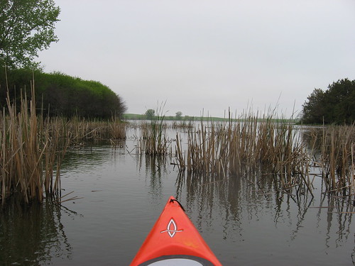
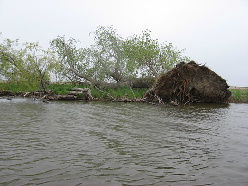
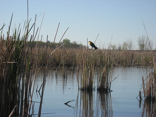
I visited some of the wetlands along the eastern shore. These are not as extensive as found on many of the area lakes, but it is still possible to move up through the reeds and check out the backwaters. Two or three times I head a chorus of frogs calling out. Somehow, these creatures are able to sense the approach of an intruder. Like turning off a switch, the chorus ceased upon the approach of my kayak – as silent as I tried to be.
This was a good early morning cruise, although I would prefer warmer temperatures, calm waters, and sunny skies. Still, this is the day that I had, and I am glad that I had an opportunity for a couple of hours on Grass Lake.
Tuesday, May 17, 2011
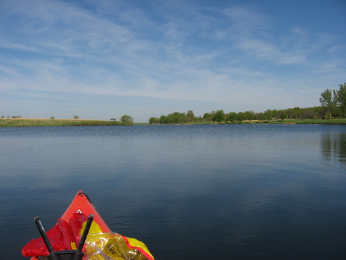
Lake Pahoja (Iowa) May 2011
Yesterday the forecast for today looked good, and the prediction for later in the week called for rain; so, I just left my kayak on the rack and thought I would take advantage of another sunny moderate day ahead.
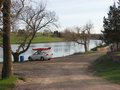
It has been four years since I last visited Lake Pahoja, just across the border in Iowa. I checked the blog entry for that visit (see Lake Pahoja on the location menu on the right side of the blog) and followed my directions the 20.4 miles. The easiest way there from my eastside Sioux Falls home is to head south on Highway 11, past the Lake Alvin turn-off, to 276th Street. I turned east there and drove on for about three miles, across the Klondike Canoe Access on the Big Sioux River and into Iowa until I saw the sign on the right for the park. Lake Pahoja is a really nice Lyon County park that offers a range of wonderful recreational opportunities, especially for families and particularly for those interested in shoreline fishing.
There is a $5 entry fee for the park, but the office was deserted and there seemed no way to pay this morning. As I arrived, there was a pick-up and boat trailer in the parking lot; otherwise, I was alone.
The lake is oriented generally east and west with deep bays extending south. It is rather long but narrow and surrounded by county-owned land. There are no houses visible, eliminating the feeling that I sometimes have that wealthy people have built their large and ostentatious homes overlooking the lake and making me feel like an intruder.
This carefully developed park clearly caters to families and fishing. There are earthen extensions projecting out into the lake to give fishermen an advantage. No gas motors are allowed on the lake, and that provides an assurance of some tranquility. A rental business at the launching dock offers rowboats, canoes, and paddleboats - both “water bikes” and the more traditional type.
I set out first heading east along the shoreline of this nearly 100 acre lake (flood stage) and then moved south into the wetlands surrounding a couple of inlets at the southeastern end.
There was a great deal of bird life to observe; this time, I saw lots of redwing blackbirds among the variety of perching birds. There were also a number of duck of various kinds.
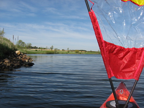
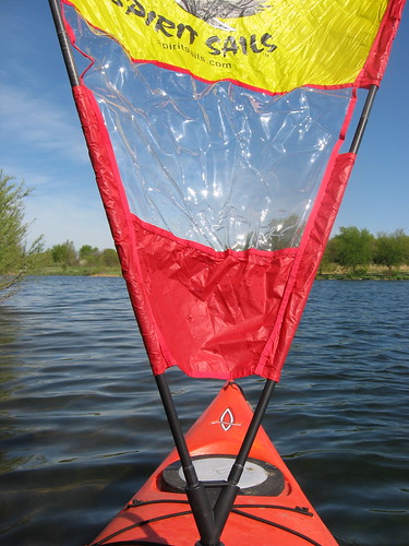
The wind was light, but I wanted to give my Spirit sail a try and found myself sailing back along the east-west axis to the next south extending bay. I found myself fumbling with the sail; as the wind increased, I tried to take it down or move it to a different setting and felt myself losing control of the sail. I could not seem to get it down, and my balance was slipping. The wind was not enough to make me feel any sense of anxiety, but I wondered what I might do with stronger gusts. I believe that the umbrella may be the best bet for me when sailing the kayak: it is easier to manage and safer.
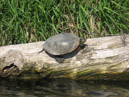
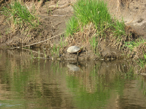
I did not see any sign of wildlife except for turtles and the birds. This park is a wildlife refuge, so I assume that there are “critters” about, although they are probably wily with the developed state of the site.
As I was finishing my trip around the two-mile perimeter of the lake, a school bus pulled up. The passengers, I found, were high school students from a PE class at West Lyon High School. They were festooned with fishing poles and spread themselves out along the shoreline and on the docks. I had a chat with the driver and found that he was a retired social studies teacher who had become a bus driver for the same school he served as a teacher. As we stood there, he reminisced about how back in the 1960s he had hunted pheasants out in fields that were now at the bottom out in the central portion of the lake. He told me that there was a little creek flowing through, and that some visionaries had decided to try and create a lake and park. That effort certainly was successful, and Lake Pahoja is a magnificent addition to the quality of life in this part of Iowa and South Dakota.
My impression of the lake has changed since my first narrative. Paddling Lake Pahoja is not high adventure, but it can offer an hour and a-half of tranquility without driving too far. The park is only about 25 minutes from my home – just ten minutes further than Lake Alvin. So, for tranquility and a contemplative paddle or as a venue for teaching a novice beginning kayaking skills, this is a good spot and I recommend it.
Monday, May 16, 2011
Beaver Lake - May 2011
After a string of cool, rainy, and windy days, the Sioux Falls area is slated for about three days of sun with temperatures up into the high 60s. I could not let the opportunity for a peaceful cruise on an area lake pass, so this morning I headed out early to Beaver Lake, just on the southern edge of Humboldt and within sight of Interstate 90.

The road to the lake access area runs along the edge of the cemetery and just west of the Humboldt elementary school. Today, the road was pretty rough with lots of potholes. Approaching the southern edge of I90, the road turns east and winds along the edge of the lake. The entrance into the public access area has a small and easy to miss sign. For most of these “out of the way” lakes, the state does not expend many resources to guide the traveler to public access areas. It is essential to have a detailed map or set of directions.
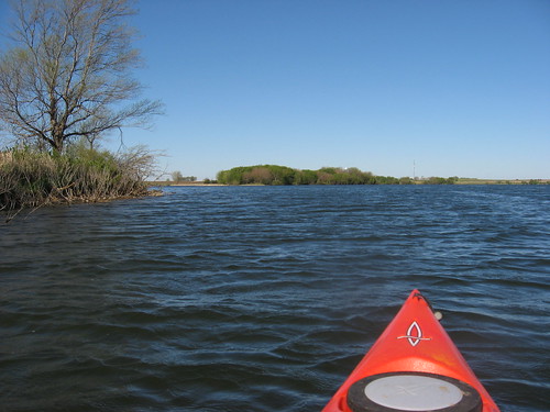
The temperature as I arrived at the lake was in the high 30s, the sky was cloudless, and there was a light to moderate wind blowing out of the north; as usual, the lake was deserted. I could hardly wait to unload my kayak and set off.
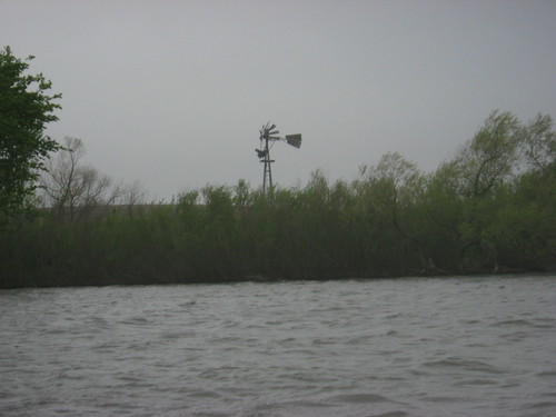
I followed my normal Beaver Lake cruise route and headed first out to the island located offshore, just northeast of the access point. This large island is a favorite of mine; it seems like a bird sanctuary, and today it was populated by flocks of blackbirds with the occasional egret flying overhead. I circumnavigated the island, peering into the interior looking at the vegetation that is in its early spring growth, listening to the cacophony of bird sounds, and searching for “critters.” As I paddled around the island shoreline, I could hear duck and geese sounds from the grasses and reeds just into the interior.
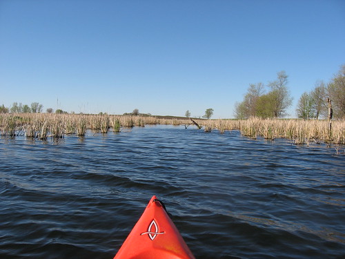
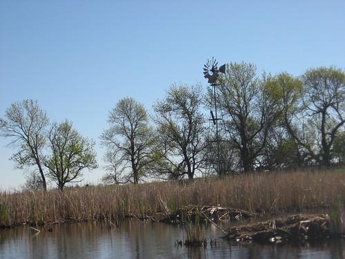
From the island, again following my usual route, I continued east into the rising sun and headed north along the shoreline into the large northern appendage of the lake. My landmark along this route is an old windmill along the eastern shore that marks an entrance to a wetlands, a place full of beaver lodges, tall grasses and reeds, and a nesting place for a variety of perching birds and waterfowl. This is a tranquil spot, regardless of the windy conditions that so often characterize this wide and open lake.
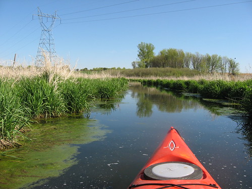
After cruising around the pool that marks the end of the wetlands channel, I headed back to the main body of the lake and continued down the northeastern arm to another entrance into a wetlands, this time moving northwest. This channel leads inland about 200 yards or so past more beaver lodges and tall grasses.
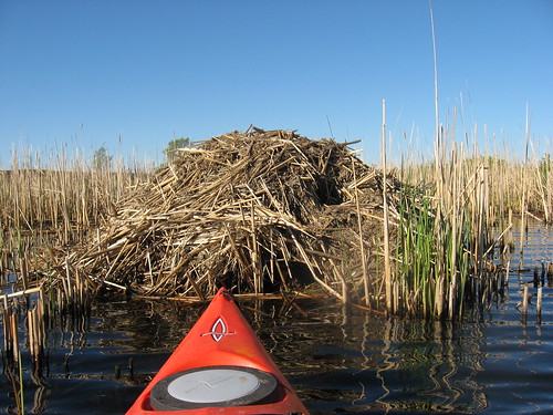
I love these wetlands with their channels and wider ponds. This is where the cattails grow, the beaver build their lodges, and the mama ducks teach their babies how to stay away from the man in the red kayak. There were lots of yellow-headed blackbirds perching on the reeds along my transit down the channels.
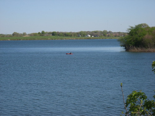
My return path led me back along the southern shoreline toward the island. As I reached the far eastern shore, a few hundred yards from the island, I spotted another red kayak. In my eight previous cruises on Beaver Lake, I have never seen another kayak or canoe. I could not resist heading over to chat with the paddler, a woman bundled up in a lightweight parka who lives in the area and frequently kayaks the lake; in fact, she told me that she thought of this as “her pond.”
In rather typical fashion, the wind had freshened since I arrived and the light winds became decidedly moderate with temperatures up to the mid 50s.
As I finished up my cruise and headed to the access area, I saw that an older gent had arrived and had his fishing equipment spread out at the end of the dock. We chatted a bit and I loaded up my kayak. My cruise this morning was about 90 minutes.
Tuesday, May 10, 2011
Lake Alvin - Early May 2010
Seasons can change quickly here on the northern plains. It was just a week or two ago when the water in the birdbath mounted on our deck was frozen in the morning. Today, the temperature is expected to rise to about 90 degrees. We are into a series of windy days now; of course, it windy here much of the time, but I wanted to take advantage of the timing for an early paddle before it got too breezy for a comfortable time on open lakes.
So, this morning after my morning routine of coffee and reading at my favorite bagel place, I set out for the short drive to Lake Alvin.
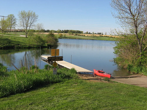
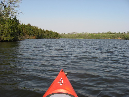
After setting off from the public access launching area on the southwestern end of the lake, I set off with a following wind and headed across to the eastern shore and north toward the dam and public fishing dock.
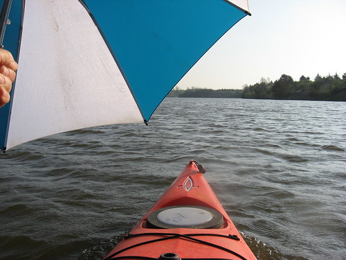
Since I was going with the wind, I took out the big golf umbrella and sailed most of the trip north. The wind was strong enough to raise a respectable wake from the kayak; I held onto the umbrella and used my foot-mounted rudder to control direction.
I lost the wind toward the northeastern end of the lake and headed over to the shoreline to cruise along looking into the vegetation along the bank, hoping to spot some animal life. Suddenly, I saw a moderate-sized animal that was about 2½ feet long, with short legs low to the ground, a head something like a seal, and brown in color. This critter moved along the shoreline, stopped and looked at me, changed directions, and then vanished before I could fumble my camera out. This animal seemed like a weasel or perhaps a mink, although I have never seen either one in the wild and am only guessing.

My easy sail north on the lake meant that I would have to slog my way back south in the face of a stiff head wind. As I moved south, astonishingly, I came across another paddler. I paddled over to say hello to Jeff and check out his craft. He was paddling a solo Bell kevlar canoe – the type of boat I had before shifting to kayaks. Actually, as I have gotten older, I have considered moving back to a solo canoe.
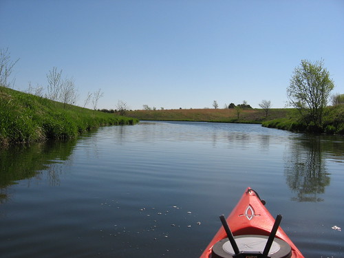
Of course, I had to continue south into Nine-Mile Creek; a Lake Alvin cruise would be incomplete without including this segment of the paddle.
Nine-Mile Creek begins with a width of about 30 feet; as it continues south, it gradually narrows down over the course of about a mile to a steady width of about 15 feet. At the end, the creek is so narrow that it is difficult to turn around.
I got out of the kayak just before the bridge to take a photograph of the course of the creek. At that point, I came across a guy who I thought was hiking along the creek shoreline. I thought that such a stroll would be tough in that terrain. As it happened, he was retrieving a lure that he had lost while fishing. I met him again on the return, but he still had not caught anything.
Along the cruise, I came across a number of ducks and geese. Perching birds along both sides of the creek offered their continuing songs. Frogs were also croaking in wetlands that extended off the course of the creek. There were lots of turtles out sunning themselves.
As I ended my cruise and headed over to the “take-out,” I came across two kayaks heading south toward Nine-Mile Creek. I began to feel that crowds of paddlers were pressing in! These two kayaks disappeared around the point and up into the creek as I was packing up my boat.
I was out for about two hours this morning.
So, this morning after my morning routine of coffee and reading at my favorite bagel place, I set out for the short drive to Lake Alvin.
After setting off from the public access launching area on the southwestern end of the lake, I set off with a following wind and headed across to the eastern shore and north toward the dam and public fishing dock.
Since I was going with the wind, I took out the big golf umbrella and sailed most of the trip north. The wind was strong enough to raise a respectable wake from the kayak; I held onto the umbrella and used my foot-mounted rudder to control direction.
I lost the wind toward the northeastern end of the lake and headed over to the shoreline to cruise along looking into the vegetation along the bank, hoping to spot some animal life. Suddenly, I saw a moderate-sized animal that was about 2½ feet long, with short legs low to the ground, a head something like a seal, and brown in color. This critter moved along the shoreline, stopped and looked at me, changed directions, and then vanished before I could fumble my camera out. This animal seemed like a weasel or perhaps a mink, although I have never seen either one in the wild and am only guessing.
My easy sail north on the lake meant that I would have to slog my way back south in the face of a stiff head wind. As I moved south, astonishingly, I came across another paddler. I paddled over to say hello to Jeff and check out his craft. He was paddling a solo Bell kevlar canoe – the type of boat I had before shifting to kayaks. Actually, as I have gotten older, I have considered moving back to a solo canoe.
Of course, I had to continue south into Nine-Mile Creek; a Lake Alvin cruise would be incomplete without including this segment of the paddle.
Nine-Mile Creek begins with a width of about 30 feet; as it continues south, it gradually narrows down over the course of about a mile to a steady width of about 15 feet. At the end, the creek is so narrow that it is difficult to turn around.
I got out of the kayak just before the bridge to take a photograph of the course of the creek. At that point, I came across a guy who I thought was hiking along the creek shoreline. I thought that such a stroll would be tough in that terrain. As it happened, he was retrieving a lure that he had lost while fishing. I met him again on the return, but he still had not caught anything.
Along the cruise, I came across a number of ducks and geese. Perching birds along both sides of the creek offered their continuing songs. Frogs were also croaking in wetlands that extended off the course of the creek. There were lots of turtles out sunning themselves.
As I ended my cruise and headed over to the “take-out,” I came across two kayaks heading south toward Nine-Mile Creek. I began to feel that crowds of paddlers were pressing in! These two kayaks disappeared around the point and up into the creek as I was packing up my boat.
I was out for about two hours this morning.
Friday, May 06, 2011
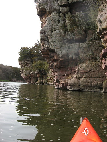
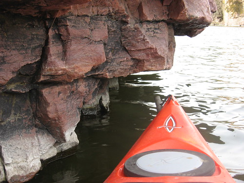
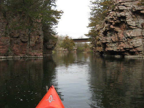
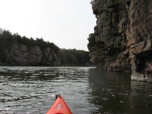
Split Rock Creek - The Palisades May 2011
This morning was the start of a beautiful day in Sioux Falls, and I took advantage of it by taking my kayak out to Split Rock Creek for a cruise upstream from the dam at the Garretson City park through the palisades.
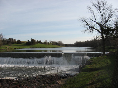
It was 50 degrees under hazy sunshine as I passed through Garretson to the park. Within the park is a dam that impounds the creek upstream for something over a mile. Downstream, the creek passes through Palisades State Park, moves on through McHardy Park in Brandon and joins the Big Sioux River just a little southeast of Brandon.

My cruise this morning was upstream of the dam. This is an area with high palisades of Sioux quartzite festooned with a variety of flora, including spruce trees growing on ledges and out of cracks.
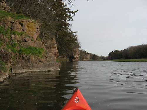 Cruises on this body of water are for me an opportunity to examine the rock formations; marvel at the tenacity of plant life growing on the tops, along the sides, and in the cracks; and watch the bird life, especially cliff swallows and geese. Today, I saw a few ducks and several pairs of geese, loudly honking at me as they protect their nests from intruders. There are a couple of farms in that area on the left moving upstream, and cows were out chomping the fresh spring grass along the left bank.
 There is a set of rapids a little over a mile upstream, and this is generally the limit of cruises along this stretch.
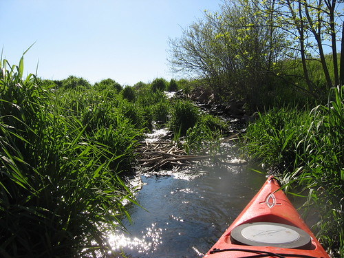
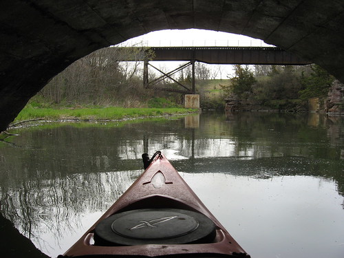
On the way back, I nearly always duck into one of the arches supporting a bridge leading deeper into the campground. There is a gulch that leads back for a couple hundred yards, and I like to move along this body of water that is also framed by palisades, although not as tall as those along the creek. The gulch ends at a brook that flows into the creek. This gulch, of course, is locally known as Devil’s Gulch, the supposed spot where Jesse James escaped by jumping across as a posse chased him after a bank robbery in Minnesota.
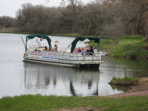
The only other water craft that I have seen on this portion of Split Rock is a large pontoon boat that takes passengers on a cruise up the same route I traveled, except under the arched bridge into the gulch. Today, the boat was taking a group of children on an adventure. The “SS Jesse James” skipper told me today that there are people who kayak this stretch on weekends. My lake cruises, however, are nearly always during the week; as a retired gent, I have that liberty and enjoy kayaking during what are working hours for most people and were also for me for 45 years or so.
I have written frequently about cruises on this portion of Split Rock Creek, and the reader can just move over to the menu on the right side of the blog and access earlier narratives of this route. As I have said before, this is one of the places I take guests of mine out for their first or second kayak ride. The scenery is spectacular, at least for waterways in this area.
Subscribe to:
Posts (Atom)