This blog is designed to highlight the paddling opportunities within South Dakota, mainly within a 50-mile radius of Sioux Falls. While Sioux Falls is far from the adventure of coastal regions, there is a certain satisfaction in utilizing the available waterways to observe weather, water conditions, and the landscape along the shoreline. In addition, there is a wealth of animal life on the waters of small South Dakota lakes, rivers, and creeks, including geese, ducks, pelicans, great blue heron, egrets, hawks, owls, perching birds, deer, raccoons, and beaver. Eagles, fox, and coyote are also sometimes spotted.

The sites described are places where I have kayaked over the past few years, mostly in South Dakota but sometimes including locations in Iowa and Minnesota. One of the best sources of information on the accessibility of small lakes is the South Dakota Atlas and Gazetteer, the large map book of South Dakota. Lakes with a public access are generally identified by a boat symbol marking the location of a launching site on public land.

You will notice the menu of paddling locations on the right side of the blog. Each of the postings is linked to one of the areas, and my intention is to provide a continuing review of the places where I paddle. Perhaps these narratives will help readers select waterways of interest to them. Please feel free to offer a comment regarding any of my postings; I would welcome the dialog.

I also maintain a companion blog that describes hiking opportunities within the Sioux Falls area. You can access that blog at: http://hikingsiouxfalls.blogspot.com

Wednesday, June 29, 2011

Kanaranzi Creek (Minnesota)

IMG_6405.JPG
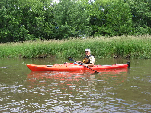
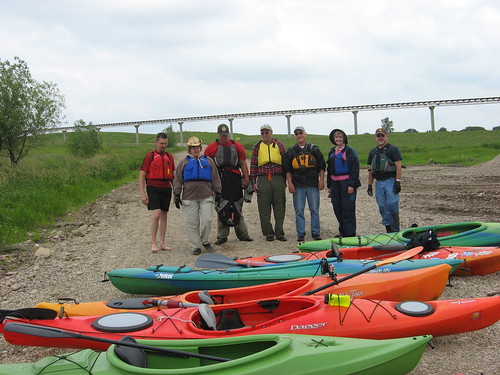
On Monday afternoon, David Finck called me to ask if I was interested in going on a cruise down Kanaranzi Creek in southwestern Minnesota. Dave had made arrangements for this cruise with Craig, a paddler in Worthington, to explore this stream. With my newfound resolve to embrace spontaneity, I accepted the invitation, and we made the trip yesterday evening.
IMG_6375.JPG
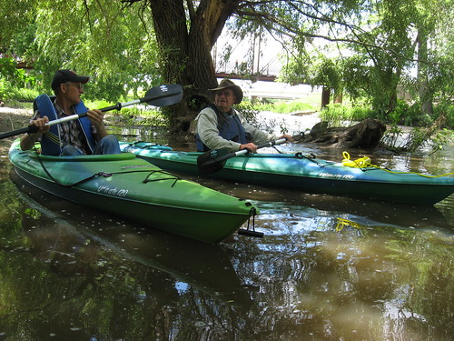
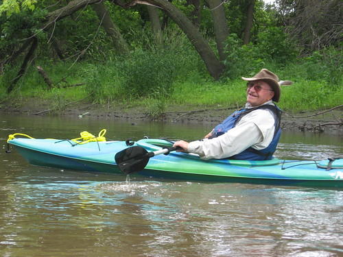
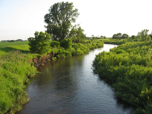
Kanaranzi Creek is a stream that originates near Lismore, Minnesota, and winds its way southwest to a confluence with the Rock River just north of Rock Rapids, Iowa. We met Craig at a gas station on the edge of Adrian, Minnesota, and headed for the put-in off a bridge just west of town. Craig had traveled down the Kanaranzi a number of times, but neither Dave nor I had done so, and he became the guide for the cruise.
IMG_6391.JPG
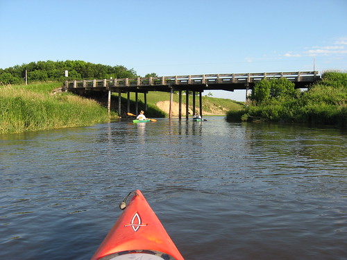
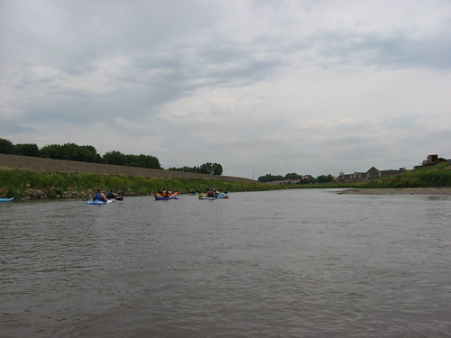
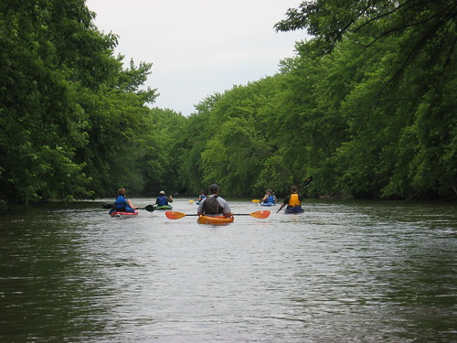
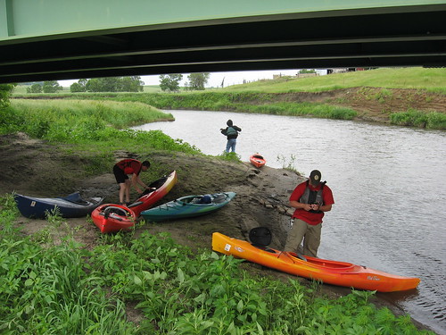
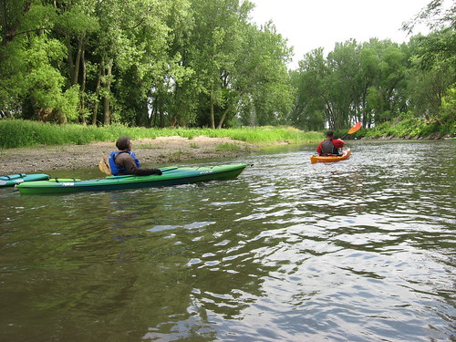
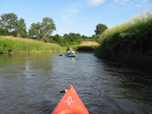
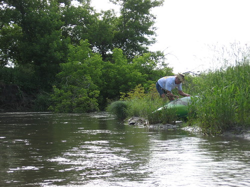
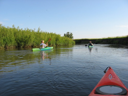
It was about 5:30 p.m. on a sunny afternoon with little wind and a temperature of 78 degrees as we arrived at the spot Craig chose for the put-in, a bridge a couple of miles southwest of Adrian. We shuttled vehicles between the put-in and a take-out site located two bridges downstream. Getting down from the road to the creek required hauling our three kayaks down a steep bank and tall grass to a muddy bank and a fast current. We quickly launched ourselves out into the fast current and a creek depth of about four feet.
IMG_6388.JPG
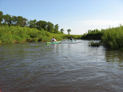
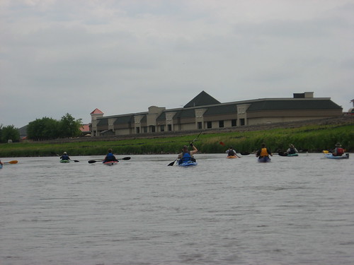
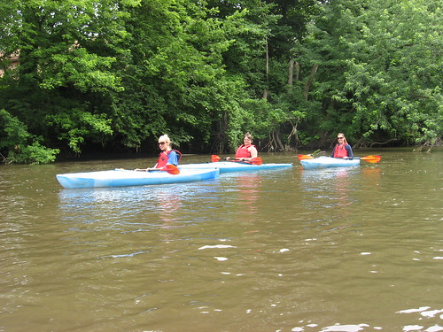
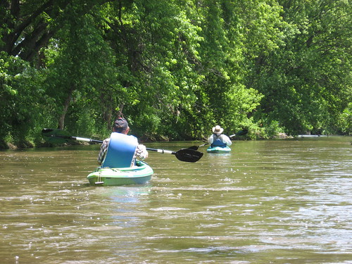
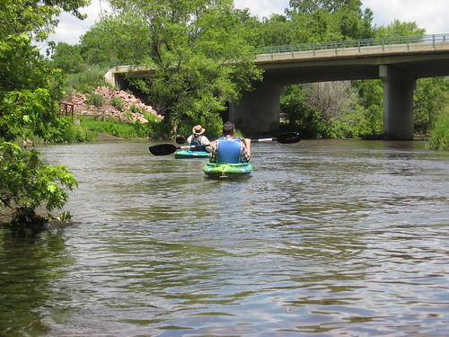
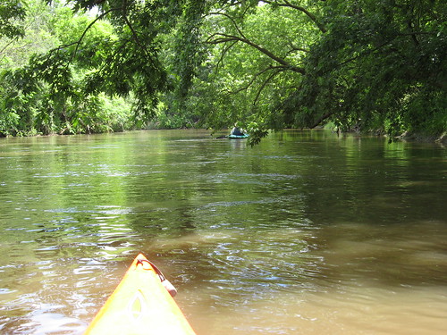
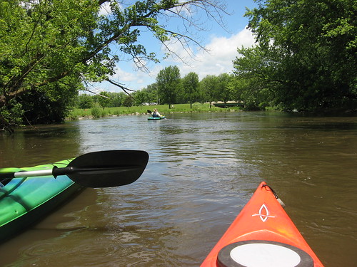
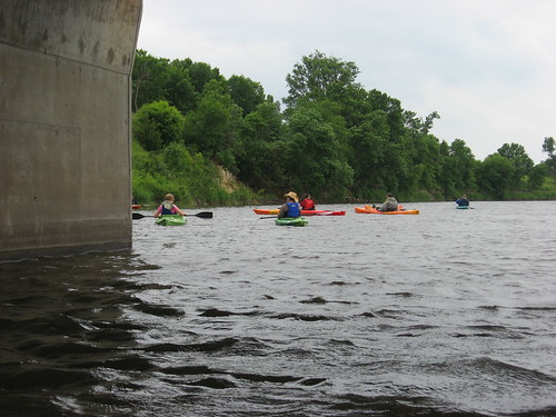
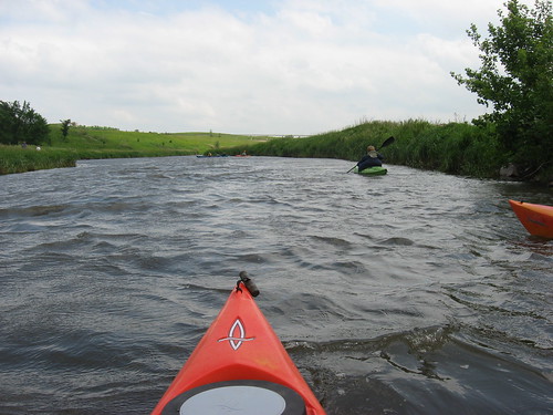
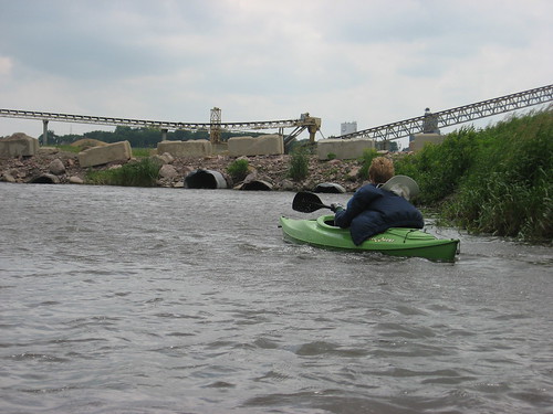
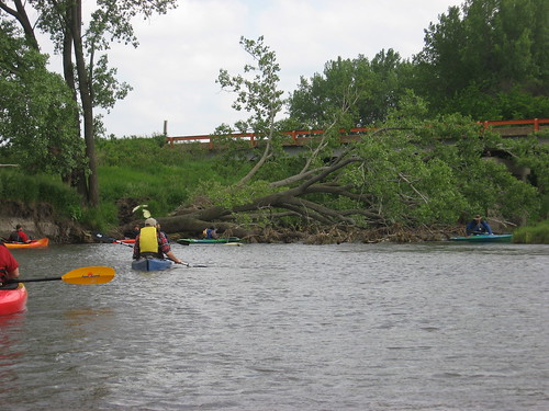
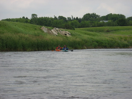
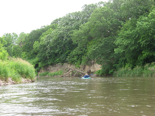
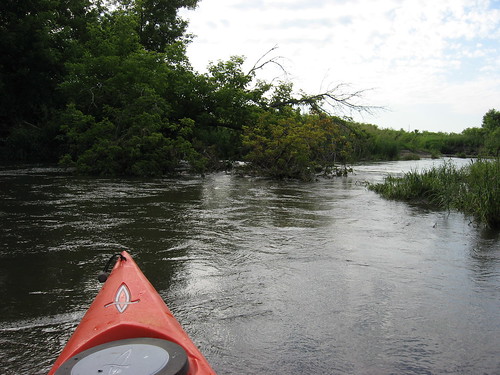
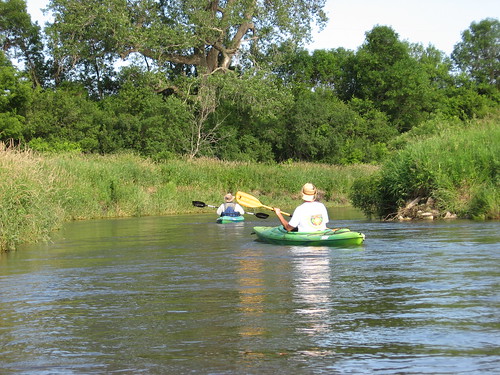
Our cruise yesterday was about six miles and passed through a varied landscape of occasional high cut-banks, steep grassy banks along both sides, a width that seemed to vary from 20 to 40 feet, a fast current, and a depth that ranged from a couple of feet to four or five feet in the channel. Sometimes the creek passed through wooded areas and sometimes through what seemed like pasture land. Occasionally the creek would split around islands in the stream. The creek course was serpentine with many bends and a resulting limited sight line for landscape features ahead.
IMG_6395.JPG
IMG_6396.JPG
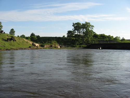
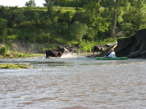
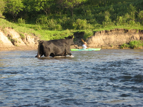
We saw three deer along the way; one was high above on a cut-bank, another was loping along through the grass on the bank, and then there was one leaping through the water just ahead of us. We also came across a herd of cattle that was crossing from one side of the creek to the other and seemed unfazed by kayaks coming down on them. We were nearly on top of some of the cattle as they stopped midstream to check out the intruders in their domain.
IMG_6398.JPG
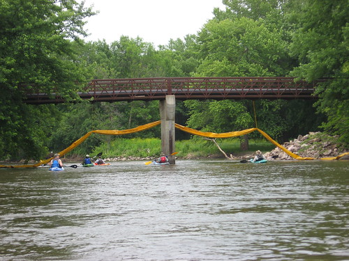
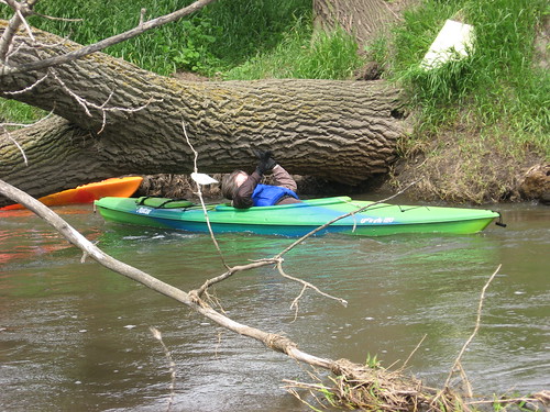
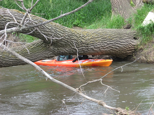
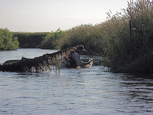
Navigational hazards are magnified on small streams, especially when a swift current is flowing. Trees can be eroded along the bank and fall across the entire stream, creating a strainer that is difficult to either anticipate or avoid. With limited sight lines ahead, a narrow stream, and a fast current, decision time is limited; a wrong decision or hesitation can quickly send a paddler into harm’s way. In addition, paddlers tend to stick close together on narrow and curving streams; otherwise, the boats become separated and it is difficult to pass the word about approaching hazards back and forth.
IMG_6383.JPG
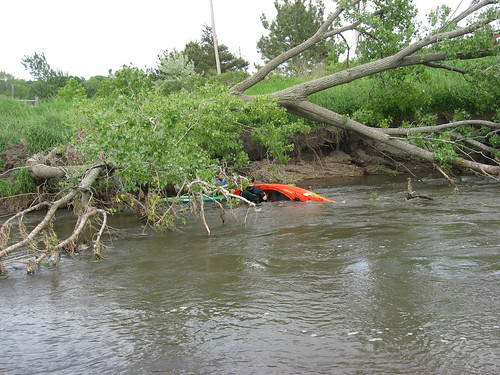
We approached such a strainer about halfway through our passage yesterday. The strainer was not visible until we were almost on it, and Dave was able to shoot through a narrow passage on the left side. The flow of the water in these circumstances tends to increase as the flow is funneled into a limited space. But, Dave made it and suddenly I was upon it. As I approached the slot, the pressure drove my kayak into the strainer and I got stuck in the branches on the edge of the passage. Water began pouring into my kayak, and I knew that I was in a tight spot. Craig was behind me, and the current inhibited his ability to avoid my kayak. He tried to stop and exit the kayak but capsized behind me. Standing in the flow, he gave my kayak a shove to free me, but some of the branches had wrapped around my body. Slipping them off with some difficulty, I was able to move downstream.
IMG_6382.JPG
We stopped so that Craig could empty his kayak. Since my pump was in the rear hatch and inaccessible to me, I used a sponge to get the several gallons of water out of my kayak. It was only because Craig gave me a push that I was able to escape capsizing my kayak.
IMG_6377.JPG
There were sets of riffles to be negotiated every few hundred yards, but these were manageable and we just shot through them. We passed under one electric fence that did not pose any problem.
IMG_6399.JPG
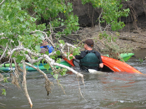
The next fence across the river was a different story. Sweeping around a bend, suddenly we saw a sagging electric fence line. The center part of the line was in the water, and there was a gap on the right side that we thought that we could get through. Again, on a narrow fast flowing stream, decisions have to be quickly made; there is limited opportunity for discussion or consideration of alternatives. Dave made the first run into the slot on the right side, leaned the wrong way to avoid the fence and capsized. I was right behind him; he was in the water, and I was sweeping toward him. My kayak slipped sideways, and suddenly the water poured into the hull. The kayak filled up with water, but it did not capsize. I was just sitting there in a kayak full of water wondering how I could get out of it without rolling. Craig saw what was happening ahead and decided to head over the sagging center of the line and made it through without incident.
IMG_6401.JPG
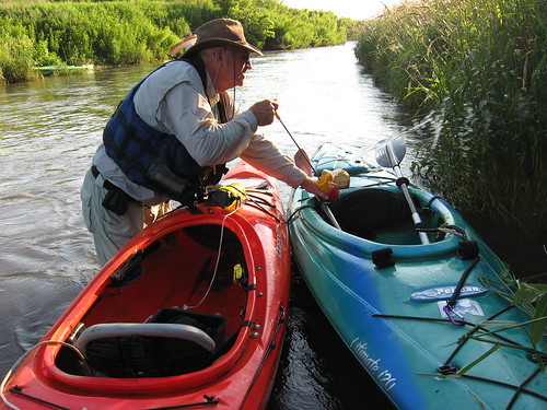
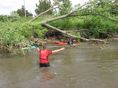
The water at this point was only about knee deep, but the current was especially fast through the gaps in the semi-submerged fence line and the debris that had caught on it. The banks were too deep to land the kayaks. We got my pump out of the rear hatch and drained both our kayaks and then floated them down and over to the other side where we had a better chance of reentering and continuing the trip.
IMG_6387.JPG
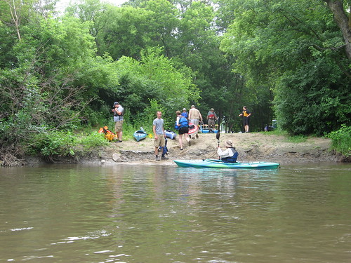
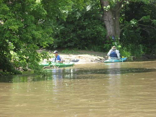
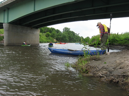
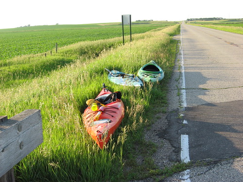
From that point on to the take-out at the second bridge, we had reconciled ourselves to being wet and experiencing mishaps. There were, however, no more incidents, and we arrived at the take-out below the bridge. We exited the kayaks without mishap and dragged our kayaks through the tall grass again and up a very steep embankment to the road.
IMG_6403.JPG
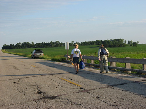
I stood by the kayaks as Dave and Craig left to pick up Dave’s van and the trailer. Our six-mile cruise took us about two hours.
IMG_6404.JPG
These narrow and twisting creeks that are full and flowing fast offer an interesting ride. Since mistakes are highlighted on such waterways, paddlers are able to hone their skills and ability to keep sharp in reading the river and dealing with unexpected circumstances. At the same time, such experience highlights the need to always be alert, wear a life jacket, and not to paddle alone on moving water. I believe that it is essential that a paddler always anticipate an unplanned incident and be prepared with a water pump, a sponge, and an extra paddle. A person should always wear some type of footwear that can be used to walk on river bottom, along rocky shores, and through brush along the shore.

Sunday, June 26, 2011

From Legacy Park along Skunk Creek to E. 26th on the Big Sioux River

IMG_6336.JPG
In a repeat of a trip organized last weekend with a fleet of 17 kayaks that made the cruise down Skunk Creek from Legacy Park on West 12th Street to the Big Sioux River and on to the East 26th Street take-out, Dave and Mary Finck led a cruise down the same route today, Sunday, June 26.
IMG_6339.JPG
Nine kayakers gathered this afternoon at Legacy Park to haul our boats a hundred yards or so to the put-in. We shuttled our cars to the take-out on East 26th Street and rode in Dave’s van back to Legacy Park where we set off about 2:15 p.m. The skies were overcast, the temperature about 78 degrees, and there was no noticeable wind.
IMG_6346.JPG
Both Skunk Creek and the Big Sioux River were full, deep, and running fast. Skunk Creek was generally about 50 to 60 feet wide, and the rapids along the way were largely submerged. We passed through riffles, but nothing that could cause any anxiety among the paddlers. The Big Sioux River was wider, and the rapids just upstream of the bicycle trail bridge were submerged, as they were last week when I passed through them.
IMG_6347.JPG
Along Skunk Creek, the banks are high, and the shoreline on the upstream potion is heavily wooded with tall cottonwood trees. Passing along that stretch of the creek, it is easy to forget the urban surroundings. There is little sign of the city.
IMG_6357.JPG
IMG_6359.JPG
The confluence of Skunk Creek and the Big Sioux River is just behind Louise Avenue, and the paddler can gaze up at the buildings close to the river. For a mile or so, the river flows through this urban landscape before moving back into the depths of the wooded shoreline further downstream.
IMG_6363.JPG
We passed two groups of paddlers in kayaks from Zach’s Kayak Rental on the stretch from 57th Street heading downstream. These five kayaks all looked the same and had red paddle blades. Then, we passed a guy heading upstream from 26th Street passing Camp Leif Erickson, the YMCA camp along the river. Finally, as we were loading up our kayaks at the take-out, a couple of vehicles pulled up with kayaks. I have never seen such kayak traffic on the river, and it must be another example of how popular kayaks have become over the past few years.
IMG_6369.JPG
We moved at a leisurely pace down the streams and did not stop along the way. Actually, there was no apparent spot for us to stop for a stretch: the water was just too high and fast. The distance from Legacy Park to the East 26th Street take-out is 9.3 miles, and we made the trip today in two hours and nine minutes. For a leisurely cruise, this was pretty fast. Those making the trip just last weekend took over three hours for the same distance, so I guess that the recent rains must have speeded up the flow.
IMG_6370.JPG
IMG_6373.JPG
Today was a wonderful day for a cruise. On trips like this, the chief attraction is paddling along in casual conversation with fellow paddlers. Cruising on moving water should be done in the company of others; there are too many opportunities for mishap to occur when traveling alone. It is also a great time to laugh it up with others who share an interest in paddling. A major benefit to membership in the SDCKA is to participate in this sort of cruise.
IMG_6360.JPG

Thursday, June 23, 2011

The Big Sioux River in Sioux Falls: 57th to 26th St.

IMG_6306.JPG
This noon as I was just fixing my lunch of cold cereal, Dave Finck called and invited me along on a Big Sioux River cruise with his old pal Ken, one of the group on a Boundary Waters Canoe Area trip last summer. My immediate response to an unexpected invitation is normally to decline; I guess that I am not the most spontaneous person around. There are too many other things that I have in my mind set for the day: reading my novel, watching cable news on TV, taking a nap. But, when I can get out of my rocking chair and do take advantage of a spontaneous invitation, I am nearly always so thankful that I could shake myself out of a sense of inevitable routine and do something.
IMG_6308.JPG
So, after reflecting for a few minutes and reminding myself of earlier resolve to take advantage of unanticipated opportunities, I called him back and agreed to meet at 1:15 p.m. at the 57th Street put-in. Dave and Ken had already left a car at the 26th Street take-out, so in short order we were underway and out into the stream.
IMG_6311.JPG
The 57th Street access point is an easy put-in, even with the high water and fast flow. After pushing off and entering the main current, we were off on a fast ride downstream. The distance between put-in and take-out is about 4.5 miles, and we made the trip in one hour and fifteen minutes.
IMG_6317.JPG
The river was very high; I could barely touch bottom with my double paddle when I checked the depth along the way. I would say that the most common depth was between five and six feet.
IMG_6322.JPG
The growth along the river is at its seasonal height now, and moving downstream was like being in a green tunnel with tall trees fully leafed out and tall grasses along the banks. The river is perhaps 100 feet or so in width along the way; there were no sweepers that impeded our progress, and no gravel bars or shallow areas.
IMG_6331.JPG
The rapids just downstream of Cliff Avenue that begin under the bike trail bridge are a special challenge on most trips down the river. I normally begin to tense up a bit as they approach. Today though, the river was so high that the rapids were nearly unnoticed. We took the right side of the stream and just cruised through.
IMG_6326.JPG
Moving fast downstream, we saw little in the way of wildlife. I saw a couple of turtles, including a big one; but, the current was so fast that we just flashed by.
IMG_6335.JPG
The take-out at 26th Street is used by the YMCA staff at Camp Leif Erickson, so it is filled with cars. The exit from the river was pretty easy, and suddenly the cruise was over. It was a great interlude in the day and another reminder to take advantage of unexpected opportunities.
IMG_6318.JPG

Sunday, June 12, 2011

Split Rock Creek - Corson to McHardy Park

IMG_6266.JPG
David and Mary Finck and Larry Braaten led a cruise this afternoon on Split Rock Creek, beginning about a mile and a-half northwest of Corson and ending at McHardy Park on the west end of Brandon. The put-in was off of 259th Street, and the road distance to the take-out was four miles. By creek travel, the distance clocked on one of the party’s gps was just over 6.5 miles.
IMG_6269.JPG
It was a partly sunny day today with a stiff wind and a temperature in the high 60s. Eight paddlers gathered at McHardy Park and used a vehicle shuttle to move the kayaks to the put-in spot, under a bridge across Split Rock Creek and accessible through a path within high grass. We then drove the cars back to McHardy Park and returned in Dave’s van.
IMG_6280.JPG
We shoved off into the creek about 2:10 p.m. to make our way downstream, moving into a relatively fast current and in water that was generally four to five feet deep. The waterway was usually about 50 feet wide. There were several riffles along the way, just fast enough to focus attention on the passage.
IMG_6270.JPG
The shoreline along the creek is elevated and wooded; therefore, the wind was diminished, although it always seemed as though we were going into a head wind regardless of the curves along the route.
IMG_6283.JPG
A couple of miles along the way, we came to a dam across the creek topped by a road at a large concrete or gravel plant. Several culverts extend under the road, and all the flow from the creek is forced through these four or five culverts. We had to portage over the road, and this served as a rest stop for us.
IMG_6287.JPG
Continuing downstream, the creek was unchanged: fifty or more feet wide, plenty of depth, wooded shoreline, and a fairly fast flow of the current.
IMG_6294.JPG
Everything was fine, and we were cruising along until we came upon a large tree across the entire width of the creek – a strainer! We were spread across the width of the creek as we came upon the strainer, and those on the left side found themselves unable to escape the flow: they were swept into the tree, the trunk of which was about three feet off the surface of the water. The tree had recently fallen, there were leaves still on the branches.
IMG_6296.JPG
Three of the kayaks found themselves in this situation. I was toward the rear of the grouping and found myself also in the grip of a steadily increasing current flowing toward and under the tree. Fortunately for me, I heard the warning of people ahead of me and began back-paddling as hard as I could and was able to make it to the right side of the creek and stop myself along the bank. Except for those three kayaks caught in the strainer, the others made it to the right bank as well.
IMG_6297.JPG
One of the paddlers was able to free herself and move on somehow and escape the trap. Two others, however were caught up at the trunk of the downed tree, facing downstream but unable to get under the tree. Of course, it was impossible to back up, and the cut-bank on the left made it impossible to get out of the kayaks.
IMG_6298.JPG
IMG_6299.JPG
So, there we were: Mary in one kayak with the bow under the trunk, and Rick in another similarly caught in the high velocity flow alongside. With some coaching from the shoreline and Robin, the man of the hour, wading out into the waist-deep water to lend a hand, Mary was able to lean backwards in the kayak so that she could move under the tree trunk and out from the strainer. Unfortunately, though, as she was holding on and trying to avoid a capsize, her paddle got away from her and was lost downstream.
IMG_6300.JPG
Rick tried the same approach, but as he leaned back to fit under the tree trunk, the kayak capsized and he found himself in the water. With the help of Robin, he was able to move the kayak away from the tree so that it could be emptied of water. Even as he went over and had to make a “wet exit,” he managed to hold on to his paddle.
IMG_6301.JPG
After the two paddlers were out of danger, the remaining problem was finding propulsion for Mary’s kayak. No one had an extra paddle, so the choices were to take apart one of the other kayak paddles and have two people share the two parts or to tow Mary the remaining couple of miles to McHardy Park. I had a rope with me, and Roger, a powerful paddler in great shape, volunteered to tow Mary to the take-out.
IMG_6289.JPG
At the downstream end of McHardy Park, there is a set of rapids, a pretty big set of steep rapids. This was the end of the cruise, and the choices were to get out above the rapids or to continue through and get out just below them. There was no real advantage in concluding the trip by going through the rapids, and I had decided not to do that. But, the majority of our party wanted to shoot through these rapids, and I did not want to be thought of as a lesser paddler, so I went along too. I was the last to approach the rapids, and people were shouting to me to go over at the center. Earlier, I was informed that the left side was the best route. So, I was conflicted as I approached the rapids. When I heard the shouting, it was too late, and I went over at the worst point. My kayak got hung up momentarily on a big rock with water pounding all around me. I felt sure that I was about to be flung into the raging water. Somehow, though, my kayak slid off and I was suddenly through the slot. Those standing on the banks thought I was about to go over as well and only wished for a camera to record my last moments.
IMG_6303.JPG
This was a new stretch of Split Rock Creek for me, and it adds to trips that I have taken downstream from McHardy Park to the confluence with the Big Sioux River, and on to the Highway 42 bridge at the newly developing arboretum. I like these waterways, set down below elevated banks and relatively obscure. The lessons of today will stay with me: (1) Travel with others on moving water; (2) Consider taking a spare paddle in the event of a wet exit and the disappearance of your paddle; (3) Never relax your vigil on moving water, a strainer or set of unpleasant rapids can come upon you without much warning.
IMG_6267.JPG