This blog is designed to highlight the paddling opportunities within South Dakota, mainly within a 50-mile radius of Sioux Falls. While Sioux Falls is far from the adventure of coastal regions, there is a certain satisfaction in utilizing the available waterways to observe weather, water conditions, and the landscape along the shoreline. In addition, there is a wealth of animal life on the waters of small South Dakota lakes, rivers, and creeks, including geese, ducks, pelicans, great blue heron, egrets, hawks, owls, perching birds, deer, raccoons, and beaver. Eagles, fox, and coyote are also sometimes spotted.

The sites described are places where I have kayaked over the past few years, mostly in South Dakota but sometimes including locations in Iowa and Minnesota. One of the best sources of information on the accessibility of small lakes is the South Dakota Atlas and Gazetteer, the large map book of South Dakota. Lakes with a public access are generally identified by a boat symbol marking the location of a launching site on public land.

You will notice the menu of paddling locations on the right side of the blog. Each of the postings is linked to one of the areas, and my intention is to provide a continuing review of the places where I paddle. Perhaps these narratives will help readers select waterways of interest to them. Please feel free to offer a comment regarding any of my postings; I would welcome the dialog.

I also maintain a companion blog that describes hiking opportunities within the Sioux Falls area. You can access that blog at: http://hikingsiouxfalls.blogspot.com

Sunday, July 25, 2010

Split Rock Creek – Molly’s First Cruise

IMG_5244.JPG
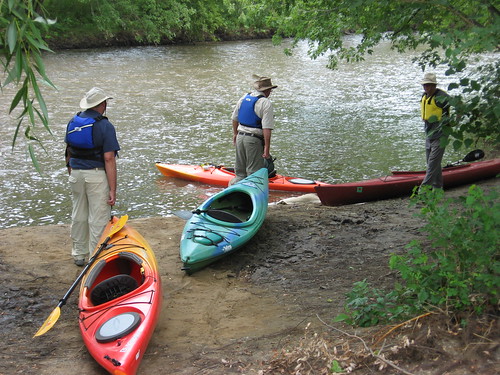
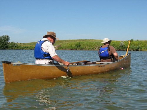
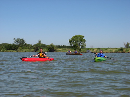
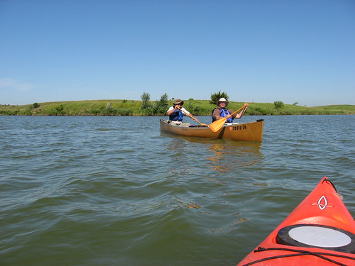
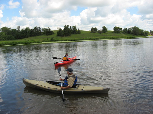
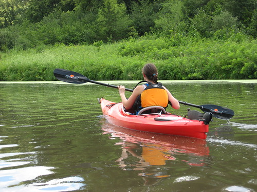
Molly, the girlfriend of our son Derek, expressed an interest in kayaking, and this morning (Sunday) she joined my wife, Finnegan the family dog, and me for an introductory cruise on Split Rock Creek from the Garretson city park upstream to the set of rapids that defines the normal end of upstream navigation. While Finnegan and my wife, Marsha, took a stroll around the park, Molly and I set out on the cruise.
IMG_5245.JPG
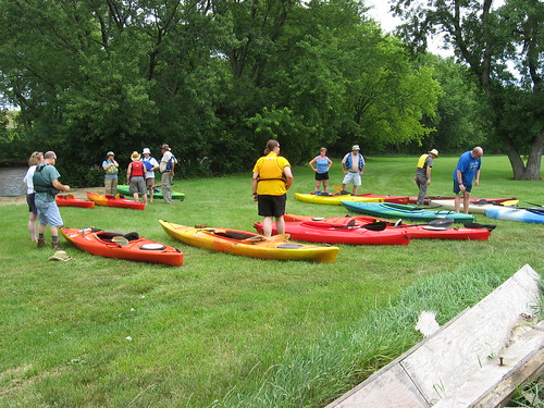
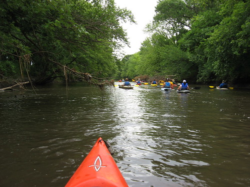
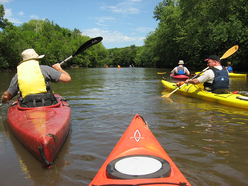
It was a glorious day with little wind, sunny skies, and a temperature in the low 80s. Since this was a weekend, there were a number of people in the park: campers, a couple of people out in a rubber raft, and people passing, including some on motorcycles. After meeting the rubber raft, though, we did not come across anyone else on the water until our return. Just as we were getting off the water, a couple with their kayaks and a swimming dog appeared.
IMG_5247.JPG
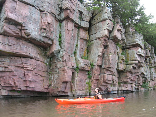
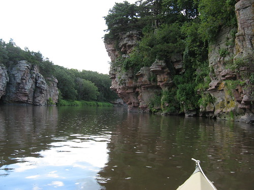
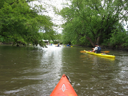
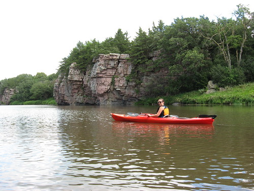
The water is high on Split Rock Creek, but that only means satisfactory depth on the cruise upstream with little danger of running aground. I had not been on this stream since spring, a time when only the evergreen trees offered any hint of color. Now, the banks and cliffs are covered in green; the landscape is now in the full glory of summer in South Dakota.
IMG_5252.JPG
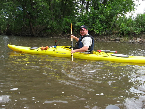
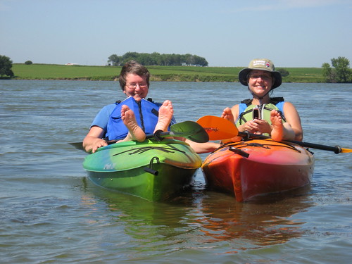
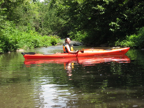
Molly was tentative in her early minutes, paddling in my Dagger 13 foot kayak. I coached her from my Folbot, and we slowly cruised upstream. She quickly got the “knack” of paddling, keeping a straight course, and negotiating turns. On the ride back downstream, I showed her how to engage the rudder, and that provided another experience. She said, however, that she liked padding without the rudder: she liked the sensation of using a set of different paddle strokes to keep moving in the desired direction. With the rudder, she said that she felt that she was “cheating.” I, on the other hand, nearly always use the rudder and enjoy the ability to easily move along a desired course, especially to sneak up on “critters” or to watch the changing landscape without concern about “corrective strokes.”
IMG_5254.JPG
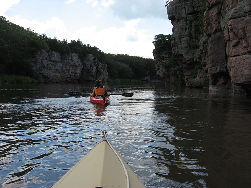
We continued upstream for about 30 minutes to the rapids at the end of this section of the waterway, a spot where a couple of homes built along the creek are visible. We turned back at that point and returned to the arched bridge located adjacent to the launching point, the “put-in.”
IMG_5261.JPG
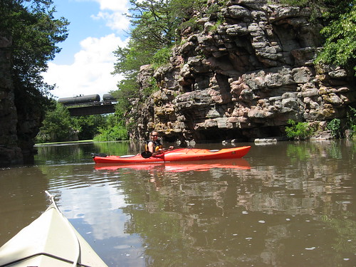
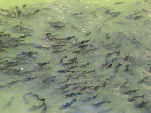
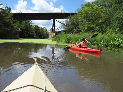
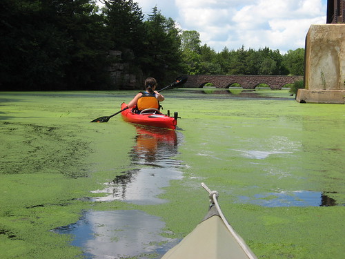
As we went through the arched bridge and under the railroad bridge, we encountered nearly continuous algae cover on the water. Still, Devil’s Gulch, is one of my favorite spots along this waterway. It is a secret and secluded area with great rock formations and vegetation that I find fascinating.
IMG_5264.JPG
Molly liked her initial cruise in a kayak, and I think that Split Rock Creek from the Garretson City Park upstream through the palisades is a wonderful first trip. We spent about an hour and 45 minutes on the cruise and have already made arrangements to go again tomorrow to Lake Vermillion.
IMG_5266.JPG
IMG_5268.JPG
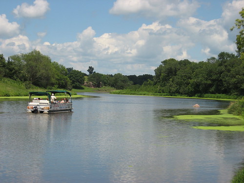
As we departed the park, the pontoon boat “Jesse James” was just leaving on its daily tourist cruise along the same route we took. My wife is eager to go for this narrated cruise on the pontoon boat, and I'm sure that we do so later this summer.
IMG_5270.JPG
For those interested in past narratives and photos of this waterway, check out "Split Rock Creek" from the menu along the right side of the blog.
IMG_5256.JPG

Sunday, July 18, 2010

The Big Sioux - Sioux Falls, 57th and Western to Cliff and 14th St.

IMG_5220.JPG
David and Mary Finck, along with Larry Braaten, alerted SDCKA members that they would be cruising on the Big Sioux River through Sioux Falls this Sunday afternoon, and joining them seemed to me like a good thing to do on a Sunday afternoon. About 1:00 p.m., a group of 18 paddlers assembled with their kayaks at Yankton Trails Park, downstream of the old bridge and just upstream of Western and 57th Street.
IMG_5226.JPG
A shuttle was arranged to transport cars to the “take-out” at a park along the Sioux River at the intersection of Cliff Avenue and 14th Street. By 1:45 p.m., all the paddlers were in place and ready to shove off into the river. The flotilla of kayaks set out and pretty much stayed together for the two hour cruise.
IMG_5232.JPG
I found myself paddling along at the tail end of the group and engaged in a number of conversations. This sort of cruise does not lend itself to contemplation and a search for wildlife. Instead, it tends to be more a social event on the water – a shared cruise down the river.
IMG_5234.JPG
There were people along the bank at various spots, people who stood there while the fleet passed in review.
IMG_5235.JPG
The river was high and fast, but it had dropped some in depth and the current was not racing as it had been in recent weeks. Conditions could really not have been better for a cruise. The paddlers ranged in experience and skill from grizzled veterans to relative novices. No one had any trouble either keeping up or negotiating the two sets of rapids between the put-in and the take-out: rapids under the bicycle trail bridge and then another set about a mile downstream at 26th Street. We all just shot through these rapids with no difficulty – paddles raised in triumph.
IMG_5233.JPG
The skies were sunny, the temperature in the 80s, there was no noticeable wind, and the water was high enough to ensure passage without going aground. The water was four or five feet deep in most of the channel, at least where I checked the depth with my paddle. The “sweepers,” or downed trees extending out from the bank were easily avoidable today. This trip took us about two hours of very easy cruising.
IMG_5238.JPG
A new “take-out” has been developed just off a parking lot on the south side of the river before the bridge at the intersection of Cliff Avenue and 14th Street. I understand that the Sierra Club had some influence in establishing this take-out. It is really a fine addition to the kayak/canoe trail through the city. A two-hour cruise is just right for most of casual paddlers, and I had a great time today.
IMG_5240.JPG
I was reminded again about what a treasure the city has in the Sioux River Greenway. As we know from recent news accounts, there is some risk associated with travel on the river. With care, however, and when the conditions are good, this is a wonderful cruise through the Greenway of Sioux Falls.
IMG_5231.JPG

Saturday, July 17, 2010

Water Sampling at Grass Lake 2010

IMG_5183.JPG
Each year the South Dakota Canoe/Kayak Association performs a number of public service activities. For the last three years, taking water samples from area waterways has been one of those activities. Dakota Water Watch is the agency coordinating the water sampling for our area, and this morning representatives of that organization provided refresher training for SDCKA members as they set out to collect samples at Grass Lake, about 20 miles west of Sioux Falls.
IMG_5194.JPG
The volunteers worked in pairs, two teams in kayaks and one in a canoe. Each team was given an overview of their assignment and provided the paperwork and equipment needed to sample conditions at three specific locations on the lake.
IMG_5184.JPG
The teams were asked to assess the environmental conditions of the lake, the shore and the sky. Their assignments included temperature of the lake, depth and clarity of the water, and taking a water sample for later analysis.
IMG_5199.JPG
IMG_5192.JPG
We all proceeded to accomplish our assigned responsibility and then lingered a bit on our way back to the staging area. From departure until returning with the data and samples, we were out for perhaps an hour and a half.
IMG_5191.JPG
It was a beautiful day on Grass Lake. We gathered at 9:00 a.m., and the temperature was about 85 degrees with moderate wind and sunny skies. The lake was perhaps two feet higher than normal at this time of year.
IMG_5208.JPG
I did not see any waterfowl or other “critters” on this cruise, although our trip was more purposeful than my typical cruise on Grass Lake. I did come across a school of little black fish that reminded me of Black Mollies that I have had in my home aquarium at times.
IMG_5204.JPG
A cruise of this sort offers an opportunity to be involved in a scientific investigation of sorts. We were working with specific protocols and gathering data to determine the condition of area lakes. This was the second sampling operation for the SDCKA on Grass Lake. The first one provided a baseline for evaluating changes over time, and this operation today provided interval data to compare conditions.
IMG_5200.JPG
As we finished our assignments, we cruised back to the “put-in” and had a few laughs along the way. Readers interested in the water sampling activity can review earlier narratives posted under Grass Lake and Diamond Lake
IMG_5215.JPG