This blog is designed to highlight the paddling opportunities within South Dakota, mainly within a 50-mile radius of Sioux Falls. While Sioux Falls is far from the adventure of coastal regions, there is a certain satisfaction in utilizing the available waterways to observe weather, water conditions, and the landscape along the shoreline. In addition, there is a wealth of animal life on the waters of small South Dakota lakes, rivers, and creeks, including geese, ducks, pelicans, great blue heron, egrets, hawks, owls, perching birds, deer, raccoons, and beaver. Eagles, fox, and coyote are also sometimes spotted.

The sites described are places where I have kayaked over the past few years, mostly in South Dakota but sometimes including locations in Iowa and Minnesota. One of the best sources of information on the accessibility of small lakes is the South Dakota Atlas and Gazetteer, the large map book of South Dakota. Lakes with a public access are generally identified by a boat symbol marking the location of a launching site on public land.

You will notice the menu of paddling locations on the right side of the blog. Each of the postings is linked to one of the areas, and my intention is to provide a continuing review of the places where I paddle. Perhaps these narratives will help readers select waterways of interest to them. Please feel free to offer a comment regarding any of my postings; I would welcome the dialog.

I also maintain a companion blog that describes hiking opportunities within the Sioux Falls area. You can access that blog at: http://hikingsiouxfalls.blogspot.com

Thursday, August 30, 2007

Oakwood Lakes

Oakwood Lakes: West Oakwood

IMG_1577

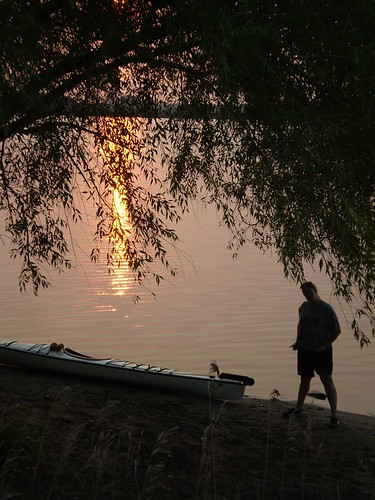
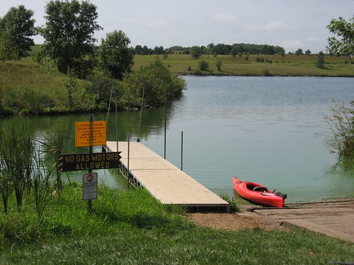
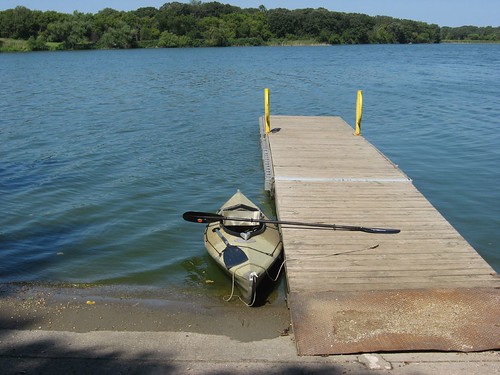
Oakwood Lakes has a well deserved reputation as a wonderful place to canoe or kayak in eastern South Dakota. This chain of eight connecting glacial lakes is broadly divided into East Oakwood and West Oakwood Lakes. East Oakwood has a public access area and is a broader single body of water. West Oakwood is the site of Oakwood Lakes State Park and offers the amenities that such a status provides. Today, I visited West Oakwood and set off from the boat ramp within the park. Oakwood Lakes State Park is 83 miles north and west of my eastside Sioux Falls home. The easiest way to get there is to go north on Interstate 29, past Brookings, to the Bruce exit. From there, you can continue on for a few miles and follow the signs to the park. Finding the park is easy; returning is another matter. Like so much of South Dakota, there are few landmarks and no signs that direct you back to the Interstate. In a fog, I guess, I drove back the wrong way and wound up in Estelline, about ten miles north. This is nothing unusual for me, I’m sorry to say. I really should have a compass in the car.

IMG_1559

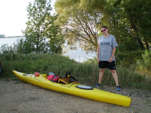
One of the towers of my Yakama kayak rack has become bent and requires replacement; the part had to be ordered. My boat on this trip was the trusty Folbot, a fabric covered collapsible 12 foot kayak. Instead of securing it to a roof rack, I just tossed the two bags in which the hull and framework are stored into the back seat of my Honda Civic. This is the first time I have used the Folbot this season. I am happy to say that the boat went together in about 15 minutes and worked quite well. The Honda Civic Hybrid, without the kayak on the roof, went back to its nearly 50 mpg rather than the 35 mpg that I tend to get otherwise.

IMG_1548

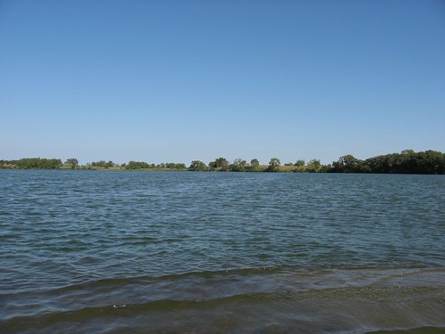
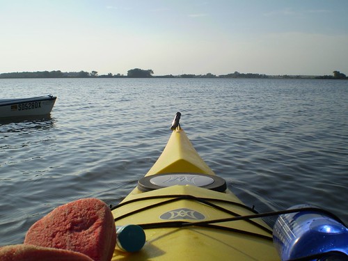
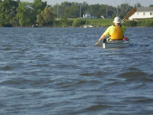
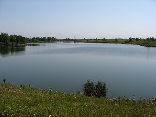
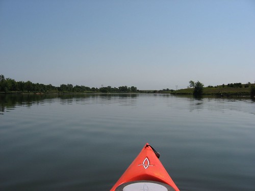
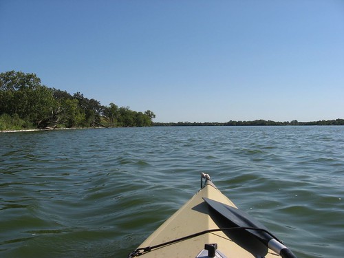
West Oakwoods Lake has a surface area of about 1,200 acres, and the name is derived from the numerous oak trees within the area. In years past, this lake was called Lake Tetonkaha. The set of lakes that makes up West Oakwood is surrounded by significant tree growth. The main body of water is pretty long and wide, and today, even with a moderate south wind, the wave action was just short of whitecap conditions. Cruising south from the dock within the main part of the park, I was experiencing head winds and waves, especially in the crossing from the east to the west side. The weather was marvelous: moderate wind, cloudless skies, and a morning temperature of around 70 degrees. This was a Thursday, so I virtually had the lake to myself. I was out for about two hours and saw only one boat, and that was during the final few minutes.

IMG_1544

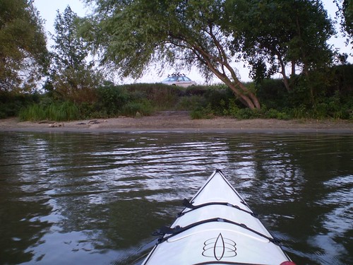
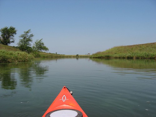
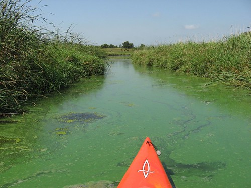
I set out from the park and headed west across the main body toward Scout Island and then continued around a point of land with an extensive sand bar out into the lake. Continuing south along the western shore, I moved through a narrow slot into Turtle Lake. There is a sand bar that extends from both ends of the slot into this lake with very shallow water. Even with my kayak, I went aground a couple of times until I got into the narrow passageway through. I doubt that a motor boat could get into Turtle Lake now.

IMG_1542

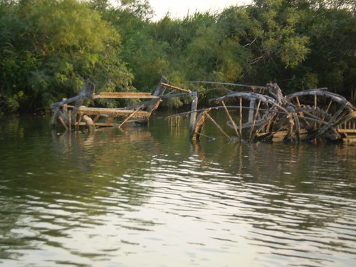
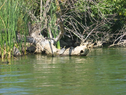
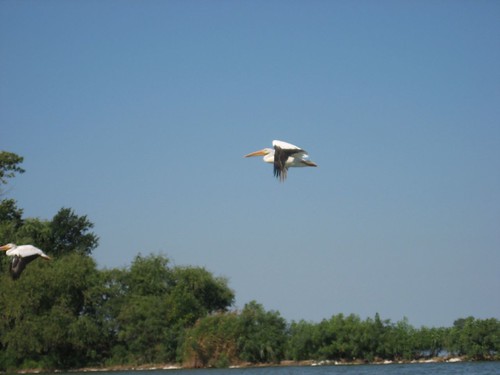
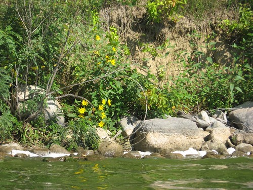
Turtle Lake was sheltered from the wind, with nearly calm conditions. The shoreline is heavily wooded, and I saw lots of waterfowl. I kept trying to get a photo of one of the several great blue herons that I saw, but these wily birds will suddenly leap out of a tall tree and fly off faster than I can get the camera out. The trees and other vegetation along the shoreline are interesting. A slow paddle around the circumference of the lake is a great time for observation and reflection. True to the name of this body, there are lots of turtles to be seen sitting on downed trees along the shoreline.

IMG_1556

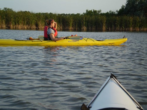
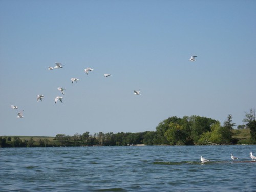
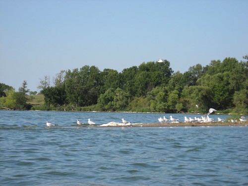
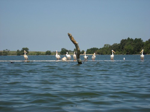
As I moved out of Turtle Lake and back into the main body of West Oakwood Lake, I was traveling with the wind through a following sea. I headed back north and into Johnson Lake, off to the west of the boat ramp and around the point of Scout Island. In the distance, I saw a big flock of pelicans; I like coming slowly up on a big flock of waterfowl to see how close I can get before they fly off. I had my camera ready to capture the closest photo that I could get. After securing my photos at the western end of Johnson Lake, I turned back for the dock and made the crossing of West Oakwood again to the dock.

IMG_1571

IMG_1574

I was out on the water for about two hours – generally my limit in a kayak without getting out for a stretch. There were, however, several spots along the shoreline where a boat could be landed, even my Folbot.

IMG_1545

Oakwood Lakes is really a wonderful place to paddle. It is good to be back in a natural lake, one with good shoreline growth, little development, and big enough to provide a variety of paddling conditions. Over 80 miles, though, is approaching the outer ring of my day paddles. I was on the road about 8:00 a.m. and didn’t get home until 3:00 p.m. Some of that time was me driving off in the wrong direction from the state park, and some was time that I spent taking a nap at the rest stop south of Brookings. Also, I should have packed a lunch for this trip. Of course, Oakwood Lakes is one of the premier paddling opportunities in this part of South Dakota, and I highly recommend it. I will return there at least once a year. I would also like to try East Oakwood Lake on a future trip.

Friday, August 17, 2007

Lake Goldsmith

Lake Goldsmith - (West of Brookings)
On the edge of one hour …


A South Dakota Kayaking Blog guest entry
By Jarett C. Bies


Lake Goldsmith is a sweet destination and yes, it does fit into the one hour from Sioux Falls parameters of this blog. It’s just north of Volga and Sioux Falls paddlers can have an entire nice-sized lake to themselves with great scenery, history and bird life, and only drive gravel for about a mile.

P8130354

My wife and co-paddler Laura Bies and I recently started working in Brookings County, and with our boats on our Taurus, we decided Monday, Aug. 13 to find water right after work. We headed west from Brookings on Highway 14, and the total time between Brookings and Volga is literally 5 minutes, so we were on the water’s edge in less than 10 minutes after leaving SDSU.

P8130353

To reach Lake Goldsmith from Sioux Falls, take I-29 all the way north past the first Brookings exit to the Highway 14/Volga bypass. From the exit, turn L (or west) and drive on, it’s literally 7 minutes to Volga from the Interstate.

As you approach the west edge of Volga, you’ll see a sign indicating Oakwood State Park and pointing to the right, turn right (or north) there and go about one mile to 210, then turn left. The road is gravel there, but head west about one mile and you’ll come right up to a sweet, sandy-beach put-in with room for a car off the gravel, across from the cornfield.

P8130357

The lake’s girth surprised us both. We were planning to hit Oakwood State Park and paddle the eastern lake there, about another 15 minutes north of Goldsmith. But we drove down though the high corn just to see if Goldsmith was worth unloading. And here sat a lake that it’d take at least an hour to cross.

As mentioned, the put-in is a long beach with multiple entry points. We hit the water about 6:30 p.m. and a couple on a motorcycle stopped and went for a dip in the shallows to the west of us. We put in with two boats heading along the east shore around the circumference to the north.

P8130395

It was still to start but the wind did pick up to make it more challenging paddle action as we reached the northeast corner. We then headed due west to an open channel in the backside of the lake. There was a tinfoil-in-your-face feeling as we headed into the setting sun at 7-8 p.m. The glare was KICKING on the surface and up into our faces.

The opening to the backwaters of this lake is tiny and to the far north; when we finished and headed back I missed the channel and had to do a bit of poling to get draft water under the boat. But the egrets, heron and pelicans were everywhere and we got quite a feathered show in the reedy back section of Goldsmith.

P8130389

Back there to the west end, tossed off behind a cornfield bordering a marshy part of the lake, sit three or four old horse-drawn combine rigs, rusted and weed-ridden. We couldn’t help but wonder who dumped these antique relics into the skanky water of this lake. My brother-in-law saw the pictures and said they were old combines.

P8130384

We rounded back and enjoyed the fact the main lake was wind-free as we sought the car. We noted a power boat with a tuber at the south end of the lake, near where we put in, but while this lake looks small on the Gazetteer page, we still far away enough to not hear the boat’s motor as we headed toward it. They left before we go to the put-in.

When we did approach the south shore of the lake, three little girls swimming on the rough beach shouted “WE COME IN PEACE!” as we approached. We estimated where they were swimming to be near our car but we were wrong. The Taurus actually was parked about 200 meters south of the peaceful evening swimming trio. When we found it, we had a nice take-out and end to our 2-hour sunset cruise.

The sandy nature of the take-out led us to do the old Superior style “from the water” car load; we exited normally, unpacked all the gear, then waded the boats back into two feet of water, where we sponged ‘em down thoroughly, then walked each right up to the rack to avoid hauling lots of sand home on the roof of the car. We were back in Brookings 10 minutes later.

P8130402

Goldsmith is a full hour’s drive from Sioux Falls, but it’s friendly and unfettered on the northwest end, so I would recommend it for someone looking for a nice place to play around. It’s got plenty of birds, it’s nice and remote, and it’s closer to Sioux Falls than Oakwood. Plus, since it’s not a state park, you can just go get crazy sans day-pass rate or sticker. Of course, one can paddle Oakwood’s eastern lake without paying day-pass rate.

But that’s another story and another lake. Check out Lake Goldsmith for a Midwestern-Farm Country backdrop lake in the middle of nowhere, yet only 10-15 minutes from the Interstate.

Jarett & Laura Bies
Paddled 8/14/2007
Entry dated 8/17/2007

Wednesday, August 15, 2007

Split Rock Cruise - September 29, 2007

SDCA Logo

South Dakota Canoe Association SPLITROCK-BIG SIOUX CANOE CRUISE

Come and join us for a Fall Canoe Cruise from McHardy Park, in Brandon, to the Highway 38/42 bridge at historic East Sioux Falls (The Arboretum) on Saturday, September 29, 2007.

Meet at 1:00 P.M. at McHardy Park in Brandon. This route has short stretches of flat water with gentle class 1 rapids. A pole is useful on Split Rock Creek when the water is low such as last year. Deer, fish, muskrat, ducks, owls and other wildlife may be seen. The cruise takes about 3 to 4 hours depending on the water conditions and the skill and goals of the paddlers. Bring a camera, snacks, and some drinking water and enjoy an afternoon on the water. I always plan an alternate route in case the water on Split Rock Creek is low. The takeout may be altered depending on conditions. It has been real good this spring from Corson south. For more information contact Eugene Preston 605/582-2573.

Eugene Preston, President of the SDCA
-------------------------------------------------------------------------------------

I went on this cruise last year, and it was a great experience for all of us. I described the event on the blog, and you can find my remarks under the Split Rock Creek link – October 14, 2006. Every time I drive to Brandon I look out to the right off Highway 11 and think back to that cruise. It is a little gem of a waterway, and Eugene Preston, the president of the SDCA, does a great job of organizing and leading the event. I intend to be on the cruise again this year.

IMG_0434

The SDCA sponsors several cruises each season, and these are highlighted in the club newsletter. Joining the SDCA is a pretty good way to keep alert to paddling and fellowship activities associated with canoe and kayak activity. The price is right: $10.00 a year for an individual membership. For those who would like to initiate a membership, just send your information (Name, Address, Phone, e-mail, experience, hobbies/interests) and a check to: Director of Membership, SDCA, P.O. Box 90227, Sioux Falls, SD 57109-0227.

Thursday, August 09, 2007

Lake Pahoja - Iowa

Lake Pahoja, Iowa

While attending a concert in McKennan Park this past weekend, I ran into a fellow kayaker who reminded me of paddling opportunities at Lake Pahoja, a small lake located near Larchwood, Iowa. I had visited this lake many years ago, but I did not retain much memory of it. Today, I decided to take my kayak out and revisit the area.

IMG_1259

I knew that Lake Pahoja was four miles south and two miles west of Larchwood. Even without an Iowa map, I figured that I ought to be able to easily locate the lake. Somehow, though, I missed the right roads and found myself driving around on unmarked highways, gradually become disoriented. After stopping a motorist at an unmarked crossroads, I was directed back to Larchwood. A young lady in a convenience store gave me directions: Drive through Larchwood on Highway 9; at the east end of town, turn south on Highway 182 just before 9 turns on toward Inwood. Continue along on 182 for about four miles until you come to the West Lyon School. Just past the school you turn west on A26, and note the sign on the highway for Lake Pahoja. You go two miles past the school on A26 until you come to a sign directing you into the park off the left side of the highway.

IMG_1242

Lake Pahoja is located in Lyon County Park, a very nice camping and recreation area with the lake as the centerpiece. The lake is 71 acres in surface area and has just about two miles of shoreline. The lake is oriented east and west, and the launching area is on the north side; it is a long and narrow lake with many inlets or bays coming off the main body. The widest portion of the lake is in front of the launching area, nearly in the middle portion of the east-west axis.

IMG_1252

The shoreline surrounding the lake is largely within the boundary of the Lyon County Park. So, the development is mostly park related: swimming beach, camping spots, picnic areas, fishing docks, and hiking trails. There is a $5.00 fee for a daily pass into the park. The launching area contains a ramp and a dock along with a toilet. No gas motors are allowed on the lake. The lake is surrounded by high banks and varied vegetation. There are many little finger bays that radiate off the main body. Both the eastern and the western ends of the lake are the more secluded. I spent just a little over an hour kayaking the circumference of the lake: taking my time, looking over the landform and shoreline, taking photographs, looking around. It was a pleasant day with little wind and temperatures in the high 70s. During this cruise, I noted a good deal of algae growth in shallow areas of the lake, especially in the finger bays and along the lee shoreline.

IMG_1244

As I left to return to Sioux Falls, I received better directions for a direct route from the gate-keeper, and here they are in reverse: From Sioux Falls, you go south on Highway 11 past the Lake Alvin exit to 276th Street. There you turn left (east) on 276th, and continue over the Big Sioux River (Klondike) and go on for three more miles. The road becomes A26 in Iowa, but it is still a straight shot east until you see the sign to Lake Pahoja on the right. If you get to the West Lyon School, you have gone two miles too far. From my eastside Sioux Falls home, it is 20.4 miles to the lake.

IMG_1254

I did not find Lake Pahoja to be a very interesting paddle. It is okay, but there is little reason to drive past Lake Alvin to locate it. The setting is really fine, and it would be a great place to do some quiet camping in a very well situated and equipped public camping area. There are boat rentals, good areas for bike riding, nice camp sites, and a beautiful environment. For the kayaker, this would be a good place to bring the family along with the kayak. You could spend time with the family and still get in an hour cruise, morning and evening. It would also be a good place to do some fishing. For straight kayaking, however, I would not recommend driving any distance to take advantage of this body of water.