Kayaks Lost on the Big Sioux
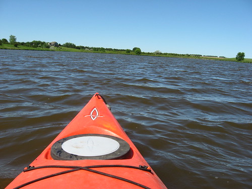
This afternoon, Sunday, June 29, a father and son were in two kayaks on the Big Sioux River heading south past the Klondike toward Canton. They came across a big tree that was positioned as a sweeper across the river; while trying to get past it, they both got caught up in the branches and capsized their kayaks. They made it out by working their way across the fallen tree to the shore. Their kayaks, though, were swept downstream and were not recovered. So, sometime around 1:00 p.m. today, two orange Dagger kayaks, one 9 feet long and the other 11 ½ feet, were lost and last seen floating down the river between the Klondike and Canton. Jeff has contacted the Lincoln County Sheriff’s Office, but he has also asked if the word might be put out regarding these kayaks. He is hopeful that someone will find them and want to get in touch with the owner. If any of our readers catch sight of these kayaks or hears about them, Jeff has asked that he be contacted at 338-0147.

Sunday, June 29, 2008
Saturday, June 28, 2008
White Caps on the Big Sioux River
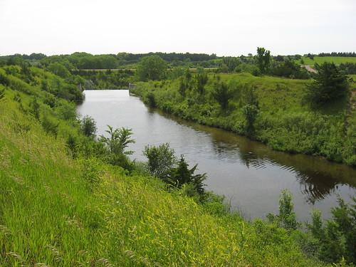
The Big Sioux River: Flandreau - Pow Wow Grounds to Low Head Dam
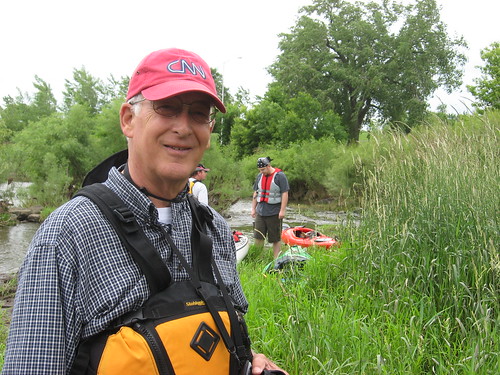
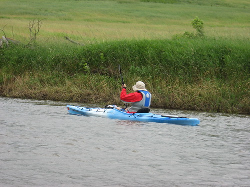
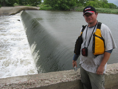
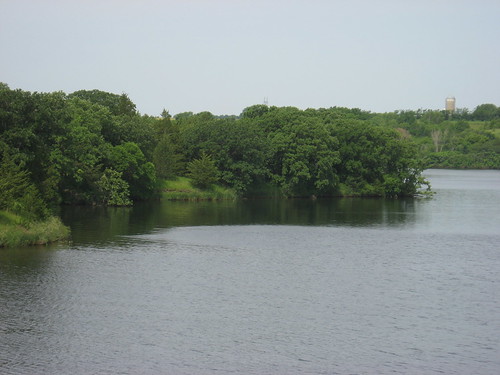
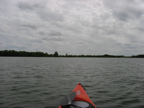
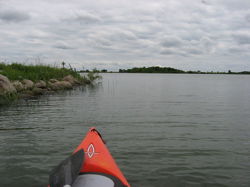
Today, I joined a group of SDCA members on a trip down the Big Sioux River, beginning at the Santee Sioux Indian Pow Wow grounds and ending 10 miles downstream at the low head dam just south of the Flandreau Indian High School. This cruise continued downstream another two miles from the Flandreau City Park, where the first SDCA cruise of the year concluded this past April.
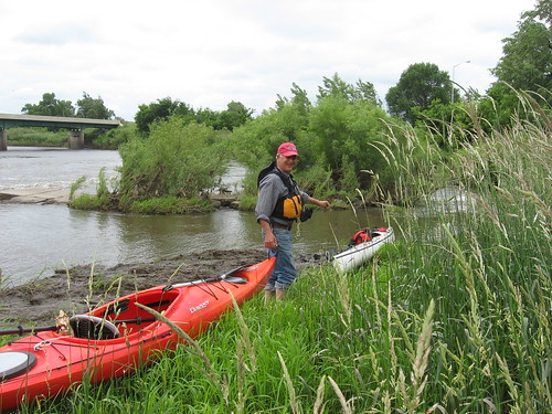
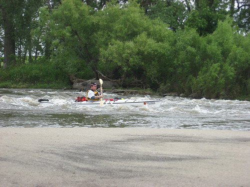
The put-in at the Pow Wow grounds requires a pass over a set of rapids created with the remains of an old sidewalk put across the river years ago. The remainder of the river is free of navigation hazards and is often a tranquil and scenic cruise. Today, however, the ride was anything but a quiet float trip downstream; instead, there was an expedition quality about it. The winds were blowing out of the northwest at up to 40 mph and it was raining for part of the trip. The temperature was in the 60s, and the skies were cloudy. Because of the serpentine course of the river, sometimes there were wind waves 18 inches or more in height breaking on the bow of our kayaks and spraying up into the cockpit and faces of the paddlers. These winds necessitated continuous paddling, often hard paddling. At other times, we were in the lee of trees and high banks, and the ride was easy.

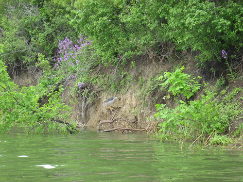
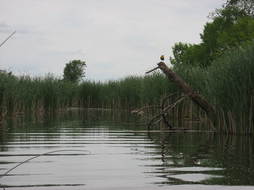
We saw a number of great blue heron and several hawks. Jarett thought that he spotted a river otter along the bank. About four miles into the trip, we came across a tributary creek and headed up that waterway to find unsettled waters and a brief respite from the wind and waves.
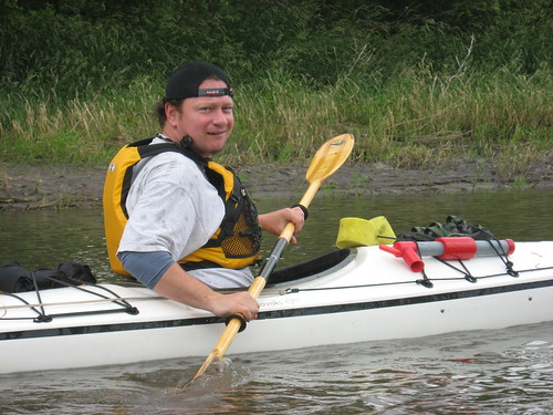
There were four of us on the trip, Jarett Bies was the cruise leader, and Pat Wellner and his pal Arnold came from Pierre to join us. Tom, a bloger from Elkton (http://elktonfarmers.blogspot.com), came along to record our departure and provided a shuttle for the four of us. We all enjoyed the three hours spent moving downstream in sometimes trying conditions. As a certified geezer, I felt good about being able to keep up with the three younger guys, the oldest of whom is nearly 27 years younger than me. Heading down the river is to me incomparable to going to the gym. I can’t imagine a better way to get great upper body exercise, enjoy the outdoors, and laugh it up with an agreeable bunch of guys.
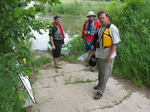
The trip ended at a take-out just above a low head dam. As I have marveled before, we were able to take a ten-mile kayak cruise on the river that began on the north end of Flandreau and ended still north of the main street, just south of the Flandreau Indian High School. This is just amazing to me. The river runs through the countryside with heavy tree growth along the banks with no indication that it is anywhere near a settled community. I think that this is one of the nicest cruises along the Big Sioux River in the general Sioux Falls area.
Today, I joined a group of SDCA members on a trip down the Big Sioux River, beginning at the Santee Sioux Indian Pow Wow grounds and ending 10 miles downstream at the low head dam just south of the Flandreau Indian High School. This cruise continued downstream another two miles from the Flandreau City Park, where the first SDCA cruise of the year concluded this past April.
The put-in at the Pow Wow grounds requires a pass over a set of rapids created with the remains of an old sidewalk put across the river years ago. The remainder of the river is free of navigation hazards and is often a tranquil and scenic cruise. Today, however, the ride was anything but a quiet float trip downstream; instead, there was an expedition quality about it. The winds were blowing out of the northwest at up to 40 mph and it was raining for part of the trip. The temperature was in the 60s, and the skies were cloudy. Because of the serpentine course of the river, sometimes there were wind waves 18 inches or more in height breaking on the bow of our kayaks and spraying up into the cockpit and faces of the paddlers. These winds necessitated continuous paddling, often hard paddling. At other times, we were in the lee of trees and high banks, and the ride was easy.
We saw a number of great blue heron and several hawks. Jarett thought that he spotted a river otter along the bank. About four miles into the trip, we came across a tributary creek and headed up that waterway to find unsettled waters and a brief respite from the wind and waves.
There were four of us on the trip, Jarett Bies was the cruise leader, and Pat Wellner and his pal Arnold came from Pierre to join us. Tom, a bloger from Elkton (http://elktonfarmers.blogspot.com), came along to record our departure and provided a shuttle for the four of us. We all enjoyed the three hours spent moving downstream in sometimes trying conditions. As a certified geezer, I felt good about being able to keep up with the three younger guys, the oldest of whom is nearly 27 years younger than me. Heading down the river is to me incomparable to going to the gym. I can’t imagine a better way to get great upper body exercise, enjoy the outdoors, and laugh it up with an agreeable bunch of guys.
The trip ended at a take-out just above a low head dam. As I have marveled before, we were able to take a ten-mile kayak cruise on the river that began on the north end of Flandreau and ended still north of the main street, just south of the Flandreau Indian High School. This is just amazing to me. The river runs through the countryside with heavy tree growth along the banks with no indication that it is anywhere near a settled community. I think that this is one of the nicest cruises along the Big Sioux River in the general Sioux Falls area.
Tuesday, June 24, 2008
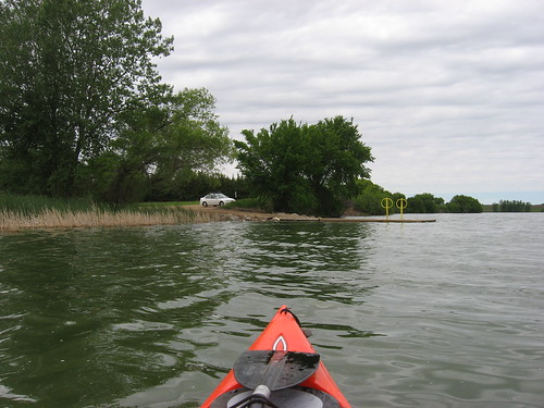
Lake Alvin - Late June 2008
Lake Alvin – Late June 2008
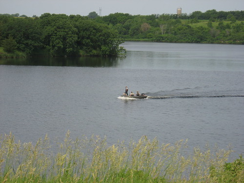
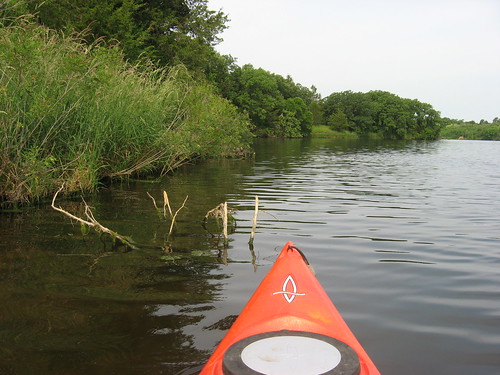
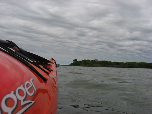
This morning I loaded up the kayak and took the 15-minute drive out to Lake Alvin for a cruise around the lake. This time, I departed from the public access area and concentrated on the main body of the lake. There was a light wind, the temperature was in the 70s, and the clouds were just lifting. The lake was deserted at 9:00 a.m. except for a crew of Game, Fish, and Parks guys who were doing a “population survey,” or a fish census. The four guys were in a wide workboat and had a series of nets strung out at various points on the lake. They were counting and classifying the fish caught, and then the fish were released over the side. On an evening cruise last year I saw a series of nets set up and wondered at the purpose: now I know.
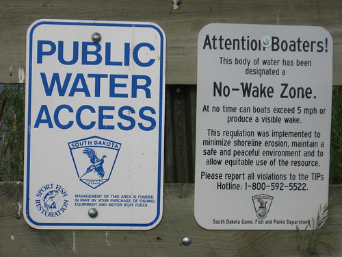
Lake Alvin is classified as a “no-wake” lake, something that had escaped me in the past. Years ago, the lake had a horsepower limitation; now, the restriction is that boats do not create a wake. I guess that is why you don’t see ski boats or jet skies on the lake.
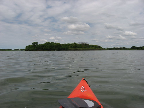
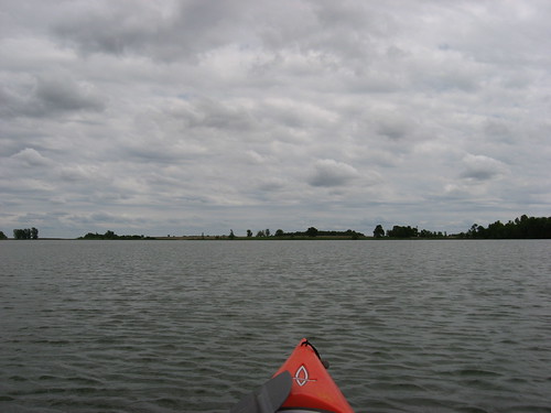
I have always appreciated the lay of Lake Alvin. Even though it is only 90 acres, it was created over the Nine-Mile Creek bed and is characterized by high banks, some cliffs, and lots of mature trees. It seems that there is always a lee side to the lake. Even if there is a stiff wind, a good part of the lake seems to be in a lee. Standing on the high bank in the recreation area and overlooking the lake, this distribution of wind is apparent.
The lake has plenty of water in it now, and I was able to paddle up into the several bays extending off the main body. I like to go into the channel leading to the spillway, the outlet for the lake. Today, I cruised into the outlet with my rudder down, and it didn’t even touch bottom. The spillway at the end of the channel presents a danger if a paddler would get too close. Throughout the lake, the bottom was clearly visible up to about four feet. There was little algae growth in or on the water. In fact, I thought that the lake was remarkably clear for this time of the year.
There were no waterfowl on the lake today. In fact, I have rarely seen waterfowl on the main part of the lake during the boating season. There is too much traffic on the water, I would guess. There is waterfowl down into the outlet of Nine-Mile Creek as it flows into Lake Alvin, but I was at the other end today.
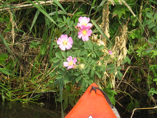
So, I cruised along looking at the vegetation and the landform along the shoreline of the Lake. There are some nice looking wildflowers to be seen at various points. I did not see any mammal life on the lake today. My cruise around the perimeter of the lake, even stopping to check out areas of interest, took me about an hour and 15 minutes. This fits nicely into my basic formula for such a trip: more time on the water than in the car.
Lake Alvin is experiencing some development, particularly just outside the park entrance. This is a familiar phenomenon that seems to have begun or is advanced at many of the state parks: Lake Vermillion, the Big Sioux Recreation Area, Beaver Creek, and at Lake Alvin. Some of these homes look ostentatious to me, an intrusion upon the tranquility of the park. Still, I guess that if I had the resources, it might seem an attractive place for me to live as well. Since I don’t, however, I can feel mildly resentful of that intrusion of private wealth looming over the public nature areas. At Lake Alvin, fortunately, there are no private docks and no homes on the waterfront. Nearly all of the lake is covered with trees and other vegetation. I am so glad that farsighted leaders preserved great swaths of land along our waterways and created parks and recreation areas before the land was grabbed up by private developers.
This morning I loaded up the kayak and took the 15-minute drive out to Lake Alvin for a cruise around the lake. This time, I departed from the public access area and concentrated on the main body of the lake. There was a light wind, the temperature was in the 70s, and the clouds were just lifting. The lake was deserted at 9:00 a.m. except for a crew of Game, Fish, and Parks guys who were doing a “population survey,” or a fish census. The four guys were in a wide workboat and had a series of nets strung out at various points on the lake. They were counting and classifying the fish caught, and then the fish were released over the side. On an evening cruise last year I saw a series of nets set up and wondered at the purpose: now I know.
Lake Alvin is classified as a “no-wake” lake, something that had escaped me in the past. Years ago, the lake had a horsepower limitation; now, the restriction is that boats do not create a wake. I guess that is why you don’t see ski boats or jet skies on the lake.
I have always appreciated the lay of Lake Alvin. Even though it is only 90 acres, it was created over the Nine-Mile Creek bed and is characterized by high banks, some cliffs, and lots of mature trees. It seems that there is always a lee side to the lake. Even if there is a stiff wind, a good part of the lake seems to be in a lee. Standing on the high bank in the recreation area and overlooking the lake, this distribution of wind is apparent.
The lake has plenty of water in it now, and I was able to paddle up into the several bays extending off the main body. I like to go into the channel leading to the spillway, the outlet for the lake. Today, I cruised into the outlet with my rudder down, and it didn’t even touch bottom. The spillway at the end of the channel presents a danger if a paddler would get too close. Throughout the lake, the bottom was clearly visible up to about four feet. There was little algae growth in or on the water. In fact, I thought that the lake was remarkably clear for this time of the year.
There were no waterfowl on the lake today. In fact, I have rarely seen waterfowl on the main part of the lake during the boating season. There is too much traffic on the water, I would guess. There is waterfowl down into the outlet of Nine-Mile Creek as it flows into Lake Alvin, but I was at the other end today.
So, I cruised along looking at the vegetation and the landform along the shoreline of the Lake. There are some nice looking wildflowers to be seen at various points. I did not see any mammal life on the lake today. My cruise around the perimeter of the lake, even stopping to check out areas of interest, took me about an hour and 15 minutes. This fits nicely into my basic formula for such a trip: more time on the water than in the car.
Lake Alvin is experiencing some development, particularly just outside the park entrance. This is a familiar phenomenon that seems to have begun or is advanced at many of the state parks: Lake Vermillion, the Big Sioux Recreation Area, Beaver Creek, and at Lake Alvin. Some of these homes look ostentatious to me, an intrusion upon the tranquility of the park. Still, I guess that if I had the resources, it might seem an attractive place for me to live as well. Since I don’t, however, I can feel mildly resentful of that intrusion of private wealth looming over the public nature areas. At Lake Alvin, fortunately, there are no private docks and no homes on the waterfront. Nearly all of the lake is covered with trees and other vegetation. I am so glad that farsighted leaders preserved great swaths of land along our waterways and created parks and recreation areas before the land was grabbed up by private developers.
Thursday, June 12, 2008
Lake Vermillion - The West End into the Marshes
Lake Vermillion – the West End
This morning began with clear skies, little wind, and a temperature of about 70 degrees. It was too fine a day to let pass without getting out on the water. Each year I take, perhaps, three cruises on Lake Vermillion, located in a State Recreation Area about 30 miles west of my eastside Sioux Falls home. There are a number of posts regarding this body of water with further details of the three basic cruise possibilities, and you can access them on the menu on the right side of the page.
The water is the lakes is quite high at this time of the year, especially with all the recent rains. I wanted to check out the wildlife and vegetation along the western arm of the lake, that portion of the lake that receives fewer visitors and that is less wind-blown. At this time of the year, there is sufficient depth in the feeder creeks and little bays that extend to the north and west to permit deep exploration.
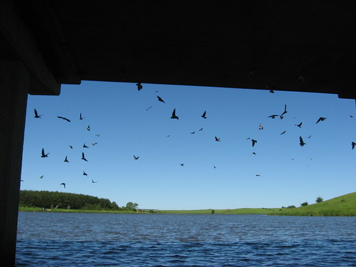
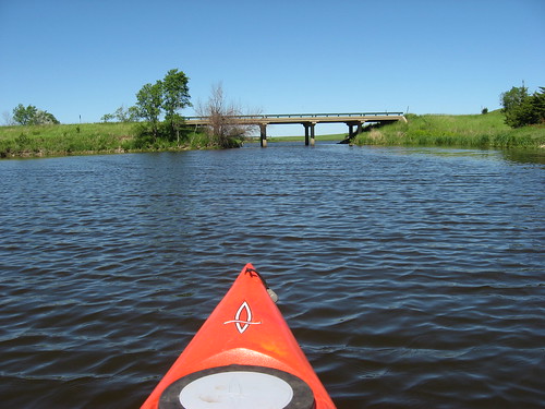
Leaving the public dock within the recreation area, I moved off and under the bridge to the right. The cliff swallows have established themselves under the bridge, and it is an interesting sight to see them flying out of their mud nests and circling just outside of the bridge until an intruder departs.
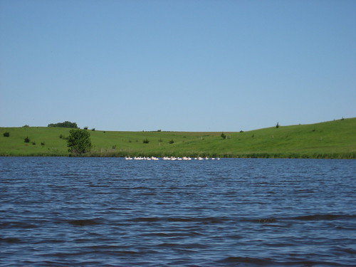
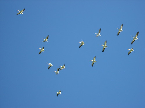
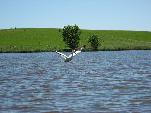
There was a flock of pelicans on the western arm today, a flock of perhaps twenty birds. As I approached, they initially flew off and then returned circling above me. One senior bird seemed to have the role of sentinel while the others flew away and awaited developments.
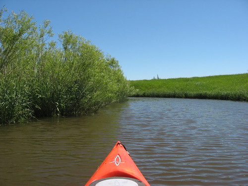
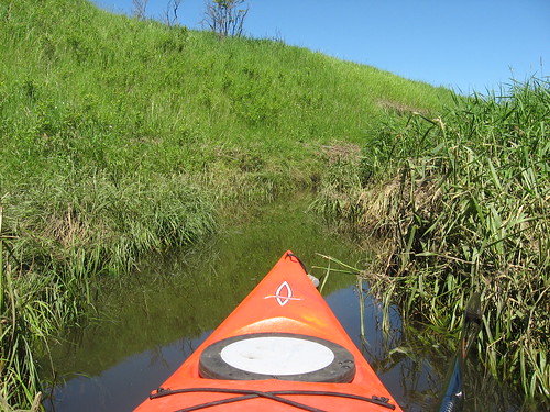
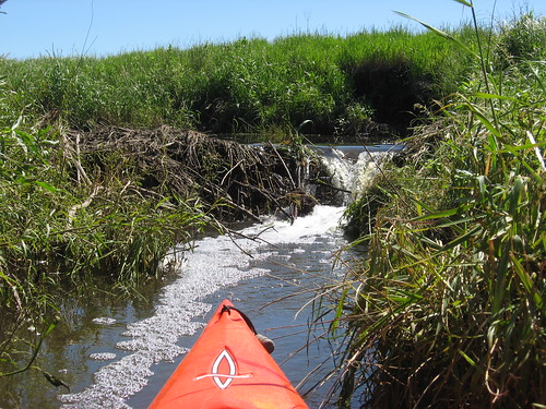
There are two general routes into the marshes of the feeder creeks. The one to the south passes by a home built just on the banks with its own dock. The other entrance to the feeder creeks requires the paddler to continue west into what seems the mouth of a river or creek. It was possible today to continue into the marshy conditions for quite a while, until I was deep within the growth along an increasingly narrow waterway. Even though the waterway narrowed to the point where I could just pull the kayak along by grabbing grasses along the bank, there was plenty of depth to the water – consistently 3 to 4 feet deep. I traveled up-stream for about 20 minutes from the main body into this very narrow waterway until I reached what seemed a beaver dam. Coming back, I had to back out for a while until I reached a spot wide enough to, with some difficulty, turn the kayak back around.
This is really a great way to be isolated and alone within the marshes. There were no people anywhere near, no boats, no homes: nothing but the water, the vegetation along the dense banks, giant carp occasionally passing or jumping, ducks nesting, and many types of birds enjoying their lives off the beaten path. The only sounds were natural: wind through the grasses, water gurgling by, birds chattering, and the kayak passing through.

Going up the north/south length of the lake is okay, and I do this a couple times a year. There is also a great area within the entrance to the Vermillion River where interesting natural sights can be found. But, it takes a 45-minute paddle up the lake to reach that spot. Heading into the western arm quickly takes the paddler into the isolation of winding waterways that are home to great blue heron, geese, ducks, pelicans, a variety of smaller perching birds and swallows, turtles, and muskrats and beaver. During the weekend day, when all the working stiffs are hard at it, any of these routes into the lake are okay, as long as the wind force and direction are acceptable. On the weekends, this cruise up into the western arm would certainly be more tranquil. Or, like with me today, this trip up into the western accommodates a desire for personal isolation and tranquility without motorboats.
This morning began with clear skies, little wind, and a temperature of about 70 degrees. It was too fine a day to let pass without getting out on the water. Each year I take, perhaps, three cruises on Lake Vermillion, located in a State Recreation Area about 30 miles west of my eastside Sioux Falls home. There are a number of posts regarding this body of water with further details of the three basic cruise possibilities, and you can access them on the menu on the right side of the page.
The water is the lakes is quite high at this time of the year, especially with all the recent rains. I wanted to check out the wildlife and vegetation along the western arm of the lake, that portion of the lake that receives fewer visitors and that is less wind-blown. At this time of the year, there is sufficient depth in the feeder creeks and little bays that extend to the north and west to permit deep exploration.
Leaving the public dock within the recreation area, I moved off and under the bridge to the right. The cliff swallows have established themselves under the bridge, and it is an interesting sight to see them flying out of their mud nests and circling just outside of the bridge until an intruder departs.
There was a flock of pelicans on the western arm today, a flock of perhaps twenty birds. As I approached, they initially flew off and then returned circling above me. One senior bird seemed to have the role of sentinel while the others flew away and awaited developments.
There are two general routes into the marshes of the feeder creeks. The one to the south passes by a home built just on the banks with its own dock. The other entrance to the feeder creeks requires the paddler to continue west into what seems the mouth of a river or creek. It was possible today to continue into the marshy conditions for quite a while, until I was deep within the growth along an increasingly narrow waterway. Even though the waterway narrowed to the point where I could just pull the kayak along by grabbing grasses along the bank, there was plenty of depth to the water – consistently 3 to 4 feet deep. I traveled up-stream for about 20 minutes from the main body into this very narrow waterway until I reached what seemed a beaver dam. Coming back, I had to back out for a while until I reached a spot wide enough to, with some difficulty, turn the kayak back around.
This is really a great way to be isolated and alone within the marshes. There were no people anywhere near, no boats, no homes: nothing but the water, the vegetation along the dense banks, giant carp occasionally passing or jumping, ducks nesting, and many types of birds enjoying their lives off the beaten path. The only sounds were natural: wind through the grasses, water gurgling by, birds chattering, and the kayak passing through.
Going up the north/south length of the lake is okay, and I do this a couple times a year. There is also a great area within the entrance to the Vermillion River where interesting natural sights can be found. But, it takes a 45-minute paddle up the lake to reach that spot. Heading into the western arm quickly takes the paddler into the isolation of winding waterways that are home to great blue heron, geese, ducks, pelicans, a variety of smaller perching birds and swallows, turtles, and muskrats and beaver. During the weekend day, when all the working stiffs are hard at it, any of these routes into the lake are okay, as long as the wind force and direction are acceptable. On the weekends, this cruise up into the western arm would certainly be more tranquil. Or, like with me today, this trip up into the western accommodates a desire for personal isolation and tranquility without motorboats.
Saturday, June 07, 2008
Beaver Lake on a Saturday Afternoon in June
This morning I waited and waited for a call regarding a probable kayak trip with others, and the call never came. So, I decided that I could not waste this nice day with light winds and no rain. The endless rains of late have put a damper on plans for outdoor activities all across the area. The local rivers are rising to flood stage with fast moving waters. This is not a good time to venture out on the Big Sioux River, nor even on the local creeks that feed into the river.
I set out from my eastside Sioux Falls home and headed west along Interstate 90, following a National Guard convoy of trucks and humvees, and listening to Hawaiian music. It seemed a good day for my annual visit to Beaver Lake, located just outside of Humboldt on the north side of I 90. Directions for locating the lake can be found in earlier narratives about Beaver Lake located on the right side of the blog home page.
As has always been the case, the lake was deserted when I arrived. In my three trips to the lake, I have never seen another boat on the water. I thought that Saturday might be different, but I again had the lake to myself. Just as I was about to set off, a couple arrived on horseback and stopped for a brief chat. The guy told me that they were going to build a house on the lake for next year along with their own dock. That would be the first such development along the shoreline. Perhaps the population growth in the Sioux Falls area and the attraction of a non-developed lake makes such building inevitable.
The wind was out of the west and there were small waves on the water. The skies were broken overcast, and the temperature was probably close to 80. It was nearly a perfect paddling day.
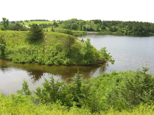
Beaver Lake, at 306 acres, is more than three times as large as Lake Alvin. The lake is generally oriented east and west and is more than a mile wide along that axis. There is a large wooded island north of the public access point, and this is where I seem drawn each time I visit the lake. I guess islands exert some attraction to me, and I can’t resist heading in that direction, regardless of the wind direction. This island has some elevation with high banks and a thick covering of large trees. The eastern end of the island is lower and filled with willows. This is where I have frequently found varieties of birds, including large waterfowl. Today, I saw an egret, a great blue heron, and a single pelican on the shore of the island.
The southern and eastern end of the lake and the island are the most interesting landforms. This is where the wooded shore runs. There are many bays extending off of the main body of water, so there is an extensive shoreline to explore.
Beaver Lake is a wide and open body of water where wind can create quickly changing conditions. With a moderate wind, large waves can quickly form. It is best to keep alert to weather developments when on this lake, especially in a kayak or canoe.
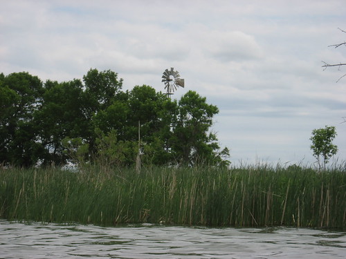
I am often drawn to old windmills that I find along the shores of lakes in this area, and Beaver Lake has one located on the eastern shore in a marshy area. I paddled close to get a good view of the structure and could not help contrasting it with the sleek, aerodynamic wind generators that we now see situated in wind farms here in the northern plains.
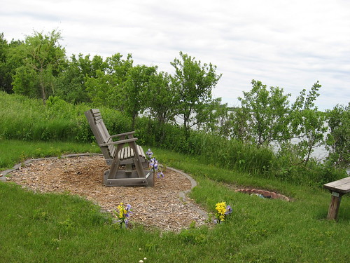
The public access point on the lake includes a path leading through a grassy area to a wooden swinging bench overlooking the lake. This bench is a memorial put up by his family to honor Adam Millikan, a young man who loved Beaver Lake.
Thursday, June 05, 2008
Grass Lake Water Monitoring Project
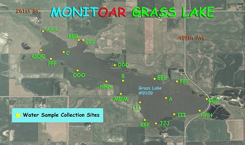
Monitoring Water Resources
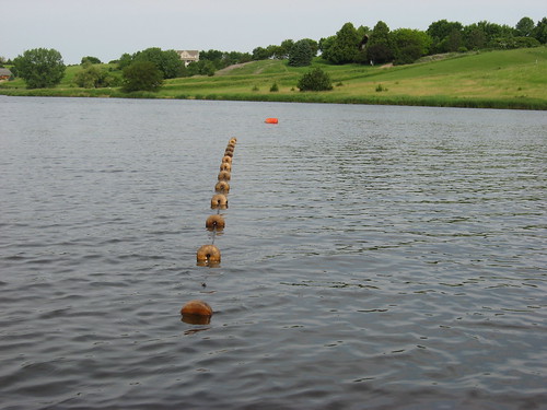
The SDCA in association with Dakota Water Watch, a water resource monitoring program of the East Dakota Water Development District, will participate in a bacteria monitoring project at Grass Lake on July 12, 2008. This will be a single event carried out to establish a base line of water bacteria levels linked to fecal material and disease-causing organisms. This event will involve collecting samples from 20 points around the lake for analysis in a “mini-lab.”
SDCA volunteers will gather at 9:00 a.m. at the Grass Lake public access point and receive training in the collection process and be provided some basic background information on the project. The training will last an hour or so, and the SDCA participants will then set out in their boats to collect samples from assigned points around the lake. The training, collection, and preparation of the samples will be lead by Jeanne Fromm, project manager for Dakota Water Watch.
After training, the SDCA participants will set out and collect their water samples. There will be enough time for kayaks to take a circuit of the lake if desired before returning with the samples. A complete circuit of the lake takes about an hour, although it is possible to spend a couple of hours checking out the islands, shoreline, and bird life. The participants will have their samples back at the “put-in” site sometime around 11:00 a.m. Jeanne Fromm will collect the samples as the boats return, and the SDCA participants will be able to help prepare the samples for analysis. That process takes only five minutes or so. The lab preparation will be done as boats return, so it should be possible for participants to finish their lap around the lake, drop off the samples, and have their assignment completed between 11:00 and 11:30 a.m.
The SDCA is participating in this project as a public service. It is also a good opportunity for members to get a closer look at how water analysis is completed. So, this project ought to offer a nice morning on Grass Lake, a chance to network with other SDCA members, and provide a feeling of contribution to environmental management.
Grass Lake is a wonderful and secluded body of water in close proximity to Sioux Falls. There is a lot of bird life to observe, especially pelicans, great blue herons, geese, and ducks. Other wildlife is often seen along the shores, including muskrat, raccoon, and deer. From Sioux Falls, the lake is reached by going west on Highway 42 (12th Street) past the Wall Lake turnoff, on to 459th Street. At 459th Street, turn right and go north about 2.5 miles. The road enters into a curve around the east end of the lake after about two miles. On the left, there is a small white sign that identifies a gravel road leading into the public access area, located just a short distance along that entrance. The public access point is on the northeastern end of the lake. There is a “turn around” area and a very primitive launching point. No SD parks sticker is needed to use this site.
For this event, there are 20 samples to be collected, and there is activity for about 10 volunteers. We would like for people to “register” in advance so that we know that there will be enough, and that there will be an assignment for each boat. If you would like to participate on this 9:00 – 11:30 a.m. event on Saturday, July 12, please e-mail or call Jay Heath at jheath@sio.midco.net or 371-3622 by July 5. If there is any need to cancel the event, calls will be made to those registering.
Sunday, June 01, 2008
Annual SDCA Canoe Fair
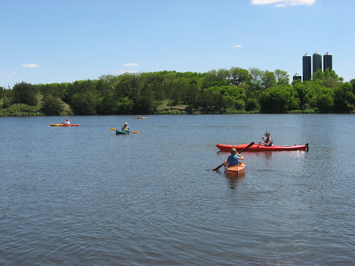
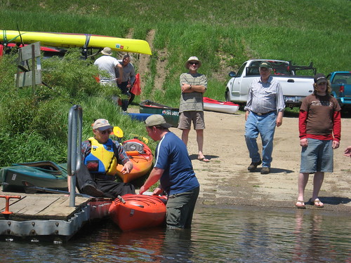
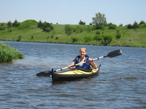
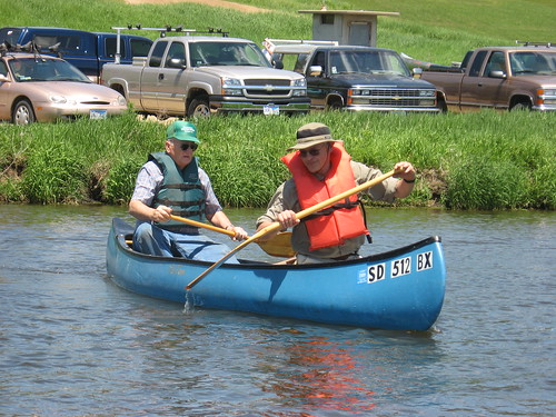
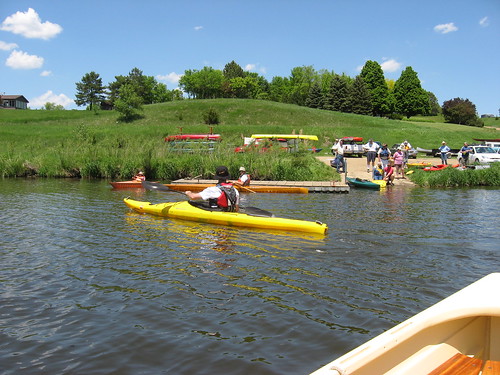
SDCA Annual Canoe Fair Held Sunday, June 1, 2008
For many years, the SDCA has sponsored the Annual Canoe Fair at Lake Alvin, near Sioux Falls. This has been a time for people interested in trying out different types of boats to actually get out on the water to see how they like both the experience and specific varieties of craft. Some people came out who have never or rarely been in a kayak, others wanted to see and try out a variety of boats, and still others came to join in a group experience and network with other paddlers. Some parents brought their children so that they could experience getting out on the lake in a kayak or canoe.
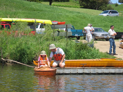
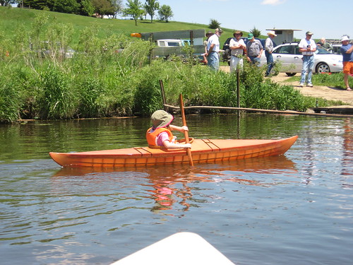
This Sunday afternoon was really magnificent. It was one of the first days when temperatures rose into the 80s, the skies were clear, and there was little wind. Altogether, it was a really fine day to be out on the water, laughing with others sharing similar interests.
SDCA members served as mentors to novice paddlers and helped them learn the very basics: getting in the kayak, handling the paddle, balance, propulsion, and finally getting out safely.
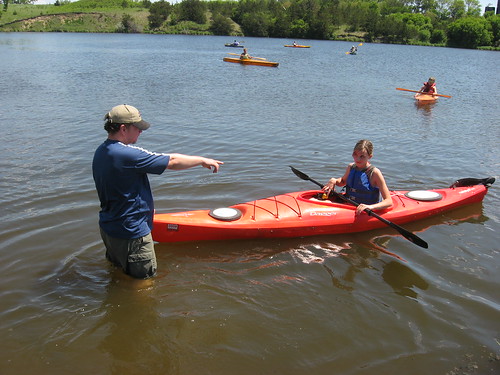
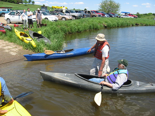
Participants at the fair ranged in age from children to older people interested in a new outdoor activity.
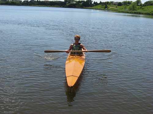
The craft available for the participants included river-running, recreational, cruising, and touring kayaks. There was also a Folbot at the event, hand-made “Rick Johns” crafted kayaks, canoes, and a rowing boat.
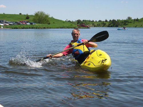
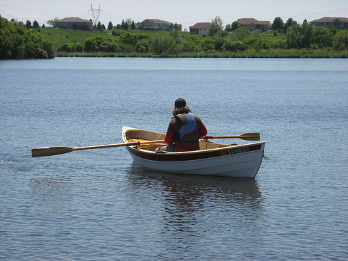
There were at least two-dozen boats available for people to try. At least six people took my 13-foot Dagger out for a short tour. SDCA members felt that the event was very well attended and fully met the objectives of the outing. Lots of people got out on the water in a variety of craft.
To keep alert to future SDCA activities, I advise readers to check the SDCA website regularly: http://skcka.blogspot.com. Club members, of course, receive a newsletter with an agenda of future activities. Any interested in becoming members of the SDCA may contact me for information on membership at jheath@sio.midco.net.
For many years, the SDCA has sponsored the Annual Canoe Fair at Lake Alvin, near Sioux Falls. This has been a time for people interested in trying out different types of boats to actually get out on the water to see how they like both the experience and specific varieties of craft. Some people came out who have never or rarely been in a kayak, others wanted to see and try out a variety of boats, and still others came to join in a group experience and network with other paddlers. Some parents brought their children so that they could experience getting out on the lake in a kayak or canoe.
This Sunday afternoon was really magnificent. It was one of the first days when temperatures rose into the 80s, the skies were clear, and there was little wind. Altogether, it was a really fine day to be out on the water, laughing with others sharing similar interests.
SDCA members served as mentors to novice paddlers and helped them learn the very basics: getting in the kayak, handling the paddle, balance, propulsion, and finally getting out safely.
Participants at the fair ranged in age from children to older people interested in a new outdoor activity.
The craft available for the participants included river-running, recreational, cruising, and touring kayaks. There was also a Folbot at the event, hand-made “Rick Johns” crafted kayaks, canoes, and a rowing boat.
There were at least two-dozen boats available for people to try. At least six people took my 13-foot Dagger out for a short tour. SDCA members felt that the event was very well attended and fully met the objectives of the outing. Lots of people got out on the water in a variety of craft.
To keep alert to future SDCA activities, I advise readers to check the SDCA website regularly: http://skcka.blogspot.com. Club members, of course, receive a newsletter with an agenda of future activities. Any interested in becoming members of the SDCA may contact me for information on membership at jheath@sio.midco.net.
Subscribe to:
Posts (Atom)