This blog is designed to highlight the paddling opportunities within South Dakota, mainly within a 50-mile radius of Sioux Falls. While Sioux Falls is far from the adventure of coastal regions, there is a certain satisfaction in utilizing the available waterways to observe weather, water conditions, and the landscape along the shoreline. In addition, there is a wealth of animal life on the waters of small South Dakota lakes, rivers, and creeks, including geese, ducks, pelicans, great blue heron, egrets, hawks, owls, perching birds, deer, raccoons, and beaver. Eagles, fox, and coyote are also sometimes spotted.

The sites described are places where I have kayaked over the past few years, mostly in South Dakota but sometimes including locations in Iowa and Minnesota. One of the best sources of information on the accessibility of small lakes is the South Dakota Atlas and Gazetteer, the large map book of South Dakota. Lakes with a public access are generally identified by a boat symbol marking the location of a launching site on public land.

You will notice the menu of paddling locations on the right side of the blog. Each of the postings is linked to one of the areas, and my intention is to provide a continuing review of the places where I paddle. Perhaps these narratives will help readers select waterways of interest to them. Please feel free to offer a comment regarding any of my postings; I would welcome the dialog.

I also maintain a companion blog that describes hiking opportunities within the Sioux Falls area. You can access that blog at: http://hikingsiouxfalls.blogspot.com

Saturday, December 01, 2007

Kayaking into Geezerhood

IMG_1745.JPG

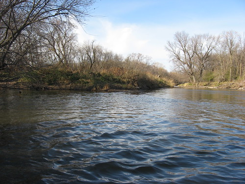
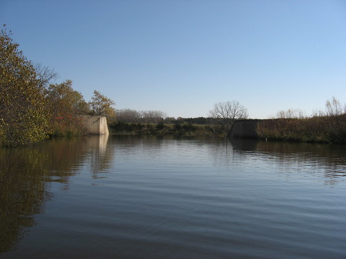
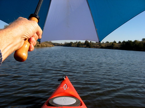
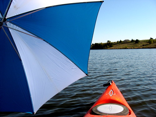
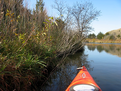
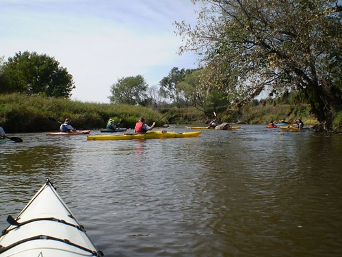
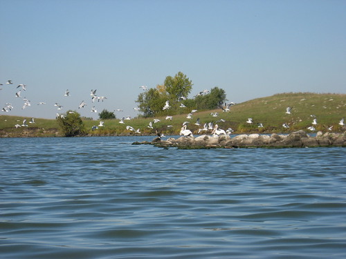
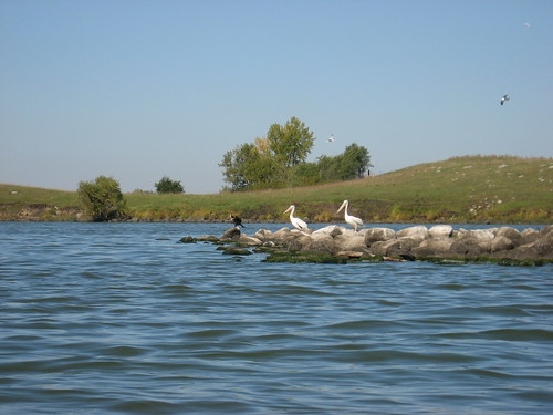
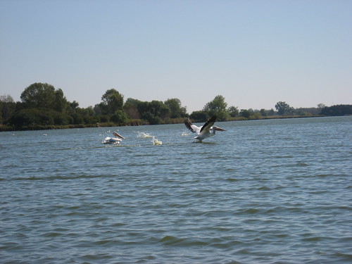
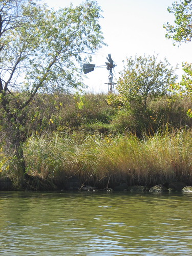
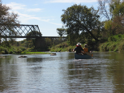
I do most of my kayaking alone on area waterways. As I have gotten older, I have been concerned about the strength needed to wrestle my kayak up onto the roof rack of my car. When I was in my 40s and 50s, I just heaved the kayak up through brute force, and that wasn’t much of a problem. Of course, its also an easy way to throw a person’s back out, and I have had my share of painful and enduring back pain. As I passed the midpoint of my 60s, I wondered how long I would be able to continue hauling my kayak around, especially by myself.

IMG_1748.JPG

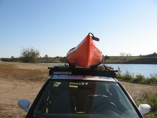
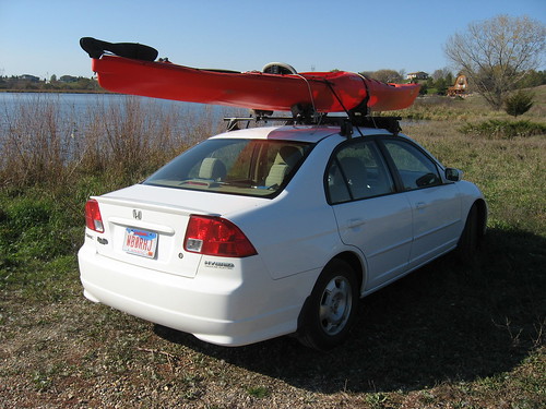
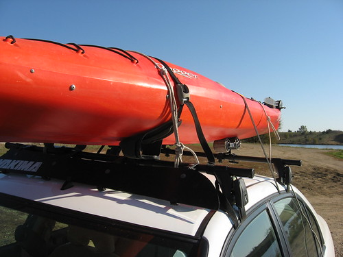
Right after buying my first rigid kayak, I purchased a Yakama roof rack. The rack has special kayak attachments that include a cradle at the front of the rack into which the kayak slips. At the rear, I have a set of rollers that enables me to slide the kayak up onto the rack. For a long time, when alone, I still heaved the kayak up over the side of the car onto the rack. One day, though, I talked with Dick Davidson, the long time president of the South Dakota Canoe Association and a great arctic adventurer, about how he managed to get his big decked Loon canoe onto his roof rack. He told me that in younger days, he used to just heave the canoe up and onto the rack, much as I used to do; as got he older, however, he began using an old burlap bag to drape over the trunk of the car so that he could slide the canoe up onto his rack.

IMG_1749.JPG


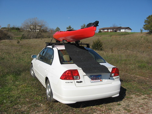
Well, I thought that this would be a good adaptation for me to try. I went to one of the big hardware stores and bought a 3 x 5 foot rubber backed floor mat that I could easily roll up and put in my trunk. It cost me less than $10.00. I also found that the hardest part about carrying the 58 lbs. kayak from the car to the water’s edge was the pain in my hands from the rim of the cockpit. So, I also got a pair of gloves to keep in the trunk and to use for carrying the kayak.

IMG_1750.JPG

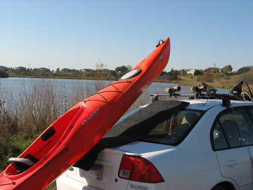
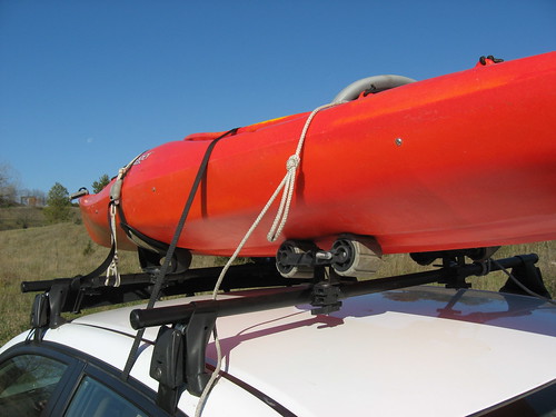
My method for loading the kayak is now to first get the straps for the roof rack ready and lay out the mat along the top of the trunk. I then, with gloves, carry the kayak out to the rear of the car and lift the bow up onto the mat. I can then just slide the kayak on the mat onto the rollers and push it up into the cradle. I then use the two straps that came with the rack to secure the kayak. Being cautious, however, I also have two rope lines that I use in addition to secure the kayak onto the rack. One end of the line is secured to one side of the rack, and I have a loop at the other end that I use to secure to the other side. So, there are really four attachments: two straps and two rope lines. One of my straps goes through the car above the rear windows so that the rack itself has an additional anchor to the roof itself. Even with all this, though, I am sometimes hesitant to drive on the Interstate for fear that the suction from a passing semi will jerk the kayak off. Over time, I have grown more confident that the kayak is securely fastened to the roof; still, though, I usually travel on secondary roads to my kayaking haunts.

IMG_1747.JPG

There are some alternatives to using a roof rack on the car. I do have a Folbot, a fabric covered collapsible 12-foot kayak, and that company makes a full line of really nice boats that can be transported in one or two bags and carried in the trunk or back seat of the car. I like this craft, but it is quite expensive. I have toyed around with the idea of getting the larger tandem model, especially as I get older. I have also seen trailers made especially for transporting kayaks and canoes advertised in magazines. There is also a company in Hull, Iowa, that makes such trailers and will customize one to meet the needs of a customer: one kayak, two, or more. I like the idea of a trailer, but I don’t like the idea of storing another piece of gear around my house. I don’t want to dedicate the garage to kayak gear and leave the car in the driveway. Or, perhaps, it is my wife who doesn’t want to see the garage used in that way or to see a trailer left on the lawn alongside the driveway all summer.

IMG_1746.JPG

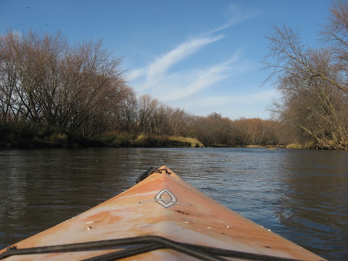
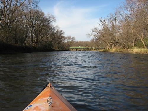
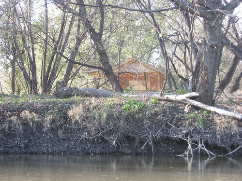
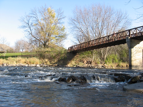
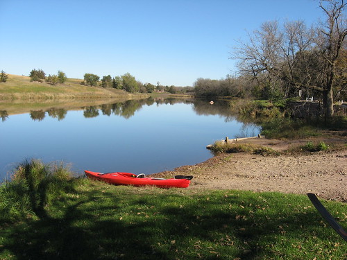
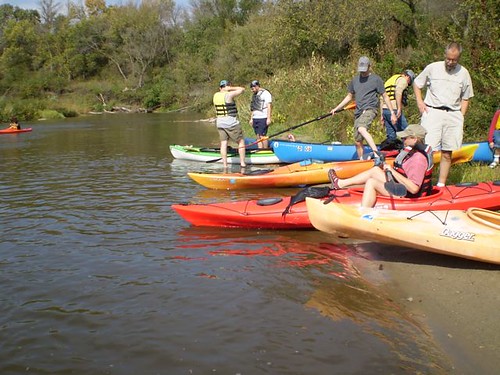
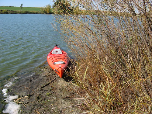
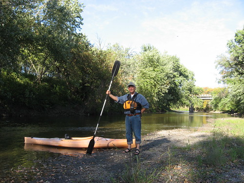
For now, I will keep using the roof rack as illustrated in these photos and find adaptations to accommodate my journey into geezerhood. I think that the next adaptation will be a wheeled contraption that will allow me to lift the kayak and just roll the it to the water’s edge, and such a device is readily available for under $100.

Sunday, November 18, 2007

Winter SDCA Conference - Sioux Falls: January 26, 2008

SDCA Logo


The annual winter conference for the South Dakota Canoe Association will be held in Sioux Falls at the Outdoor Campus on Saturday, January 26, 2008, from 12:00 noon until 3:00 p.m. This is a time for fellowship, networking, and learning for those of us interested in paddling our waterways in kayaks or canoes.

The conference this year will feature a PowerPoint slide show of waterways in the general Sioux Falls area – the Missouri River to Oakwood Lakes, navigational and personal safety, boat building, perhaps kayak fishing, Boundary Waters cruising, and bird watching on area lakes and streams. In addition, Dick Davidson will present a slide show describing one of his many adventures on northern rivers. A High Arctic Solo Canoe Trip on the Mara and Burnside Rivers to Bathurst Inlet will be great fun for all of us armchair adventurers who wish we could just chuck it all and head out on a long wilderness adventure. Dick Davidson is the most adventurous paddler I have ever known. For over 25 years, I have followed his canoe treks through Canada and Alaska. Just listening to him and looking at his slides is a great treat; I hold him in the highest regard. As the very long time president of the SDCA, he has helped many people find satisfaction in self-propelled travel on both area waterways and distant rivers, usually rivers flowing through northern wilderness areas.

There will be a discussion of cruises planned for next season, and an opportunity for conference attendees to offer their ideas for SDCA sponsored trips. We will elect officers for the next year, and there are several spots open for those who would like to take on a leadership organization within the organization.

So, I hope that you will mark your calendars for January 26, from noon to 3:00 p.m., and join us at the Sioux Falls Outdoor Campus, located near the Butterfly House and the Empire Mall –between 49th and 57th Streets.

Sunday, November 11, 2007

The Big Sioux River Through Sioux Falls: A last cruise of the year.

Today was a glorious gift to those of us here on the northern plains. A bright, sunny, weekend day with temperatures approaching 65 degrees on November 11 cannot be allowed to pass without notice. Many of us feel compelled to take advantage of this welcome respite preceding the inevitable winter shutdown. Just weeks from now, the lakes and rivers are likely to be frozen. In fact, we expect a return to cold grey days next week.

IMG_1791.JPG

So, after a midday hike in the hills overlooking the Big Sioux River at a state recreation area near Sioux Falls, I felt anxious to load up the kayak and take a last cruise of the season on the river. Within minutes of returning from the hike, I had my old beater of a river kayak (10.5 foot Dagger) lashed to the Yakama rack and was heading down 26th Street to the park along the Big Sioux River. This is less than a ten-minute drive for me from my east side Sioux Falls home: 10 minutes from driveway to “put-in.”

IMG_1788.JPG

There was a great deal of traffic on the Sioux Falls bike trail, and many people were in the parks. As usual, however, there was no one on the river nor any cars parked at the canoe access point on the west side of the river at 26th Street.

IMG_1796.JPG

I headed upstream in a pretty full river with good depth all along my route. Going upstream, the YMCA camp is located along the west bank and the bicycle trail on the east bank. I was able to check out any new developments within view of the river at Camp Leif Erickson, a beautiful YMCA facility that runs for nearly a mile along the river.

IMG_1789.JPG

The current was strong, especially for this time of the year. The weather was shirtsleeves, rolled up shirtsleeves at that. I did not see any notable wildlife other than a few ducks and flocks of crows in the leafless trees. The vista certainly has changed since my last cruise along this part of the river. With no leaves on the trees and the weeds going dormant, it was a brown world.

IMG_1793.JPG

It took me about 35 minutes to paddle upstream from the bridge over 26th Street to the bicycle trail bridge, and I spent another 35 minutes enjoying a float trip back down to the take-out at the canoe access point.

IMG_1777.JPG

This short stretch of the Big Sioux River is a little jewel here in the city. It requires the investment of only an hour or so on the water, but the views and experience of isolation are wonderful. Sometimes we neglect this waterway because, I guess, it is so close and not much of an adventure. For a tranquil paddle and the opportunity to check out seasonal changes, look at a variety of bird life, and experience the winds and currents, the Big Sioux through Sioux Falls ought to be on the cruise agenda of city paddlers. Also, no shuttle is necessary for this short paddle.

IMG_1779.JPG

This was probably the last cruise of the season for me. With the return to colder, grey and windy days next week and the approach of Thanksgiving, I will take the kayak rack off the Honda Civic and empty the trunk of PDFs and paddles. It seems like a long time until March when we can all get back on the water around here. In the meantime, I will read Sea Kayaker Magazine and Canoe Magazine and look at the area maps for new waters ahead. The South Dakota Canoe Association will be having a board meeting this next week, and the annual conference will be held in January, so talk will revolve around new opportunities and adventures for the next season.

Monday, October 29, 2007

Lake Alvin - A Late Fall Cruise on Familiar Waters, Oct. 2007

After my cruise on Split Rock Creek last Friday, I just left the kayak on the rack atop my car in hopes of going out again within a few days. Today was a magnificent Indian summer day with clear skies, light winds, and a temperature in the 70s, a day not to be wasted with inside work. On days like this, I congratulate myself on being retired and free to take advantage of such a gift.

IMG_1767.JPG

I decided to return to familiar waters. Lake Alvin is often the first and last paddle for me in the season. It is only about 10 miles from my eastside Sioux Falls home, and I can go from driveway to unloading the kayak in 15 minutes.

IMG_1775.JPG

We had a killing frost this weekend, and I wanted to see the effect this descent into deep fall had on the vegetation along the lake. Most of the leaves are down from the deciduous trees, the grasses are all brown, the algae has largely disappeared from the lake surface, and there were very few birds to be heard or seen.

IMG_1773.JPG

The lake was full. I was able to easily go up into the channel leading to the spillway and to kayak around the several bays that lead off the main body of the lake.

IMG_1760.JPG

With a light wind, I was inspired to take my golf umbrella out with me and do a little umbrella sailing today. I sailed from the put-in on the north side of the western end of the lake nearly up to the northeastern end. My speed was about half of what I might have done paddling, but I just wanted to cruise along the shoreline with the umbrella slanting out into the wind. After 20 minutes or so of sailing, I got the paddle going and cruised the perimeter of the lake. After all, I thought, I did come out for some upper body exercise, and holding the umbrella out was just a novelty.

IMG_1753.JPG

IMG_1752.JPG

The lake was deserted, as usual on a weekday late morning. There were no boats on the water, and there was no one fishing. When I returned to the put-in, however, there was a pick-up there with three guys standing around drinking beer and enjoying the wonderful day.

IMG_1763.JPG

Once again, I was reminded that Lake Alvin is really a nice body of water for kayaking. I am drawn to explore other lakes, creeks, and rivers and sometimes don’t appreciate the attractiveness of this area: maybe it is just too close to home. I was a little reluctant to go out to some of my other haunts during pheasant hunting season. I don’t want to see a bunch of guys with red caps and vests totting shotguns when I am silently cruising by below the banks and the shoreline growth.

Saturday, October 27, 2007

Split Rock Creek: From Garretson City Park Through the Palisades: Late October 2007

IMG_1711.JPG

Friday morning (yesterday), on the spur of the moment, I decided to load up the kayak and go on a late October cruise. With the boat on my rack atop my Honda Civic low-powered hybrid and with the “Forty Licks” CD from the Rolling Stones cranked up loud, I took off on back roads to Garretson, SD. The city maintains a very nice park at the dam across Split Rock Creek, alongside Devil’s Gulch where Jesse James supposedly hid out after his bank robbery in Northfield, Minnesota.

IMG_1744.JPG

As usual, the park and the waterway were deserted as I put my kayak in for a ride up through the spectacular quartzite palisades that line both sides of the creek at this point. The temperature was about 50 or so when I set out on the water and the skies were nearly cloudless. There was only the lightest of breezes, and for South Dakota such conditions would be like a flat calm anywhere else. As I paddled upstream from the dam, the weather only got finer. I was conscious that such days are dwindling here on the northern plains. The trees are bare of leaves, the last of the corn is being harvested, and winter is coming. I especially like to take a cruise at this time of year when most people are working while I am liberated from the job. The joy of living my own agenda while retired is a special treat not to be taken lightly.

IMG_1731.JPG

Split Rock Creek at this point, as it moves past Garretson, is wide enough to be considered a river if it continued in that state. Going upstream, the land on the right bank seems to be public while most of the land on the left bank is private. High palisades rise up at scattered points on both sides of the creek. These quartzite cliffs house swallows during the nesting season, and the crumbling remains of this season remain affixed to the cliff walls. I find the vegetation growing out of cracks and on the edge of ledges to be interesting, especially twisted evergreen trees. The cliffs are high enough to cast interesting shadows and reflections, especially on calm waters. On the right bank, there is waterfall of about 20 feet down a quartzite cliff that can be heard for a hundred yards or so.

IMG_1736.JPG

A railroad track runs up on a ridgeline along the right bank, and a freight train came by with a long line of cars. On the left bank, I saw cows lounging at one spot, and one came down to the water’s edge. There were some geese on the left bank that flew off on my approach and a couple of cormorants out on the water. I thought that these birds ought to be thinking of moving on to the south as colder weather approaches.

IMG_1735.JPG

There is plenty of depth on this waterway, but occasionally my paddle would strike a rock below the surface close to the right shoreline.

IMG_1741.JPG

Paddling this stretch of Split Rock Creek is always a tranquil ride, and each season has its special visual treats. I like to come here in the spring, during the summer, and then late in the fall. My cruises here tend to last about an hour and a-half, with plenty of time for poking into the palisades or up into Devil’s Gulch. Garretson is about 25 miles from my east side Sioux Falls home.

IMG_1728.JPG

Check into the Split Rock directory listed on the menu over on the right side of the blog for more description and photos of this waterway.

Saturday, October 06, 2007

Umbrella Sailing in Colorado

A few days ago I received the following message about using an umbrella sail with a kayak. Rod had read my posting on this blog about umbrella sailing on Lake Alvin near Sioux Falls and related his experiences in doing the same sort of thing on a lake in Colorado. As you can see in his photo, there is a marked contrast in landscape between the two locations. Also, it appears as though Rod was engaged in an early effort to sail without a rudder, and, as he says, that is a rather challenging task. Using a rudder provides some keel effect and allows the kayaker to hang onto the umbrella with both hands while steering with the foot-operated rudder.

I have been carrying my umbrella in the trunk of my car for months, and reading about Rod’s experiences gives me some motivation to get it out and do a little sailing before the winter sets in. I think that sailing on a small and sheltered body of water like Lake Alvin is best for me. There is a little sense of unease about sailing a kayak; a good gust of wind can be an unexpected challenge, and I like being in a position where I feel free to just let the umbrella fly and take up the paddle if necessary.

You can review my own adventures with umbrella sailing by clicking on that topic on the menu on the right hand side of this blog.

I appreciate Rod sharing this experience with us, and I also encourage any other kayakers to share some aspect of their slant on the hobby with the readers of this blog. Just contact me by e-mail, and we can work out a guest blog entry.

---------------------------------------------------------------

Hello Jay,


I was Googling "Umbrella Sailing" and came across your article. I live
out in the woods near Lake George, Colorado. I am relatively new to the
sport, having paddled for the first time last season. We live about 10
minutes from a large mountain reservoir, with several others within an 
hour's drive, so getting involved in some sort of water activity seemed 
almost mandatory, even though I've never been a "water person" in the 
past. I am also involved in Motorcycling (for 40 years) and SkiBiking.

I came across some mention of umbrella sailing on the web, and, suitably
impressed, I ordered in a "Gustbuster" to give it a try. I also have a
yakking buddy who did the same. What a kick! It adds a whole new 
dimension to the sport. On a typical day we can paddle around the coves 
in the AM and then hitch a downwind ride on the breeze for the trip back 
to shore as the wind picks up in the afternoon. It's amazing the power 
of that umbrella, I calculated that there is over 20 sq. ft. of sail area 
in a 62" canopy, pretty substantial. My friend lost his grip on the 
handle and it slipped into the water, it sunk like a stone, which I
found surprising. We now use leashes! I consider sailing fairly safe, if
the wind speed gets too strong, all you have to do is lift the canopy up
horizontal to spill it.

Rob Umbrella Sailing


I started out with a 12' rec boat, an Old Town Loon (my wife has a 10'
Loon). But, as I discovered, sailing without a rudder was quite a
challenge. In a mellow breeze, I would hold the umbrella with one hand
and rudder with the paddle with the other. As the velocity picked up, I
would have to hold the sail with both hands and the boat would just
gradually weathercock. Kind of a pain. So, I used that for an excuse to
buy a new boat, a 14' Dagger Specter w/ rudder. What a difference it 
makes to have a stick in the water! Now I have that little extra
something, otherwise known as directional control...

I am considering purchasing a Pacific Action (www.pacificaction.com) kayak sailing rig for next season ($250). It has some advantages, although the umbrella works quite well. I love the strange looks you get
from other people!

By the way, how would you rate the tracking stability of your Dagger 13,
with the rudder up?

Rod Ratzlaff

Thursday, October 04, 2007

SDCA Cruise Down Split Rock Creek

Fresh Scratches - and Appreciation for Split Rock Creek

By Jarett C. Bies
Guest blogger

Last Saturday Eugene Preston led a group of nearly 20 paddlers on a four-hour trip down the Split Rock Creek and Big Sioux River under a partly cloudy sky with windy conditions.

P9290450.jpg

Low water levels didn’t thwart the plans of the group, who assembled their boats at McHardy Park in Brandon. Preston offered a detailed scouting report from his early journey down the route, and provided maps for the group.

P9290449.jpg

Putting in just below a snarl of rocks and rapid-moving water, the group slid into the creek and made good time along the shallow stream. Most of the paddlers were in single kayaks, but a few made the journey in canoes. A tandem open-hulled kayak was among the group, and one paddler made the journey in a white-water kayak.

P9290457.jpg

Low water and rocks led to a few logjams of boats, but using their hands, most of the group avoided the “in-and-out” effect of the day. Split Rock Creek winds out of the Brandon area behind Huset’s Speedway, then cuts back to the west where it connects into the Big Sioux River.

Wildlife was present; one paddler saw a large white-tail doe crash from the scrabble brush and descend the bank in front of her. As the deer ran across the shallow riverbed and ascended, the paddler said she was amazed at the sight at midday.

P9290479_2.jpg

Of course, no trip on a river or stream in South Dakota would be complete without a cattle encounter. These moms and calves seemed startled but did not trample any boats. They were willing to share their river now, and their delicious meat later, one hopes.

P9290461.jpg

Not every paddler had an easy go. The two young men in the tandem kayak found plenty of shallow spots with their heavier boat. The young boy and his older companion who made good time down the route in their canoe seemed to find a few snags and trouble spots as well.

The wind was strong enough to create some waves on the river, but it did not bunch the group; and all the battles with shallow water and wind were not daunting but did remind paddlers that yes, this sport is called paddling for a reason. This was no carefree float.

This author regretted, at times, putting glass on the rocks with his fiberglass boat, but it is a boat after all, not a museum piece, and she did great. I never had to get out, save for one time to help another paddler in a shallow spot.

The take-out posed few problems and even led one paddler to rejoice the end of the trip with a dip in the murk of the Big Sioux. Muddy conditions at the take-out were not pleasant but they couldn’t stop the smiles and conversations at the conclusion of the day.

P9290486.jpg

Preston’s scouting work paid off as everyone made the take-out around the same time and no one left without a better understanding of “hunting the channel” and shallow-water navigation.

One hopes this trip will be a part of the South Dakota Canoe and Kayak Association’s annual offerings. Split Rock is close to Sioux Falls and challenging, no matter what time of year one dips an oar or paddle blade.

Tuesday, October 02, 2007

Grass Lake: The Islands and Pelicans

Grass Lake, Fall 20007: A visit to the islands and gazing at the pelicans

IMG_1665.JPG

One of the great benefits of being largely retired is the freedom to seize the day and make spontaneous plans. This morning was glorious in Sioux Falls: sunny skies, light winds, temps in the 60s and 70s, and an uncluttered personal agenda. So, I decided to take advantage of the day and revisit Grass Lake, a jewel of a waterway less than 30 miles from my eastside Sioux Falls home. I go out to Grass Lake several times a year and try to see it in the three seasons that we have for kayaking here in SD.

IMG_1667

As always, I was absolutely alone on the lake. The lake access area and the lake itself have been deserted every time I have visited; and, of course, that is the way I like it. Here in SD, it seems, if there is another person in sight, the area is crowded. At least, that is how I see it.

I put in at the very rough launching area and headed west along the north shore. I decided to see if I could land and stroll around on the two islands within the lake. I had not ever set foot on either of them, and this seemed like a good time to do just that. These islands are covered with growth: small trees, willows, and tall grass. In the spring and summer I would expect to find ticks galore on the islands; they look like a tick haven to me. Now though, the ticks seem to have faded away, and I had to take advantage of the moment.

IMG_1701.JPG

The island on the north side of the lake is at least twice the size of the other island, and that is where I went first. I was able to easily land the kayak, get out, and stroll around about half of the shoreline. Then, I went inland through some deep weeds. There were a couple of goose eggs left from the brooding season, eggs that never made it for some reason.

I also landed on the smaller island, but the willow growth creates a dense wall of vegetation that effectively bars easy access to the small interior of the island. So, I contented myself with moving around a little on the shoreline.

IMG_1704.JPG

Still, I did get out of the kayak and explore to some extent both of the islands.

There was a flock of pelicans on the water, and I was able to get fairly close to them. As usual, they were hanging out along a rocky peninsular at the northwestern end of the lake. Hanging with the pelicans was a large flock of gulls, and these were a bit more flighty than the pelicans. I found it interesting to approach as closely as they would allow while trying to capture good photographs of them on the water and then as they took off. Pelicans are usually at home on Grass Lake, and I wonder how long they will stay into the approaching colder weather.

IMG_1677.JPG

IMG_1680.JPG

IMG_1697.JPG

There is an old windmill along the southwestern shoreline of the lake, and I often stop for a view of it. It must have been used long ago to pump water.

IMG_1689.JPG

Grass Lake is not well marked, and without an area detailed map it would be quite difficult to find. The only sign is an old and faded one that indicates a public access area. There is a very rough launching area, one I would not want to use to back a trailer into. Still, I did see tracks in the mud that indicated that someone had recently used this ramp. For kayaks and canoes, it is an easy carry down to the shoreline and an easy put-in.

IMG_1708.JPG

I have never been disappointed in the lake. It has always been deserted, and I have always found a variety of wildlife, vegetation, and water conditions. It takes me about an hour to kayak around the lake, more if I stop along the way. You can check prior entries about Grass Lake by clicking on that link among the bodies of water listed on the right side of the blog page.

Sunday, September 23, 2007

Split Rock Creek: A Scouting Trip

Split Rock Creek: Brandon to Highway 42 Bridge

Scouting the Route – Sept. 2007

The South Dakota Canoe Association is presenting a cruise opportunity next Saturday, September 29, from McHardy Park in Brandon to the bridge over the Big Sioux at Highway 42. I am not going to be able to make the cruise because of an out-of-town commitment, but the SDCA president, Eugene Preston, invited me to accompany him yesterday on a scouting trip along the route.

IMG_1659.JPG

The day was warm, sunny, and windy. Eugene had a friend along as bow paddler in his full-size Old Town canoe, and I had my old “beater” 10.5-foot Dagger kayak. Eugene and his friend had arranged the shuttle from the “take-out” to the “put-in” points, and we set off from McHardy Park about 2:00 p.m.

IMG_1660.JPG

The first challenge of the trip was a couple of riffles within the first hundred yards of the put-in, and we managed these without having to get out of the boats. From that point on, there were alternating stretches of smooth, but shallow, water and occasional sand or gravel bars that have to be avoided or forced through. Eugene had a long thick pole with him that worked very well to lift his canoe some and give him the force to power through some very shallow spots. He was able to stand in the stern of the canoe to check out water conditions and to give him purchase for use of the pole. Generally, I followed in my kayak and had the advantage of seeing his progress and adjusting accordingly. For the first couple of hours, neither of us had to get out of our boats to lift or drag them over a bar.

IMG_1639.JPG

At McHardy Park, the creek is about 25-30 feet wide and it continues at about that width for several miles. As usual on creeks and rivers, there is a high bank along which the deeper water normally flows. On this waterway, it is critical to “read the river” to locate the most likely channel. The water runs at a good flow, and it is laborious to backtrack after becoming caught in a shallow spot. Moving down this waterway is great practice in low-risk “river-reading.” The water depth ranges from a few inches to two or three feet along most of the creek, with some deeper holes. Both the width and depth of the waterway increases as Beaver Creek joins the flow. Split Rock runs into the Big Sioux River south of Huset’s Speedway, and generally the problems of depth diminish and the width of the waterway increases as it flows south.

IMG_1632.JPG

While the day was quite windy, the waterway along Split Rock and the Big Sioux is generally sheltered by high banks and hills. Our progress was hindered somewhat by the wind during some stretches of both Split Rock and the Big Sioux. Split Rock is characterized by a winding course, so the effect of wind is varied. At some points on this trip, the wind would blow us back upstream if we were not paddling. There was no “free ride” on this trip: no just floating along with the current. Trees along the route were changing colors and presented a wonderful sight. This time of year along the waterways the paddler can observe the intersection of summer with fall; only a few trees were bare of leaves, many of them were still green, but there were also many with yellow or orange leaves just beginning to drop to the ground. We came across two single-strand wire fences stretching across the creek along the middle section of the cruise

IMG_1657.JPG

We saw a number of great blue herons, some ducks, and a few hawks. In addition to the waterfowl, though, were the cows we saw along the banks at spots and a group of goats along a hillside farm near the racetrack. We did not see any other people along the way, although at the end we found that a party of two kayaks was about half-an-hour behind us on the Big Sioux.

IMG_1650.JPG

Split Rock Creek is a really interesting waterway in that it flows just out of sight beyond the woods along Highway 11. Most people passing along would have no idea of the waterway lying just beyond the trees and occasional buildings. And yet, as a kayak makes its way down the creek and into the Big Sioux River, there is a sense of isolation that can make the paddler forget about cities and towns.

IMG_1629.JPG

The trip this year seemed to take longer than it did last October. Maybe it was the steady wind or the shallow depth at spots along the way. Or, maybe we just maintained a slower pace on the water. Perhaps it just felt longer because I had forgotten to eat lunch or to bring along a snack. From the put-in to the take-out, we spent over four hours on the cruise, and that was a bit long for me. We did get out for a stretch along the way, and we got out twice to lift off shallow bars or riffles. The take-out at the arboretum site near the intersection of Highway 42 and the Big Sioux is a difficult spot. There are rocks to clamor over, a barbed wire fence, a gate, and a very steep bank and pathway up to the parking area.

IMG_1662.JPG

For this trip, I recommend taking along a lunch, water, some type of footwear that will give good support and still be okay in the water, and a willingness to jump out and lift the boat over sand bars or shallow riffles. I like the Split Rock cruise; next time, however, I will be better prepared.

Eugene Preston will adjust the cruise for September 29 to reflect his observations of this scouting trip. The gathering will take place as announced, but the route might be somewhat altered to accommodate to the water conditions.

The following is a repeat of the announcement earlier on this blog about the cruise. I recommend it to all who wish a kayaking/canoeing outing this next weekend. Eugene is a meticulous planner and organizer. He will do all he can to ensure that this is a pleasant experience for all who chose to take the cruise.

--------------------------------------------------------------------------------------------------

SDCA Logo

South Dakota Canoe Association SPLITROCK-BIG SIOUX CANOE CRUISE

Come and join us for a Fall Canoe Cruise from McHardy Park, in Brandon, to the Highway 38/42 bridge at historic East Sioux Falls (The Arboretum) on Saturday, September 29, 2007.

Meet at 1:00 P.M. at McHardy Park in Brandon. This route has short stretches of flat water with gentle class 1 rapids. A pole is useful on Split Rock Creek when the water is low such as last year. Deer, fish, muskrat, ducks, owls and other wildlife may be seen. The cruise takes about 3 to 4 hours depending on the water conditions and the skill and goals of the paddlers. Bring a camera, snacks, and some drinking water and enjoy an afternoon on the water. I always plan an alternate route in case the water on Split Rock Creek is low. The takeout may be altered depending on conditions. Life vests are required for this cruise. For more information contact Eugene Preston 605/582-2573.

Eugene Preston, President of the SDCA