This blog is designed to highlight the paddling opportunities within South Dakota, mainly within a 50-mile radius of Sioux Falls. While Sioux Falls is far from the adventure of coastal regions, there is a certain satisfaction in utilizing the available waterways to observe weather, water conditions, and the landscape along the shoreline. In addition, there is a wealth of animal life on the waters of small South Dakota lakes, rivers, and creeks, including geese, ducks, pelicans, great blue heron, egrets, hawks, owls, perching birds, deer, raccoons, and beaver. Eagles, fox, and coyote are also sometimes spotted.

The sites described are places where I have kayaked over the past few years, mostly in South Dakota but sometimes including locations in Iowa and Minnesota. One of the best sources of information on the accessibility of small lakes is the South Dakota Atlas and Gazetteer, the large map book of South Dakota. Lakes with a public access are generally identified by a boat symbol marking the location of a launching site on public land.

You will notice the menu of paddling locations on the right side of the blog. Each of the postings is linked to one of the areas, and my intention is to provide a continuing review of the places where I paddle. Perhaps these narratives will help readers select waterways of interest to them. Please feel free to offer a comment regarding any of my postings; I would welcome the dialog.

I also maintain a companion blog that describes hiking opportunities within the Sioux Falls area. You can access that blog at: http://hikingsiouxfalls.blogspot.com

Thursday, August 25, 2011

Beaver Lake - August 2011

IMG_6572.JPG
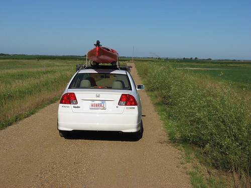
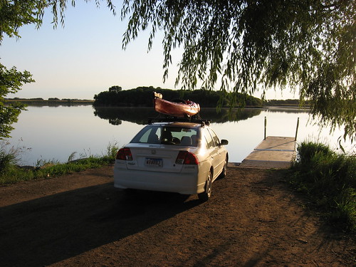
The forecast yesterday for this morning seemed the best this week for kayaking: light winds, sunny, no rain. So, to lock in my intentions, I loaded up the kayak on the car last night so that I might make a quick getaway after my bagel, coffee, and hour-long read at my routine morning spot.
IMG_6571.JPG
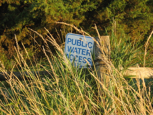
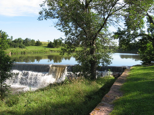
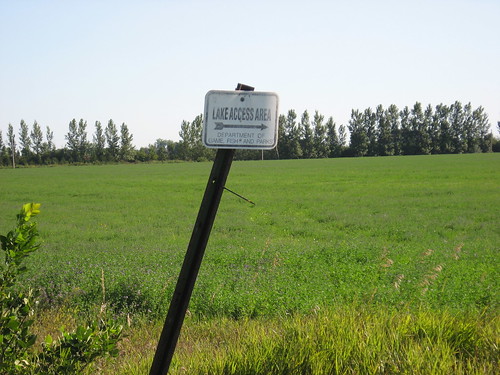
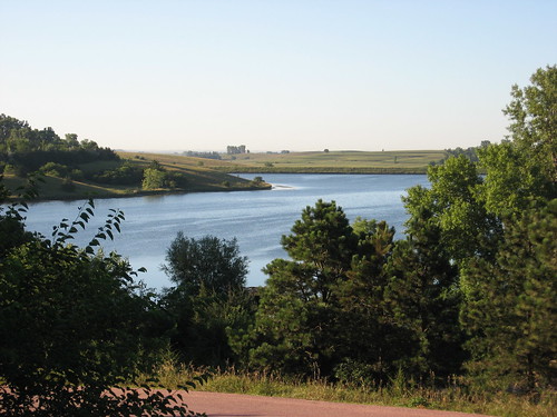
I wanted to revisit Beaver Lake, a body of water that I last paddled in May, just as the area was experiencing the arrival of spring. Beaver Lake is about 25 miles from my eastside Sioux Falls home and an easy drive out on Interstate 90 to Humboldt. The lake is about 300 acres, roughly three times the size of Lake Alvin. As I arrived in Humboldt this morning looking for the gas station that marks the road leading past the cemetery and the back of the elementary school and on to the lakeshore, I thought about how hard it would be for someone to actually locate the lake. Signage is not a strength here in South Dakota, especially when searching for a lake. There is nothing indicating a lake or launching area until passing an obscure small sign covered in weeds, and there is almost never a sign providing a name for a lake. Perhaps this is to keep such locations nearly private, only accessible to those in the know. Specific driving directions from Sioux Falls are provided on earlier narratives located in the area waterways inventory on the right side of this blog.
IMG_6576.JPG
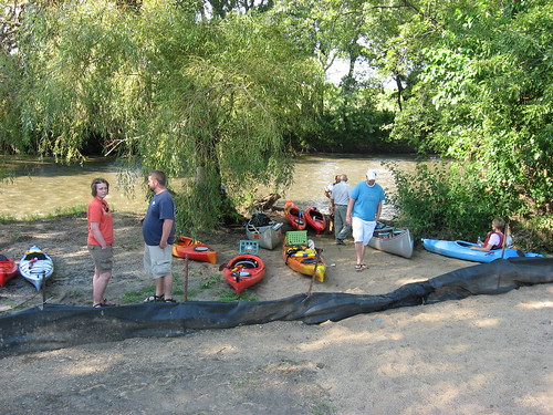
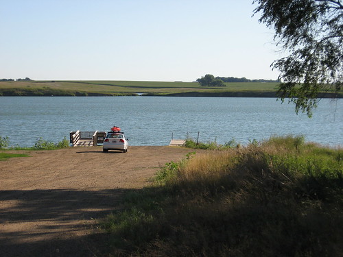
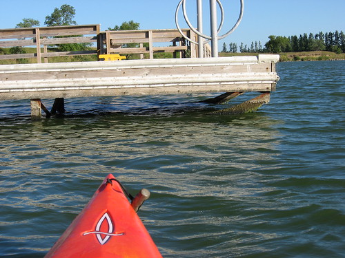
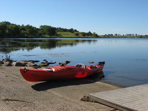
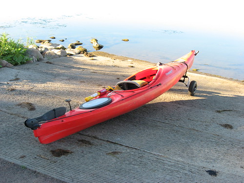
The launch area is quite nice and has a ramp, dock, ample parking, and a vault toilet. There was no one about, neither on the shore nor on the water; I was completely alone for my cruise.
IMG_6574.JPG
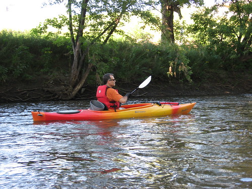
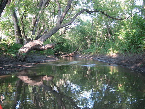
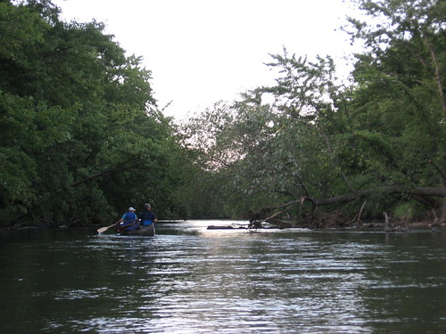
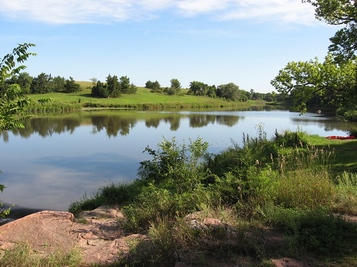
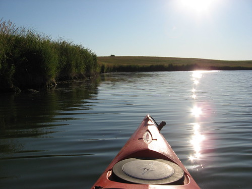
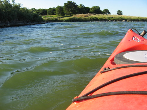
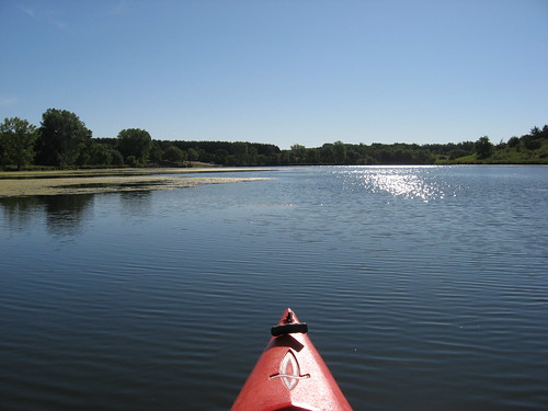
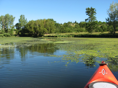
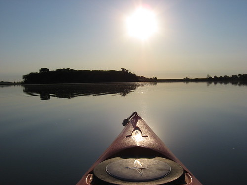
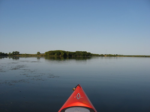
I launched my kayak at 7:45 a.m. into mirror calm waters. This lake can be quite a challenge when there is a stiff wind, but today it was just beautiful. I rushed through my readiness steps so that I could get underway before a wind arose to shatter the reflective surface.
IMG_6611.JPG
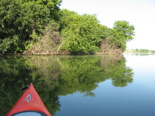
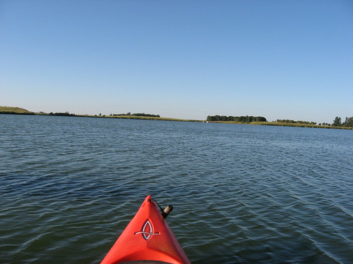
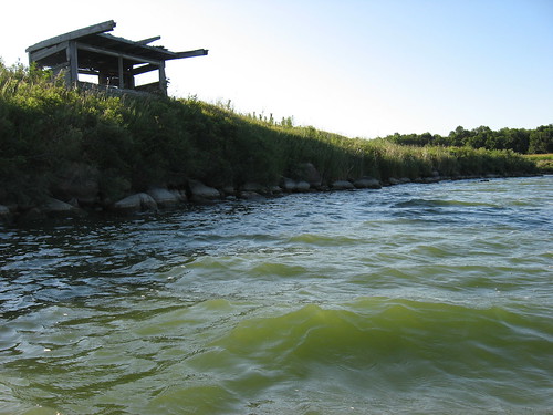
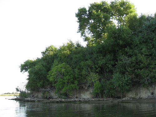
My usual route on Beaver Lake is to take off from the launching area on the southern end of the lake and head out to the island directly in front of the ramp. The island is heavily wooded with a varied shoreline. The southwestern side has high cut banks, perhaps up to 20 feet in height, while the eastern and northern shoreline is gently shelving into a thickly wooded interior.
IMG_6612.JPG
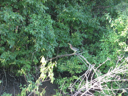
The island is a bird paradise. I have seen great blue heron, egrets, owls, geese, ducks, and a great variety of perching birds. There does not seem to be any clear path into the interior of the island. I suppose that there is some animal life that either swims to the island or is stranded after crossing during the winter, although I have seen only squirrels.
IMG_6606.JPG
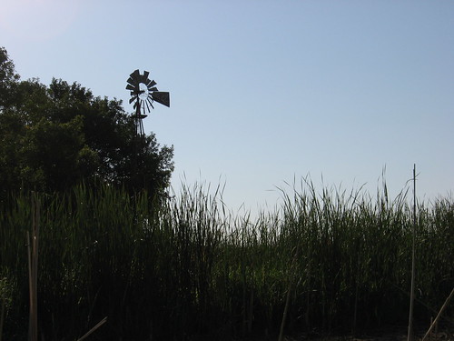
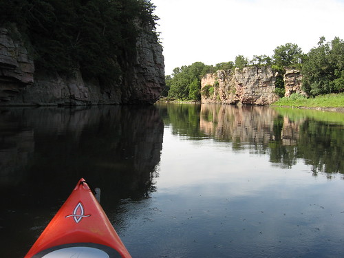
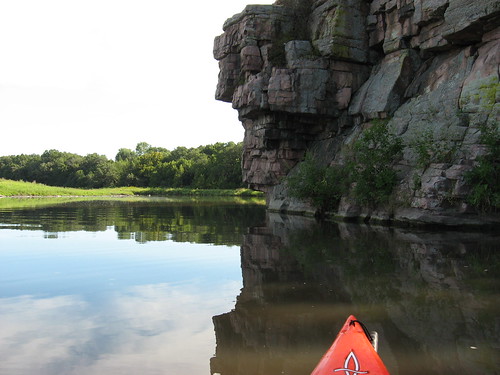
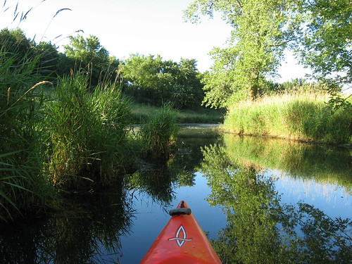
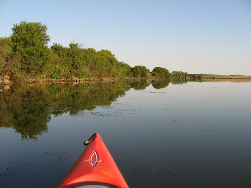
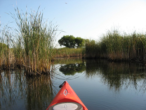
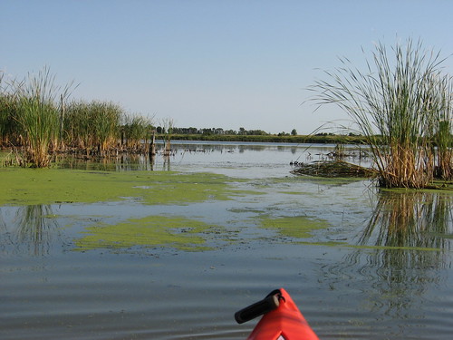
As nearly always, I paddled out to the island and went right around the eastern shore to the north and entered the northeastern arm of the lake. Keeping to the right side, I paddled close along the shore until I came to the channel, marked by an old windmill, leading south about 1,000 feet into a large marshy pool.
IMG_6581.JPG
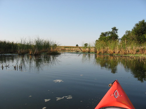
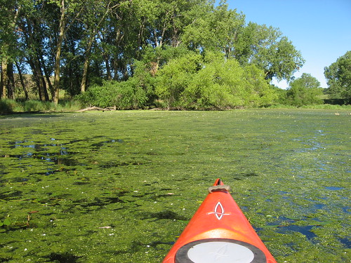
This pool is deep in the marsh and bordered by tall rushes and cattails. There are beaver lodges aplenty throughout the channel and the pool. Also, this is a nesting area for a great variety of waterfowl and perching birds.
IMG_6599.JPG
I like to ground my kayak among the rushes and sit quietly watching the reappearance of birds that took flight initially upon my arrival.
IMG_6596.JPG
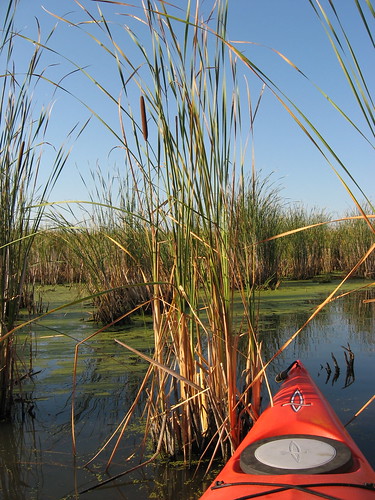
Sitting there in the pool is a great vantage point for observing the life of this secluded spot.
IMG_6581.JPG
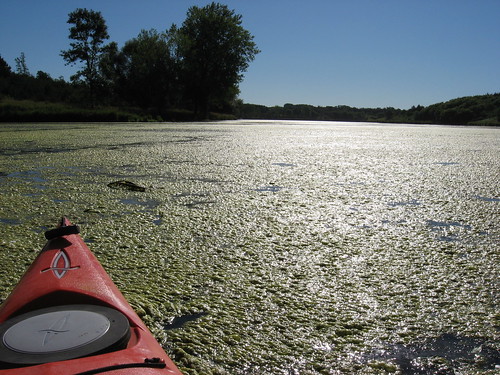
Even though the lake has lost some depth at this point in the summer, there was plenty of water to float my kayak anywhere I wanted to go.
IMG_6603.JPG
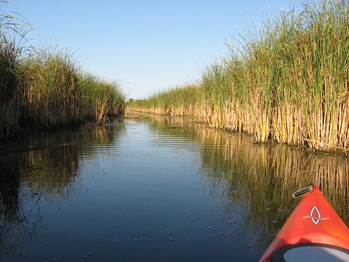
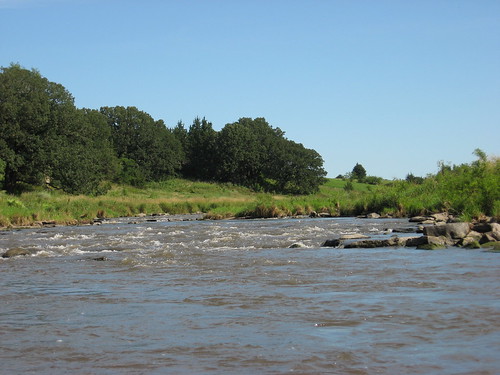
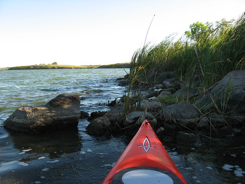
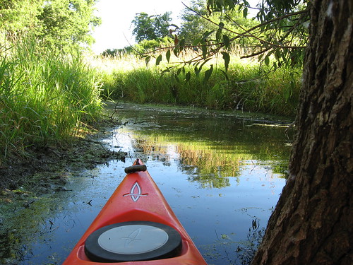
After my cruise through that channel and into the pool, I reentered the eastern arm of the lake and continued east to the end. On the north side of the very end of this arm, there is another channel that flows northeast and allows passage for about 800 feet through the marsh and rushes. As always, I continued up this channel until my forward progress was halted by a single-wire fence. This channel was pretty shallow with depth ranging from just a few inches to perhaps one or two feet. As I thrust my paddle down, it sank into about a foot of muck. I did not want to be in a situation where I had to get out of a grounded kayak and find myself flailing around in muck that reached my knees. But, this did not happen, and I continued as usual until I reached the wire.
IMG_6615.JPG
Coming back, I returned to the island and continued around the remaining shoreline, peering into the interior and impressed by the constant cacophony of bird calls – calls from unseen birds deep in the woods.
IMG_6579.JPG
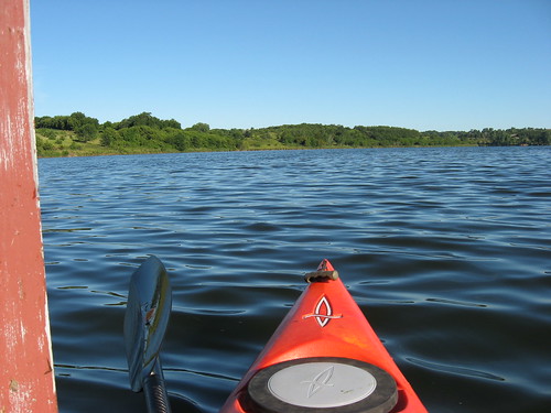
I was out for about two hours this morning. While I was out, the mirror calm was replaced by a surface sculpted into wavelets from a developing light breeze. Again, the inescapable lesson of lake cruising in South Dakota: go paddling early!
IMG_6609.JPG
Beaver Lake is a very nice spot for varied landscape and bird watching. As the reader might review in earlier narratives (see the inventory of specific paddling areas on the right side of the blog), this is also a lake that can become dangerous when the wind rises. I have a paddling colleague who goes out to Beaver Lake during windy conditions specifically to ride the waves, but I prefer a calm water surface, especially when out alone. My tip-off for going to Beaver Lake is a forecast that calls for winds from 5-15 mph, and then I go early to take advantage of the calmest part of the day.

Thursday, August 18, 2011

Big Sioux River Clean-Up: August 2011

IMG_6546.JPG
One of the public service activities sponsored by the South Dakota Canoe/Kayak Association is an annual river clean-up. This year, the group took on a section of the Big Sioux River through Sioux Falls from the “put-in” near 57th Street and Western to the “take-out” at 26th Street and Southeastern Ave.
IMG_6547.JPG
At 5:30 p.m. yesterday afternoon, about 18 paddlers with at least four canoes and ten or more kayaks assembled at the put-in and arranged a shuttle of vehicles downstream to the take-out. The general plan was to have the canoes move down the river functioning as “mother ships” with the fleet of kayaks picking up rubbish along the banks. In actual operation, though, the canoes were just as engaged in gathering debris as the kayak; in fact, the canoes were able to pick up large items that the kayaks just could not handle.
IMG_6550.JPG
Some of the kayaks had milk crates strapped on the forward deck, while others had other types of containers to hold debris. Everyone had a supply of plastic garbage bags into which rubbish was stuffed. Sometimes the kayaks handed off materials to the canoes.
IMG_6548.JPG
The river was still pretty high and running fast as we set out. The fast flow created an opportunity for paddlers to work on their maneuvering skills as they angled in to pick up plastic bottles, plastic bags, styrofoam, cardboard coffee cups, and other bits of trash. It was often a judgment call to risk a capsize or being caught up in a strainer in order to snag a discarded plastic soda bottle. The river was flowing so fast that it was often necessary to circle back and move upstream along the shore to retrieve a piece of debris.
IMG_6551.JPG
The boats moved out in a group and I wondered if there would be enough trash for so many boats. I was one of the first paddlers to move downstream and was able to gather the “low hanging fruit” at first. About fifteen minutes into the trip, I moved into a narrow channel that had created an island in the river. The stream I followed was deep enough to easily navigate, but I was alone. As I continued to move down this channel, I saw that no one had followed.
IMG_6555.JPG
After about 15 minutes, I reentered the main course of the river and saw only one other boat, an aluminum canoe with two guys weighted down with some heavy debris, including a couple of long boards, most of a child’s wadding pool, and other items that made the canoe seem more like a barge.
IMG_6552.JPG
We two boats continued along the course of the river. I had no idea whether we were in the lead or in the rear; there was no sign of any of the other dozen boats. We both continued to load up our boats as we moved downstream. From the point where we encountered each other until the end, there was no sign of any other boat. It was as if we were alone on the river.
IMG_6557.JPG
As we approached the rapids under the bicycle trail bridge, I could hear the water rushing over the rocks. My normal practice is to hang back and watch someone else go through the rapids first and, if they are successful, to follow their track. The guys in the canoe, however, wanted me to go first. The last time I came through this stretch, the water was so high that there was no sign of rapids. This time, though, it was different. I thought I recalled that it was best to head to the right side of the rapids, and this is what I did. As I was moving through, I saw rocks ahead and had to move between them. Later, David Finck told me that I took the wrong side; it would have been better to shoot through the center. But, I made it through and, so I heard, did all the other boats. I generally feel a little tense as I approach these rapids, even though I have never had a problem with them. The next time, I will try to follow my routine and observe someone else go through first and follow along in that pathway. There is a sense of exhilaration at shooting through these rapids, and we all hope that there will be spectators on the bridge to appreciate our skill and courage!
IMG_6559.JPG
I understand that two of the kayaks capsized in waist-deep water when approaching a downed tree (strainer). A capsize would be easy with kayaks maneuvering to gather litter caught up along the shore or in strainers.
IMG_6554.JPG
Also, the kayaks were loaded up with debris, making them more unwieldy.
IMG_6565.JPG
When we got to the take-out, my canoeing companions and I were indeed the first boats in. Zach, of Zach’s Kayaks and Canoes, was at the landing to help pull the boats up. The bank at the take-out is muddy and steep. Someone to help people get their boats out is certainly welcome, and Zach was there! In fact, he contributed two canoes to the clean-up effort and stayed at the landing assisting people until we were all ashore. Zach told me, by the way, that this stretch of river that we paddled was the primer route selected by his clients.
IMG_6564.JPG
Within ten minutes or so, other boats began arriving with their load of rubbish. We created a large heap of debris, mostly more than twenty large garbage bags full of junk. The canoes had some larger items, including a television set. Someone picked up two pairs of tennis shoes tied together. A small bullhead was in one of the shoes, and I took him back to the river to live on a while longer.
IMG_6561.JPG
The last two kayaks arrived about 8:30 p.m. in the dark. We piled up the debris, took a group photo, and called it a good effort.
IMG_6570.JPG
The last time the club did a Big Sioux River clean-up, there was one canoe and three kayaks involved. This year we had about 18 people and more than a dozen boats. I think that the large number of people turning up is an indication of the increasing popularity of kayaking in our area and the increasingly robust nature of the SDCKA.
IMG_6567.JPG

Wednesday, August 10, 2011

Split Rock Creek - Through the Palisades: August 2011

IMG_6497.JPG
With a forecast for today similar to yesterday, I just left the kayak on the car top and planned on another cruise. This morning was nearly perfect: temperature about 60, calm winds, sunny skies – just right for a return to Garretson City Park and a cruise upstream from the dam and through the palisades. My last trip on this waterway was April, a time when the spring growth was just developing.
IMG_6498.JPG
Garretson City Park was nearly deserted this morning. I have never come across another kayak or canoe during my cruises on this section of Split Rock Creek. Occasionally, I see the pontoon boat “Jesse James” taking people on a sightseeing cruise upstream, but not today.
IMG_6534.JPG
While at 9:30 a.m. there was plenty of sun, it was below the cliffs on the right side going upstream, creating interesting shadows that highlighted reflections of the cliff face and the vegetation growing on ledges, in cracks, and on top.
IMG_6513.JPG
There are high cliffs scattered along both sides of this impounded creek. The water is quite deep in the channel, although there are rocks just under the surface along the low banks. These are the type of rocks that can “highside” a kayak in water that is sometimes three feet deep. Getting off these rocks can present a risk of upset since it is difficult to fend off the bottom or to get out of the boat. I did find myself caught on rocks a couple of times, but I got off without incident and just moved further out into the channel. In the channel, I could not touch bottom with my extended double-bladed paddle.
IMG_6508.JPG
I did not see much wildlife today – really only some perching birds, a few jumping fish, turtles, and a muskrat, similar to yesterday’s paddle on Loss Lake.
IMG_6531.JPG
There are a couple of homes built on a rise at the end of the impounded waters at the entrance of the creek flowing through. While the water level is no doubt a bit lower than it was earlier in the season, there was no problem moving up through this familiar waterway.
IMG_6539.JPG
On the way back, as usual, I ducked through the arched bridge leading into Devil’s Gulch. This is one of my favorite sections of the cruise, and I never miss the opportunity to slip into this secluded world. There was a section of heavy algae and aquatic grasses midway in the Gulch stream, but the water was fairly clear at the far end where a brook feeds into the creek and then clear again as the water passed through the bridge.
IMG_6541.JPG
This cruise offers solitude and a chance to observe the great variety of plant life that find ways to thrive on the cliff faces. A railroad runs off to the right side going upstream, but the vegetation obscures the train itself; when a train passes, there is the romantic sound of the whistle and a distant roar of passing cars. Cruising along, I glanced up to watch east-bound passing jet planes with their contrails extending back as the aircraft swept over this “fly-over” state. Water pouring over the dam spillway is clearly heard upon departure and return from the put-in.
IMG_6518.JPG
I lingered on the water for about 90 minutes this morning. As I have noted before, this is perhaps the most scenic paddling opportunity in the Sioux Falls area, and it is a place I almost always introduce to friends or relatives who are new to kayaking.
IMG_6524.JPG
A full range of narratives from previous cruises upstream from Garretson City Park as well as other sections of Split Rock can be reviewed in the "Area Waterways" list on the right side of the blog.

Tuesday, August 09, 2011

Loss Lake - August 2011

IMG_6494.JPG
The heat wave seems to have passed for now here in Sioux Falls. As I looked at the weather forecast over the next few days, I knew that now is the time to get out on the water again. So, this morning I got back into my morning paddling routine and stopped by my bagel spot for a bagel, coffee, and an hour-long read before heading out to Loss Lake, a small lake west of Sioux Falls (west on SD 42 to SD 19, north 2.5 miles, back east along a dirt road for about .5 miles to the lakeside).
IMG_6495.JPG
Like most of these small lakes, there is very limited signage and no location identification. Because of an error in one publication, there has been some confusion about the name of this lake. Some people call it Lost Lake, but that is not correct. The South Dakota Game Fish and Parks identifies it as Loss Lake, and that is the agency that owns the access area – parking, dock, fishing pier, vault toilet. The data about the lake can be found on the SDGFP web site at the following URL: http://gfp.sd.gov/fishing-boating/fishing-access.aspx Loss Lake is south of I 90, Lost Lake is north several miles, near Humboldt.
IMG_6491.JPG
The lake was deserted when I arrived at 7:30 a.m., and no one appeared during my 90 minutes at the location. The skies were sunny and the winds seemed light when I arrived but steadily build to a moderate breeze by the time I finished my one-hour cruise around the perimeter.
IMG_6478.JPG
The shoreline around Loss Lake is generally grasses, with some tree cover limited to the southern shore. The banks are high, so that even with a wind there is a lee to be found under the shelter of the bank, at least along the shore from where the wind is blowing.
IMG_6482.JPG
There is one home on the western side of the lake, and there is an old structure on the eastern shore that was the official’s station for hydroplane races that were held on the lake many years ago. I have often speculated about the atmosphere that might have characterized this lake years ago when the hydroplanes were roaring across the surface and the crowds were cheering on their favorite. The official’s station seems to just be a little bit more weathered each year.
IMG_6480.JPG
Sometimes I have seen pelicans on the lake. Today, though, wildlife was scarce; I came across a muskrat, an egret, a few duck-like waterfowl, some jumping fish, and the occasional turtle’s head poking above the water to check out the passing kayak. My favorite time to visit the lake is in early spring when ducks and geese are nesting. I waited too long this year for my annual visit.
IMG_6487.JPG
While the water was pretty smooth when I set out this morning on the west side, by the time I got around to the east side the wind had increased. There were enough waves by then to provide a little bounce to the ride, and one wave slopped over the cockpit coaming to douse me. From the water stains on the dock, it would seem that the lake level is between one and two feet lower than when the dock was installed this spring.
IMG_6488.JPG
Loss Lake is not an exciting lake to explore. It is pretty small and includes only the main body and one bay that extends off into the northeast. What seems to be the feeder creek is fenced off with an electric wire. It does, however, provide the opportunity for a quiet and contemplative one-hour paddle. I have been informed by those fishing the lake that the water is deep and seems to provide good habitat for the fish. The distance from my eastside Sioux Falls home to the lakeshore is about 25 miles. Further details of earlier cruises on Loss Lake can be found in the "Area Waterways" inventory on the right side of the blog.
IMG_6484.JPG

Wednesday, August 03, 2011

Lake Lakota - August 2011

IMG_6443.JPG
We finally escaped from a prolonged heat wave here on the northern plains; this morning the temperature was in the low 60s, the skies were clear, the wind moderate, and the high only expected to climb into the mid 80s. For the past month or so, family events and then the heat have moderated my kayaking. I have taken people out on Lake Alvin a couple of times, but my routine summer cruising has been on hold. This morning, I left home around 6:00 a.m., had my usual bagel, coffee, and an hour for reading my latest novel before heading out to Lake Lakota, a part of Newton Hills State Park.
IMG_6471.JPG
I arrived at the launching area by 7:30 a.m. and, as expected, found it deserted. My last trip to Lake Lakota was in early April, and the first hints of spring growth were visible. Mostly, though, the area was still clothed in the drab brown that follows the snowmelt. Today, the area looked transformed and predominately green: grass, flowers, leafed-out trees, and a good share of the lake surface.
IMG_6445.JPG
As I moved my kayak over to the launch area, I saw a pair of pants lying on the surface of the ramp: jeans, belt, and some loose bills both on the ramp surface and in the pockets of the jeans. There was no identification. I wondered how a person could forget his pants; was he so absent minded or was he wasted so much that he was unaware of his circumstances. I hung the pants with the cash on a posted sign and took off. When I returned two hours later, there was a parks guy driving a mowing machine. I let him know about the pants and the cash, and he told me he would take them to the park office for Newton Hills.
IMG_6468.JPG
The lake was tranquil, and I began my usual clockwise circuit, heading left (east) from the dock. There is an inlet on the eastern side that extends back into the bush for a few hundred yards, and I always move up into this creek-like flow until I reach the point where further travel is no longer possible.
IMG_6451.JPG
I like to sit quietly in the kayak to listen to the sounds resuming after my passage. This seems to me like a special place where I can listen to the backwaters sounds of wind in the trees, insects, and bird life.
IMG_6449.JPG
Continuing on my cruise around the shoreline of the lake, I headed south to the dam and spillway for Pattee Creek. The entire lake is within Newton Hills State Park, so the shoreline has no visible reminder of the larger outside world.
IMG_6457.JPG
There is a great deal of aquatic growth on the lake now and extending in deep banks of seaweed-like plants just under much of the surface. The surface growth generally extends out about 10 feet from the shoreline on much of the lake. Even away from the shoreline, however, there are walls of plant growth that are several feet deep. This degree of growth seems present in the summer, but it is not so evident during the spring and fall. I imagine that motorboats would have some difficulty in keeping propellers clear of this growth, and fisherman would have the same trouble in casting their lines. A kayak, however, can just glide over most of the aquatic growth. Motorboats would seem restricted to the open areas in the center of the lake.
IMG_6463.JPG
From the dam, I cruised back down the western shore and into the arm that extends west to the Pattee Creek inlet, and this is where the surface growth is most intensive. As I moved through heavy plant growth, my kayak slid along the surface and my paddles brought up heavy “seaweed” with each stroke. I was reminded of my snowshoeing this past winter. I was, in effect, skimming along the surface of pretty deep plant life. It was not quite thick enough to be “poling,” but it was certainly not normal cruising. Once, I found myself aground and thought about how unpleasant it would be to have to exit the kayak and wade through the muck to a deeper spot.
IMG_6464.JPG
In any event, I was able to move back into deeper water and continue on. I noticed that there were streaks of clear water weaving through the seaweed, and I headed over to these river-like passageways through the plants. It seemed rather like following a lead in the polar seas between ice floes.
IMG_6467.JPG
This was a good contemplative cruise, and I enjoyed it very much. I was out for an hour and a-half and was able to experience a variety of waters. On most of my cruises, I try to pick up six bottles or cans that I find floating or embedded along the shore. That is about what I can fit into the bottom of my kayak without feeling crowded, and I did that today.
IMG_6446.JPG