
Monday, December 25, 2006
Saturday, December 16, 2006
Arm Chair Kayaking
Here in most of South Dakota, the paddling season comes to a halt in late October or early November. There are some brave souls who canoe/kayak on the Missouri River near Vermillion nearly all year, but that is pretty cold water and is outside the pale for most paddlers. Here in the Sioux Falls area, the rivers, creeks, and lakes are now frozen. Even though we have so far had an unseasonably warm winter, there is still ice cover on these waterways. It will be late February before the fastest streams begin to flow, and that sort of paddling requires – or should require – a wet suit and a willingness to get wet and be cold. For most of us, we feel lucky when able to get out on the water in March; and for many of us, it tends to be April before we feel comfortable, even along the shore line of nearby lakes. This past spring, I was able to get out on lakes in March, but then it got cold again through much of April.
The South Dakota Canoe Association hosts a winter conference in Sioux Falls each January, and area paddlers gather to hear tales about grand trips members have taken, see a range of boats that members have made, and plan activities for the coming season. This is a good time to sit back, watch the videos that people have made, and think about the fun ahead within a few weeks. It is also time to connect with area paddlers. As details of the conference this year develop, I will post what information I receive.
This is also a time for arm chair paddling, and I want to offer a retrospective on some of the paddling books that I have been reading this year.
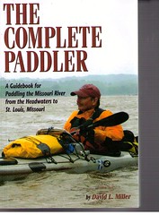
Right now, I am reading The Complete Paddler, A Guidebook for Paddling the Missouri River from the Headwaters to St. Louis, Missouri by David L. Miller. Miller is a professor of geography at a university in New Your and has a long fascination with the Missouri River. In this account, he takes us on a detailed journey down the entire 2,321 miles of the river and offers us his observations and advice for such a river journey. Interestingly, he describes paddling the 240 mile Lake Oahe segment as the most difficult paddling he has ever done. His description of the weather, the hazards, the physical aspect of the river, the communities, and the people is compelling. We in South Dakota can readily travel along with Miller as he passes familiar points within this state. Chad Caldwell, of Missouri River Expeditions in Vermillion, makes an appearance in this book as he travels with Miller from Vermillion down to Ponca State Park along the river.
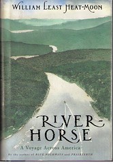
A couple of years ago, I read River Horse, by William Least Heat-Moon. This is an account of a trip across America by water, beginning in New York Harbor, up the Hudson, through a series of rivers, including the Missouri, to the Columbia River at Astoria, Oregon. This is a great book by a gifted writer. He appeared at USD a couple of years ago to offer his observations about the trip, and I was fortunate enough to be in the audience and later to meet him. This book is a look at America from the perspective of a river traveler, and it rather harkens back to a bygone era when that was the dominate transportation mode through the heartland. Least Heat-Moon devotes some good description to his travels through South Dakota along the river, including especially his time in Chamberlain and up to Bismarck.
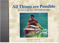
Verlen Kruger is a near icon among those who seek out expedition travel in canoes or kayaks. Kruger is the person who did over 100,000 miles of expedition canoe travel throughout North and South America. He designed the famous Loon decked canoe and with it made some incredible journeys. Kruger did not begin his paddling career until age 41. I first heard of Verlen Kruger through his articles in Canoe Magazine, and then I heard Dick Davidson speaking of him. Davidson is one of the most amazing people I have ever met in the canoe world. He lives here in Sioux Falls, but he has been on numerous very long canoe expeditions, including trips to the Artic Ocean and along the Yukon River. For most of the past decades, Dick has been the president of the South Dakota Canoe Association. His boat is a Loon decked canoe, designed by Verlen Kruger. This book, All Things are Possible, is not really the most expedition oriented reading; instead, it is an account of Kruger’s life. Canoe expeditions, of course, were a very major part of his life, so this book does feature the many travels he made over about thirty years. It is full of photographs and is an easy read. The book is new, and I ordered it from one of the advertisements within Canoe Magazine.
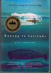
Finally, I read Rowing to Latitude by Jill Fredston this year. Fredston and her husband live in Alaska and they have traveled the coast lines from Seattle through the northern part of Alaska, along the Beaufort Sea, and along the entire length of the Yukon and Mackenzie Rivers. Her boat of choice is a seagoing rowing shell. Her husband used a sea kayak for much of the travels, but later changed to the rowing shell as well. In addition to her Alaska trips, she has also rowed the east coast of Canada from Newfoundland to the northern part of Labrador, the west coast of Greenland, the coast of Norway and a circumnavigation of Spitsbergen Island (Svalbard). Jill Fredston is a great writer, and her narrative also includes a healthy description of a life style that concentrates more upon experiences than the accumulation of possessions. I bought this book at Barnes and Nobel.
Tuesday, November 07, 2006
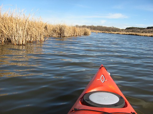
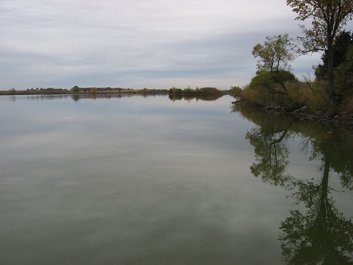
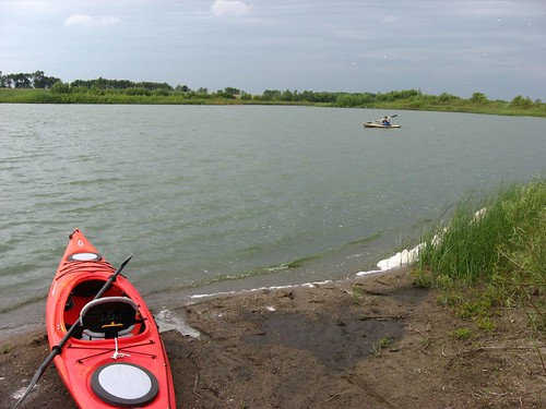
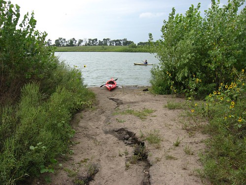
Lake Vermillion - A November Cruise
Earlier in the blog there is a description of my kayaking cruises at the southwestern end of Lake Vermillion, running into Battle Creek. Lake Vermillion is about 25 miles west of Sioux Falls, just north of Highway 42. I found this part of the lake to be more tranquil because of a lack of other watercraft. Also, it is a sheltered part of the lake and not nearly as subject to wind conditions. Today, however, I decided to return to Lake Vermillion and cruise up into the main body.
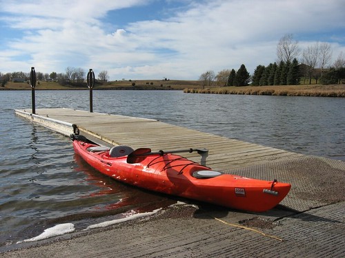
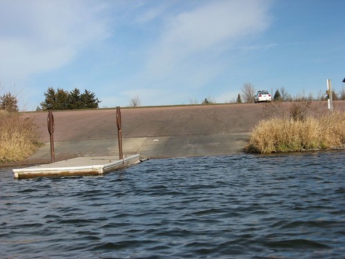
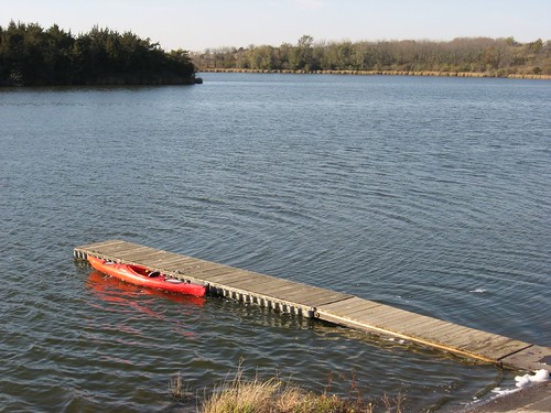
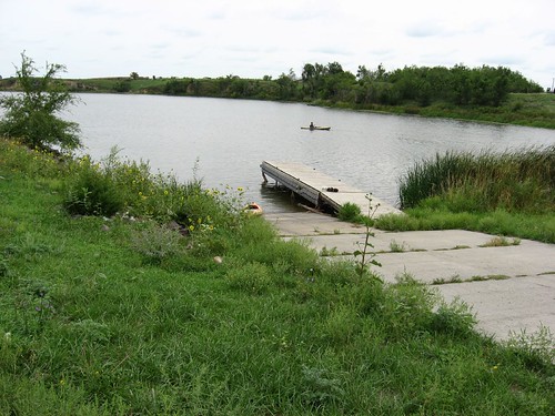
Lake Vermillion is generally in the shape of the lower case letter “j.” The curl of the letter is the lower, southwestern arm that is fed by Battle Creek. The longer arm is oriented north and south and is much narrower than it is long. The South Dakota Department of Game, Fish, and Parks maintains two access points. On north shore of the east/west lower arm, there is a well developed launching point with a first rate dock and boat ramp. There is also a restroom facility, picnic areas, and camping sites, including three of those small log cabins. In addition, there is an access point on the southeastern shore just north of the dam.
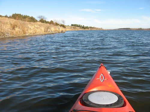
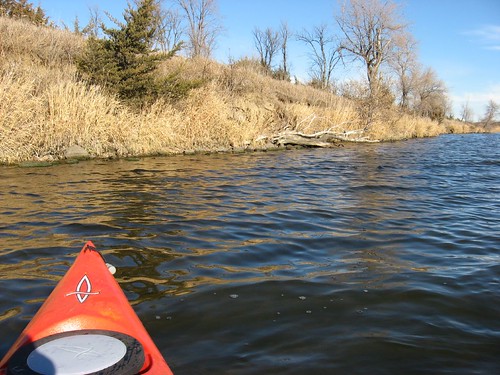
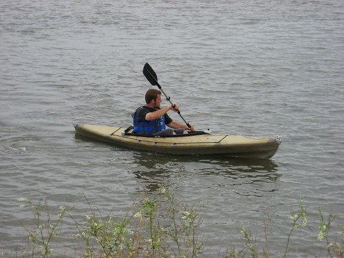
I put in at the main launching point in the park and headed east to the main body and then went north along the western shore to the point where the lake turns into the Vermillion River. The lake is probably about three miles in length, including the lower arm. I moved up the western shore pushed by a southerly wind. When moving with the wind, there are frequently waves generated, and on this occasion the waves were, at times, perhaps six or eight inches in height. The water offered a clear view of the bottom at four feet depth. I kept looking for wildlife along the banks, but there was little to be seen. About a mile into the cruise, I must have flushed up a group of pheasants. Maybe a dozen of them shot up through the grasses and took off flying. Now, I had hoped not to see any pheasants! I had visions of guys with red caps and guns tearing through the brush trying to get their limit, and that notion had caused me a little anxiety even before taking off for a cruise. But, there were no hunters to be seen nor gun shots heard. I did see a group of cormorants moving off as I approached. Other than those birds, though, I saw no wild life.
I came across a single fishing boat about halfway up the lake. As I approached, I called out a greeting, and the guy seemed startled; he kept swinging his head around in different directions trying to localize the sound. Perhaps he was lost in his own thoughts and just didn’t see or hear the silent approach of my kayak. Later, on the trip back down the lake, I came across him again. I observed what a wonderful gift a great day like today is to us; he said, “Yeah, we’ll pay for it though!” With that affirming conversation, I paddled on.
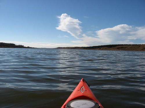
The lake continues as a rather wide body of water for about two and a-half miles upstream. At that point, the lake narrows from the western shore until it blends into the Vermillion River. I made it to that northern end of the actual lake in about an hour and a quarter. It took me about the same time to get back. I was going into the wind, but I was also moving right along in the main channel. So, the trip took me two and a-half hours, and that is about all the time that I can manage in a kayak without getting out.
The lake has a few expensive looking homes along the southeastern shore, right across from the state park. Then, there is a community of homes at the very southwestern end along the highway and across from the launching point at the park. After leaving the launching point, however, I did not see another dock. The eastern side of the lake seems more scenic to me, with high cliffs and no development after those first few expensive homes at the very southern end of the lake above the dam. The next time I go to Lake Vermillion, I think that I will take advantage of the southeastern launching point and move up the eastern shore.
Going out in my kayak in November was a real treat to me. Today, the temperature was expected to reach nearly 70. I was kayaking with no jacket, just a wind shirt for the morning. I generally have taken the kayak rack off my car and put my boats away for the winter by now. Of course, I am in the first year of retirement, and I have more opportunities to take advantage of very nice days in the late fall. Still, I feel fortunate to have had this opportunity for another cruise this year.
Wednesday, October 25, 2006
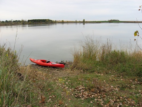
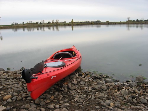
Lake Alvin - Paddling Season Coming to a Close
This was a beautiful fall day in late October, and I wanted to be sure and get in at least one last cruise before the onset of winter. I decided to head out to Lake Alvin, about 10 miles southeast of Sioux Falls, and see how the lake environment was changing as the season advances. I arrived about 10:00 a.m. to a deserted lake – no cars, no boats, no people about – and a temperature of about 40 degrees. The sun was bright on the water; there was a little breeze that created wind waves in the more exposed portion of the lake of about 4 inches or so. I stayed out for about two hours, and the temperature gradually rose into the 50s. I did not need a jacket nor were gloves necessary.
>
The docks are still in at both the State Park and at the public access area. More importantly, the water was higher than I had seen it all summer. I was able to paddle up into the outlet of the lake all the way to the spillway without touching bottom. I paddled around the total perimeter of the lake and then went up Nine Mile Creek until I reached the bridge over 479th Ave. This was the first time since last spring that I was able to make it up Nine Mile, and I could easily have continued even further. The water in the creek was consistently 3 to 4 feet deep. The water throughout the lake was clearer than it has been; I could see bottom easily up to about 2 ½ feet.
During most of the cruise, there was little sign of wildlife; but, as I moved up into the southwestern part of the lake toward the mouth of Nine Mile Creek, I saw lots of waterfowl. I came across a large flock of geese – maybe 30 of them – and they remained stationary on the water as I allowed my kayak to drift along with the wind toward them. There were a couple groups of ducks behind the geese, and they were spooked by my presence and flew off. Later, the geese also took off in a group and moved east, away from me. At about the same point, I saw multiple large bullheads coming up to the surface of the water around my kayak.

The cruise was pretty quiet. As I mentioned, there were no other boats. From time-to-time, there was some vehicle noise, but mostly the only sound was the wind moving through the dried leaves of large cottonwood trees.
On this trip, I put in at the State Park and was able to enter and exit the kayak from the dock without getting my feet wet. The water was a little chilly, and I did not want to wade into the lake to get into the kayak. It all worked out pretty well, and I had a totally dry cruise around the lake.
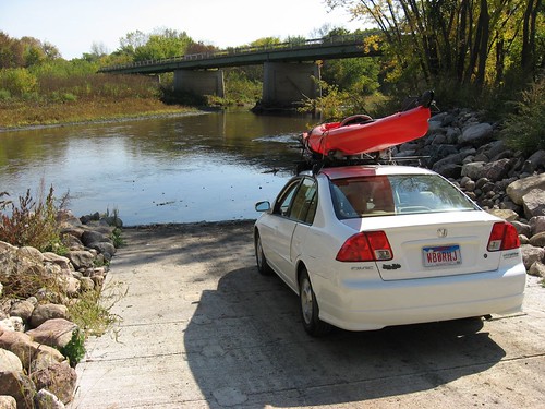
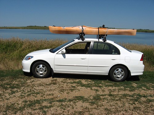
Normally, by this time of the year I have taken the Yakama rack off the top of my car. I have a Honda Civic Gas/Electric car, and the rack has a major effect upon my gas mileage. Normally, I get close to 50 mpg with the Hybrid, but with the rack affixed to the top of the car, the mileage drops down to about 38 mpg. I think that I will leave the rack on a bit longer this year. I am hoping to get in another cruise before the inevitable winter conditions arrive.
There are a couple of earlier descriptions of conditions on Lake Alvin in this blog. If you are interested in reading more about this very accessible body of water, just look at some of the earlier entries. .
Saturday, October 14, 2006
Split Rock Creek to Big Sioux
The South Dakota Canoe Association sponsored a cruise today that began at McHardy Park in Brandon along Split Rock Creek and ended at the Highway 42 bridge over the Big Sioux River at the developing Arboretum to the east of the Perry Nature Center and across from Arrowhead Park at the eastern edge of Sioux Falls. Gene Preston of the SDCA organized and led the cruise, and there were four canoes and four kayaks that made up the fleet. One of the advantages of going on a SDCA sponsored cruise, of course, is the shuttle arrangements from the "take out" point back to the "put in." Gene made those arrangements and that made the trip so much easier for all.
The water was down a bit along Split Rock Creek, so the canoes put in at a point downstream. The kayaks, however, put in at McHardy Park along a sand beach. I took my older Dagger Bayou 10.5 foot kayak on the trip. Even though the kayaks bumped along on some rocks and scooted through some shallows, none of us had to get out of the boats during the trip. Split Rock Creek meanders along out of Brandon, past the race track, and through a variety of landforms and water conditions. There were a number of riffles to pass through, and occasionally some light rapids. The land was typical for prairie streams, low and high banks alternating and lots of old cottonwood trees. There was a good bit of bird life to observe, but the socializing aspect of a group cruise tends to warn wildlife off. Split Rock Creek passes the confluence of Beaver Creek and then the Big Sioux River. The passage becomes easier as each confluence is passed – more water, deeper passages, and fewer riffles.
The cruise for the kayaks took about three hours, with pretty steady movement. We did not stop for strolls along the sand and gravel bars. The road distance between the park in Brandon and the bridge at Highway 42 is about 6 miles. I would guess that the river mileage is more in the range of 10 miles. The temperature was about 50 degrees, it was sunny, and the breeze was light. Since none of the kayak paddlers had to get out into the water, it was a really great cruise.
This was a new waterway for me, although it has been frequently paddled. The SDCA has done this trip each year for some time. I am so glad to know about this paddling opportunity; I want to go on it next summer and
recreate the trip next fall as well. It is a wonderful half-day paddle.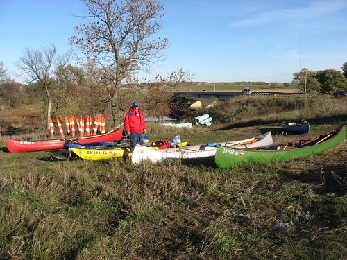
I had considered selling my older Dagger kayak because I bought a newer one this summer with additional features. This trip showed me, however, how useful it is to have a smaller and sturdy kayak for use in rocky rivers. All the kayaks were able to slide through and over rocks, and none of us were worried about damaging the boats. I would not want to take my Folbot or a handcrafted kayak down a waterway such as Split Rock Creek. So, I will just hang onto the old Dagger and use it for rougher waters. It has served me well.
Tuesday, October 10, 2006
Back to Grass Lake
This morning I decided to take advantage of a relatively nice day before the arrival of considerably colder weather. I left our eastside Sioux Falls home and drove out to Grass Lake, along 459th Ave, north of Highway 42 – about ten miles west of the city. I have described past paddles on Grass Lake earlier in the blog, and you might want to review that material along with my observations from today.
The lake was mirror calm and the temperature was probably about 45 degrees. I arrived at the launching point about 9:00 a.m., got the kayak off the car, put on my water sandals, and moved off into the lake. The lake was deserted, as normal for that body of water.
I set off down toward the west end of the lake, past the larger island, and began to encounter lots of waterfowl. The first birds I saw were great blue heron, and then there were lots of gulls flying about. Geese in great numbers were on the water and flying over the area. There were also a few ducks to be seen. I was happy to see that the pelicans had not left the lake yet. I first came across a small flock of about eight pelicans; then, as I continued down the western end of the lake, I came to the spot where I normally see pelicans in large numbers on a shelving gravel peninsular. On this trip, I saw an additional 30-40 more pelicans in a large group in the shallow water off the peninsular. The geese seemed skittish and flew off as I approached; the pelicans, however, seemed calmer and remained in place watching as I passed them in my kayak.
Along the way, I saw a beaver and a skunk, both moving away from me as I approached. On the south side of the lake, however, I came across a brown ferret moving along the water’s edge. The ferret seemed fearless. I stopped the kayak and moved along the shore to be close – less than ten feet. The ferret stayed in place and climbed up on a rock, stood on his hind legs and gave me a close examination. We looked at and followed each other along for about five minutes. To me, it was a real privilege to get so close to the ferret and share a mutual observation. The experience was much like the one I had with the family of raccoons as described in my earlier post of Grass Lake.
I continued kayaking for nearly an hour and a-half. By the time I made my way back to the “put-in,” my feet were pretty cold. I was wearing only the water sandals, and I had to wade in to launch the kayak. After I got the kayak back on top of the car and took off, I turned on the heater of my car for the first time this year. I need to look into finding some type of water shoes that might serve me better as the cold descends over the area.
Again, you can add these observations to my earlier posting on Grass Lake. It still is one of my favorite small lakes in the area. As I reached Highway 42 for the turn east back to Sioux Falls, I saw a real estate sign with a “for sale” notice for two sites “on the water” two miles north – it has to be Grass Lake. I suppose that it is only a matter of time before people begin constructing lake homes on this body of water, much as happened to so many other lakes. The only public area on the lake seems to be the boat access spot owned by the Dept. of Game, Fish, and Parks.
Tuesday, October 03, 2006
Big Sioux River
Unexpectedly late this morning, I found that I had a free day. It was beautiful outside with temperatures in the low 80s, clear skies, and a light wind – just a great fall day. So, I decided to take one of my kayaks out on the
The launching point is just upstream of the highway bridge, and it is not difficult to put a kayak into the water here. Like most river spots, there is a bit of black mud on the bottom, and it is difficult to get the boat in the water without stepping in a few inches of mud. I use a pair of water sandals that I can just hose off when I get home.

Thursday, September 07, 2006
Umbrella Sailing
Somewhere along the line, I heard about sailing a kayak using a golf umbrella. Golf umbrellas are just larger versions of the common rain umbrella, and they are readily available for purchase. I gave umbrella sailing a try some years ago on Lake Alvin and found it enjoyable to cruise past fishing boats while hanging onto an umbrella, laughing in the wind.

My 13 foot Dagger kayak has a rudder, and that is really necessary. After all, both hands are needed to hang onto the umbrella, and the foot operated rudder makes steerage possible. The umbrella can be easily positioned to adjust on either a horizontal or vertical plane. I have found that you can sail a kayak to about 45 degrees off the wind, so the umbrella effectively functions as a down wind sail. The rudder functions as a weak centerboard as well, so side slippage is reduced.
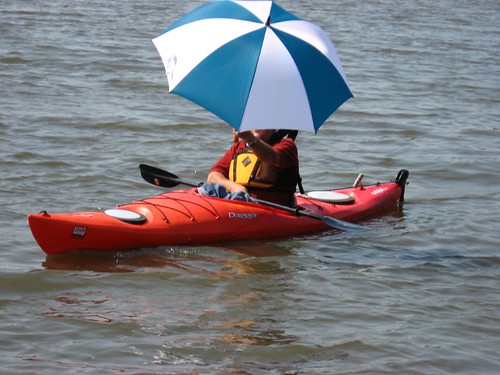
Sailing with an umbrella is an inherently unstable act. It is necessary to hang on to the umbrella with both hands and to slip it through the wind so that the force is sufficient to propel the kayak but not so strong as to roll it over. I have found that it is easy to slip the umbrella into a more forgiving angle to the wind when it begins to gust or if the kayak begins to feel unstable. At all times, though, the kayaker needs to be willing to just let go of the umbrella if instability develops or if the speed becomes uncomfortable. It is easy to go back and pick up the umbrella if it needs to be cast aside. Remember, the paddle is usually just laying across the cockpit of the kayak, and the kayaker has to be aware of that dynamic as well.
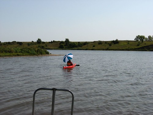
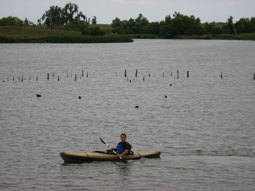
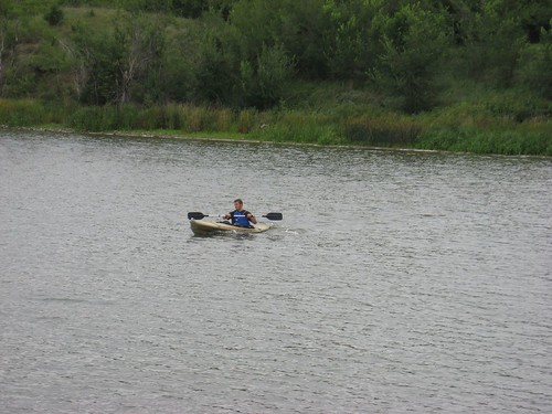
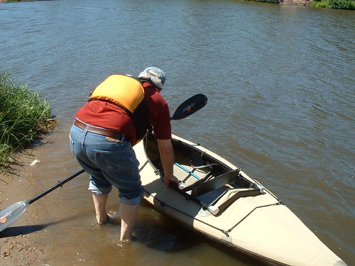
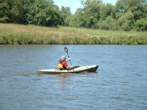
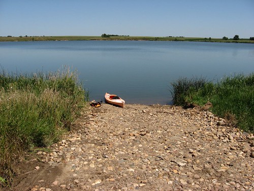
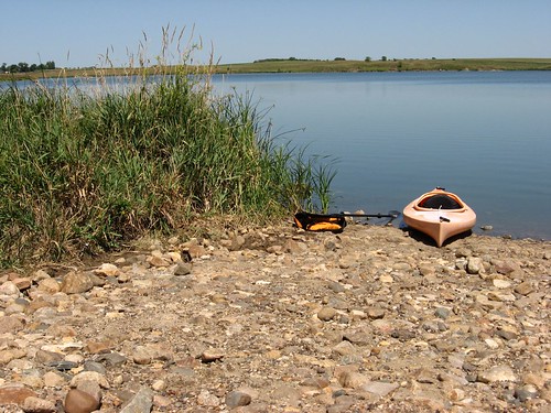
Today, September 7, I went to Lake Alvin with my son Derek to cruise around the lake with him. I took my golf umbrella to see how it would work with this kayak, and my son took the following photos to illustrate the cruise. We put in at the public access point on the western part of the lake, and I sailed nearly to the eastern end of the lake with the umbrella. The speed varied markedly because of the varied landform along the banks. My son was using my Folbot, and he is quite strong. He moves the kayak through the water at about its maximum speed. With the umbrella sail, I was unable to keep up with him over the long haul; he had to wait for me. Still, when the wind was blowing at a reasonable rate, my kayak cruised along raising a bow wave and leaving a wake.

I guess that I would caution anyone using an umbrella sail that maintaining stability is the critical issue. The umbrella adds an additional element to the cruise, but it also increases the chance of an upset. While I have not overturned a kayak yet, I know that using the umbrella adds some risk. I am prepared to let go of the umbrella whenever I feel any hint of instability. I also always wear a life jacket in a kayak, and I think that it would be foolhardy to go umbrella sailing without being prepared for the possibility of an upset.
It really is quite a sight to see a kayak cruising down the lake with a big umbrella held aloft. I keep the golf umbrella with my kayaking gear, and I will probably give this another shot this fall. It is a pretty inexpensive sailing rig!
Thursday, August 31, 2006
Long Lake
Like so many of the more underutilized waterways, finding the lake and an access point is an adventure in itself. Long Lake is located just south of Lake Madison, separated by a narrow isthmus from that more well-known body of water. From Sioux Falls, an easy route is north on Cliff Avenue to North 60th Street, then left to State Highway 38. At Hartford, you would turn north on 464th Avenue, through Colton, and on to County Road 52, just at the edge of Chester. After a couple of miles, you turn north on 461st Avenue. until reaching County Road 44 running between Lake Madison and Long Lake. Along CR 44, heading west, you would look for the intersection of Lenola Heights and 237th. The sign for Lenola Heights is on the north side of the road, and you should start looking for it after passing the “Hillside Resort.” Directly across from that sign is a rough dirt road heading down to the north shore of Long Lake. You can see the lake off to the left as you are moving down CR 44.
Only after proceeding down toward the lake on a slopping narrow dirt road is a small “lake access” sign visible. A large turnabout is provided at the end of this entry road with an eroded pathway to the water’s edge, about a 50 foot carry. There is no other public facility at this lake access point. A shelving bottom at the access point provides an easy launch for a canoe or kayak into the lake.
Long Lake, as its name implies, is a long narrow waterway with a number of islands in the middle portion of the lake. An immediate impression upon seeing the water for the first time is the large number of waterfowl present. We saw a lot of egrets throughout our paddle on the lake. They were in groups and solo: standing in the shallows, on the shore, and resting in trees; more egrets than I have ever seen in a single location. Also, there were a number of great blue heron seen about the lake. All around us were great flocks of gulls. While we did see cormorants, we did not observe any ducks, geese, or pelicans during our paddle. On the way back, however, we passed a spot on the south eastern shore called Pelican Point, and there we saw a few pelicans and hundreds of gulls. As we stood on the shore after returning from our paddle, across the lake we saw a deer wading from one of the islands to the mainland. Egrets were there in the path of the deer, but they remained in place as the deer moved across the shallow water.
There was quite a wind blowing across the lake on this trip; it was overcast with dark clouds in the west and thunder booming in the distance. The wind was from the south, so there was a lee along the southern shore. The water conditions, therefore, ranged from a good chop in portions of the lake to a dead calm along the southern shore. I was using my 13 foot Dagger kayak with a rudder, and my son was in a 12 foot Folbot with no rudder. He experienced some tracking difficulty in the teeth of that wind. With a rudder, however, it was easy for me in the Dagger. Water was coming up on the bow and side decks, but there was no real problem for either of us – except for Derek’s need to paddle a lot on one side when experiencing a cross wind.
The south shore of Long Lake is characterized by low rolling hills and a lot of vegetation. We did not observe any noticeable cliffs along the shore line. At some points of the lake an isolated home has been built, but this is still a pretty deserted lake; we saw no other boats on the water. The lake is posted “no wake” which pretty well eliminates fast motor boats or jet skies. I would imagine that people who want to zoom around the lake in a motorboat simply use Lake Madison or the other larger lakes in this region.
My son, Derek, told me that Long Lake was, so far, his favorite waterway in the area. He loved being in the waves out in the wind with waterfowl flying all around him. We were surrounded by sound on this cruise: the wind in the trees, the calls of the birds, the waves on the shore. This is really a wonderful lake for a two hour cruise, just slowly meandering among the islands and observing the multitude of birds.
Friday, August 25, 2006
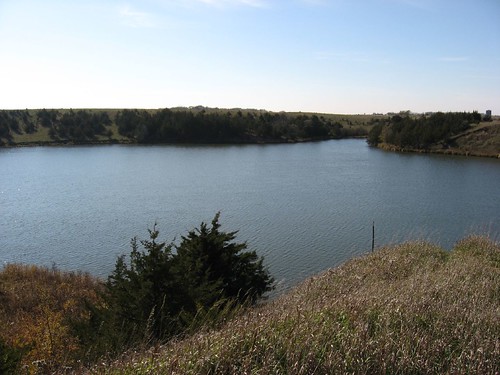
Lake Dimock
One of my sons was enchanted with the notion of visiting Lake Dimock because of the shape of the lake in the Sportsman’s Connection: South Dakota Fishing Map Guide. It took us about an hour and a-half to get there from our eastside Sioux Falls home.
Although the lake is rather small (75 acres), it is varied and has an extensive shoreline. There is a wide part of the lake at the eastern edge; wide enough to provide something of a chop when the wind is blowing. On this portion of the lake there are high banks with cliffs running down to the shoreline. We ran into a group of cattle on the southeastern shore, and we all gazed at each other. We observed lots of bird life on the lake, including great blue heron, ducks, and cormorants. The shoreline of Lake Dimock is very interesting because of the variation observed: from cliffs to marshes, from wide to narrow waters, and a varied airflow off the landscape. An island full of rushes, flowers, grasses, and bushes is situated in the middle of the lake area, and we landed our kayaks to walk around it. There are also a number of boulders in the water, including one very large boulder that sits like a solid island along the northern shore. The lake was created along the bed of the South Fork of Twelvemile Creek, and some trees were evidently submerged when the lake was developed. The stumps of some of these trees are still visible, and we kayaked our way through these remains of a long ago stand of trees that graced the banks of the creek.
An interesting feature of this lake is the many arms that extend in different directions. We went up one little arm of the lake near the dam, and it seems liked an idealized microhabitat for wildlife. We also kayaked up Twelvemile Creek for a mile or so and could have gone on further. This entryway into the lake is about 40-50 feet wide, deep enough for easy kayaking even in August, and filled with interesting deep vegetation along both banks. The creek extends to the west under a bridge. There is another arm of the lake that extends to the south.
There is a very attractive launching point for entry into the lake. A concrete ramp is provided, there is a modern outhouse-type toilet, and a covered shelter for a picnic has been constructed along the spacious parking area. There is even a bench provided out on a point overlooking the lake. These facilities are placed along the southern shore of the lake.
While this is a small lake, it provides a surprising degree of interest for the kayaker. I think that the varied shoreline and the irregular shape of the waterway are major qualities in my satisfaction with this setting. There seems plenty of wildlife available for viewing and a variety of vegetation. I wholeheartedly recommend that anyone taking a kayak to Lake Dimock take advantage of the opportunity to go upstream on Twelvemile Creek. This portion of the creek is like a small river, and there is a lot to see. As usual on South Dakota lakes, we were alone on the water. We went on a Friday the week school begun. Even in late August, the water level was high and we had no trouble moving about the lake. In some spots moving up Twelvemile Creek, there are shallow spots with a mud bottom, but it is pretty easy to avoid getting bogged down there. We spent about two hours on the lake.
I really liked this cruise. It is too bad that it is so far from Sioux Falls, but for people who live in the Mitchell area, especially south of Mitchell, this is a gem of a lake for tranquil paddling. I hope to return there again.
Sunday, August 20, 2006
Folding Kayak - The Folbot

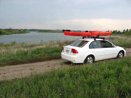
In my family, we have always driven small cars. Many years ago I had a Chevy Vega, and I carried a 17 foot aluminum canoe on top of the car. Living in

Folding kayaks had always interested me because of the ease of transportation and storage. After all, there is a certain attraction in a boat that can be stored in a closet and carried in the trunk of a car. Folbot, one of the major builders of folding kayaks, used to be advertised in National Geographic, and that offered an image of being able to explore all sorts of waterways with ease. Through these advertisements the contrast with my enduring tension of a canoe blown off the car top was sharply etched. Paul Theroux is one of my favorite travel writers, and I found my interest in folding kayaks renewed after reading his adventure in The Happy Isles of Oceania, an account of traveling through the south Pacific in his folding kayak. Somewhere along the line, I also discovered the writing of Ralph Diaz, one of the best know proponents of folding kayaks. His book, The Complete Folding Kayaker, is a review of the history of folding kayaks as well as reviews of major brands, and an introduction to kayaking techniques.
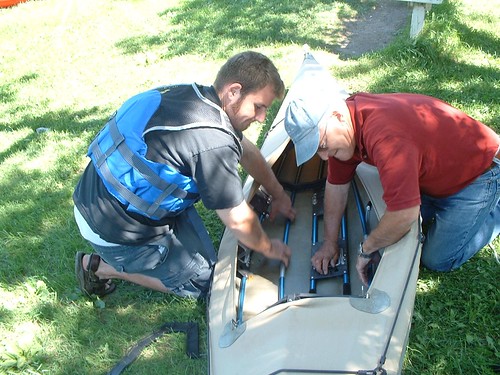
About eight years ago I bought an Aleut model of Folbot. This is a 12 foot, exceptionally stable, entry class into folding kayaks. It has an aluminum framework that connects three ribs that then slides into the Hypalon fabric hull. My Aleut came in two bags that easily fit into the trunk of my Honda Civic Hybrid or on the back seat. The boat weighs about 40 pounds when assembled and is pretty easy to carry for short distances. It takes me about 15 minutes to assemble the boat and less than 10 minutes to take it apart.
The Folbot is very stable and easy to paddle. It tracks well without a rudder, although I do have a rudder which I no longer use. The boat is not fast, but I am primarily interested in slowly cruising along the shoreline looking at the vegetation and hoping to spot wildlife. This boat has served me well over the years. The only problem I have ever had with the boat is developing a leak in the air inflated sponsons inside the top of the fabric hull. Folbot, though, offers a lifetime warranty on these components, and replacements arrived within five days of my request. But, these sponsons lasted for at least seven years and were replaced easily – with the help of my wife.
Now that I have both rigid kayaks and the Folbot, I find that I use them both. When I want to take one of my sons or a friend out kayaking with me, I put one kayak on top of the car and then put the Folbot in the trunk. Early and late into the paddling season, I generally use the Folbot rather than put the rack back on the car. I have used the folding kayak in lakes and rivers, and there has never been a problem. I suppose that it would be easier to poke a hole in the folding kayak than in one of the rigid kayaks, but it has never happened to me. Folbots are more expensive than a rigid kayak, but then a person doesn’t have to be concerned with buying an expensive car top rack or in finding a place to store the boat. You can find more information on the Folbot by checking out the company website at http://www.folbot.com.
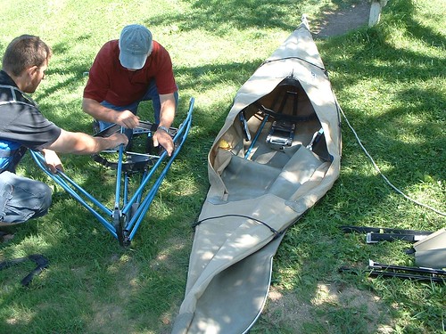
The following video clip was shot by one of my sons as I assembled the Folbot along Split Rock Creek near
Friday, August 04, 2006
Loss Lake
The east bank of the lake has a set of high embankments, some up to 20 feet in height. Some large rocks protrude from the high banks, and I am reminded of how Paleolithic era remains are sometimes found in such conditions. The lake is surrounded by low hills that affect the wind flow, and the banks have either high embankments or regular high banks covered with tall grass, rushes, and cat tail plants. These banks and vegetation provide a nice lee along the edge of the lake. There was plenty of water in the lake, and the depth was just fine for kayaking.
As usual in lakes of this sort, I like to kayak along the shore line to peek into the grasses and along the banks to observe wildlife and the growth of vegetation. On this trip, I came across two great blue heron that flew off as I approached and seemed to settle down again somewhere ahead of me to repeat the cycle along the entire trip. When I arrived, there was a flock of 20 geese out on the lake, but once they spotted me they flew off. In past trips to this lake, I always saw a flock of white pelicans. This time, I caught sight of one large white bird, but it was too distant to verify as a pelican. There was an abundance of other bird life. I came across several large turtles out in the water. This was a hot day on the lake, and I suspect they were keeping cool in the water; I did not observe any turtles sunning themselves along the shore line. There were lots of tunnels in the embankments and pathways through the tall grasses along the shore, but I did not see any actual animals in these settings. I would suppose that 1:00 p.m. in August is not the greatest time for viewing wildlife.
As I cruised along the north end of the lake, I came around a corner and saw a herd of cattle standing in the lake behind a single strand fence that separated off this backwater spot. I suspect that the fence was electrified, but I did not get close to it. Among the 16 cows standing there knee deep in the water, there were several large full-grown cows and several calves. As I was departing the area, something spooked the cows, and they started running through the water creating an interesting sound. I would not have wanted to be in the way of these cows as they decided to move on.
As I was ready to depart the lake, a car came into the access area, and a couple got out an inflatable boat. The guy told me that
Thursday, July 20, 2006
Swan Lake

The lake itself is oriented generally east and west. Development is located in scattered parts of the eastern part of the lake on both the south and north shores. The lake homes seem more modest than those at
While I was paddling, there was a power boat out on the lake towing a big tube with riders. This was the only boat I saw on the lake, but many were on ramps beside lake cabins. Power boats are restricted to the eastern “main” portion of the lake. The western side is posted for “No Motorboats.” This western side opens up from a narrow strait and extends back into an area surrounded by tall grass. This grass creates a nice lee from the winds, and it is the sort of place where some wildlife might be seen. On this trip, I saw only a single great blue heron in this portion of the lake. Paddling the perimeter of the lake takes about an hour.
Generally, I thought that the lake offers a pleasant cruise around the perimeter. It is always enjoyable to cruise around islands, and there is still a good portion of the lake shore that is not occupied with cabins. On an earlier trip to this lake, I observed more waterfowl, but this time there was only that single great blue heron. So,