This blog is designed to highlight the paddling opportunities within South Dakota, mainly within a 50-mile radius of Sioux Falls. While Sioux Falls is far from the adventure of coastal regions, there is a certain satisfaction in utilizing the available waterways to observe weather, water conditions, and the landscape along the shoreline. In addition, there is a wealth of animal life on the waters of small South Dakota lakes, rivers, and creeks, including geese, ducks, pelicans, great blue heron, egrets, hawks, owls, perching birds, deer, raccoons, and beaver. Eagles, fox, and coyote are also sometimes spotted.

The sites described are places where I have kayaked over the past few years, mostly in South Dakota but sometimes including locations in Iowa and Minnesota. One of the best sources of information on the accessibility of small lakes is the South Dakota Atlas and Gazetteer, the large map book of South Dakota. Lakes with a public access are generally identified by a boat symbol marking the location of a launching site on public land.

You will notice the menu of paddling locations on the right side of the blog. Each of the postings is linked to one of the areas, and my intention is to provide a continuing review of the places where I paddle. Perhaps these narratives will help readers select waterways of interest to them. Please feel free to offer a comment regarding any of my postings; I would welcome the dialog.

I also maintain a companion blog that describes hiking opportunities within the Sioux Falls area. You can access that blog at: http://hikingsiouxfalls.blogspot.com

Tuesday, August 24, 2010

A Return to Familiar Waters: Lake Alvin – Late August 2010

IMG_5447.JPG
My son, Derek, called last night and asked if I was available to go out kayaking this morning with him. After kicking back for a week after my days in the Boundary Waters, I was happy to take him up on the notion. We tossed the Folbot into the back seat of my Honda Civic, loaded up the Dagger on the roof-rack, and headed out to Lake Alvin about 9:30 a.m.
IMG_5448.JPG
It has been very hot and humid in Sioux Falls over the past few days, and today was a gift: light winds, sunny skies, and a temperature in the 70s. It was a wonderful day, especially on a weekday during “working hours.” The lake was nearly deserted, as is usually the case on weekdays after school has begun.
IMG_5442.JPG
We arrived at the public access area of the lake and headed south into Nine-Mile Creek. The water level is high, and there was no trouble making it around the southeastern point leading into the mouth of the creek. It was pleasant moving up this increasingly narrow waterway towards the set of rapids that ends further navigation.
IMG_5439.JPG
After reaching the rapids, we then turned around and cruised easily back down the creek to the main body of the lake. From there, we paddled to the northern shore of the lake and turned into the channel leading to the spillway.
IMG_5456.JPG
Going back down the lake to the access point, there was a head wind, not enough to cause any strain but just enough to be refreshing after so many hot sticky days here in SD.
IMG_5446.JPG
We spent a couple of hours paddling the length of Nine-Mile Creek and the main body of Lake Alvin. This was a great time to chat, observe the shore conditions, and experience the sensation of moving across the water.
IMG_5452.JPG
Derek again reminded me of how accessible Lake Alvin is to our home and of how easy it is to take a nice kayak cruise without spending much time on the road. From driveway to the put-in is less than 15 minutes!
IMG_5438.JPG

Tuesday, August 17, 2010

Boundary Waters Canoe Area Wilderness (BWCAW) Trip - Part 3

IMG_5382.JPG
During our week in the BWCAW we sometimes moved about on day trips as a group, and several times I just headed out on my own to explore the lake and portages of Ensign Lake. I tried once to ride in the middle seat of a canoe with the group, but the experience left me considering the services of a chiropractor. After that short effort, I decided to just go out on my own cruises, much as I do here in home waters.
IMG_5402.JPG
Ensign Lake is a rather large body of water, and I enjoyed paddling the shoreline, landing on islands, and hiking the portage trails.
IMG_5401.JPG
There are several islands in Ensign, and these tend to be heavily forested and elevated. On one of the islands, the shoreline was exposed enough to allow me to hike around to check out the geology and flora.
IMG_5394.JPG
Hiking the portage trails was a lot more manageable than trying to haul my kayak. Since I was wearing my aqua socks on the hikes, navigating the rocky pathway up and down hills required caution. The portage trails I took led from Ensign Lake to Trident Lake (100 rods) and then another trail to Ashigan Lake (55 rods).
IMG_5328.JPG
The lakes that I visited all seemed pretty much the same, varying mostly in the nature of the shoreline. It seemed to me that one could get the flavor of the BWCAW in a short cruise that led through two or three lakes and a couple of portages. A longer cruise seems to me more of the same.
IMG_5329.JPG
There is an aspect of journey, however, in doing an expedition type of cruise, a circular trip that provides for paddling and portaging most of each day with a different campsite each night. For groups and hardy individuals or teams, I suspect that there is great satisfaction in accomplishing the journey. If I were in my 20s or 30s, the journey would appeal to me. Perhaps with the right equipment, time, and expectation, I might enjoy such a journey even now at my advancing age (68).
IMG_5405.JPG
I got the impression that there are generally two types of experiences in the BWCAW: the tripping sort of adventure that is measured in miles traveled and portages negotiated, as in “we did 70 miles and 10 portages on our week-long trip.” Then, there is the camping and day-touring type trip that provides for a week out in the wilderness with forays out each day but a return to the base camp for the night.
IMG_5412.JPG
On a trip to the BWCAW, it seems that one must be prepared to adjust plans based upon daily conditions or events. The weather changes quickly: a morning calm under clear skies can change to heavy cloud cover, rain, and wind within hours. Then, there is always the possibility of losing gear to a bear or perhaps through capsizing a boat. Twisting an ankle on a portage or wrenching a muscle is certainly possible, especially for older more brittle paddlers. So, a journey on the lakes requires a tolerance for dealing with adjustments to the route plan and a willingness to be flexible in accommodating to circumstances.
IMG_5411.JPG
In the final analysis, however, spending a week in the Boundary Waters is a wonderful addition to the life experiences of people who either enjoy camping in a beautiful natural setting or who enjoy a self-contained and self-propelled journey through the wilderness. It becomes an unforgettable element in a person’s life story.
IMG_5432.JPG

Monday, August 16, 2010

Boundary Waters Canoe Area Wilderness (BWCAW) Trip - Part 2

IMG_5421.JPG
Losing a portion of our food to the bear could have caused complications for our planned six days in the BWCA. After all, it would have taken a full and demanding day to replenish our food stocks: an eight hour round-trip paddle, an hour drive round-trip into Ely, and then shopping for food items. It would have been an exhausting trip for the pair of paddlers who took on that task. But, luckily, there was enough food left to see us through without much of a problem.
IMG_5325.JPG
The best advice from the Forest Service when confronted with bear problems is to shift camps, and so we moved across Ensign Lake to another setting – actually, the preferred setting by the veteran members of our party.
IMG_5420.JPG
Travel through the BWCAW is accomplished through multiple lakes connected by portage trails. These portages range from a “pull-over” offering relatively easy passage to long primitive rocky trails that wind up and down through heavily wooded hills.
IMG_5342.JPG
There are no reference marks in the area we traveled; paddlers use detailed maps carried in waterproof folios. The terrain looks pretty much the same throughout the lakes we traveled: a wall of green made up of coniferous trees mingled with birch trees, generally high banks, rocky shores and cliffs, and scattered islands. It looked to me as though it would be easy to become disoriented or even lost within this wilderness area. When paddling alone, I tried to remain my “situational awareness” so that I would not experience the anxiety of trying to find my way back when everything looked the same.
IMG_5429.JPG
Most of the watercraft on the lakes were kevlar canoes that could be carried on the shoulders of a single person. The canoes within a party approach a portage, unload, and the paddlers carry their load across to the next put-in. A straight-line portage is not complicated nor particularly difficult; it just takes time to unload, carry across, and then repack the canoes. For portages that move up over steep rocky paths, however, it seems like an activity recommended by an orthopedic surgeon drumming up business.
IMG_5361.JPG
I saw only a few kayaks during this trip, and those only in areas with an easy portage path. My kayak weighs nearly twice that of a kevlar canoe, and it was a strain to portage even with two people. I think that only a body builder could muscle a kayak alone across even the relatively short portages.
boundary 2010 146.JPG
Portages in the BWCAW are measured in rods, an archaic linear unit that harkens back to 19th and early 20th century farming. A rod is equal to 16.5 feet, but I doubt that many people know that. To me, it seems like continued use of this unit of measurement is jargon that separates the old-timers from the novices. The use of meters, yards, or feet would provide greater comprehension for visitors. Who among us, I wonder, can visualize a passage of “180 rods.”
IMG_5310.JPG
I saw several bald eagles on this trip, and some of them flew relatively low over the water just offshore from our camping site or near the canoes. In the closest encounters, I could clearly see their features.
IMG_5333.JPG
Luckily, I came across a group of four otters close inshore while out alone in my kayak. I was able to sit there quietly and watch them together for a few minutes.
IMG_5391.JPG
Loons were omnipresent, and I enjoyed moving close to them in my kayak to watch them diving and surfacing. The call of the loon was frequently heard during both the day and in the evening hours. I have heard so much about loons over the years, especially on Prairie Home Companion with Garrison Keillor, that I was really thrilled to actually watch them and listen to that distinct call. Loons seem to be an iconic aspect of life in Minnesota, and I feel enriched to have been able to see them in the BWCAW setting.
IMG_5372.JPG
One evening we all watched a wolf move down the shoreline on Ensign Lake across from our base camp. Ensign has an exposed shoreline of about 2-4 feet, and the wolf was moving down that shoreline. We watched him for about 10 minutes through my binoculars. The distance was too great for me to capture a photograph with my limited camera; it just doesn’t have the telephoto quality needed for a recognizable image at that range. Our second campsite had a family of chipmunks that seemed fearless as they scavenged for any tidbit dropped or offered to them. In the campsite, I saw one dark brown rabbit. We came across a few garter snakes on portage trails or in the woods around the camp. Fortunately, we did not see the bear that visited our camp on that first night. I ran into someone who said that he saw a moose along the shore.
IMG_5376.JPG
To be continued..........

Sunday, August 15, 2010

Boundary Waters Canoe Area Wilderness (BWCAW) Trip - Part 1

IMG_5437.JPG
Several months ago, I was invited by David Finck, one of the officers in the South Dakota Canoe/Kayak Association, to join his late summer group trip to the BWCAW this year. The notion of going to the Boundary Waters has appealed to me for many years, but I never actively pursued it. As the years passed, so did the likelihood of ever making the trip. So, when this invitation was offered at the SDCKA Annual Conference last January, I decided to take advantage of the opportunity. David offered me space in a canoe, the loan of whatever gear I needed, and the encouragement to be part of the group this year. The cost of going on an eight-day trip was also very modest. I realized that, for the sake of my self-image, I just could not let the opportunity pass. It was also another experience that I wanted to add to my collection; a chance to see this wilderness area that I had heard so much about.
IMG_5300.JPG
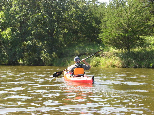
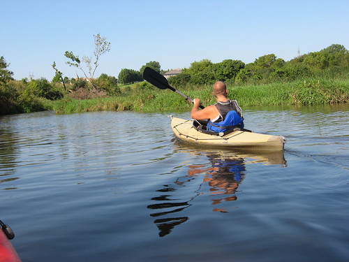
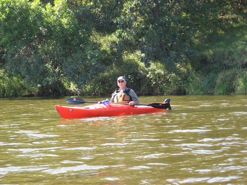
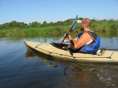
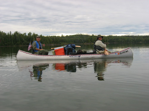
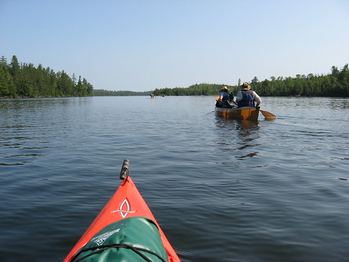
The group this year included seven people, one person had withdrawn and that left an odd number for crewing the canoes. Dave asked if I could bring along my kayak, so the fleet consisted of three canoes with two people each and nearly all the gear, and then I had my kayak as well. There were two husband/wife pairs, a father/son, and then me.
IMG_5303.JPG
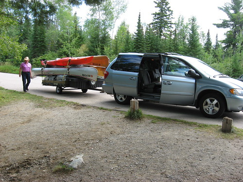
We traveled northeast about 450 miles to Ely, Minnesota, one of the key “jumping off” points into the BWCAW. Dave had a van and pulled a trailer with the four boats, and five of us rode with him. One of Dave’s old pals, Ken, drove with his son in convoy behind us during the round trip.
IMG_5306.JPG
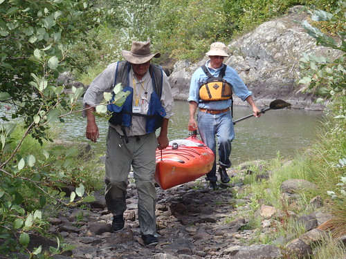
Ely is really an outdoors oriented community, and many vehicles passed up and down the main streets and were parked alongside motels, stores, and outfitters with canoes lashed down on roof tops or in trailers. By far, the most common canoes were the 17-foot Kevlar We-no-nah boats. After beginning the trek across lakes loaded to the gunnels with gear and negotiating the portages, I could see the attraction of such light, although expensive, canoes.
IMG_5309.JPG
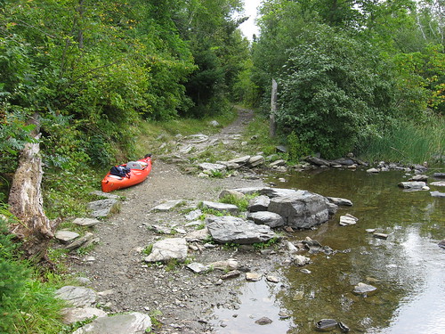
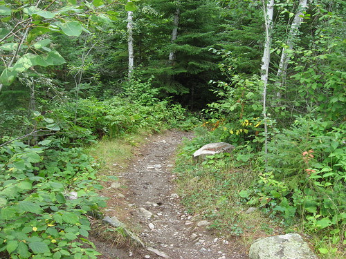
We spent the first night in Ely at a Motel, and then in the morning, after a hardy breakfast at a well-known local spot, we set off on a planned course through Moose Lake, Newfound Lake, Splash Lake, and into Ensign Lake. This routing included two portages, one of 35 rods and the other of 5 rods.
IMG_5313.JPG
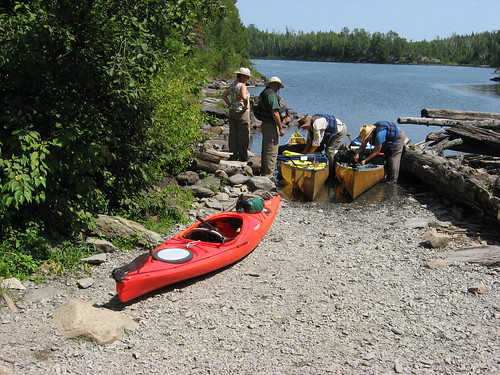
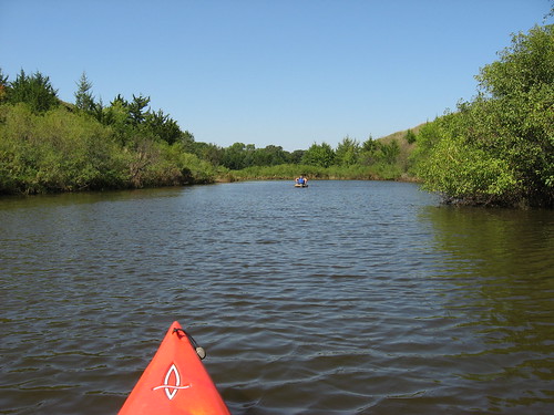
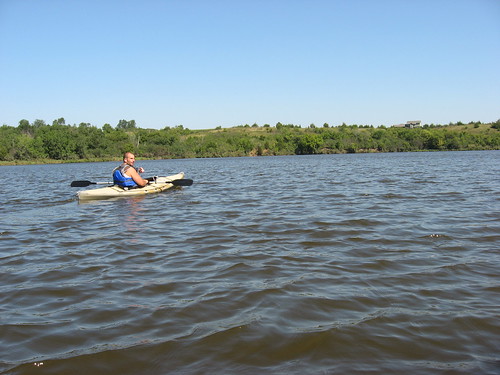
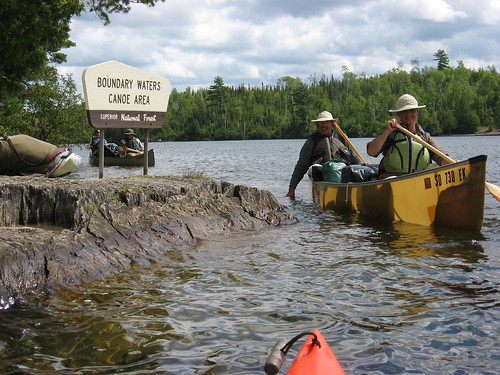
There was a steady stream of canoes heading both ways along the highway of Moose Lake. We entered the BWCAW at Entry Point 25, adjacent to the Boy Scout Somers Canoe Base, about 20 miles northeast of Ely. Outfitters have a motorboat service using big Jon boats with a rack on top that will accommodate two canoes. Lots of people use this service to speed their travel deeper into the BWCAW; motors of up to 25 hp are allowed in some portions of Moose and Newfound Lakes, after that no motors are allowed on the waterways. But then, lots of people just paddle down Moose and Newfound Lakes and continue on into the wilderness, and we were among the paddlers.
IMG_5413.JPG
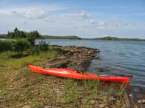
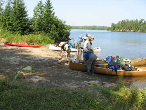
Dave and his wife, Mary, and their pal, Ken, and his son, John, had traveled into the BWCAW many times over the years and had a clear intention of where to establish a base camp for our week. Their practice over the years has been to find an attractive campsite and stay in that location during the week and then make day trips to various interesting places, all within a few hours travel time of the base camp. The plan this year was to establish a base camp toward the eastern end of Ensign Lake, a four-hour paddle from the “put-in” on Moose Lake.
IMG_5380.JPG
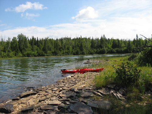
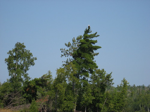
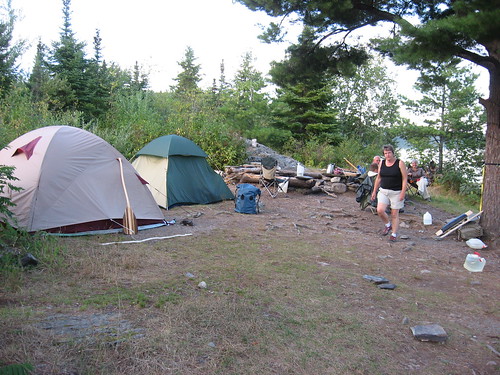
The campsites are well spaced in isolated spots, up on a high bank with generally easy access by canoe and ample room for the maximum capacity of nine people. A fire pit with grate and an open toilet with a “throne” are provided. There is adequate space for pitching the tents and plenty of shade. Forest Service restrictions are placed upon the type of containers used for food, there is only lake water available; once in the BWCAW, communication is very limited: no cell phone coverage, no roads, and no motorboats. It is certainly a place to escape or avoid continual 24/7 news, cell phone messages, and being constantly in touch with the office, family, or friends.
IMG_5410.JPG
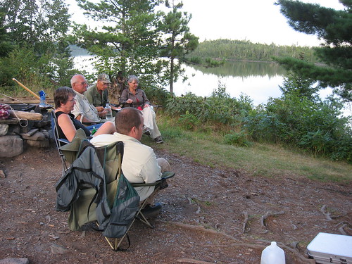
The seven of us set up camp upon arrival at the site on Ensign Lake. We settled in during the late afternoon and then enjoyed a delicious pork chop dinner prepared by Dave. Being the only “singleton” of the group, I had a small tent by myself. The mosquitoes tended to become pretty bothersome at dusk, so we tended to tuck in around 9:00 p.m.
IMG_5419.JPG
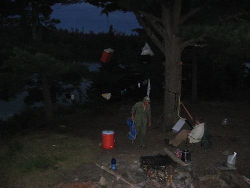
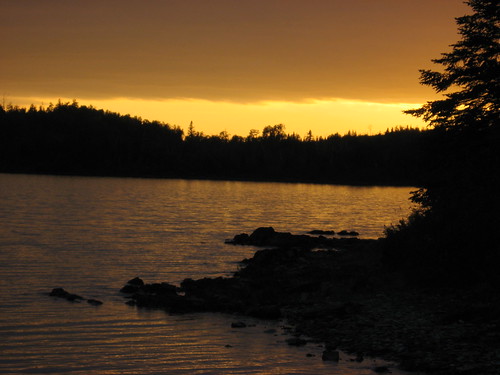
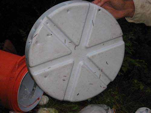
On that first night, we hoisted the food backs up on a line from a tall tree in hopes of thwarting interest by bears. One food container, however, was not hoisted that night, the container with all the meats prepared for the week. Late in the night, a heavy thunderstorm rolled over the area with spectacular lightening, cracking thunder, and a downpour of rain.
IMG_5319.JPG
With the storm, I didn’t focus upon other sounds, the sounds of a bear roaming through the camp and the theft of the container with all the meat products. In the morning, we located the food container that had been taken by a bear and chewed open. The menu for the week was about to change markedly. Among some of the party, the anxiety level was about to rise as well.
IMG_5320.JPG

To be continued..........