This blog is designed to highlight the paddling opportunities within South Dakota, mainly within a 50-mile radius of Sioux Falls. While Sioux Falls is far from the adventure of coastal regions, there is a certain satisfaction in utilizing the available waterways to observe weather, water conditions, and the landscape along the shoreline. In addition, there is a wealth of animal life on the waters of small South Dakota lakes, rivers, and creeks, including geese, ducks, pelicans, great blue heron, egrets, hawks, owls, perching birds, deer, raccoons, and beaver. Eagles, fox, and coyote are also sometimes spotted.

The sites described are places where I have kayaked over the past few years, mostly in South Dakota but sometimes including locations in Iowa and Minnesota. One of the best sources of information on the accessibility of small lakes is the South Dakota Atlas and Gazetteer, the large map book of South Dakota. Lakes with a public access are generally identified by a boat symbol marking the location of a launching site on public land.

You will notice the menu of paddling locations on the right side of the blog. Each of the postings is linked to one of the areas, and my intention is to provide a continuing review of the places where I paddle. Perhaps these narratives will help readers select waterways of interest to them. Please feel free to offer a comment regarding any of my postings; I would welcome the dialog.

I also maintain a companion blog that describes hiking opportunities within the Sioux Falls area. You can access that blog at: http://hikingsiouxfalls.blogspot.com

Sunday, September 19, 2010

The Big Sioux River: Canton to Newton Hills

IMG_5567.JPG
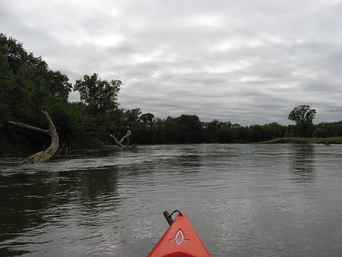
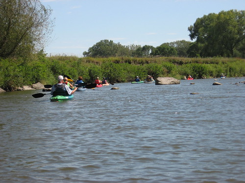
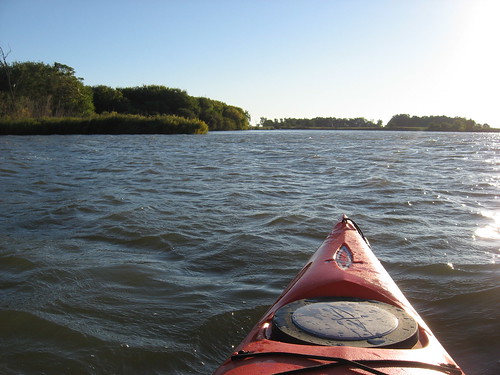
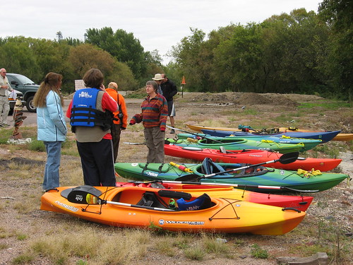
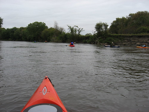
Today, I joined with a fleet of eight kayaks paddling from Canton to Newton Hills, a distance of nine miles along a full, deep, and fast Big Sioux River.
IMG_5573.JPG
This was a cruise that had been planned by David and Mary Finck and Larry Braaten, board members of the SDCKA, and had also been postponed a number of times due to high water.
IMG_5574.JPG
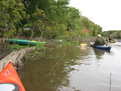
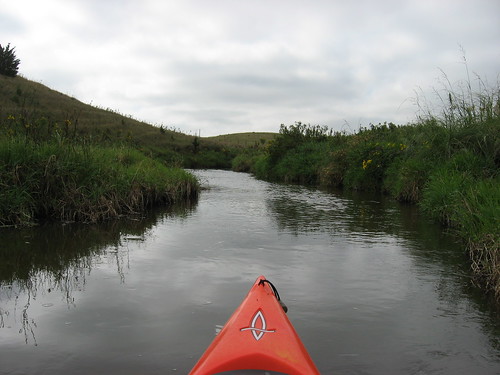
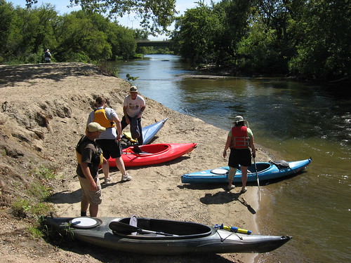
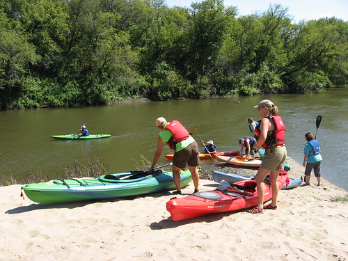
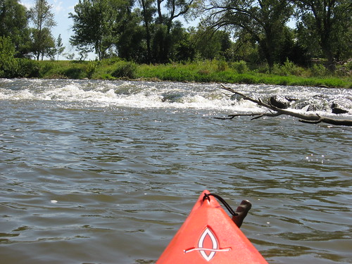
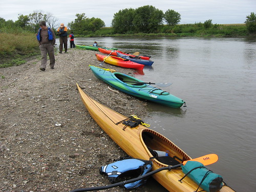
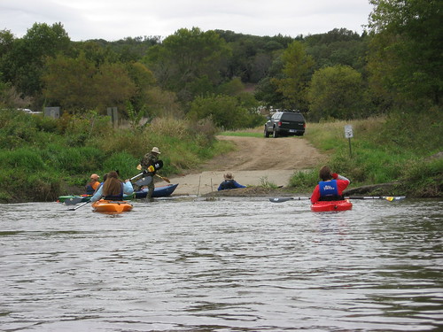
The cruise today began just above the park in Canton in an industrial type parking lot with a ramp leading down to the river. A set of rapids, formed as the river flows through the debris of a low-head dam dismantled long ago, faced us within just 100 feet or so from the put-in. We all stood on the high bank looking out at the rapids considering the best approach. The ramp leading into the river at the park was closed due to earlier flooding and damage. The passage through seemed okay to all of us, and we moved through without incident.
IMG_5581.JPG
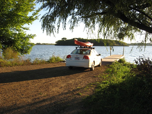
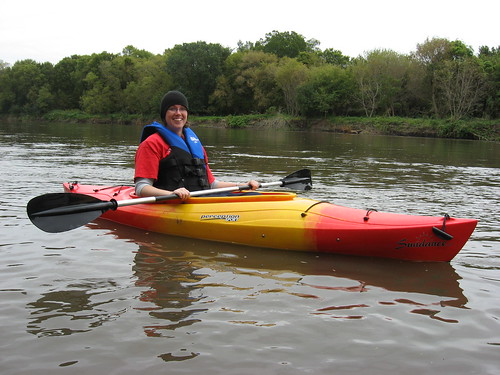
We had gathered at the prearranged put-in by 1:00 p.m., and David Finck provided a shuttle for all of us. That, of course, is the advantage of going on a river cruise with others, especially a cruise that is planned by the SDCKA. By 1:50 p.m., we had all shoved off and were on our way down the river.
IMG_5578.JPG
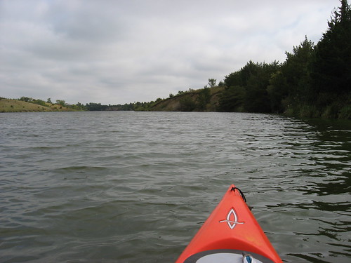
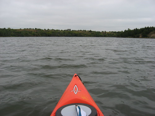
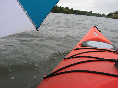
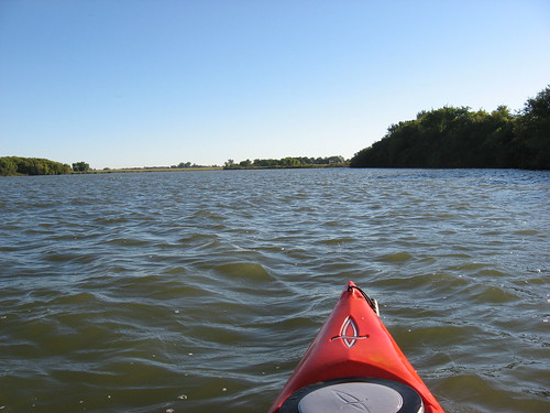
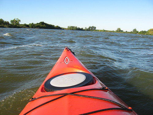
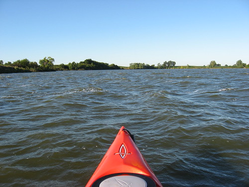
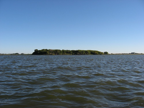
The current was swift today on the Big Sioux, the water was deep, and the river was wide. I tried to find bottom with my double-bladed paddle several times along our cruise, and I never touched it. The water was over six feet deep along nearly the entire width of the river.
IMG_5591.JPG
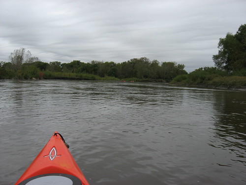
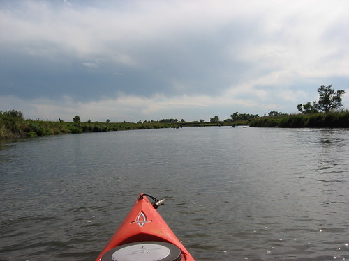
The temperatures were in the high 50s for our afternoon cruise, and this follows a cold snap yesterday that had high temperatures in the 40s. The skies were cloudy during the entire afternoon. Winds were not a factor at all on the cruise.
IMG_5595.JPG
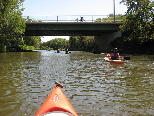
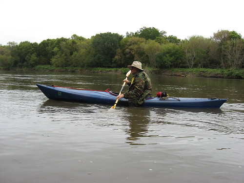
With the eight kayaks moving along, there tended to be a couple of conversation groups, and then some of us moved along the edge or behind the pack to commune with nature in near solitude. These configurations of paddlers were fluid; at times I found myself bringing up the rear and cruising along the shore, and then at other times I found myself engaged in conversation. Generally, paddlers string out on these river cruises, sometimes for over a mile. A smaller group, as we had today, tends to be more bunched up as it moves downstream – at least everyone in sight.
IMG_5592.JPG
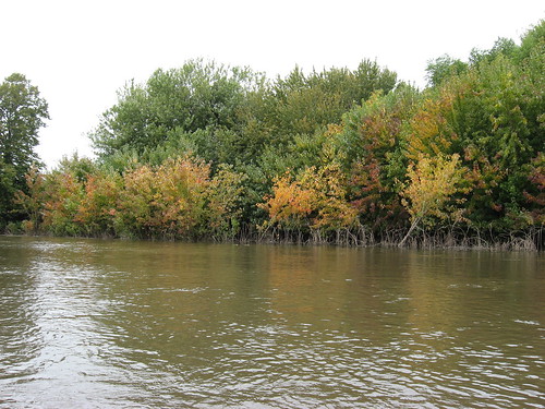
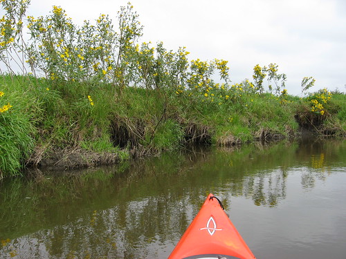
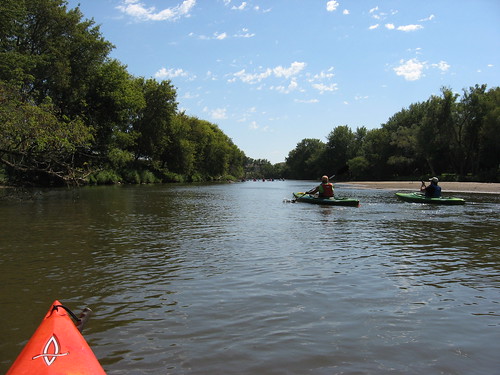
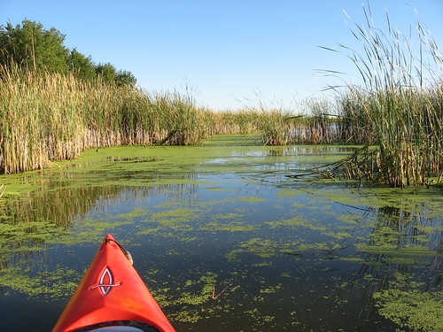
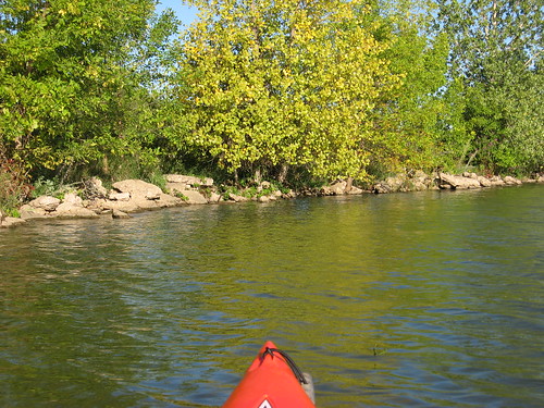
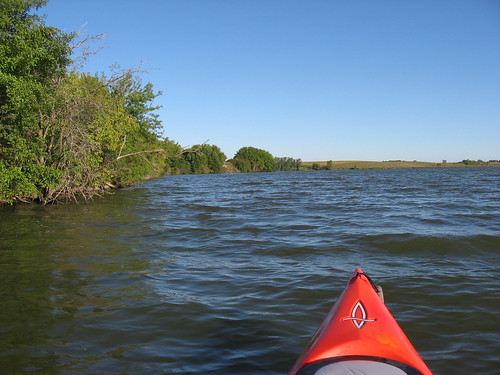
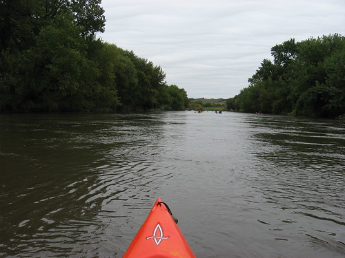
The change in seasons is readily seen in the changing colors of the trees. The banks of the Big Sioux tend to be wooded, most often with large cottonwood trees. On this stretch, one can see the drying corn fields through the tree stands along the shore. The approach of fall was apparent as we moved along the river.
IMG_5600.JPG
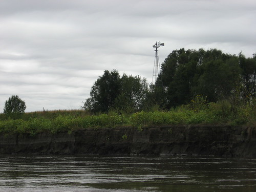
The river and the banks were deserted during our trip. I didn’t see another person or hear any machinery. There were only isolated buildings visible along this part of the river.
IMG_5604.JPG
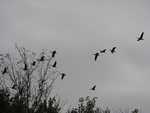
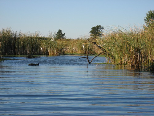
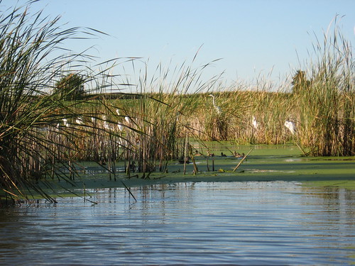
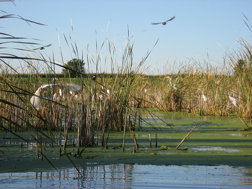
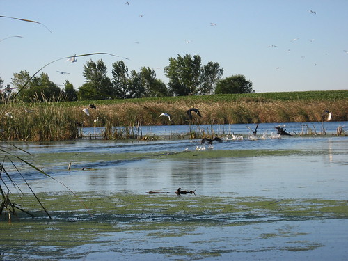
We did not see much wildlife; groups tend to cause most wildlife to lie low until the boats and talk pass. We did see a large group of geese at one point. Many migratory birds have already left for more attractive feeding areas south of here.
IMG_5599.JPG
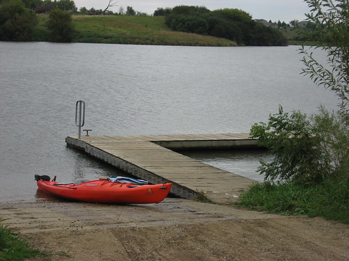
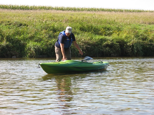
We stopped about halfway down our planned course at a gravel beach. Since we really had not worked terribly hard on the trip, we spent only about 10 minutes stretching. From there, it was another easy 45 minutes or so until we reached the take-out. Our trip concluded at a public access area just across the highway from the Newton Hills Trail Camp. We zipped down the nine miles in two hours today, including our brief rest stop.
IMG_5609.JPG
This was another of those many segments along the Big Sioux that are pretty easy to paddle. I can’t remember being on this stretch of the river, although club cruises have given me the opportunity over the past couple of years to paddle nearly from Flandreau to Newton Hills. As I paddled along, I thought about Brian Gundvaldson and his trip through these waters just a couple weeks ago. Brian is the young guy who left Egan, SD, on September 3 heading for the Gulf of Mexico, a trip of 2,100 miles. As of yesterday, he had reached Kansas City and will be on his way to St. Louis next. Like many, I am following his trip on Facebook.
IMG_5605.JPG

Friday, September 17, 2010

Changing of the Seasons: Lake Alvin, Sept. 2010

IMG_5564.JPG
The nighttime temperatures here on the northern plains have dropped into the 30s at various places and have been in the low 40s here in Sioux Falls. It is apparent that the end of summer is upon us and that the fall is at hand. The trees and bushes seem to have lost their luster, some leaves are falling, and a frost could happen at any time. Also, the hunting season is rapidly approaching and with that greater care in kayaking on isolated waterways is warranted. When hunters are toting shotguns, I tend to limit my kayaking to waters bordering state parks and protected areas.
IMG_5532.JPG
Sometimes I feel that I have to constantly paddle a variety of waterways in order to present a range of locations on this blog. That feeling sometimes inhibits my spontaneous paddling opportunities on familiar and often described waters. Going to familiar and local waterways seems “lame,” and I feel sort of a sense of duty to move out on the edges of my paddling circle so that the narratives seem fresh. But, today I beat that feeling down and returned to Lake Alvin, only 15 minutes from our eastside Sioux Falls home.
IMG_5538.JPG
I got a late start today because of lingering too long with my coffee and novel at Bagel Boy on East 10th Street and arrived at the public access area on the southwestern end of the lake just before 11:00 a.m. The lake was crowded today with perhaps three fishing boats out and a few guys fishing from the shore near the state park and at the public access area. I felt the press of this teeming mass of people and headed in solitude up into Nine Mile Creek. There was plenty of depth to the water, and I was able to continue upstream to the usual point where navigation is halted because of a set of low rocky rapids. This trip is perhaps a mile upstream and is my favorite part of the lake. Motorboats cannot make it up Nine Mile Creek. This is also the part of Lake Alvin where wildlife might most easily be observed.
IMG_5539.JPG
Today was largely overcast with moderate wind out of the north and temperatures in the low 50s. Going up Nine Mile Creek, the wind was not noticeable. On the way back up the main body of the lake, there was a fairly stiff headwind and choppy conditions. I moved up the lake and greeted a couple of fishing parties. Along the way, I picked up my self-imposed quota of floating trash – mostly bottles and cans. I carry a plastic bag in the kayak and expect to pick up from 5-10 items on each cruise. This isn’t much, but it is a minor contribution to a cleaner environment and provides me an opportunity to practice maneuvering my kayak in along the shore and into foliage as I grasp the offending pieces of trash.
IMG_5545.JPG
On the way back down the lake to the public access area, I set the umbrella and sailed the complete distance, perhaps a mile or so. I am able to take photos while sailing when the wind is not too strong. When it gusts, however, I need both hands on the umbrella as I steer with my feet on the rudder pedals. So, taking photos while sailing is a bit tricky; using an umbrella sail adds some additional risk to kayaking
IMG_5554.JPG
Today was a day for exercise and contemplation. Traveling with a group, as on river cruises, is really an enjoyable experience. I also like to move along through the lake by myself, observing the grasses, the bird life, the wind across the water, while searching for wildlife.
IMG_5563.JPG
Today, all I saw was a single great blue heron, some jumping fish, a few turtles, and very few perching birds. I guess that much of the bird life knows when it is time to go, time to move away to sunnier and warmer climes for the winter. They want to get out before the freeze. The older I grow, the more I share that sentiment.
IMG_5540.JPG

Sunday, September 05, 2010

The Rock River near Rock Rapids, Iowa

IMG_5498.JPG
A few days ago I was pleased to learn that David and Mary Finck, along with Larry Braaten, were planning to lead a cruise along the Rock River, in Iowa, today. All three of these paddlers are officers in the South Dakota Canoe/Kayak Association (SDCKA), and they frequently announce and lead cruises within the area.
IMG_5496.JPG
At 1:00 p.m. today, Sunday, thirteen paddlers with their kayaks gathered at Island Park in Rock Rapids, Iowa. Rock Rapids is about 30 miles east of my Sioux Falls home, east on Highway 9. After arranging a shuttle and leaving most cars just south of the bridge along Highway 75, about 7 miles south of Rock Rapids, the thirteen kayaks left a launching point within the park and headed south along the river.
IMG_5504.JPG
The Rock River is a tributary of the Big Sioux River and wanders for about 100 miles from near Pipestone, Minnesota, to near Hawarden, Iowa, where it flows into the Big Sioux. Many years ago I paddled a stretch of the river from near Steen, Minnesota, to Rock Rapids. The river is aptly named; there are plenty of rocks scattered along the bed of the river, and there are also three or four sets of rapids south of Rock Rapids. None of the kayaks tipped in the rapids; still, they were enough to give a person pause, especially if cameras were not protected – as none of ours were. I shipped water over the bow and up along the cockpit of my kayak. I think that all of us got a little wet in the rapids.
IMG_5515.JPG
Heading south out of Rock Rapids, there are some very nice homes built up on the high banks. After leaving the city, the river was generally deep enough to avoid any difficulties, especially in the northern half of our trip. Perversely, the river tended to have more shallow gravel bars along the southern half of our trip. Generally, the depth seemed to be about three to four feet. Like most waterways, though, there were deep channels and shallow shelving at times. As we moved closer to the Highway 75 bridge over the river, most of us had to get out of the kayaks at some point to drag them over gravel bars or shallow spots. That was not, however, much of a problem; mostly it involved just moving the boat a few feet into the deeper current.
IMG_5523.JPG
The river flows through farm country, and the banks are not heavily wooded. We occasionally ran into people, friendly people who would wave and shout out a greeting. People stopped along the way to watch the flotilla pass.
IMG_5508.JPG
We came across several electric fences across the river. Fortunately, these wires were noticed early and they were high enough to permit passage close along the bank. None of us received a shock from the fences.
IMG_5520.JPG
About half way through the 3.5 hour trip, Dave called a halt along a beach so that we could stretch, take off the life jackets, and have a sip of water.
IMG_5519.JPG
With such a group of kayaks, there was little chance to see any wildlife; even birds seemed scarce to me. People chatter as they paddle, and the group stretched out for a few hundred yards – plenty of time and warning for any wildlife to sit tight and wait for the fleet to pass. This sort of trip is social in nature, and on this cruise people helped each other and kept the conversation going.
IMG_5529.JPG
The hazards encountered today included the several sets of rapids, a tree that had fallen across nearly the entire river,a few electric fences, and shallow gravel bars that left boats stranded in fast running current and insufficient depth.
IMG_5518.JPG
Although we did not have a gps among us, we probably traveled about 12 miles on the river. The road distance from the put-in to the bridge over Highway 75 was about 7.5 miles. The take-out under the bridge requires a long carry, although it did not measure up to the portages I experienced in the Boundary Waters last month. People helped each other carry their boats up to the highway, and then the trip was over. We all got into our vehicles and headed home for our separate Labor Day festivities.
IMG_5525.JPG
The Rock River seemed to be about 75-80 feet wide along most of our trip today, and the depth was nearly always four feet or less. Veterans of this river cruise said that we would not have been able to make it this late in the season expect for the unusual rains that we have had over the summer. This is another paddling option that the paddlers around Sioux Falls might keep in mind. While it is not as easily kayaked as the Big Sioux River, it is a very pleasant cruise through farm country and an easy opportunity to expand kayaking into western Iowa. I’m very glad that David, Mary, and Larry organized and led the cruise today.
IMG_5513.JPG

Friday, September 03, 2010

Beaver Lake - September 2010

IMG_5458.JPG
About twice a year I head west out of Sioux Falls on Interstate 90 to visit Beaver Lake, located just on the edge of Humboldt, SD. My last visit there was in April, and the landscape was just “greening up” after a long winter. This morning I made my “bookend” visit to the lake – spring to see the arrival of the season and fall to see summer disappearing. After my customary morning stop at the local bagel spot for coffee, a bagel, and an hour with my novel, I departed Sioux Falls as the sun was coming up on a brisk 50-degree day. By 7:45 a.m., I was at the “put-in.” This was the first day since April that I wondered whether a jacket would be needed.
IMG_5460.JPG
The forecast for the day spoke of “breezy” conditions, and that seemed okay; after all, a calm day in South Dakota is rare. As I drove west with my kayak atop the car, however, I saw the battery level for my hybrid Honda Civic dropping down to a single bar; without “electric assist,” the maximum speed for the car dropped to about 55 mph. Headwinds out of the west caused a depletion of battery power, and that was my first tip-off to probable wind conditions on Beaver Lake.
IMG_5462.JPG
When I arrived at the lake, I saw that the wind was whipping down the length of the lake from west to east. Beaver Lake is 300 acres in surface area (more than three times the size of Lake Alvin) with large open space along the west to east axis. There is little cover on the western shore to break the wind, so it tends to generate significant wave action, especially on that west to east axis. The waves in the open part of the lake today were one to two feet from trough to breaking tops with whitecaps.
IMG_5466.JPG
As usual, though, there was enough variance in the shoreline to provide areas of sheltered water, some areas of light wave action, and also areas of heavy waves that can create apprehension for the solo paddler.
IMG_5467.JPG
I seem drawn to the large wooded island located about 300 yards out from the public access point on the southern shore. That channel between the mainland and the island is the first area of concern for a paddler on a windy day: the wind seems always to come out of the west on my visits to the island. The eastern and northern shores of the island are home to a variety of bird life and are also generally sheltered from prevailing winds. The island, therefore, is irresistible to most paddlers.
IMG_5473.JPG
As I approached the island, bobbing about in the waves, I saw four egrets slipping away from me. They flew off to the north, but I knew that I would encounter them again.
IMG_5480.JPG
Moving away from the lee of the island, I was once more into heavy wave action, and I struggled across the wind to the northern shore and then turned west into the wind as I headed to the northern bay and the entrance into a wetlands area.
IMG_5489.JPG
This wetlands area is my favorite part of the lake. My landmark, as usual, was an old windmill along the eastern side of this northern bay of the lake. I slipped through the channel and moved east down a waterway through the aquatic growth and beaver lodges.
IMG_5491.JPG
The elusive egrets from the island had joined a large flock of egrets within the wetlands; there were more than a dozen of them along the shoreline or perched in trees. Slowly, I approached the flock with my camera ready and managed to capture several photos before they all departed.
IMG_5487.JPG
As I left the wetlands and headed back into the main body of the lake, the heavy wave action began again. Water was breaking over the bow of my kayak, and I had to concentrate upon my steering and paddling until I reached the eastern shore. From there, the waves seemed to decrease, probably because of the lee created by the island, and I cruised along the eastern and southern shore of the lake in much smoother water.
IMG_5492.JPG
As I was finishing my cruise, a Cadillac SUV pulling a nice boat entered the access area, and two older gents got ready to go fishing. I had to wait for them to finish at the dock, so I continued west around the southern end of the lake. Ready to harness the wind, I took out my big golf umbrella and sailed back down the lake along the southern shore. There was a great tail wind, so I just hung onto the umbrella and went “flying” back, creating a nice wake while steering with my foot-operated rudder. There was an element of “showing off” to the fishermen as I raced past them.
IMG_5495.JPG
So, this was a good cruise. I really prefer calmer waters so that I can concentrate upon the landscape and search for wildlife, but there is also exhilaration in moving through the waves and wind.
IMG_5486.JPG
My hands were actually cold today, even with the muscle movement involved in paddling. The signs of a change in seasons are apparent. Fall is approaching, and fall in South Dakota is really the beginning of winter.
IMG_5488.JPG

As always, if you are interested in earlier narratives of visits to Beaver Lake, please check the index on the right side of the page under the name of the lake.