This blog is designed to highlight the paddling opportunities within South Dakota, mainly within a 50-mile radius of Sioux Falls. While Sioux Falls is far from the adventure of coastal regions, there is a certain satisfaction in utilizing the available waterways to observe weather, water conditions, and the landscape along the shoreline. In addition, there is a wealth of animal life on the waters of small South Dakota lakes, rivers, and creeks, including geese, ducks, pelicans, great blue heron, egrets, hawks, owls, perching birds, deer, raccoons, and beaver. Eagles, fox, and coyote are also sometimes spotted.

The sites described are places where I have kayaked over the past few years, mostly in South Dakota but sometimes including locations in Iowa and Minnesota. One of the best sources of information on the accessibility of small lakes is the South Dakota Atlas and Gazetteer, the large map book of South Dakota. Lakes with a public access are generally identified by a boat symbol marking the location of a launching site on public land.

You will notice the menu of paddling locations on the right side of the blog. Each of the postings is linked to one of the areas, and my intention is to provide a continuing review of the places where I paddle. Perhaps these narratives will help readers select waterways of interest to them. Please feel free to offer a comment regarding any of my postings; I would welcome the dialog.

I also maintain a companion blog that describes hiking opportunities within the Sioux Falls area. You can access that blog at: http://hikingsiouxfalls.blogspot.com

Sunday, October 05, 2008

Split Rock Creek Cruise - Fall 2008

IMG_2753.JPG
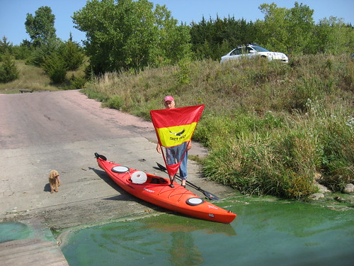
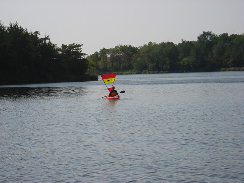
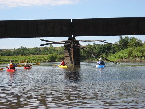
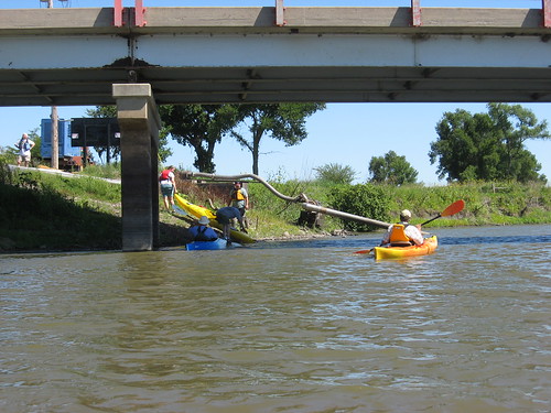
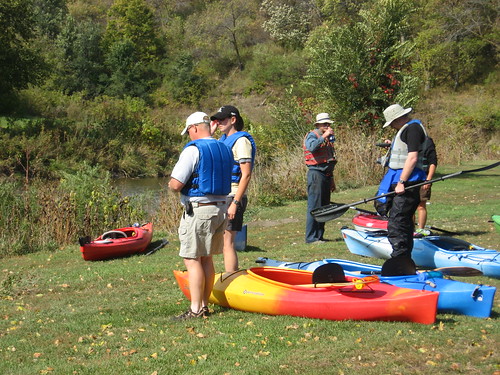
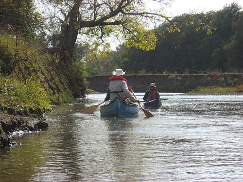
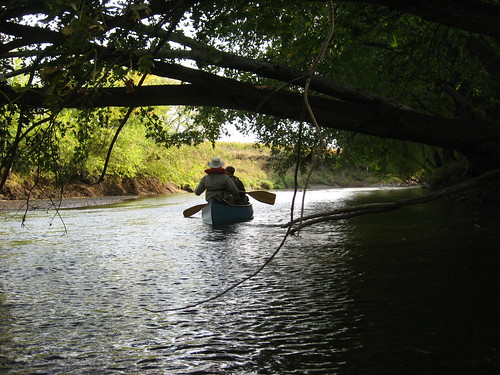
Under the leadership of SDCA president Gene Preston, a fleet of nine kayaks and one canoe set out from McHardy Park in Brandon yesterday afternoon for a cruise down Split Rock Creek to the Big Sioux River bridge over Highway 42 at the new arboretum development on the far eastern end of Sioux Falls. This is a SDCA sponsored cruise that has become traditional in the fall.
IMG_2758.JPG
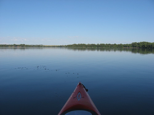
The day was magnificent with temperatures in the 60s, sunny skies, light wind. As the day wore on, the wind came up, but the conditions generally were great for such a venture. Initially, there was some concern about sufficient depth of water within Split Rock Creek, but the attractiveness of the cruise down this winding and scenic waterway won out, and the group set out about 1:30 heading downstream.
IMG_2765.JPGIMG_2767.JPG
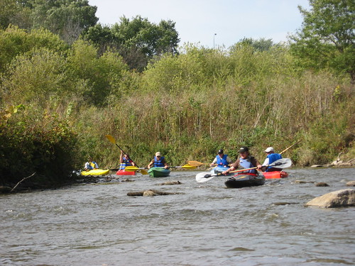
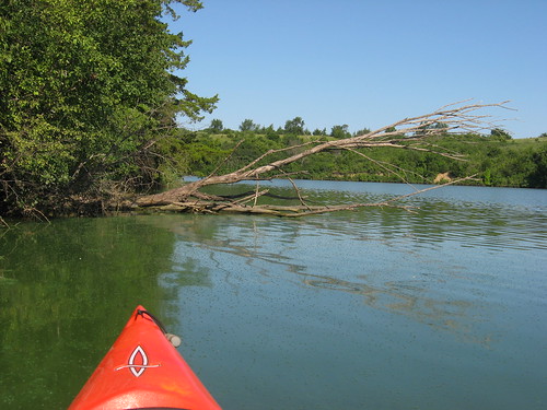
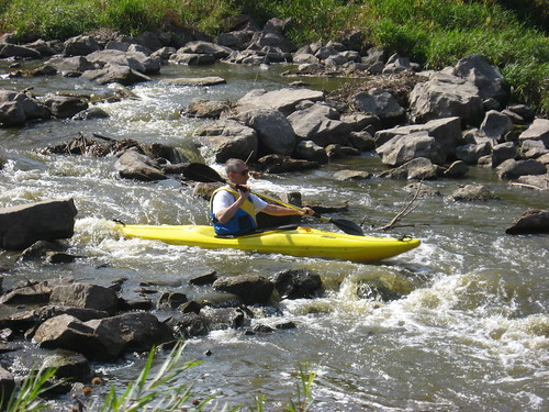
The first shallow spot on this waterway is always just around the first bend, and this was no exception. Pete Larson, one of the longtime SDCA members, showed us how to claw our way off shallow sand or rock bottom by using your hands to push the kayak up a little and, with both hands, to drag the kayak along the bottom. This technique worked pretty well on most groundings. Still, I got out of the kayak six or seven times during the trip to drag the kayak across shallow spots.
IMG_2770.JPG
IMG_2772.JPG
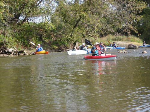
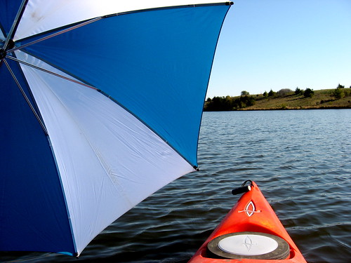
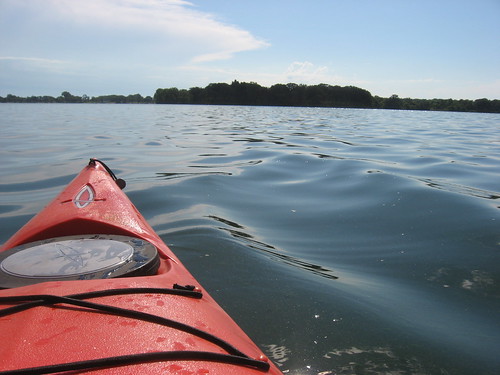
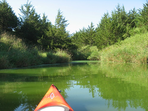
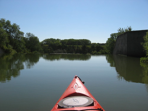
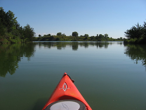
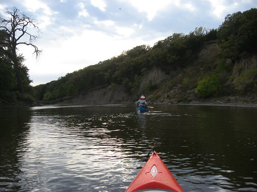
Split Rock Creek moves through the Brandon area, meets Beaver Creek, and finally joins the Big Sioux River. Each confluence adds volume to the flow, reducing the tendency to scrape along on shallow spots. Along Split Rock, the water depth ranged from 2 ½ feet or so to just a few inches. Navigational skill lies in the ability or luck in “reading” the river. There is almost always a channel, usually along the highest bank; that is not always the case, however, and taking the wrong side can mean clawing along with your hands, pushing along with the paddle, or just getting out and dragging the boat along. I forgot to take along a sponge; and every time I got out and back into the boat, more water tracked in with me until an inch or more water was sloshing around in the bilge. Larry, one of our better-prepared kayakers, let me use his a couple of times.
IMG_2774.JPG
IMG_2797.JPG
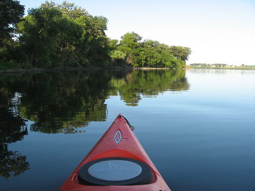
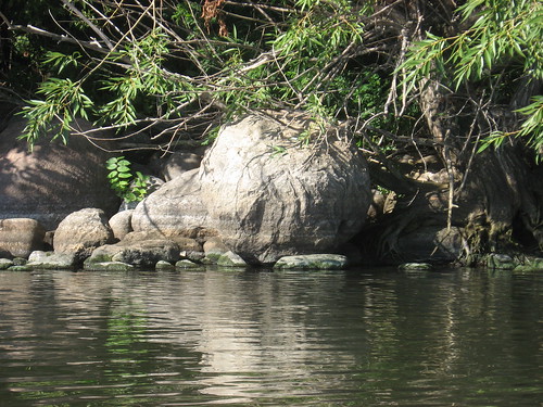
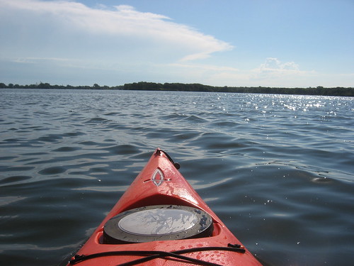
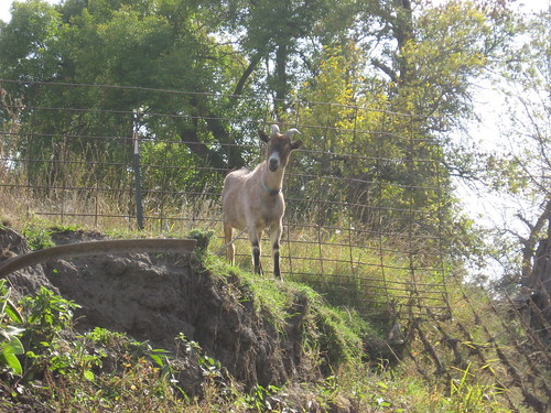
Split Rock Creek moves along, out of sight, behind Highway 11, passing the racetrack in Brandon, skirting the goat ranch just east of the racetrack, under a canopy of trees and some very high banks. A “rock garden” of big boulders offers an interesting sight just past the confluence with the Big Sioux River, and this point marks a change in water depth. The Big Sioux River seems, generally, a deep channel after Split Rock. Even on the BSR, however, there were shallow areas, generally where the river becomes wider.
IMG_2788.JPG
We passed a couple of electric fences along the way, but with team work managed to get by without getting shocked.
IMG_2790.JPG
IMG_2773.JPG
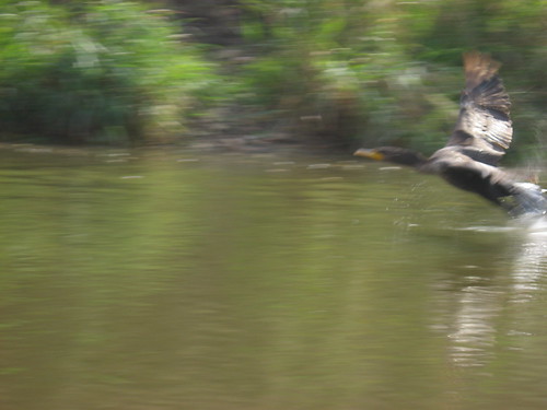
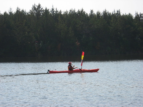
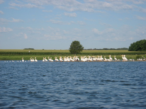
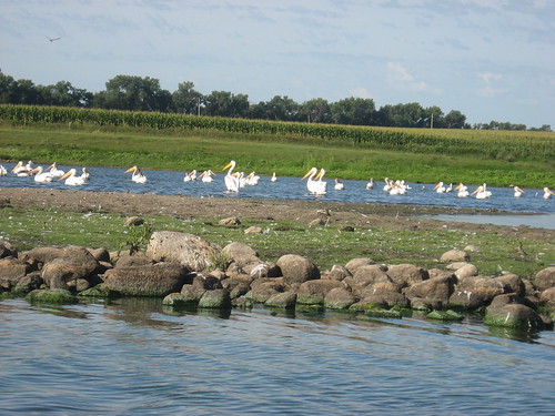
We saw lots of waterfowl along the trip: geese, ducks, great blue heron, and a few cormorants. Along the BSR, very near the “take out,” we passed along a great set of duck decoys both fixed and floating. As I passed a blind of brush and logs, three guys in hunting gear rose up with shotguns in their hands. They wanted, obviously, to give us a scare. I think that I was too tired to react to their stunt, at least to provide the sort of start they probably wanted. Still, I wondered if we had stumbled into a hunting season – the sort of thing that I dread on a river trip.
IMG_2796.JPG
IMG_2800.JPG
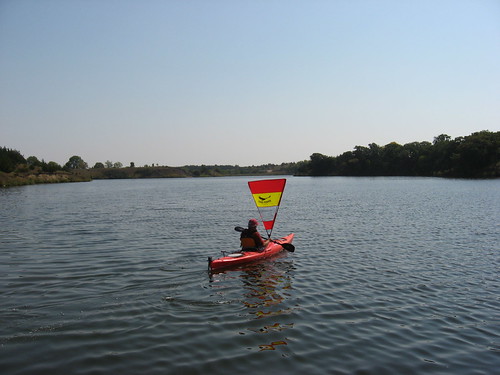
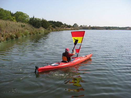
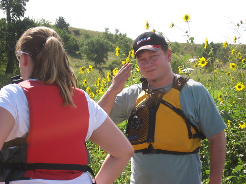
There were boats on this trip from Pierre, Mitchell, Jefferson, as well as the general Sioux Falls area. Pat Wellner, an engineer from Pierre, measured the trip at 8.65 miles on his GPS(Check out the link for his review and photos of the cruise). The trip this year took between 4 ½ and 5 hours, and this was a bit on the long side. During most years, the cruise can be accomplished in 3 to 4 hours. My back was a bit sore after five hours sitting in the kayak, and clawing along shallow spots or climbing in and out of the boat is a little tiring. This was a great cruise, a great way to spend Saturday afternoon. I was pretty tired, however, by the time I got home.
IMG_2802.JPG
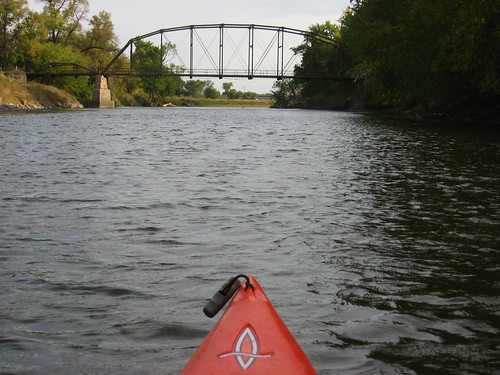
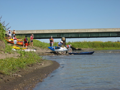
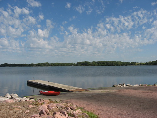
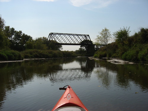
(bridge at the arboretum near the Perry Nature Area "take-out.)

Monday, September 22, 2008

First Use of Spirit Sail

First Sail
IMG_2733.JPG

The sail for my kayak that I ordered from Spirit Sail arrived while I was in California visiting old Peace Corps pals. This past weekend was the first chance for me to try out the sail in light winds. A day or two before, the wind was blowing 25 miles per hour, and I thought that it would be best to make a first effort at sailing the kayak with a real sail under milder conditions. So, on Saturday, the winds were light, probably too light. In the morning, I looked out at the trees and saw leaves slightly moving. But, this was the day, and I just hoped that there would be some wind at Lake Alvin. The weather bureau reported winds at just over 5 mph, and for South Dakota that is almost a flat calm.

I headed out to Lake Alvin with Marsha and our dog; our Saturday routine always calls for a walk in one of the nearby nature areas around noon. Lake Alvin seemed okay for both needs – a walk for Marsha and Finnegan and a try-out of the sail for me.
IMG_2717.JPG
Earlier, I had attached the sail mount to my kayak. I drilled out four holes on the fore deck of the kayak and, with some difficulty, managed to get the mount attached along with a backing plate on the bottom of the deck. The mount has a fitting to attach the sail, and it is possible to rig the sail while underway. I needed to practice attaching the sail and adjusting it, as well as sailing the kayak downwind.
IMG_2718.JPG
IMG_2721.JPG
The sail is called a “downwind rig” and is akin to sledding down a hill. As long as the boat is running within 30 degrees either way of the wind direction, the sail should draw. There are three settings for the mast, and the sail can be adjusted by grasping the mast mount, lifting it free of its seat, and adjusting it for straight downwind sailing or sliding it to either the left or right to the 30 degree mark for sailing slightly off the wind. It is by no means a sail that would permit tacking. My rudder acts somewhat like a centerboard.
IMG_2725.JPG
The sail can be used for messing around on a lake as long as the kayak is placed in a position where the direction of travel is downwind. Like a sled, the kayaker might have to paddle upwind to a point and then sail back. If the direction of travel were to be lengthy, such as on a wide or long body of water, the sail might ease the burden of paddling and be used to effortlessly move along.
IMG_2732.JPG
The sail can also be used just as a chance to experience the most rudimentary form of wind-born travel. Many of the features of sailing are there: the draw of the sail, the luff in a sail as the wind shifts across its surface, the snap of the sail as the wind grabs it, and the sound of water passing under the hull just from the pull of the sail.
IMG_2741.JPG
This sail is called the “mid-size” and is billed as good for “older (geezer)” sailors. The sail area is only 8.5 feet, not really much more that my big golf umbrella. The advantage of the sail over my umbrella is that my hands are free to balance the paddle for a potential brace or draw. I steer the boat with my foot-operated rudder.
IMG_2747.JPG
On this occasion, I found myself more concerned with operating the sail than in enjoying the time on the water. I paddled from the dock in the Lake Alvin Recreation Area down to the fishing dock and then sailed back. The sail back was slow with the wind conditions. I could have easily have raced myself with just a leisurely paddle. But then, I chose a day with limited wind. I want to try it again with the wind about 10 mph and see how the boat moves. For now, I have the sail in its bag and will carry it in the bottom of the kayak on future paddles. When the occasion presents itself, I will set up the sail and continue to learn how to use it effectively.
IMG_2750.JPG
There is a certain irony in using a sail with the kayak. I got the boat, in large part, to provide another avenue for exercise – a form of exercise that is very appealing to me. The sail might reduce the exercise aspect of kayaking, and that would not be good. Also, it is not the effort of paddling that tends to bring on fatigue for me; it is, instead, the time spent sitting in the boat. I can only endure a couple hours before getting out and walking around. At my advanced age, four hours total is about my daily limit of paddling.
IMG_2748.JPG
For now, however, I can imagine those first days of sail as early man set out in dugout canoes with a scrap of sail to ease the effort. My sail is very similar to those earliest devices.

By the way, the regional magazine Living Here did a feature story of me in their fall issue. The cover is one of my photos of kayaking Split Rock Creek among the rock palisades.

Sunday, September 07, 2008

Sailing the Kayak

IMG_1752.JPG
Last week I went out to Lake Alvin for a little umbrella sailing. The wind was just right, and I was able to sail in a moderate breeze from the public access point on the northwestern side up nearly to the fishing dock on the southeastern shore. The umbrella can be shifted to capture the wind along an arc of perhaps 60 degrees, 30 degrees on either side of the wind direction. I was alone on the lake and just cruised along, laughing in the light winds. I had to paddle back down to the western end of the lake, but I was able to umbrella sail again across from the south to the north side.

As I have begun to run out of new waters in the Sioux Falls area, I have turned to the notion of sailing as a way to add a little spice to my paddling activities. The notion of adding a sail to one of my kayaks has held appeal to me for many years, but the cost of a sailing rig has deterred me. Using the umbrella has been sort of a novelty, and I have enjoyed the feeling of being pulled along faster than I can paddle while hanging on one- handed to a big golf umbrella.

In the last couple of weeks, I have begun an e-mail correspondence with another former University of South Dakota professor who has moved to Virginia. He contacted me in response one of my postings and invited me to check out his own blog describing kayaking experiences along the coast in the Virginia area. He really offers wonderful photography and narrative description of exploring the lakes, rivers, and coast of Virginia in his fleet of sea kayaks. I was immediately taken by remarks about sailing the kayak using a “Spirit Sail.” This is a very basic sailing rig that can easily be fitted to nearly any kayak. It is a “downwind” sail that can be adjusted on its mount 30 degrees either side of fore and aft.

After reading his narrative and looking at the photos, I located the company that sells these sails and called the owner. We had a nice chat about her experiences using the Spirit Sail, and she answered the several questions that I had.

The long and short of this is that I have ordered myself the “mid-size” Spirit Sail that comes with everything needed to install it: mounting plate, bolts, sail, mast, battens, and carrying bag. The cost was $225, which seems a modest investment for the fun I anticipate and the new experience of dealing with winds and sails. The sail has already been shipped, and I look forward to using it yet this fall before the winter chill sets in too deeply.

I highly recommend checking out the Virginia Paddler at http://www.virginiapaddler.com/ You will find the Steve Hildreth is an excellent writer who offers very interesting observations and comments about his kayaking ventures. You can also read in some detail about how he has adapted the Spirit Sail to fit his kayaking needs. If you want to check out the sail rig itself, you can go to http://spiritsails.com There is a range of accessories to the sail so that it can be adapted to most kayaks or canoes, and there are two size sails. I got the smaller of the two, the “geezer” sail for timid old-timers. I can hardly wait for the sail to arrive and a good day to head out to Lake Alvin to sail off in search of adventure in my sailing kayak!

Sunday, August 24, 2008

The James River: South from Mitchell

James River – August 2008

Under the leadership of Jarett Bies, a South Dakota Canoe Association (SDCA) fleet of 16 kayaks set out for a 12 mile cruise down the James River this Sunday morning. The “put-in” was at a public access point at the bridge on State Highway 38, just a couple miles east of Mitchell. An easy launching area along with ample parking is available for canoes or kayaks at this site.
IMG_2578.JPG
IMG_2580.JPG
Jarett Bies organized a shuttle service, and a few cars were positioned twelve miles downstream near a bridge at 258th Street, just four miles east of the bridge and three miles south of Highway 38. The highway mileage from the put-in to the take-out is just over seven miles, although the river distance is twelve miles.
IMG_2585.JPG
There were three boats from Pierre, two from Vermillion, two from Brookings, and others from a variety of communities, many from the Sioux Falls area. The put-in is about 70 miles west of my eastside Sioux Falls home. The informal standard for kayak trips for me is “less time on the drive than on the water.” The roundtrip drive took me about two and a-half hours, and the cruise took about four hours. On this trip, there were no canoes; everyone was in a kayak. There was, however, a tandem kayak along on the cruise, one of the boats from Pierre.
IMG_2593.JPG
The weather for the cruise was perfect; there was sun the entire day, only a little wind toward the end of the trip, and the temperature was in the high 70s and low 80s. Even wearing a hat with a wide brim, I came home with a red face. There was plenty of depth to the river along the entire course. I never went aground in my kayak, and the water in the channel was usually between five and seven feet deep. Passing under a railroad bridge, previous flooding along the river was quite evident with tree limbs caught in the bridgeworks twenty feet or so over the current level of the river.
IMG_2589.JPG
The river was, according to the estimates of two civil engineers among us, generally about 150 feet across, and there were no hazards to navigation at all: no rapids, no sand bars, no shallow water, no deadfalls or sweepers across the river, and no fences. The shoreline is varied, but not as much as along the Big Sioux. Generally, there is a high bank on one shore and agriculture just beyond the shoreline. There are usually trees along at least one side of the river, often large trees. We saw little wildlife on this trip. With 16 kayaks moving along the river at mid-day, it is likely that birds and other critters just waited for us to pass.
IMG_2583.JPG
The river is a little slower than the Big Sioux. One of our group had a GPS, and he informed me that our speed was generally about 3.3 miles per hour. We made one stop along the way to stretch it out.
IMG_2603.JPG
Even with 16 kayaks on the water, we were spread out for over a mile. Sometimes I paddled along with no one in sight. Other times, I paddled along with one or two people. Conversation groups formed and dissolved as we cruised along. No one was in a hurry; we just cruised along. If someone fell too far behind, one of us would slow down and wait a little while. One of our group was on his first kayak cruise in his brand new boat; he was a novice and learning as we went along. Others were veterans of many kayak trips in a variety of waters.
IMG_2598.JPG
None of us had been on this stretch of the “Jim” River, and many of us had not been on the James at all before today. We didn’t know what to expect of this river. All of us, though, left with a very positive image of this paddling opportunity. This was a perfect stretch of water for a four-hour cruise. Mitchell isn’t really so far from Sioux Falls, and it is also only a couple hours from Pierre. Kayakers from Pierre often participate on SDCA outings, and it was good to finally have an event within a decent drive for them (Check out Pirates of the Missouri from my kayak links). I drove out on Interstate 90 and just cruised along with no trouble. On the way back, I decided to take the scenic route along Highway 38 and drove back on the two-lane listening to “the best” of Bruce Springsteen on my car CD player.
IMG_2595.JPG
So, as Jarett Bies would say, “ the intel for the trip was great, and this was a good op.” We all had a great time on the Jim.
IMG_2610.JPG
You will probably find further descriptions of this cruise on the following blogs which can be accessed through my links: SDCA, Kayak SoDak, Peddle and Paddle, and Pirates of the Missouri.

Wednesday, August 13, 2008

Lake Herman - Mid-August 2008

IMG_2510.JPG
In preparation for a kayak trip this morning, last night I loaded the boat on top of the Honda Civic and made sure that all my gear was ready for an early morning departure for one of the area waterways. I decided to return to Lake Herman, near Madison, SD, and about 58 miles north and west of my eastside Sioux Falls home. I left town at 7:00 a.m. and arrived at Lake Herman State Park about 8:00. The winds were calm, the temperature was in the 60s, and the lake was deserted. Although this is known as a busy lake on weekends and holidays, on this Wednesday morning in mid-August, I did not see another boat on the lake; it was completely deserted throughout my entire cruise.
IMG_2513.JPG
Lake Herman is a good-sized glacial lake with a general north-south orientation. The surface area is 1,350 acres, or about 15 times that of Lake Alvin. The map of the lake resembles a seahorse shape, divided into a northern larger portion and a smaller southern part, with the lake narrowing through a strait at the dividing point. The distance from the northern shore to the southern is about 2.5 miles, and the lake is about 1.5 miles wide at the greatest separation, east to west. I paddled in my usual perimeter fashion and covered about 2/3 of the shoreline. I ran out of time and did not cover the northern half of the larger portion, even though I spent two hours on my paddle. My rule is to spend less time in the car than on the paddle, and I needed to spend those two hours in the boat in order to live up to my self-imposed personal expectation. My route along the lake was rather slow paced with time to appreciate the landscape and to take photos. I would guess that two hours of steady paddling would be adequate for a circuit around the entire lake.
IMG_2516.JPG
The South Dakota Department of Game Fish and Parks manages a park along the eastern shore, and there is a very functional launching ramp, ample parking, and a vault toilet just inside the park entrance.
IMG_2553.JPG
The park property extends from about the middle of the eastern shore of the larger portion of the lake, down south around a peninsula, and continues south toward the middle of the southern portion of the lake. Even past the park property, though, there is nearly continuous tree growth along the shore to the west side of the southern portion. I kayaked for 30 minutes or more before coming to a group of about a dozen cabins on the eastern shore of the southern portion.
IMG_2522.JPG
Passing offshore of the cabins, I noticed a flock of pelicans hanging out on a narrow spit of land along the east side of the southern body of water. I was able to get pretty close to the flock without spooking them into flight. As I got closer to them, they began edging off their point and moving a little farther away from me. There must have been a couple dozen pelicans, along with some of their pals, the gulls.
IMG_2530.JPG
IMG_2543.JPG
I continued along the eastern shore, past a resort that was a 4-H camp, until I reached the eastside public access point. This launching area is across the northern portion of the lake from the park, and this is the widest part of the lake. While the park itself is a “fee area,” no park sticker is generally required at “lake access” points.
IMG_2550.JPG
When I arrived at the lake, there was nearly a flat calm upon the water at the park launching area, and this calm extended about 100 yards off shore. The sun was low on the horizon at 8:00 a.m., so I was able to stay in the shade as I made my way south along the western side. On the way back north, however, the sun had come up higher, and I was in direct sunlight; in addition, the wind came up, creating 6-8 inch waves in unsheltered parts of the lake, especially noticeable as I headed west back to the dock.
IMG_2556.JPG
But, again, the lake was deserted. There was no worry about wakes to avoid or concern about being run down by a maddened power boater. No one was even fishing!
IMG_2559.JPG
I was very pleased with the paddling opportunity this morning. The shoreline of Lake Herman is mostly wooded, and there are cabins on only a few scattered parts of the lake. Much of the shoreline is ringed with large boulders to prevent erosion. There are no islands in the lake, nor much in the way of coves to be explored. This is a fine lake for paddling, with a good bit of variation in topography. The lake is pretty large in terms of prairie lakes, and wind will always be a factor when venturing out on such a large body of water.
IMG_2561.JPG
A few years ago, I visited Lake Herman with my Folbot, but I was not much impressed by its possibilities; it did not draw me back. This time, I have a very different view. The nearly perfect conditions observed created a warm feeling in me toward this body of water. I like the tranquility of the lake, the foliage along most of the shoreline, and the variations presented by such a larger body of water. I recommend Lake Herman and will be returning.

Thursday, August 07, 2008

Mid-Summer on Lake Alvin

IMG_2502.JPG
In retirement, it seems to me that one of the major tasks is to keep fit. Each day I try to engage in a set of outside physical activities for two hours; in a given week, I will go kayaking once or twice, go on a circuit of the Sioux Falls bike trail (20 miles) once or twice, and take a long hike in one of the nearby nature areas, usually with our dog, Finnegan, the other days of the week. This was a day I had set aside for kayaking. While I most enjoy going to a new or seldom visited area, sometimes going out to Lake Alvin is my best bet, especially if there are other obligations coming during the day. A trip to Lake Alvin can be accomplished in 2½ hours, providing a good 1½ hours or more on the water. It is 15 minutes from my driveway to the dock. I go out to this body of water about a dozen times a year.
IMG_2489.JPG
While it may seem as though this lake might become “old hat,” I nearly always find a new slant to the water, the skies, the angle of the sun, the shoreline, the birds, and the foliage. Each trip to the lake is unique, there are always subtle changes to observe, special nuances about the environment that capture my attention.
IMG_2497.JPG
Today, I put in at the public access area and found it deserted, as usual. There was only a light breeze that ruffled parts of the lake. I considered taking my umbrella to sail a little, but there was too little wind to make that worthwhile. Parts of the lake were in the lee of the wind and were a millpond. This phenomenon creates sharp reflections, and I enjoyed looking at the foliage as it formed a dual pattern of images.
IMG_2491.JPG
The surface of the lake was varied. In those areas touched by the wind, there were 2-inch waves lapping the side of the kayak. In those sheltered areas, there was sometimes a thin green coating of algae spread out from the shoreline. There are a number of little coves along the shore, and this was a good day to move into them to observe the still waters.
IMG_2492.JPG
One boat was out on the lake with two guys on their first time fishing this lake. They asked me were the fish were biting, but I’ve never fished the lake. In fact, I have never been sport fishing. A couple of times in my life, I have worked as a deckhand on fishing boats in the Pacific Northwest, but I don’t know anything about sport fishing. I had no advice for these guys. I did, however, see lots of carp in shallow waters, but I doubt that this is the sort of fishing they had in mind.
IMG_2500.JPG
I did the normal circuit of the lake perimeter, beginning at the public access area, going across the lake and up toward the fishing dock, around to the spillway, and then back down the shoreline past the swimming beach and the Recreation Area dock, ending up at the public access dock again. I did not go up into Nine-Mile Creek today. I was to meet my wife and a couple of friends at a restaurant downtown in Sioux Falls at noon, and my time was running out.
IMG_2507.JPG
Lake Alvin is a great place to paddle for exercise and also provides a bit of scenery. I have never been able to maintain a gym membership; I prefer outdoor activities for caloric expenditure and to keep my muscles toned rather than work on machines in a gym. So, I have to remind myself that Lake Alvin is a good spot for paddling and looking at the environment, and it is not always necessary to drive so far to another lake every time I want to go out.
IMG_2499.JPG
A guy and his dog were in the public access area as I wrapped up my little cruise today. He told me that his daughter and her husband have kayaks and have been out in the Pacific Ocean with their boats, as well as down whitewater rivers in Colorado. Maybe he was offering a contrast to my rather tame circuit around Lake Alvin. But then, he was standing on the shore, and I was out in my kayak on the lake: Better Lake Alvin on a calm day than kicking back in the recliner watching the day pass.