This blog is designed to highlight the paddling opportunities within South Dakota, mainly within a 50-mile radius of Sioux Falls. While Sioux Falls is far from the adventure of coastal regions, there is a certain satisfaction in utilizing the available waterways to observe weather, water conditions, and the landscape along the shoreline. In addition, there is a wealth of animal life on the waters of small South Dakota lakes, rivers, and creeks, including geese, ducks, pelicans, great blue heron, egrets, hawks, owls, perching birds, deer, raccoons, and beaver. Eagles, fox, and coyote are also sometimes spotted.

The sites described are places where I have kayaked over the past few years, mostly in South Dakota but sometimes including locations in Iowa and Minnesota. One of the best sources of information on the accessibility of small lakes is the South Dakota Atlas and Gazetteer, the large map book of South Dakota. Lakes with a public access are generally identified by a boat symbol marking the location of a launching site on public land.

You will notice the menu of paddling locations on the right side of the blog. Each of the postings is linked to one of the areas, and my intention is to provide a continuing review of the places where I paddle. Perhaps these narratives will help readers select waterways of interest to them. Please feel free to offer a comment regarding any of my postings; I would welcome the dialog.

I also maintain a companion blog that describes hiking opportunities within the Sioux Falls area. You can access that blog at: http://hikingsiouxfalls.blogspot.com

Sunday, July 29, 2007

The Missouri River in South Dakota: Myron Grove to Clay County Lake Use Area

This past weekend I had a spontaneous invitation to join Jarett Bies and his wife Laura on a short cruise on the Missouri River. Although I have been on a lot of canoe and kayak trips in South Dakota over the past thirty years, I never had an opportunity to use such a craft on the Missouri. The notion of going along with them on this trip was instantly attractive to me.

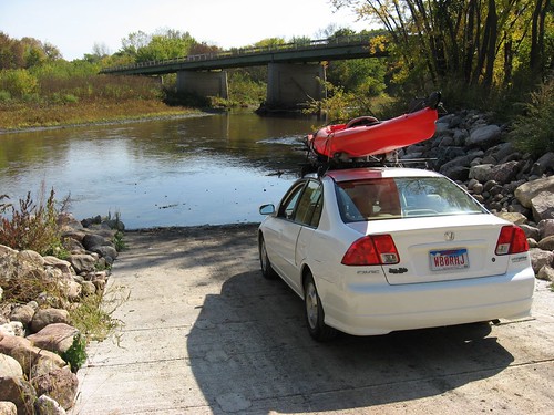
We set out from Sioux Falls at 10:00 a.m. and went down the Interstate to the Vermillion exit and then traveled west along Highway 50 through Vermillion and onto Timber Road. This road led us just a few miles west until we passed the Clay County Park (also the state Lake Use Area) which would be the take-out spot. We then continued along Timber Road for about 6 miles or so until we came to a gravel road leading down to the Myron Grove County Recreation Area – also know locally as the “highlines.” The distance between the two points by road is a little over nine miles.

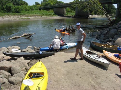
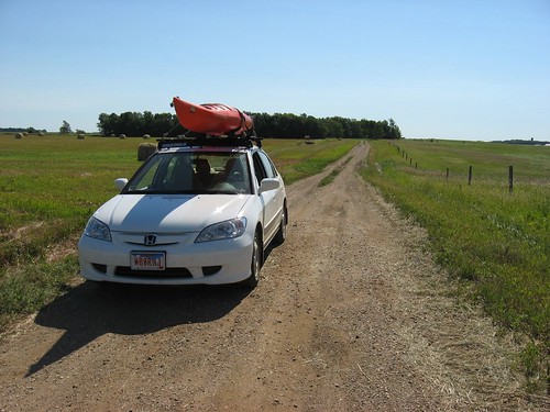
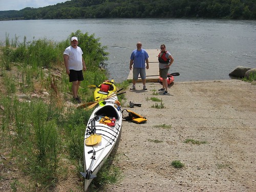
We left our three kayaks at Myron Grove with Laura, and Jarett and I drove our cars back to the Clay County LUA where we met a friend of Jarett’s who had agreed to shuttle us back to the departure point.

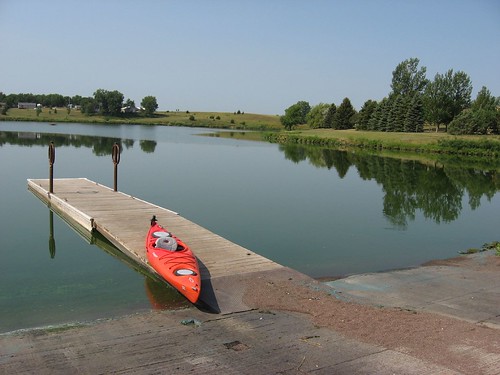
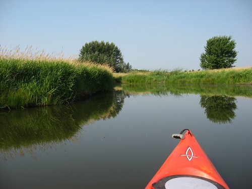
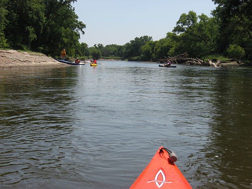
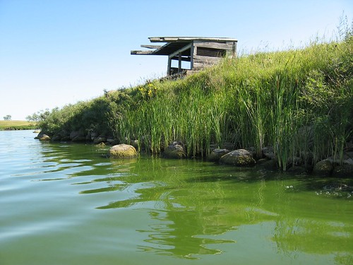
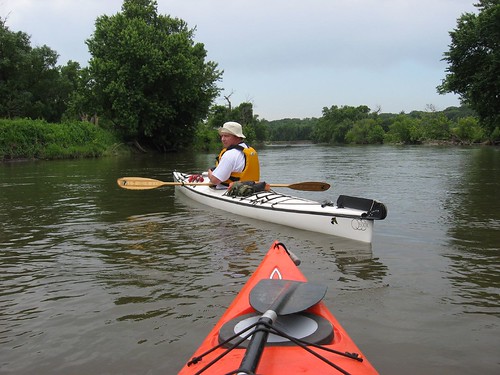
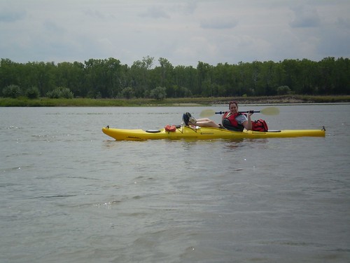
Myron Grove is a good launching point with a ramp, dock, and decent parking. The water gets deep quickly along the shore, so we put our kayaks in alongside the dock. The current was moving along, so the trip got a quick start as we set off.

IMG_1223

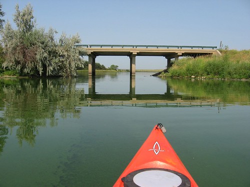
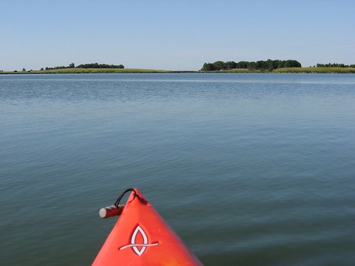
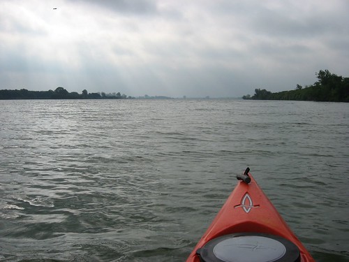
The Missouri River from the Gavins Point Dam west of Yankton downstream to the Ponca State Park in Nebraska is a 59 mile stretch of river that is listed on the National Register of Wild and Scenic Rivers. The appearance of the river is said to be much the same as when Lewis and Clark made their assent in 1803. This section of the river is known for its large wooded islands and sandbars.

P7280298

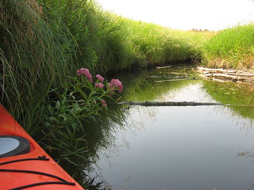
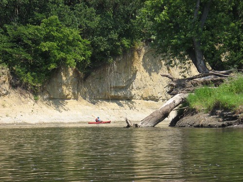
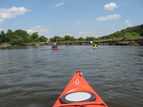
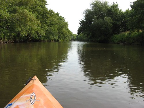
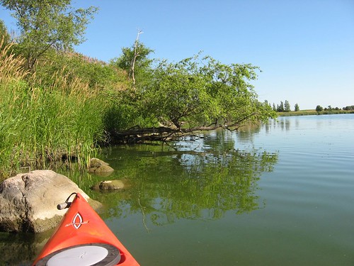
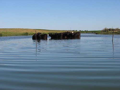
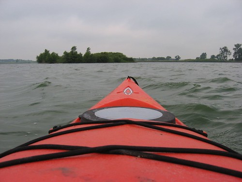
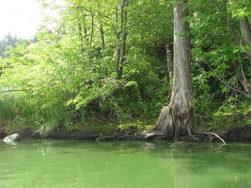
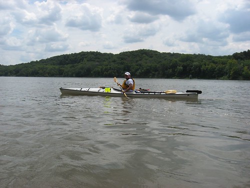
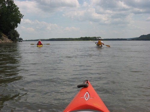
The river at Myron Grove is relatively narrow, at least according to Missouri River standards. There is some development in the nature of scattered lake homes on the South Dakota side of the river, but the Nebraska side, as well as the large islands in the stream, is much more undeveloped.

IMG_1240

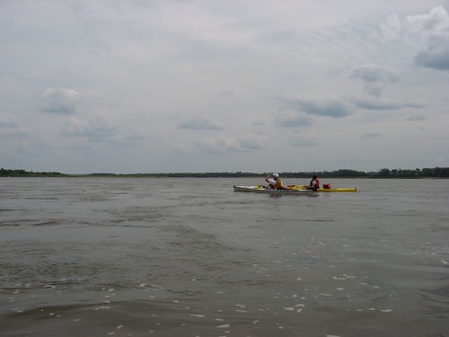
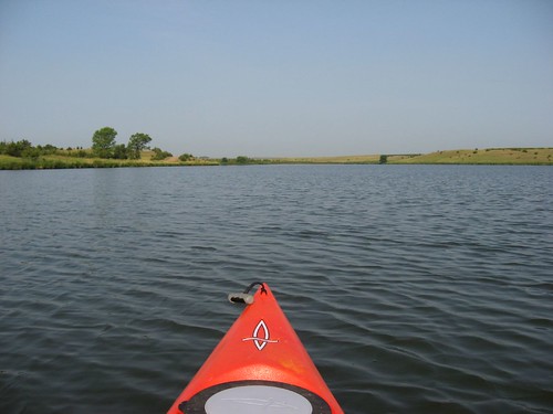
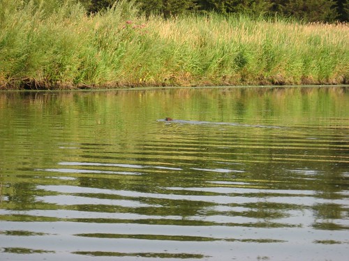
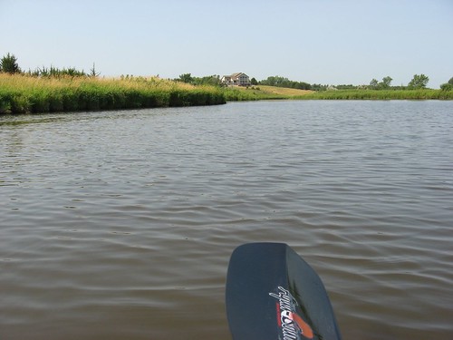
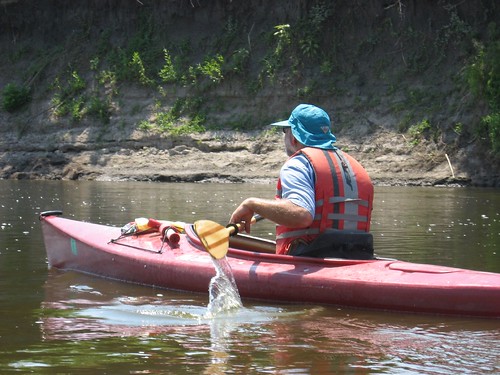
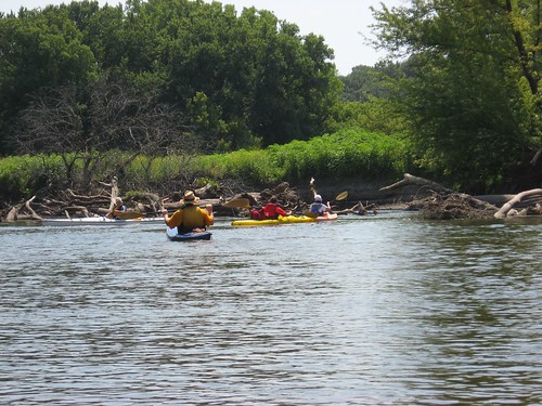
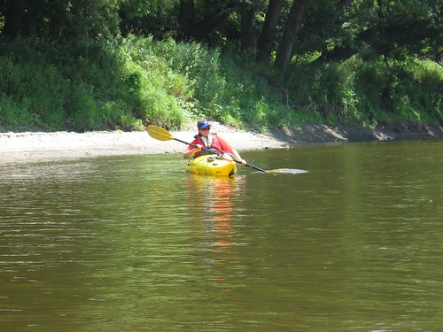
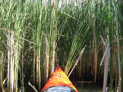
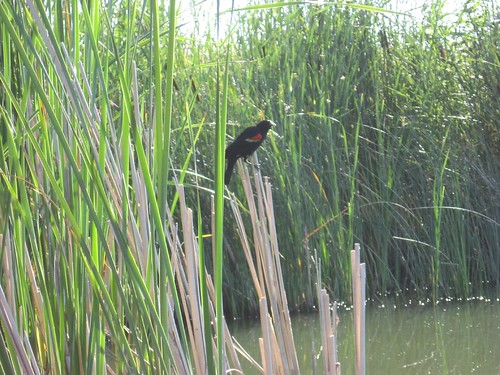
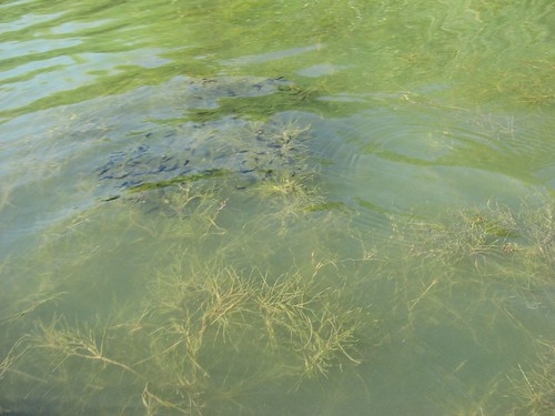
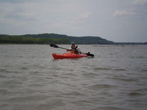
We kept to the South Dakota side of the river as we made our way downstream. We found that it was necessary to carefully “read” the river as we moved along; the biggest challenge was avoiding rapid shelving of the water until we found ourselves stranded on shifting sandbars. I actually had to get out of the kayak at one point and drag it a few feet off a sandbar. It felt odd to be in nearly the middle of the Missouri River standing in a couple inches of water! Jarett and Laura were able to wiggle and pole their kayaks off without having to get out. Except for a couple of times when we ran into this very shallow water, there was plenty of depth to the river. The current was fast but not a problem. There was some head wind, but it served mostly to cool us down. The day was nearly perfect with a partly cloudy sky and a temperature of about 80 degrees.

IMG_1226

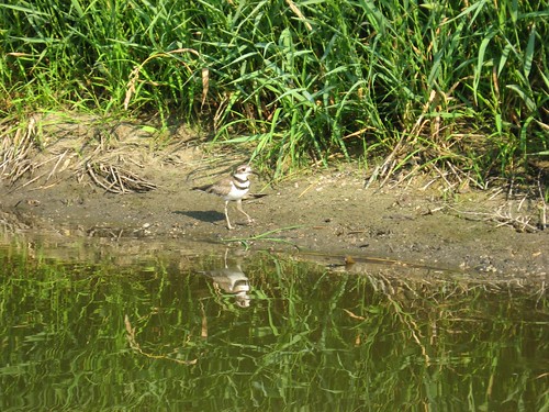
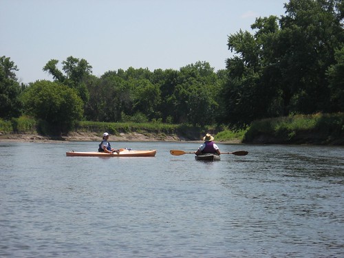
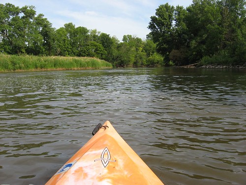
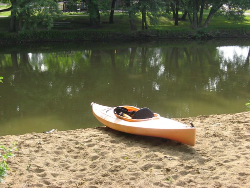
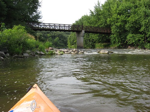
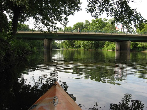
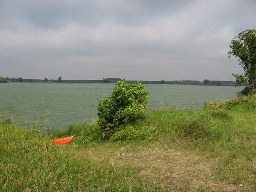
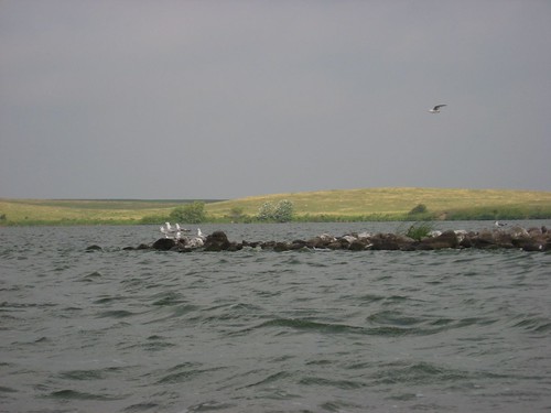
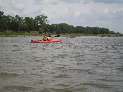
The distance from Myron Grove to Clay County LUA is listed by the State Department of Game, Fish, and Parks to be 7 miles. We cruised along enjoying the scenery, checking out many great blue heron and the large jumping fish, chatting, and completed the trip in one hour and forty minutes. The take-out point at Clay County LUA is even more well developed than the put-in at Myron Grove.

IMG_1228

With the weather and flow conditions that we experienced, this seemed to me like a great opportunity for people to experience travel along the Missouri River. The put-in and take-out are first rate, there seemed to be no hazards to navigation, and there were very few power boats on the river. We passed a large youth group in about a dozen canoes pulled ashore on Goat Island and then saw them as they finished up at Clay County LUA. Even coming from Sioux Falls, this is a great way to spend the afternoon. You can leave Sioux Falls and be at the put-in within an hour and forty-five minutes. From the take-out, it may take an hour and fifteen minutes to get back home.

P7280304

I found that the wide expanse of river is quite a different experience than on streams like the Big Sioux River. The current on the Missouri is a bit faster and, of course, there is much greater depth of water. Along the smaller streams, there might be a greater sense of intimacy with the river because of the close banks, trees that cast the traveler in shade, and the need to attend more closely to navigation. Also, there is usually a greater sense of isolation and a greater opportunity to come across wildlife. Still, going out on a big river has its exhilaration and sense of adventure. Moving along the Missouri River, you can’t help but be aware of endless possibilities for further travel – all the way to St. Louis and on down the Mississippi to New Orleans. While the Missouri River upstream is a series of very large lakes behind a set of dams, this section from below Yankton to Ponca is a great way to connect with historical river travel from the 19th Century.

P7280294

The only rub with this sort of trip is the need for arranging a shuttle. Also, Jarett told me that some groups have found conditions on the river that included strong headwinds and waves. That could be nasty, but we found a nearly perfect day. We thought that the trip could well have included another five mile or so segment. The SD Department of Game, Fish, and Parks has published a brochure, Canoeing and Kayaking in South Dakota, that gives river miles between points on major streams in the state, including the Missouri River from Fort Randall to Ponca State Park. This is a valuable resource in planning trips along the rivers of SD.

Tuesday, July 24, 2007

Lake Vermillion, the West End

Lake Vermillion – A Cruise up the West End to Battle Creek: Late July 2007

This has been an especially dry month in the Sioux Falls area, and I wanted to check out the conditions up in the feeder creeks that flow into Lake Vermillion on the west side. The west side is generally all that portion of the lake west of the main recreation area dock and beyond the County Road 3A Bridge. This is an area of the lake that receives very little motor boat traffic and is often quite calm, at least as compared with the windy conditions that can arise quickly on the main body of the lake.

IMG_1219

I took off from my east side Sioux Falls home about 7:30 a.m. and traveled west on Highway 42, listening to Bob Dylan tunes on my car CD player, arriving about 8:30 to a very hot and still launching point within the main part of the park. The temperature was already in the 80s when I left the dock and had climbed to around 90 when I returned. There was virtually no wind at that time, and the bird calls and sounds of insects were very clear. The lake had a mirror surface. As often on these mid-week trips, there were no boats or people visible, and I did not see anyone on this cruise; the lake was deserted.

IMG_1211

IMG_1186

I headed out into the lake, went west under the bridge, and began exploring the inlets that flow from the northwest into the lake. There was a great deal of particle algae growth in the main part of the lake, although I could see down to about three feet through the swirling algae. As I moved west under the bridge, the water began clearing up a good deal. I suppose that the water flowing into the lake pushes the algae out into the main body.

IMG_1212

As you head west on this portion of the lake, there are a number of passages that lead up into the marshy shores. I took the most northerly passage first and was able to travel up about half a mile before grinding to a halt on a gravel bar in a very narrow portion of the feeder creek. I believe that this first passage is Battle Creek. On this portion of the cruise, I saw a beaver swimming near my kayak and a large number of birds flying, in the bushes, and standing around on the gravel or mud bars along the shore. Surprisingly, the birds often seemed lest flighty that I expected. I was able to come within just a few feet of some of them before they took wing.

IMG_1189

IMG_1195

The more southerly passage begins near a home that has been built on the south bank. The kayaker just passes this house and its dock on the left and continues heading west. This inlet passage is wider than the northern one and winds a little deeper into the marshes until it too came to an end after about half a mile.

IMG_1200

On both of these passages, there was plenty of depth to an increasingly narrow channel. I was able to continue up both of these passages until the width of the channel was only three or four feet, and I was able to use my rudder on nearly the entire cruise.

IMG_1202

I saw lots of jumping fish, many smaller birds, and the beaver mentioned above. The vegetation was interesting, especially the marshy growth along both shores. I was not troubled by bugs, I never had to get out of the kayak to shove off shallow bars, and the total isolation from other boats or people provided the conditions for a contemplative cruise. From shoving off at the dock to returning, the cruise took me 90 minutes.

IMG_1207

This portion of the lake would be an excellent choice on the weekend when lots of power boats are out on the main body of Lake Vermillion. Also, this western end is much more sheltered from the wind, so breezy conditions would be less noticeable than on the main body. It is also more isolated so that the kayaker can be assured of some solitude while cruising up into the feeder inlets.

So, Lake Vermillion provides three general routes. This one up the west end is the easiest and best for some circumstances. The cruise north on the main body can be taken along either side, and the conditions are a little different on this trip up north through the lake and into the Vermillion River depending on the route chosen. Earlier postings describe the northerly cruises on both side of the lake.

Sunday, July 15, 2007

The Big Sioux River - Lake Alvin to the Klondike

The Big Sioux River: From Near Lake Alvin to the Klondike – July 2007

IMG_1146

The South Dakota Canoe Association (SDCA) sponsored a Big Sioux River cruise from the public access area at the bridge on 272nd Street near Lake Alvin to the bridge just above the old Klondike dam off County. Road 116 on the Iowa side of the river. This is a river distance of about 8 miles and was a leisurely two and a-half hour cruise for most people.

IMG_1155

The cruise was led by Larry Braaten of Canton, and there were 28 boats within the flotilla that set off about 1:30 p.m. yesterday, Saturday, July 14. The majority of the boats on the cruise were kayaks, but there were also a good number of canoes. Paddlers ranged from those with very limited experience to well seasoned veterans of many years on the water.

IMG_1152

Even though the flotilla seemed large as it assembled at the put-in, within just a few minutes the craft were spread out along the route so that people could paddle alone or with small groups of companions. As I paddled, I seemed to drift among a couple of congenial groups of two or three people. Often times, the spread of boats meant that other groups were out of sight ahead or behind. There is a strong social aspect to a cruise of this sort. It is a time to network with people of some similar interests and an opportunity to get to know a few more paddlers. There is a certain commonality among people who choose to spend some of their free time running rivers in kayaks.

IMG_1158

I did not observe any hazards to navigation on this trip of about 8 miles. There was plenty of depth to the water; it was only necessary to evaluate the probability of staying in the deepest channel by keeping generally to the high banks on bends. Most often, the water seemed to be around four or five feet deep. Some of the canoes would occasionally ground on sandbars or shallow areas, but it was easy enough for the paddlers to jump out and move on a few feet into deeper water. Kayaks seemed able to avoid grounding problems on sandbars. I touched sandbars a couple of time but was able to push off easily. I kept my rudder deployed during most of the trip, although I may have been alone in using a rudder; most other kayaks were not similarly equipped.

IMG_1164

There were no major log jams on this portion of the river, and the current was running pretty good. There was also no wind problem facing us, and the temperatures were moderate – the 80s I would guess. It was nearly a perfect day for a river cruise.

IMG_1147

The scenery along the route is pretty typical of the river in general. There are large trees on either side, some providing shade to the paddler. Lots of the trees are beautiful cottonwoods that reach up with massive trunks and leaves that whisper in the breeze. The shoreline generally shifts between a high embankment on one side to a slope down to the water on the other. Some banks are, in effect, cliffs while others are a few feet high. I did not see any “critters” on the cruise, only birds. There were a few homes up on the shore on the southern portion of the cruise, and we ran across one group of cattle standing around in the shallows on once occasion.

IMG_1149

The take-out for us was just above the dam, at the public access area on the Iowa side of the river. This is a serious “lowhead” dam that used to power a mill. It is not possible to run the dam, and it would be very risky to go over it. The first hint of completing this section of the river is the passage under a highway bridge. Just beyond the bridge is a large island that seemingly can be negotiated on either side. My group took the right side and came closely around the south end of the island just above the dam. The sound of falling water over the dam is quite clear, warning the paddler about the dam ahead. We were able to easily cut across in front of the dam to the take-out point. On another occasion, I think that I would go on the left side of the island to approach the take-out without cutting in front of the dam. This take-out did not pose much of a problem for any of the group. In fact, there were a couple of guys fishing there above the dam who quickly lent a hand to pull in landing boats.

IMG_1171

So, this was a very successful SDCA sponsored cruise. It was a great way to spend Saturday afternoon on the water, looking at the trees along the bank, navigating the shifting channel of the river, feeling free in our boats, and laughing it up with people of similar spirit. I do most of my paddling alone, but this is a wonderful addition to the kayaking experience. I hope to take more of these cruises this summer, and I appreciate the willingness of SDCA members to take on the leadership of such events.

Monday, July 09, 2007

The Big Sioux River Through Sioux Falls

The Big Sioux River – Through Sioux Falls: 26th Street Bridge up to bridge over the Bike Trail - July 2007

One of the most accessible waterways for those living in Sioux Falls is the relatively short paddle beginning at the canoe access point on the west side of the Big Sioux as it passes east 26th Street and continues up to the bicycle trail bridge over the river, about 1 ½ miles upstream.

IMG_1135

There is a large parking area at the launching point and a ramp of deep sand provided. This is a fairly easy put-in, but like most river launching points, the shallow shoreline is relatively narrow, and the water rapidly becomes deeper – maybe a foot deep just offshore. Parking at this launching point can be tight during the YMCA camp hours as the employees use this as a parking spot and cross under the bridge to the camp itself. I got to the area about 8:30 a.m., and there was plenty of parking available. When I returned about 9:30, the parking area was full. I think that there is nearly always some place to park there, and the launching area itself is a “no parking” zone.

IMG_1130

Cruising upstream, the paddler passes under the 26th Street Bridge with the bike trail on the left side and Camp Leif Erickson on the right. This is a scenic path up the river; the land on the left side is all park land, and the bike trail is largely hidden beyond the shoreline trees and brush. Occasionally, you catch a glimpse of people passing on their bikes. The YMCA camp property extends along the right side, and you can see parts of the Leif Erickson setting along the shore and through the trees.

IMG_1138

I found plenty of depth to the river as I cruised up and down this stretch. Within the channel, the average depth seemed to be about four feet. I did not run aground at all on the round trip. There was a surprisingly strong current running on this trip, and it got stronger as the river narrowed or split on occasion. It took me about 30 minutes to paddle up to the bicycle trail bridge, but I slowed a few times to take photographs. On the way back, it took about 20 “kick back” minutes to mosey along and enjoy the scenery.

IMG_1137

There is an interesting quality about this little cruise. First of all, the dense vegetation and heavy tree cover gives the impression of being in a remote area. It really is a scenic paddle. On the other hand, the sounds are mixed. You can hear the birds and the wind through the trees as well as the flow of water. At the same time, you can hear the sounds of young people in the YMCA camp, the hiss of tires on the nearby Interstate, and the snatches of conversation of people passing on the bike trail. Today, a freight train of many cars filled with rock passed along the east side of the river. The sound of the engines of this train set my kayak vibrating. The sounds pass, though, and I did not think of them as major annoyances.

The easy paddle is “book ended” by a set of rapids near the bike trail bridge on the south end of the cruise and by another set on the north end. There are no good portages around these rapids, although they can be run when the water is high enough. In the past, I have both run them and “lined” them (walking along the shore or hopping from rock to rock with lines attached to the kayak as it floats through).

IMG_1134

IMG_1141

I used to take this little cruise a number of times each year. It has been a couple of years, though, since I put my kayak into this section of the river. Now, I wonder why I didn’t do it more often. This is not a high adventure cruise by any means, and I may have just come to think of it as just too limited. But, that is narrow thinking, I believe. This stretch of the river is great for someone who wants a close area to paddle and has limited time to devote to the cruise. It is a one hour trip, and it is possible for nearly any of us to do this at “the drop of a hat.” This can easily be an after work paddle, an opportunity to get a little exercise with only the commitment of an hour or so. I recommend the trip for any of us who wants a short cruise without the drive or for people who are working on their paddling skills. It is a good place to practice upstream paddling; it is also a good place to slowly drift back while checking out the river life. The distance and conditions also make it easy to accomplish a short cruise without the bother of arranging for a shuttle or someone to pick us up.

Thursday, July 05, 2007

Loss Lake - July 2007

Loss Lake - July 2007

This morning I headed west on Highway 42 to Loss Lake, just north off of Highway 19 a couple of miles. Like many of the area lakes, it would be difficult to find this spot without some detailed directions or a good map. Just north of 263rd Street, there is a small sign off to the right, heading north, that indicates a public access area to an unnamed lake. There is a minimally maintained gravel leading up into a stand of trees where a launching area is provided by the SD GFP. There is a decent parking area and a primitive boat ramp; no toilet facilities are provided.

IMG_1111

IMG_1129

This was a pleasant morning in the midst of a hot July; at 8:30 a.m., the temperature was in the 70s, there was a light breeze, and the skies were clear. As always on this lake, I was alone for my contemplative paddle around the circumference. Today, I took about 70 minutes to paddle along the entire shoreline. There was plenty of depth to the water, although there was considerable algae growth along some of the shoreline.

IMG_1112

IMG_1115

I did not see any waterfowl today, unlike most other times on this lake. I did run across a beaver, and a pair of large owls flew up out of some trees on the south end of the lake as I approached them.

There are swaths of the lake with a dense growth of cattails. I tucked the bow of the kayak into the reeds to sit quietly and observe the bird life. While the initial approach tends to spook them off, birds tend to return if the paddler sits quietly waiting. Also, I saw clusters of little black fish often. One of the attractions of Loss Lake is the opportunity to move slowly along the shoreline and closely observe details of the life forms that inhabit the lake community.

IMG_1118

IMG_1116

IMG_1122

At the north end of the lake, where I believe the feeder creek must enter, there is an electric fence line stretched across the outlet where cows seem to stand around to escape the heat. I saw this herd of cattle on my trip to Loss Lake last year as well. Such a sight is not uncommon on these prarie lakes where the shoreline joins farm land. It is a sight often seen along the Big Sioux or Split Rock Creek. The cows only gaze at the paddler, however, and they keep to themselves.

IMG_1114

I looked again at the old dilapidated structure that I was told had been the reviewing stand for officials when small hydroplanes used to race on Loss Lake.

IMG_1125

While taking a cruise on Loss Lake is not exactly high adventure, it is a tranquil time to mull over events, to observe life within and alongside the lake, and just to enjoy a little time alone on the water. As I drove west and then back east on Highway 42, I had the windows down, enjoyed the green scenery, and had Bruce Springsteen cranked up loud as I sang along with him and the E-Street Band about “Glory Days.”

Wednesday, July 04, 2007

Big Sioux River Cruise Planned for Saturday, July 14

SDCA Logo

Big Sioux River Cruise: Lake Alvin to the Klondike: July 14, 2007

I have received the following information from Jarett Bies of the SDCA regarding a great cruise planned for July 14. I plan to be on this cruise, and it marks another segment south on the Big Sioux River for me. Jarett and I did the Big Sioux Recreation Area to Lake Alvin segment a couple of weeks ago. I look forward to seeing several of you on the river on July 14.

The South Dakota Canoe and Kayak Association will host a paddling outing starting at 1:00 p.m. on Saturday, July 14, on the Big Sioux River.

The event will begin at the river access located on 272nd Street (SD) below the Big Sioux River bridge. The highway there (272nd St.) becomes 140th St. in Iowa when it crosses the river. This bridge is the closest one to Lake Alvin Recreation Area, about 12 miles south of Sioux Falls on 480th Avenue. Heading south from Sioux Falls, this road is also called Grandview County Road and is off to the left just before arriving at the Lake Alvin Recreation Area. There is a steep gravel road running down to the bridge area on the South Dakota side of the river. This is a SD GFP access point, and no park sticker is required.

IMG_0417

Paddlers will feast on scenery along the route as the river rolls into Iowa to the east, then bends back to intersect 276th St. (SD), also known as the "Klondike" road. The trip will end there. This road becomes 180th St. in Iowa, similar to the way the road has two names at the northern bridge.

The SDCA will host the 3-4 hour trip and members will provide shuttle service as necessary. The event is free and personal flotation devices are required. Call 941-4940 or 605-764-5654 for information.

IMG_0955

The cruise will be hosted by Larry Braaten of Canton. He was featured in a story about canoeing in the Sioux Falls area written by Jarett Bies of the Sioux Falls Argus Leader. If you have that story, you can see him pictured in his kayak at the top of the page: "On the Water" in the Monday, July 2, 2007 edition.

Monday, July 02, 2007

Grass Lake on a Windy July Morning, 2007

Grass Lake – A Windy July Cruise – 2007

Last night I decided to head back to Grass Lake to check out any changes since my last cruise there in May. By 6:30 a.m., I was drinking my morning coffee and by 7:30 a.m. was at the public access area about 22 miles from my eastside Sioux Falls home. The morning was cool, about 68 degrees, with a stiff wind out of the southeast. The sky was mostly overcast with a hint of mist or fog about in the low areas. It looked to be a pretty grey day with waves over as much of the lake as I could see. There was a flock of six pelicans feeding within sight of the launch point.

IMG_1102

Being mostly a creature of habit, I decided to take off on my normal route along the north shore heading from the eastern end to the western end of the lake. The wind was blowing across the lake, and I was in waves of 6-12 inches right away. Waves kept rolling into the north shoreline during this initial leg of the cruise, and I had to keep alert to wave and wind action on the kayak. The waves splashed up on the hull during most of this portion of the cruise, soaking my front: pants, shirt, and life jacket.

IMG_1085

Toward the northwestern end of the lake, there is a rocky promontory where aquatic birds seem to spend a lot of time. The rocks are white from droppings over the season. There was a variety of birds at this spot, much as there has been on most of my cruises to Grass Lake. Today, the great blue heron were the most skittish of the bird crowd, and they flew off as I approached. The pelicans followed next, and finally the gulls departed. There were a number of other types of birds out along the shoreline. I did not see any mammals out today.

IMG_1090

At the western end of the lake, I crossed over to the south side and found a nice lee to ease my cruise back toward the launching point on the northeastern end. This cruise back was a marked contrast to my outward route: the lee was very calm, and I could move slowly while looking into the shoreline growth for possible sightings of animals. There was a constant sound of the stiff wind blowing through the trees and other shoreline growth.

IMG_1094

My cruise this morning took me about two hours. I decided to make my way back along the southern and eastern shoreline to avoid the heavy wave action that dominated the lake surface just off the banks of the lee side. As nearly always, the lake was deserted today. I rather like it that way, of course. Most of my paddling is solo, and I find the empty waterways to be a springboard to personal reflection. It is also very quiet and there is always a good chance to observe interesting wildlife: although, not today.

IMG_1097

Grass Lake is a jewel for area paddlers.