This blog is designed to highlight the paddling opportunities within South Dakota, mainly within a 50-mile radius of Sioux Falls. While Sioux Falls is far from the adventure of coastal regions, there is a certain satisfaction in utilizing the available waterways to observe weather, water conditions, and the landscape along the shoreline. In addition, there is a wealth of animal life on the waters of small South Dakota lakes, rivers, and creeks, including geese, ducks, pelicans, great blue heron, egrets, hawks, owls, perching birds, deer, raccoons, and beaver. Eagles, fox, and coyote are also sometimes spotted.

The sites described are places where I have kayaked over the past few years, mostly in South Dakota but sometimes including locations in Iowa and Minnesota. One of the best sources of information on the accessibility of small lakes is the South Dakota Atlas and Gazetteer, the large map book of South Dakota. Lakes with a public access are generally identified by a boat symbol marking the location of a launching site on public land.

You will notice the menu of paddling locations on the right side of the blog. Each of the postings is linked to one of the areas, and my intention is to provide a continuing review of the places where I paddle. Perhaps these narratives will help readers select waterways of interest to them. Please feel free to offer a comment regarding any of my postings; I would welcome the dialog.

I also maintain a companion blog that describes hiking opportunities within the Sioux Falls area. You can access that blog at: http://hikingsiouxfalls.blogspot.com

Thursday, June 28, 2007

A Sunset Cruise on Lake Alvin

A Sunset Cruise on Lake Alvin – June 2007

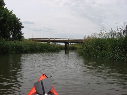
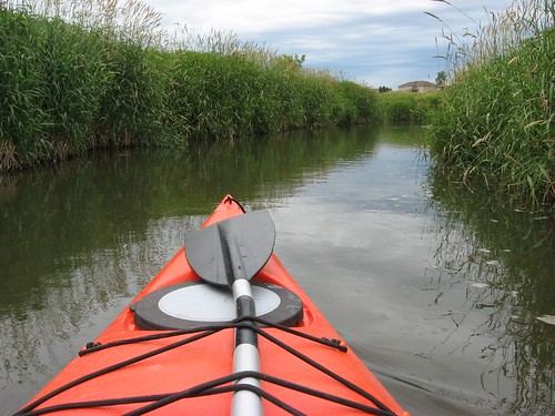
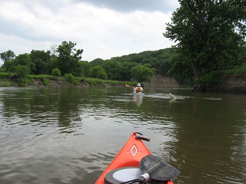
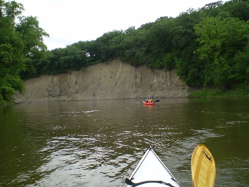
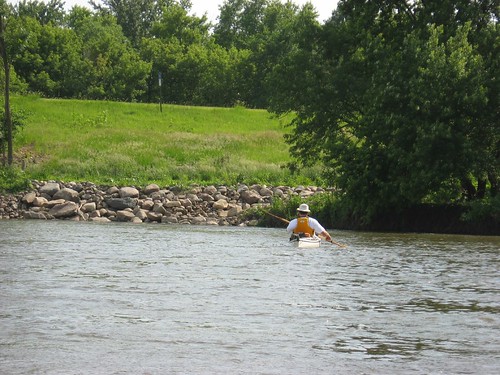
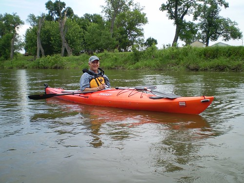
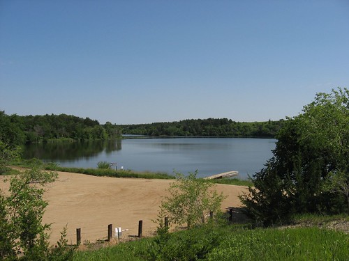
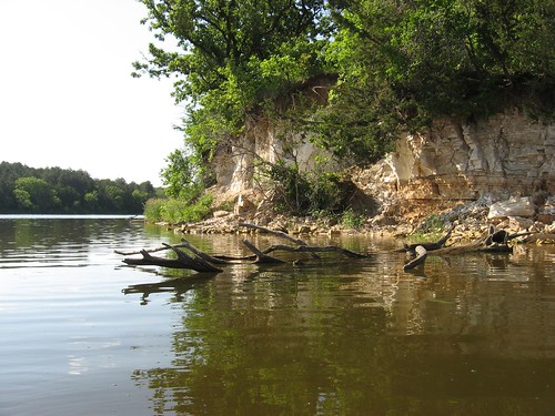
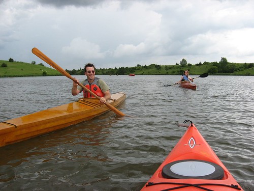
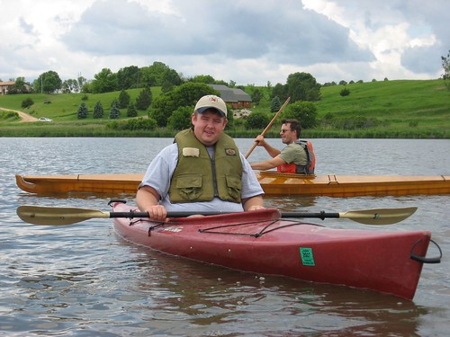
At least once or twice a year, I like to go out to Lake Alvin on a weekday evening for a sunset paddle. During the summer, the public access area at the northwestern part of the lake is generally a more agreeable spot from which to launch. There are often fishermen in that area, but the dock in the state park section is often crowded with people hanging out, and I find it is a little uncomfortable wading into the crowd lounging on the docks with my kayak.

IMG_0973

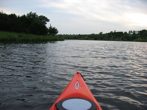
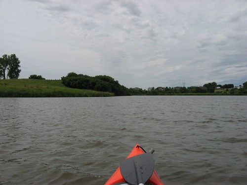
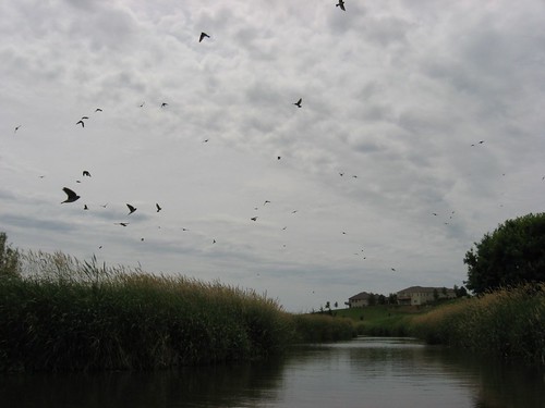
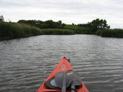
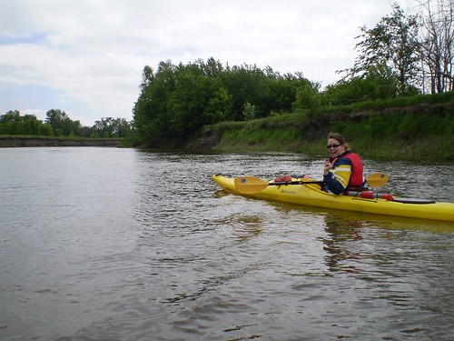
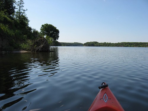
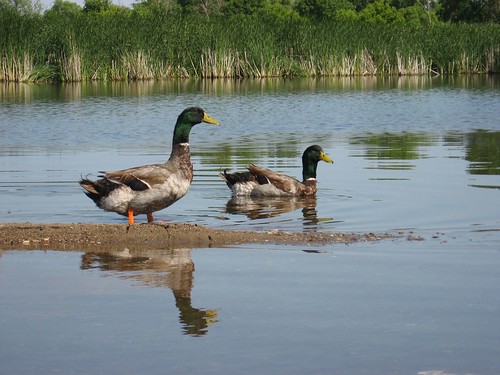
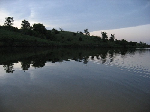
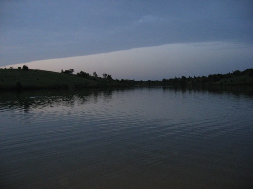
Boaters on the lake begin to thin out, even in the summer, with the approaching sunset. There are usually a couple of fishing boats up in the eastern part of the lake, but I have found these boats pretty quite just sitting in coves making one last effort to catch their limit. Evening is when the birds begin settling down for the night, and I find it interesting to see them looking for a good place to roost overnight. The trees and other vegetation take on a sharper silhouette on the hills surrounding the lake, and the sunset begins to take shape on the horizon, especially when there are great cloud conditions. Even on a hot day, the temperature drops significantly in the evening. Generally, the lake is quite calm, and the ripples from the kayak spread out across the flat water.

IMG_0981

One night last week, I was at home thinking about the great evening, and I just decided to take a sunset cruise on Lake Alvin. I live on the east side of Sioux Falls, near 26th and Sycamore, and I was able to load up and be at the lakeside within 15 minutes. For the first time, I saw lines of nets set out from the shore on both sides of the lake at the western end. I have no idea why the nets were out, but I assume that the SD GFP people must have been trying to deal with an excess population of some type of fish. These nets would pose a navigation hazard to motor boats during the day, I would think. I have never seen nets set out from the shore at Lake Alvin.

IMG_0980

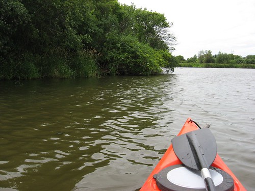
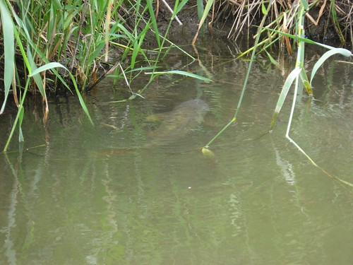
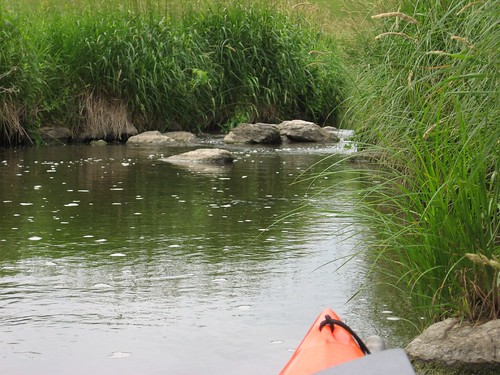
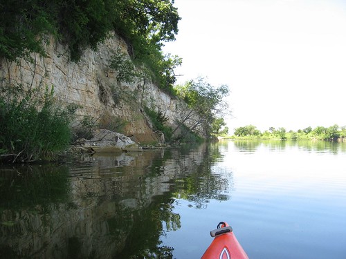
I made my usual cruise along the circumference of the lake, from the western to the eastern end. On my way back into the western part of the lake, the narrower part approaching the launching point, I began to see beaver crossing the lake in front of my kayak. I observed at least six beaver making the crossing from the south to the north shore on this return to the public access area. At a distance of up to 10 feet or so, the beaver seemed unaware of my presence; any closer, however, and they generally dived down and away. Sunset is the only time that I have seen beaver on this lake.

IMG_0982

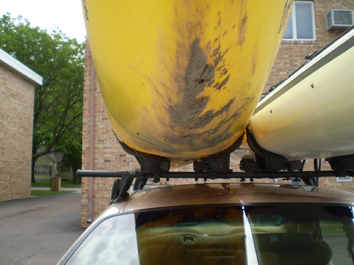
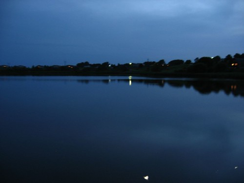
There are a number of homes build up on the hills overlooking the lake, and I was able to see the lights come on within these houses and a few cars moving along the road over the extreme western part of the lake. The launch area is not lighted, so it is probably best to arrive back with at least enough light to get the kayak back on the car. The last time I did this, I arrived back at the dock in total darkness and had some difficulty in loading up my boat. This time, I brought a flashlight, but it was not needed.

IMG_0985

Evening provides a special contemplative time for the solo paddler, and I may well find another opportunity this summer to do a sunset cruise on Lake Alvin.

Tuesday, June 19, 2007

Lake Alvin - Up Nine Mile Creek

Lake Alvin – Cruising Up Nine Mile Creek – June 2007

Lake Alvin is certainly one of the most accessible waterways in the Sioux Falls area, and many of us visit the lake often. For me, the best times to cruise on the lake are weekdays, especially early in the morning or at twilight.

IMG_0987

For a change of pace, I have found it interesting to put my kayak in at the southwestern end of the lake and take a cruise upstream on Nine Mile Creek. As you depart the launching point, it is important to keep to the left bank making your way down to the western end of the lake. The waters off to the right tend to be shallow with a muddy bottom: it is easy to get hung up on the mud banks of that side. The channel seems to run deepest about 15 feet off the left (eastern) bank.

As you approach the end of the lake, there will be a passageway through the aquatic vegetation about 20 feet wide. This is the mouth of the creek as it empties into Lake Alvin.

IMG_0988

The creek twists and turns its way to the south. During the first part of the trip, the creek is fairly wide, and the water is deep enough so that there is little problem with running aground. Early into the cruise, you will pass under the bridge over 479th Ave. Cliff swallows have constructed their conical mud-built nests under the bridge, and clouds of them rise into the air with the approach of a boat.

IMG_0993

IMG_0995

IMG_0998

Past the bridge, the creek varies in width as you move upstream. The course is always very winding, and the depth continues to be okay. There is a high bank on both sides, and lots of birds nest in the grasses. I saw dozens of big carp in the shallower areas of the creek; their large oval mouths were above the surface, and the fish emitted some sort of cough-sounding gasp as they fed.

IMG_1000

Going upstream, I used my double bladed paddle, and on the way back downstream I used a single-bladed bent-shaft canoe paddle that I carried on the deck of my kayak. In a constricted waterway like Nine Mile Creek, I think that is it better to use a canoe paddle because you can keep closer to the shore line and also use it to fend off or to pole along in shallow water. It also allows closer approaches to any wildlife without scaring it off.

IMG_0999

From the launching point at the public access area, it takes about five minutes to approach the mouth of the creek. From that point, it takes about 20 minutes to move upstream to the end of kayak or canoe navigation. The end of possible movement is where the creek becomes too shallow and rocks prevent further passage upstream. Until that point, however, I did not run aground and kept the rudder of my kayak deployed.

IMG_1006

IMG_1001

So, this is a change from just paddling the circumference of the lake, and it takes about an hour to do this cruise: a slower cruise upstream checking out the vegetation, taking photographs, lost in contemplation and a quicker return. I think that this is a wonderful variation for people. My trip took place from 12:25 to 1:30 p.m. on Monday, June 18, with the temperature in the 70s. The key, again, is to keep to the left bank in making the approach to the creek.

Monday, June 11, 2007

Big Sioux River: Brandon to Lake Alvin

The Big Sioux – From Big Sioux Recreation Area (Brandon) to Grandview Country Road (Near Lake Alvin) - June 2007

On Sunday, Jarett Bies and I set out on a trip along the Big Sioux River from the launching point within the Big Sioux Recreation Area located on the edge of Brandon to the state owned access point by the bridge along Grandview County Road on the west side of the river just north of the Lake Alvin State Park. The distance of this run is listed by the SDGFP as 12.8 miles, and it took us about 3 ½ hours. The current on the river was moving fairly fast and there was plenty of water depth. The skies were overcast with a vague threat of a thunderstorm that did not materialize, the winds were light, and the temperature was about 80 degrees during the afternoon paddle.

IMG_0962

The launching point at the Big Sioux Recreation Area is decent, by river standards. We had shuttled my car down to the take-out point and left Jarett’s car there at the BSRA. The course of the river is winding, of course, and there is lots of vegetation along the high banks. There are many large trees along the shoreline and occasional tree trunks rafted together in islands of sorts along the course of the river. There are some cliffs of perhaps 100 feet along the banks as hills have eroded down to the river bank.

IMG_0955

The only wildlife that we observed along the run were owls, hawks, some geese and ducks, and lots of smaller birds. There were some jumping fish, but no mammals were to be seen.

Scattered along the course of the river are sand or gravel bars and occasional beaches. It is easy to find a beach to stop at along the way for a stretch and a short walk, and we stopped once on this trip at such a spot. Most of the river bank, however, is pretty high, muddy, with a fast current running. I thought that there was very little litter to be seen along the river; it was a pretty clean ride.

IMG_0964

Within this 12.8 mile run, there are a few homes built within sight of the river, and we passed one where a couple of guys were fishing. Otherwise, we did not run into any other people on the trip.

There does not seem to be much opportunity to exit the river along this stretch. The Highway 42 bridge near the new Wegner Arboretum has been the site of a lot of construction and development. Although the SDGFP map indicates this as an access point, it would not be an easy take-out at this time. There is a barbed wire fence and lots of newly deposited rock fill at this point. The map also indicates an access point at the Gitchie Manitou State Preserve (Iowa), but we did not recognize any access point in this stretch of the river; so if there is a launching area at this location, it is pretty well disguised.

IMG_0966

There is one hazardous point that should be noted along the river. About a mile north of our take-out spot near Lake Alvin, there is a site where a bridge had stood in the past. The big stone stanchions that supported the bridge are still there, and there is a set of wooden supports that extend along the western shoreline. There is a large logjam that obstructs three of the passageways through the stanchions and the current rushes through the remaining and open slot through this ruined structure. This is a trouble spot along the route, and I recommend great caution at this point. I made it through the slot on my first try but was pushed into the stanchion by the current and had to fend off with my hands to work around it. The current is strong enough to capsize a boat if pressed into the stanchion at the wrong angle. Jarett had trouble working his 17 foot kayak into the turn through the slot and had to make repeated tries. I was downstream along the shoreline waiting for him, and I wondered if he had run into trouble. We shouted back and forth, and after several minutes he came shooting through. There does not seem to be a viable portage around this logjam, although I suppose that a person could drag a kayak around it through the weeds and brush if necessary. Last year I paddled upstream through this spot without too much difficulty. This year, under the present circumstances, I would not attempt it. You can check out my earlier posting for this section of the river in the Big Sioux River section of this blog.

IMG_0969

This trip concluded at the bridge over Grandview Road. There is a pretty well developed parking area and launching point. The actual launching area, however, is very muddy. This mud is deep, soft, and black. Both Jarett and I had our boating shoes sucked off in the mud as we sank 8 or 10 inches into it. There doesn’t seem to a way to avoid the mud; so, if you intend to give this part of the river a try, be prepared to wade through mud at the “take-out” point along Grandview Road.

P6100085

A SD Park sticker is required for the Big Sioux Recreation Area but not for the access point along Grandview Road.

IMG_0970

As always, the time spent on the river seemed longer than we might have anticipated; river trips always seem that way. I would recommend allocating four hours for this 12.8 mile stretch of the river, although we did not break our backs racing downstream. The landform and vegetation are always interesting along the river. There were a couple of riffles that offer a change of pace during the trip, but there was no real concern about rapids or other hazardous conditions – except for the logjam described above.

This was a great Sunday afternoon paddle. It would have been so easy to find an excuse not to go out yesterday: storm clouds gathering, a book to finish, a nap to take, general inertia. But, the older I get, the more I appreciate the need to take advantage of opportunity as it presents itself. I am seldom sorry for taking advantage of an unexpected opportunity to get out; I often kick myself for finding an excuse for inactivity.

P6100076

As Jarett Bies, a former Marine, said: “This was a good op (as in operation).”

Saturday, June 09, 2007

Big Sioux River - Trent to past Dell Rapids

Not for the Meek

A Guest Blog Entry by Jarett C. Bies, Sioux Falls

On the Saturday before Memorial Day my wife Laura and I sought some Big Sioux paddling and we considered several options before choosing a run from Trent, SD, to Dell Rapids. I had done the trip before and she had not, so when I mentioned we could go past Dell Rapids and through the Dells of the Big Sioux River, she said, sure that sounds good.

P5260003

While the day was windy, it wasn’t hot, and so we drove north to Trent (about 30+ miles N. of Sioux Falls) after calling The River of the Double Bend Campground. Deb and Morris Kirkegaard run that campground, and they said they’d be willing to shuttle our car from Trent to our stopping point down river.

We paid them $10 for this service to cover gas and unloaded in the grass at their put-in. The access point is neither easy nor dry, and so we started our journey (at about 1:45 p.m.) with a bit of black mud in our cockpits but with good spirits.

Almost immediately after launching at Trent, one finds the remnants of a lowhead dam near the bridge that crosses the BSR entering the town of Trent. Approaching it from the water it looks scary, with tremendous swells and surges in the water’s surface, but it’s actually fun and besides getting a chilly lapful of water, most folks will have no trouble going through this five-seconds-of-rapids section.

After we went through that part, the river winds were in our face, then our side, then behind us as we snaked south down the Big Sioux. Having the river to ourselves, we imagined fur traders and others who before us had made this trip. There are splendid views along the way, and the trip between Trent and Dell Rapids does feature a number of natural sandy beaches.

We stopped at one beach to stretch, and the wind’s howl was enough to leave us feeling chilled and ready to get back into the cockpit. With all its bends, the Big Sioux is not a trip for the meek; it is a long stretch, regardless of where you start and finish, and beginners should not be coddled. You will have to paddle, working hard, to get down river. This is not a mere float or excursion where resting is the focus.

We reached Dell Rapids (“Just around the bend, I swear it,” I said more than once) City Park around 6 pm. Since we were fresh at the start, I has asked Mr. Kirkegaard to drop our car at a bridge (I believe it is the Colton Road Bridge) below the Dells. I regret that choice, as after 4+ hours of paddling we were both ready to be done.

Wildlife sightings along the way had bolstered our efforts but four hours of anything is indeed a bit much. We saw several owls and a few hawks, also spotted a turkey vulture and a few deer, but early morning or late evening is the best time to see all the critters on the river.

After a snack and some rest, we put back in at Dell Rapids City Park. The journey from Trent to that point is a nice solid 4-hour paddle and is perhaps a better “starter” paddle from Trent down. But we needed to reach our car and so onward we paddled.

On a gear note, my wife recently started using some soft rubber paddle sleeves to avoid blisters. They worked really well; in the past she’s gotten nasty cuts on the webbing between her thumb and forefinger and with these grips she was able to avoid them. The “reduces fatigue” claim the product makes was something we laughed about; our long trip was tiring.

Shortly after the park, the river splits into left and right channels. If you’re doing this trip for the first time, you HAVE TO GO LEFT, otherwise, you’ll face a nasty lowhead dam and a portage. But again, the trip’s level of difficulty goes up; we hit the rapids that give the town its name with a vengeance. A shore fisherman said “You’re going thru those?” and wished us luck.

These rapids, unlike the ones at Trent, are at least 100 yards long. Both of our boats (mine 17 feet, hers 15 feet) were turned sideways and bumped rocks as we passed through. We both realized at a certain point that you have to just let the river do what it will and while we were turned around we were never turned over, so it was a thrill and over before we knew it.

Immediately after that rush of water, the Dells of the river are visible and beautiful. It was worth it to see those towering multi-colored walls. Like the canyons at Palisades State Park in Garretson, SD, the walls fade away quickly and we were back to the same scenery we’d experienced during the four hours above Dell Rapids.

P5260012

Again the twisting river led us to hope that next bend would give way to the car. Kirkegaard said it was about 30 minutes from the park to the bridge. I would clock it at twice that, but finally, shortly after the rivers reconverge, we found ourselves looking at the bridge.

I was able to crawl from my boat on the bank on the west side below the bridge, but the take-out there is murky, weedy, and not for a beginner. There was no way for me, save climbing into chest deep water, to stabilize my wife’s boat for her to take out there, so I grabbed my kayak and told her to paddle to the other side, on the east bank, where there appeared to be an easier departure point.

I was wrong; the bank was clearer but the vegetation gave way to ankle-deep mud. With the fatigue of the day on our shoulders, we did our best to stay calm and find a way for her to exit. Finally I just climbed into the water and man-hauled her and her yellow kayak onto a muddy bank. I was caked from toes to mid-thigh as we hauled the boat up to the car.

P5270022

Folks seeking a long, adventurous paddle with rapids, beautiful scenery and a challenging take-out point will enjoy this route. Softer folks would not enjoy this endurance test. We’d do it again, albeit on a less windy day (and with a lunch packed along) but it’s not a relaxing half-day of fun. It was after 8 p.m. when our boats were loaded and we were driving back to Sioux Falls.

P5270015

The Big Sioux River is close, and challenging, but alas, hit it soon; after July 4 it’s usually not as much fun as water levels go down. Here’s to hoping for June rains! As for the driving distance, it’s a nice option for the determined paddler seeking away-from-folks action on a diverse body of water.

Jarett C. Bies
June 8, 2007

Tuesday, June 05, 2007

Lake Marindahl

Lake Marindahl – June 2007

For a long time I have wanted to visit Lake Marindahl. I had heard good things about it from fellow small boat enthusiasts and colleagues at the University of South Dakota, and today I finally made the trip. This lake is on the outside of my normal cruising perimeter; it is 70 miles from my eastside home in Sioux Falls, and I normally resist spending more time on the drive than I do on the water.

IMG_0950

This morning, I set off in my Honda Civic with the big red kayak on top and drove along secondary roads through the springtime green with Joan Baez singing to me on a set of CDs as the decades dropped away along the drive. I drove down Highway 11 to Canton, west on Highway 18 to 19, through Viborg down to Irene, west on Highway 46 for a few miles until I saw the sign to Lake Marindahl. The sign indicated that the lake was three miles south on 446th Ave. That was the last sign to be seen. With my South Dakota Atlas, I saw that the launching point was at the south end of the lake. From 446th Ave, you have to turn back east to 447th Ave. and go for about a mile or so until you get to 301st Street. At that point, you head north for a mile or so on a gravel road to the State of South Dakota Lake Access point. The launching area is at the extreme south end of the lake just north of the dam and spillway and is well developed with a good gravel approach and parking area, a dock, and a toilet.

IMG_0942

The lake has been created by damming up Clay Creek which feeds into the northern end. It is a beautiful setting with heavy tree cover and high banks at the southern two-thirds of the lake. There are some spectacular cliffs, especially on the eastern side, that are perhaps 100 feet high. The lake is long and relatively narrow with irregular shoreline on both sides. I was impressed with the large trees that are dominate along the southern end. The lake is pretty deep for prairie waterways and is about a third again as large as Lake Alvin.

IMG_0949

There is plenty of variation along the shoreline and high banks so that there would nearly always be a sheltered side. On this trip, the wind was quite light, the temperature was about 70 or so at 9:30 a.m. when I arrived, and there were only a couple of fishing boats out on the water. By the time I returned, I was alone at the site.

IMG_0922

As I cruised up the length of the lake, I moved along the shoreline peering into the growth of trees and bushes and up at the cliffs. As I got further north, there was much more birdlife, including ducks and great blue herons. The tree cover and hills begin to diminish as you move into the northern third of the lake. Still, this is an area where there seems to be more bird life. I saw lots of turtles sunning themselves on logs along the shore and jumping carp in the shallower areas. I did not, however, see any mammal life on this cruise, although the habitat seemed as though it would support a variety of animals.

IMG_0938

IMG_0933

Lake Marindahl is really a jewel of an area waterway. It is a tranquil and beautiful setting that provides great visual variety. It is fun to hover along the shore and stare up at the high cliffs. Still, it is a pretty long drive from Sioux Falls. I spent the whole morning for those 90 minutes on the lake. But then, I am retired and riding along listening to Joan Baez and Bob Dylan is not a bad way to spend the morning. For people who live in Vermillion or Yankton, this would be a great trip to take frequently. For me, I suppose that once a year is probably going to be my scheduled visit to Lake Marindahl.

Sunday, June 03, 2007

Lake Alvin Canoe Festival - June 2007

Canoe/Kayak Festival – Lake Alvin June 3, 2007

IMG_0915

The South Dakota Canoe Association (SDCA) hosted its annual festival of boats at Lake Alvin on Sunday, June 3. This is an event sponsored by the SDCA that provides an opportunity for people to try out a variety of canoes and kayaks that belong to members. People who want an introduction to kayaking often come out to try their hand at one or more of the available boats. Also, people who are interested in the experience of paddling another style of boat are encouraged to take advantage of this opportunity.

IMG_0908

The day began with temperatures in the 70s, light wind, and sunny skies. Within an hour or so after the event began, a thunderstorm developed, and most of us were caught out on the lake or at the launching area and got a little wet. The rain was not cold, however, and we all were able to deal with it just fine. After half-an-hour, perhaps, the rain moved off and the boats were back on the lake. By then the wind was a little stronger, but the sun had reemerged and the day looked good.

IMG_0911

IMG_0913

Pete Larson brought a couple of whitewater kayaks along and demonstrated how to roll them. Rick Johns brought a couple of finely hand crafted kayaks for people to try out. He even did a little fishing from his kayak. ShaRon Kelly had a trailer full of canoes for people to try out if they wished. There were perhaps eight or ten kayaks out on the water most of the time.

IMG_0916

The SDCA sponsors several cruises each season, and these are highlighted in the club newsletter. Joining the SDCA is a pretty good way to keep alert to paddling and fellowship activities associated with canoe and kayak activity. The price is right: $10.00 a year for an individual membership. For those who would like to initiate a membership, just send your information (Name, Address, Phone, e-mail, experience, hobbies/interests) and a check to: Director of Membership, SDCA, P.O. Box 90227, Sioux Falls, SD 57109-0227.

IMG_0906