Scouting the Route – Sept. 2007
The South Dakota Canoe Association is presenting a cruise opportunity next Saturday, September 29, from McHardy Park in Brandon to the bridge over the Big Sioux at Highway 42. I am not going to be able to make the cruise because of an out-of-town commitment, but the SDCA president, Eugene Preston, invited me to accompany him yesterday on a scouting trip along the route.
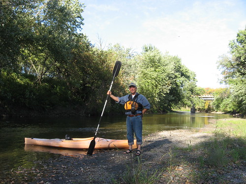
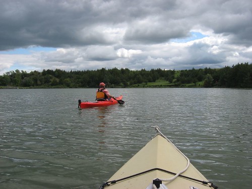
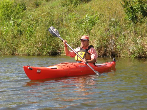
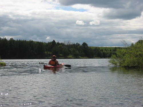
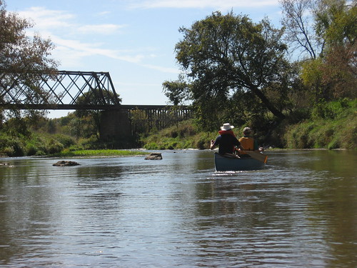
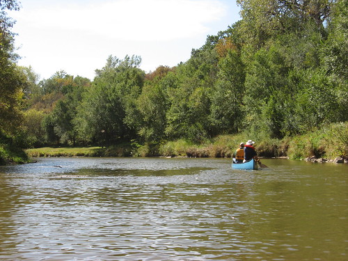
The day was warm, sunny, and windy. Eugene had a friend along as bow paddler in his full-size Old Town canoe, and I had my old “beater” 10.5-foot Dagger kayak. Eugene and his friend had arranged the shuttle from the “take-out” to the “put-in” points, and we set off from McHardy Park about 2:00 p.m.
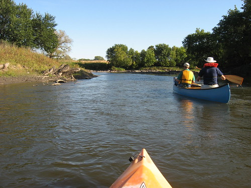
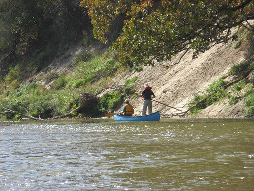
The first challenge of the trip was a couple of riffles within the first hundred yards of the put-in, and we managed these without having to get out of the boats. From that point on, there were alternating stretches of smooth, but shallow, water and occasional sand or gravel bars that have to be avoided or forced through. Eugene had a long thick pole with him that worked very well to lift his canoe some and give him the force to power through some very shallow spots. He was able to stand in the stern of the canoe to check out water conditions and to give him purchase for use of the pole. Generally, I followed in my kayak and had the advantage of seeing his progress and adjusting accordingly. For the first couple of hours, neither of us had to get out of our boats to lift or drag them over a bar.
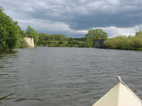
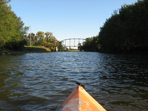
At McHardy Park, the creek is about 25-30 feet wide and it continues at about that width for several miles. As usual on creeks and rivers, there is a high bank along which the deeper water normally flows. On this waterway, it is critical to “read the river” to locate the most likely channel. The water runs at a good flow, and it is laborious to backtrack after becoming caught in a shallow spot. Moving down this waterway is great practice in low-risk “river-reading.” The water depth ranges from a few inches to two or three feet along most of the creek, with some deeper holes. Both the width and depth of the waterway increases as Beaver Creek joins the flow. Split Rock runs into the Big Sioux River south of Huset’s Speedway, and generally the problems of depth diminish and the width of the waterway increases as it flows south.
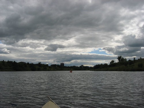
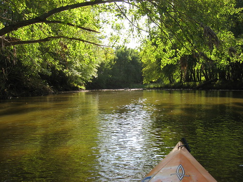
While the day was quite windy, the waterway along Split Rock and the Big Sioux is generally sheltered by high banks and hills. Our progress was hindered somewhat by the wind during some stretches of both Split Rock and the Big Sioux. Split Rock is characterized by a winding course, so the effect of wind is varied. At some points on this trip, the wind would blow us back upstream if we were not paddling. There was no “free ride” on this trip: no just floating along with the current. Trees along the route were changing colors and presented a wonderful sight. This time of year along the waterways the paddler can observe the intersection of summer with fall; only a few trees were bare of leaves, many of them were still green, but there were also many with yellow or orange leaves just beginning to drop to the ground. We came across two single-strand wire fences stretching across the creek along the middle section of the cruise
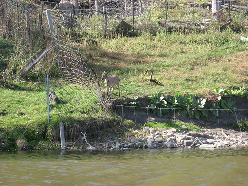
We saw a number of great blue herons, some ducks, and a few hawks. In addition to the waterfowl, though, were the cows we saw along the banks at spots and a group of goats along a hillside farm near the racetrack. We did not see any other people along the way, although at the end we found that a party of two kayaks was about half-an-hour behind us on the Big Sioux.
Split Rock Creek is a really interesting waterway in that it flows just out of sight beyond the woods along Highway 11. Most people passing along would have no idea of the waterway lying just beyond the trees and occasional buildings. And yet, as a kayak makes its way down the creek and into the Big Sioux River, there is a sense of isolation that can make the paddler forget about cities and towns.
The trip this year seemed to take longer than it did last October. Maybe it was the steady wind or the shallow depth at spots along the way. Or, maybe we just maintained a slower pace on the water. Perhaps it just felt longer because I had forgotten to eat lunch or to bring along a snack. From the put-in to the take-out, we spent over four hours on the cruise, and that was a bit long for me. We did get out for a stretch along the way, and we got out twice to lift off shallow bars or riffles. The take-out at the arboretum site near the intersection of Highway 42 and the Big Sioux is a difficult spot. There are rocks to clamor over, a barbed wire fence, a gate, and a very steep bank and pathway up to the parking area.
For this trip, I recommend taking along a lunch, water, some type of footwear that will give good support and still be okay in the water, and a willingness to jump out and lift the boat over sand bars or shallow riffles. I like the Split Rock cruise; next time, however, I will be better prepared.
Eugene Preston will adjust the cruise for September 29 to reflect his observations of this scouting trip. The gathering will take place as announced, but the route might be somewhat altered to accommodate to the water conditions.
The following is a repeat of the announcement earlier on this blog about the cruise. I recommend it to all who wish a kayaking/canoeing outing this next weekend. Eugene is a meticulous planner and organizer. He will do all he can to ensure that this is a pleasant experience for all who chose to take the cruise.
--------------------------------------------------------------------------------------------------

South Dakota Canoe Association SPLITROCK-BIG SIOUX CANOE CRUISE Come and join us for a Fall Canoe Cruise from McHardy Park, in Brandon, to the Highway 38/42 bridge at historic East Sioux Falls (The Arboretum) on Saturday, September 29, 2007. Meet at 1:00 P.M. at McHardy Park in Brandon. This route has short stretches of flat water with gentle class 1 rapids. A pole is useful on Split Rock Creek when the water is low such as last year. Deer, fish, muskrat, ducks, owls and other wildlife may be seen. The cruise takes about 3 to 4 hours depending on the water conditions and the skill and goals of the paddlers. Bring a camera, snacks, and some drinking water and enjoy an afternoon on the water. I always plan an alternate route in case the water on Split Rock Creek is low. The takeout may be altered depending on conditions. Life vests are required for this cruise. For more information contact Eugene Preston 605/582-2573. Eugene Preston, President of the SDCA