
While attending a concert in McKennan Park this past weekend, I ran into a fellow kayaker who reminded me of paddling opportunities at Lake Pahoja, a small lake located near Larchwood, Iowa. I had visited this lake many years ago, but I did not retain much memory of it. Today, I decided to take my kayak out and revisit the area.
I knew that Lake Pahoja was four miles south and two miles west of Larchwood. Even without an Iowa map, I figured that I ought to be able to easily locate the lake. Somehow, though, I missed the right roads and found myself driving around on unmarked highways, gradually become disoriented. After stopping a motorist at an unmarked crossroads, I was directed back to Larchwood. A young lady in a convenience store gave me directions: Drive through Larchwood on Highway 9; at the east end of town, turn south on Highway 182 just before 9 turns on toward Inwood. Continue along on 182 for about four miles until you come to the West Lyon School. Just past the school you turn west on A26, and note the sign on the highway for Lake Pahoja. You go two miles past the school on A26 until you come to a sign directing you into the park off the left side of the highway.
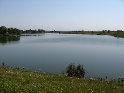
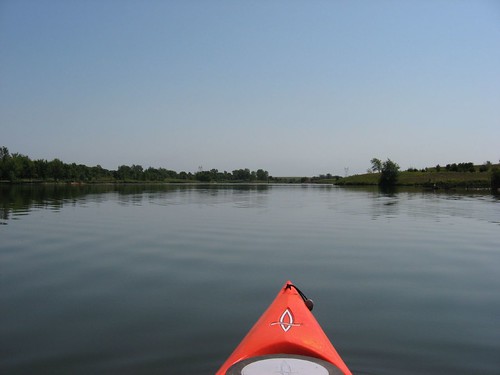
Lake Pahoja is located in Lyon County Park, a very nice camping and recreation area with the lake as the centerpiece. The lake is 71 acres in surface area and has just about two miles of shoreline. The lake is oriented east and west, and the launching area is on the north side; it is a long and narrow lake with many inlets or bays coming off the main body. The widest portion of the lake is in front of the launching area, nearly in the middle portion of the east-west axis.
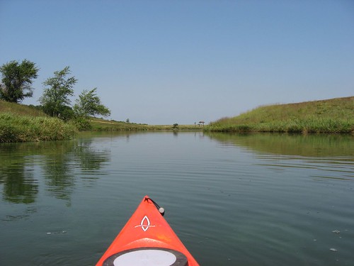
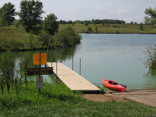
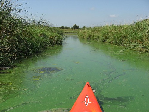
The shoreline surrounding the lake is largely within the boundary of the Lyon County Park. So, the development is mostly park related: swimming beach, camping spots, picnic areas, fishing docks, and hiking trails. There is a $5.00 fee for a daily pass into the park. The launching area contains a ramp and a dock along with a toilet. No gas motors are allowed on the lake. The lake is surrounded by high banks and varied vegetation. There are many little finger bays that radiate off the main body. Both the eastern and the western ends of the lake are the more secluded. I spent just a little over an hour kayaking the circumference of the lake: taking my time, looking over the landform and shoreline, taking photographs, looking around. It was a pleasant day with little wind and temperatures in the high 70s. During this cruise, I noted a good deal of algae growth in shallow areas of the lake, especially in the finger bays and along the lee shoreline.
As I left to return to Sioux Falls, I received better directions for a direct route from the gate-keeper, and here they are in reverse: From Sioux Falls, you go south on Highway 11 past the Lake Alvin exit to 276th Street. There you turn left (east) on 276th, and continue over the Big Sioux River (Klondike) and go on for three more miles. The road becomes A26 in Iowa, but it is still a straight shot east until you see the sign to Lake Pahoja on the right. If you get to the West Lyon School, you have gone two miles too far. From my eastside Sioux Falls home, it is 20.4 miles to the lake.
I did not find Lake Pahoja to be a very interesting paddle. It is okay, but there is little reason to drive past Lake Alvin to locate it. The setting is really fine, and it would be a great place to do some quiet camping in a very well situated and equipped public camping area. There are boat rentals, good areas for bike riding, nice camp sites, and a beautiful environment. For the kayaker, this would be a good place to bring the family along with the kayak. You could spend time with the family and still get in an hour cruise, morning and evening. It would also be a good place to do some fishing. For straight kayaking, however, I would not recommend driving any distance to take advantage of this body of water.
No comments:
Post a Comment