
The dam at the city park is a demarcation point. Downstream, Split Rock Creek descends through rapids and moves through Split Rock State Park. Kayakers in the area use this portion of the waterway for white water thrills early in the spring as the snow melts. Above the dam, the creek continues for a couple of miles to a set of rapids which effectively ends the extended backed up water and limits further passage with a canoe or kayak.
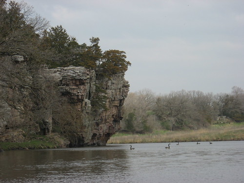
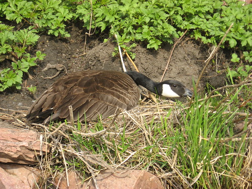
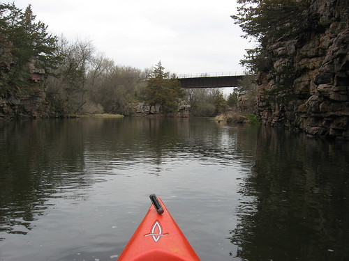
The high palisades on both sides of the creek are spectacular in the way they loom over the waterway. Trees grow improbably out of cracks in the high cliffs and on ledges. There is a wide variety of bird life on this waterway, including a very large colony of cliff swallows during much of the summer. The swallows have not returned yet, but I saw many ducks and geese and a turkey today. The waterfowl seem to be nesting now and present an interesting sight as a kayak approaches. Most of the time, the ducks swim or take off for a short distance. Groups of geese began honking at the sight of my kayak, but those nesting geese seemed almost docile at my approach.
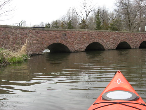
Whenever I go up Split Rock Creek at this location, I almost always head up into Devil’s Gulch to check out that especially secluded little pond community. Departing from the launching point in the park, almost immediately the paddler comes to a four-arch bridge on the right side that leads into the camping part of the park. Passage through one of the arches is easy for a kayak. I usually just approach the arch, lean down, and push off the top of the tunnel until I am through.
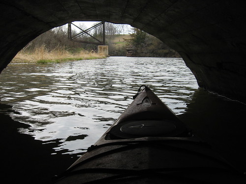
On the other side, the water is deep and wide enough to permit passage for a half mile or so. Moving up this feeder stream, the paddler passes under a railroad bridge and into a new set of palisades on a somewhat smaller scale than those on the main body of Split Rock Creek.
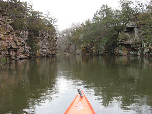
This is a very quiet spot, and I suppose that it is not frequently visited. The palisades, the shoreline, the slowly moving water presents their own attraction. I like to get into the corner of a set of high rock cliffs and just sit there quietly to observe the life in this tranquil spot. I think of the passage of seasons and the flow of events within this secret set of connected pools. Two beaver kept me company up in the gulch today.
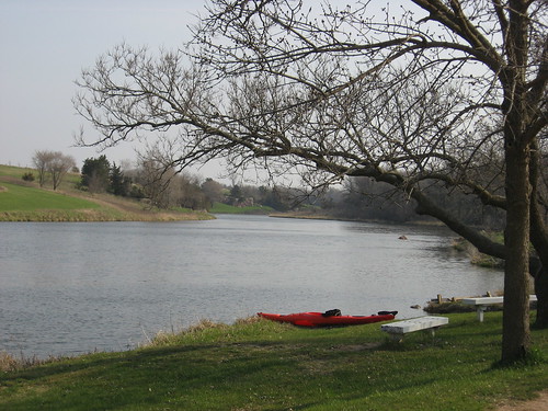
This is a fairly short cruise on Split Rock Creek. Today, I was on the water for about 75 minutes. But, I was alone and able to focus upon the landscape, the birds, and the sky. I like being alone in such surroundings. Garretson is about 22 miles from my eastside Sioux Falls home, so this was a 30 minute drive each way, and it fit one of my basic rules: more time on the water than on the drive. By the time I got home, the skies had become completely overcast and rain seemed likely.
2 comments:
Great pictures! Looks like a nice paddle.
I went out with a friend this past sunday and we launched from palisades state park and kayaked all the way down to McHardy park in Brandon. my primary kayak is a 14'6" old town cayuga. Very scenic and the rapids we went through were awesome. don't know if i would have wanted to kayak it with the water level any lower, as we felt many rocks. very scenic and fun, however.
Post a Comment