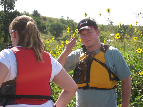
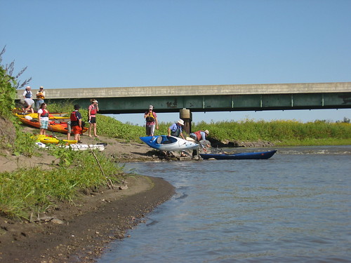
Under the leadership of Jarett Bies, a South Dakota Canoe Association (SDCA) fleet of 16 kayaks set out for a 12 mile cruise down the James River this Sunday morning. The “put-in” was at a public access point at the bridge on State Highway 38, just a couple miles east of Mitchell. An easy launching area along with ample parking is available for canoes or kayaks at this site.


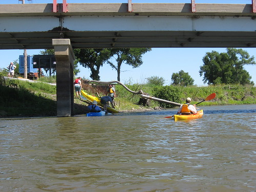
Jarett Bies organized a shuttle service, and a few cars were positioned twelve miles downstream near a bridge at 258th Street, just four miles east of the bridge and three miles south of Highway 38. The highway mileage from the put-in to the take-out is just over seven miles, although the river distance is twelve miles.

There were three boats from Pierre, two from Vermillion, two from Brookings, and others from a variety of communities, many from the Sioux Falls area. The put-in is about 70 miles west of my eastside Sioux Falls home. The informal standard for kayak trips for me is “less time on the drive than on the water.” The roundtrip drive took me about two and a-half hours, and the cruise took about four hours. On this trip, there were no canoes; everyone was in a kayak. There was, however, a tandem kayak along on the cruise, one of the boats from Pierre.

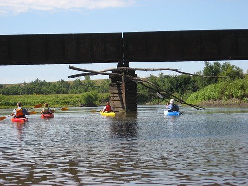
The weather for the cruise was perfect; there was sun the entire day, only a little wind toward the end of the trip, and the temperature was in the high 70s and low 80s. Even wearing a hat with a wide brim, I came home with a red face. There was plenty of depth to the river along the entire course. I never went aground in my kayak, and the water in the channel was usually between five and seven feet deep. Passing under a railroad bridge, previous flooding along the river was quite evident with tree limbs caught in the bridgeworks twenty feet or so over the current level of the river.

The river was, according to the estimates of two civil engineers among us, generally about 150 feet across, and there were no hazards to navigation at all: no rapids, no sand bars, no shallow water, no deadfalls or sweepers across the river, and no fences. The shoreline is varied, but not as much as along the Big Sioux. Generally, there is a high bank on one shore and agriculture just beyond the shoreline. There are usually trees along at least one side of the river, often large trees. We saw little wildlife on this trip. With 16 kayaks moving along the river at mid-day, it is likely that birds and other critters just waited for us to pass.

The river is a little slower than the Big Sioux. One of our group had a GPS, and he informed me that our speed was generally about 3.3 miles per hour. We made one stop along the way to stretch it out.

Even with 16 kayaks on the water, we were spread out for over a mile. Sometimes I paddled along with no one in sight. Other times, I paddled along with one or two people. Conversation groups formed and dissolved as we cruised along. No one was in a hurry; we just cruised along. If someone fell too far behind, one of us would slow down and wait a little while. One of our group was on his first kayak cruise in his brand new boat; he was a novice and learning as we went along. Others were veterans of many kayak trips in a variety of waters.

None of us had been on this stretch of the “Jim” River, and many of us had not been on the James at all before today. We didn’t know what to expect of this river. All of us, though, left with a very positive image of this paddling opportunity. This was a perfect stretch of water for a four-hour cruise. Mitchell isn’t really so far from Sioux Falls, and it is also only a couple hours from Pierre. Kayakers from Pierre often participate on SDCA outings, and it was good to finally have an event within a decent drive for them (Check out Pirates of the Missouri from my kayak links). I drove out on Interstate 90 and just cruised along with no trouble. On the way back, I decided to take the scenic route along Highway 38 and drove back on the two-lane listening to “the best” of Bruce Springsteen on my car CD player.

So, as Jarett Bies would say, “ the intel for the trip was great, and this was a good op.” We all had a great time on the Jim.

You will probably find further descriptions of this cruise on the following blogs which can be accessed through my links: SDCA, Kayak SoDak, Peddle and Paddle, and Pirates of the Missouri.

3 comments:
I wish I would have checked in to see that you were doing this! I would have tagged along. Looks like a good time : )
The best way to keep alert to SDCA cruises is to visit the club website: http://sdcka.blogspot.com. We generally try to host a cruise at least once a month.
Jay Heath
I recently moved back to my home state of SD from WY. Have been considering a goal of canoeing the James River from the ND line to the Missouri R. I would do it in 2-3 day outings over a period of years (probably). Planning to do two stretches this spring between Huron and Yankton. Your 2008 report gave me some idea of travel times. If anyone else has some suggestions, especially for overnight camping areas, please email me. thanks. Jerry Jasmer, Huron - grjasmer@aol.com
Post a Comment