
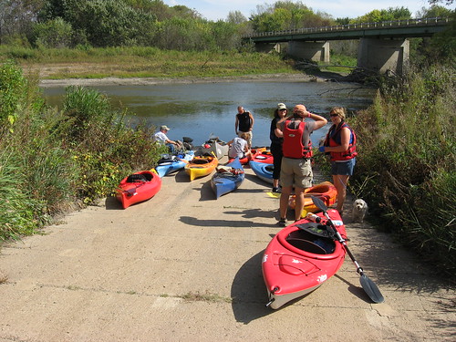
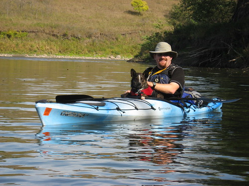
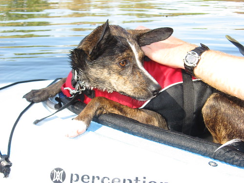
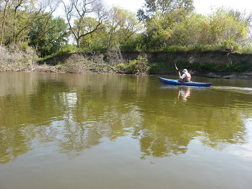
On this last weekend of the summer, the SDCA sponsored a quickly announced cruise on the Big Sioux River from the access area near Lake Alvin to the Klondike Dam located 8.1 miles downstream. Twelve kayaks, one canoe, 14 people, and two dogs showed up on a beautiful late summer Saturday for the event. A shuttle was organized among the paddlers, and the group set out at about 2:30 p.m. under sunny skies, a temperature in the high 70s, and with a south wind blowing down the river.
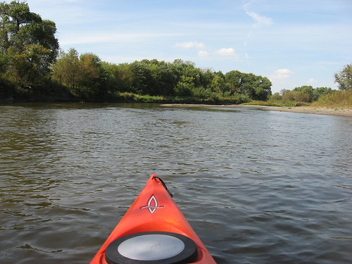
Even this late in the season, there was adequate depth to the river; generally the depth was 2 to 5 feet, although there were spots with deeper water and several spots with the water moving across shallows and sand bars with only inches of depth. Some boats occasionally became stalled in shallow water. I found my boat skimming across sand bars a few times, times when I had to “claw” myself off and into deeper water. It was never necessary, however, for me to get out of the kayak to drag it off a shallow spot. The trick seemed to be in “reading” the river, trying to gauge the course of the deepest channel. The channel shifts between low and high banks, and sometimes even seasoned paddlers make the wrong choice of sides. This sometimes means changing direction quickly and heading for the opposite bank, and this can also sometimes cause the kayak to stall in very shallow water when making the change of course.
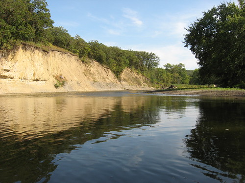
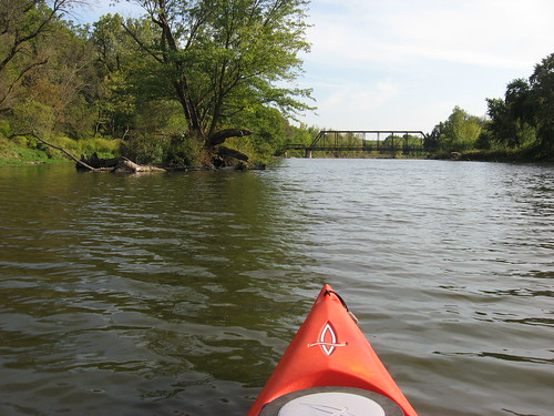
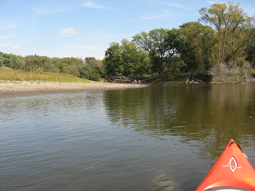
The landscape along this stretch of the Big Sioux River is varied, and there are some steep cliffs dropping down to the river level and hills in the near distance visible along the course of the river. The banks are generally heavily wooded, including very large cottonwood trees. As the season is now turning, some of the cottonwoods have already lost most of their leaves. It is interesting to seen the progression of tree and grass cover in September, and this weekend offered a full range of flora in change. To me, while the colors are beautiful, the message is inescapable: winter is coming. We could have some snow and ice next month. Or, of course, we could have a wonderful and lengthy fall of “Indian summer.”
The paddlers on this trip included seasoned veterans of many years as well as some novice kayakers in their newly purchased boats, some of which were only nine feet in length. Because of this range of experience and variety of craft, the time required to complete the cruise was 2 ½ to 3 ½ hours. The slower flow of the river and the south wind acted as inhibitors to speed on this cruise as well.
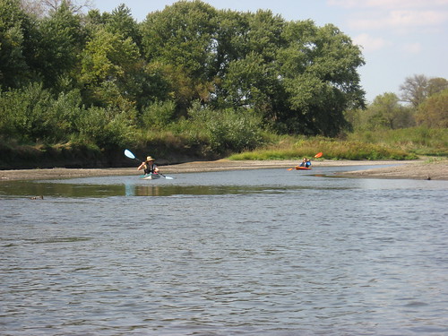
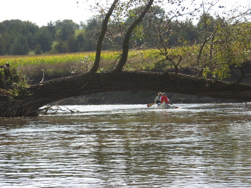
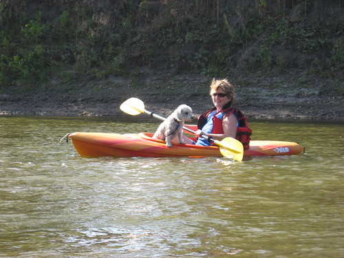
I didn’t observe any wildlife on the cruise other than small birds. We passed a herd of cattle grazing on the SD side of the river about halfway down. The river crosses under a couple of rural road bridges, but there is limited evidence of people, farm buildings, or houses along this portion of the river. There were no hazards to navigation along the course of the river, although the dam at the conclusion of this stretch presents a hazard that requires careful attention. There are warning signs ahead of the dam that give direction to paddlers.
We met a pair of paddlers at the “put-in” who had just completed the trip and their shuttle back from the Klondike. As we were forming up the SDCA group, another pair of boats arrived independently and moved upstream to extend their cruise. So, this is a popular spot for paddlers throughout the season. The “put-in” is, of course, on the SD side of the river; downstream, Iowa maintains a park and access point right above the dam, while SD maintains a similar launching area just below the dam. There has been some work on the dam this summer, and hazard warnings are posted to warn paddlers on the Iowa side.
Group cruises like this provide support to the new paddlers, an opportunity to see a variety of boats on the water, conversation groups that form and dissolve, and a way to strengthen networks formed among people with a shared interest in water travel. It is a nice balance for me between the value of paddling with others and my desire for solo paddling and quiet contemplation and observation of lake or river life. For me, this balance is important, and I enjoy both types of paddling.
For more description of this portion of the Big Sioux River or to read about other sections of the river in the general Sioux Falls area, refer to the menu of area waterways on the right side of the home page of this blog.
1 comment:
This is a stretch of the river my wife and I have yet to travel. We would have loved to join you. Great pictures and write-up. Hopefully, we will keep better track of what's going on in the future so we can make it.
Post a Comment