
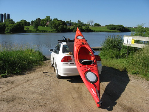
The past week here on the northern plains has been characterized by strong winds and heavy rains, a seemingly endless series of wet days, thunderstorms, day-long drizzle, flooding, and cool weather. Today was forecast as a break in this pattern: a one-day respite before more rain and storms arrive tonight or tomorrow. So, last night I decided to take advantage of the predicted good conditions and loaded up my kayak for a cruise this morning.
About 9:00 a.m., I left my eastside home and headed to Lake Alvin, a quick trip of about 13 minutes south on Highway 11. My last cruise on Lake Alvin was in March, just after the ice went out and the first hint of spring was apparent. On that cruise, I looked for evidence of new growth in the grass along the banks and observed many waterfowl getting ready for the nesting season. The dominate color around the lake in March was brown, still the drab colors of the long winter.
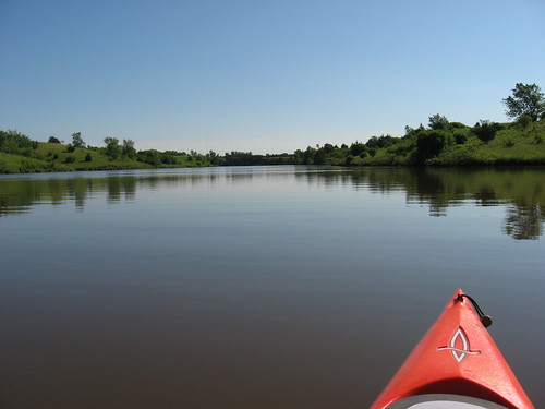
Today, a great transformation has taken place. The two and a-half months has turned the lakeshore into a lush green setting, almost a poster for the beauty of South Dakota in the summer. The temperature this morning was in the high 60s as I set out, and the predicted high today is about 80 degrees. The skies were clear, and there was only a light wind on the water.
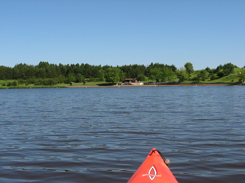
As I set out, there was a fishing boat in sight, but the guy must have been wrapping up his trip; I passed it right away off the launching area but did not see it again. I headed north from the public access area and skirted the shoreline up to the northern end of the lake.
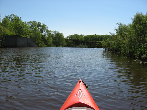
On my way back south, I stopped in at the spillway to check out conditions and found plenty of depth to enter the channel leading to the spillway. The spillway on Lake Alvin does not have any kind of warning signage nor a restraint across it. While it is difficult to imagine anyone foolish enough to approach the edge, it still is something to be aware of for the paddler. The spillway edge is a danger point for a boat, and any kayak or canoe should stand well clear of the edge. It is a long way down into turbulent water.
The lake was nearly deserted, as I usually find most waterways in the area, especially during the week. The swimming beach was empty. I did see a guy who seemed to be preparing a canoe for launch at the recreation area dock and ramp, but I did not see him again.
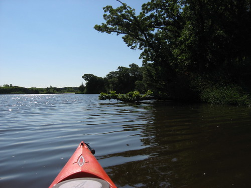
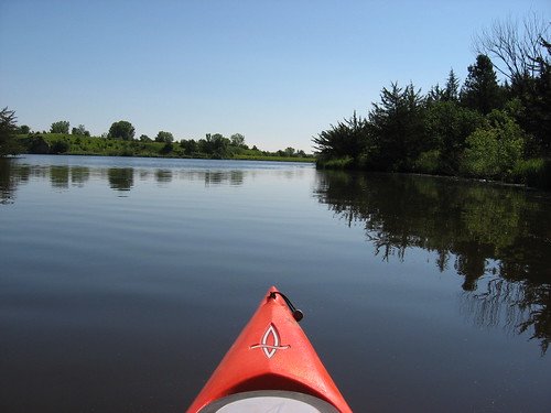
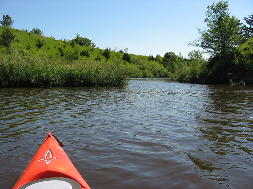
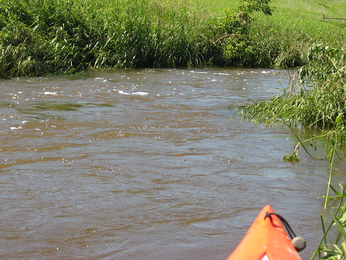
Paddling up to the northern end of the lake and back was a good first step, and that gave me an hour of sustained paddling. Then, I decided to head into Nine Mile Creek to see how it had changed over the past 10 or 11 weeks. The lake gradually narrows down from north to south until it reaches the entrance to Nine Mile Creek. The flow was strong going up the creek, and it got stronger as I continued upstream for a mile or so.
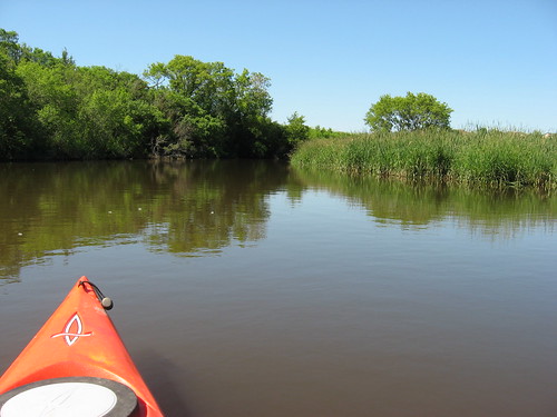
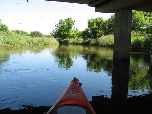
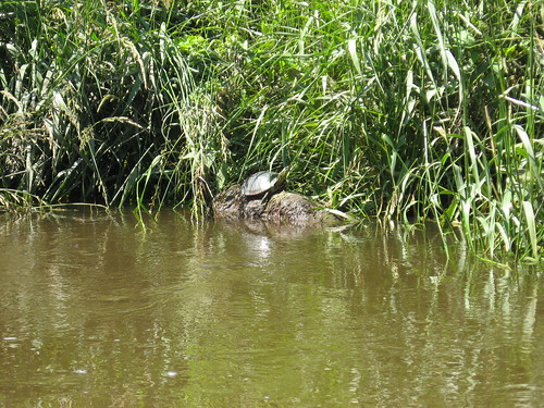
The channel in the middle of the creek was generally around four feet in depth, sometimes up to five feet. I did not see any waterfowl along the creek today, in marked contrast to the many ducks and geese that I saw in March. There were lots of perching birds, such as swallows and redwing blackbirds, that I could see and hear. Birds were calling continuously as I paddled past. There is a colony of cliff swallows nesting under the bridge along the creek course, and they flew about in large numbers as I passed.
I have kayaked Nine Mile Creek many times, always continuing until I have run out of water. Today, after so much rain, I continued upstream until the current was too strong to go any further. I had powered my way upstream as the creek narrowed to only five or six feet, and I was concerned as I tried to back out into the quick flowing current. The creek was too narrow at that point to turn, so I drifted backwards for several yards until I could turn around. The depth of water in this narrow, fast flowing stream was four or five feet. I did not want to get sideways in this stream, unable to turn and subject to being rolled over.
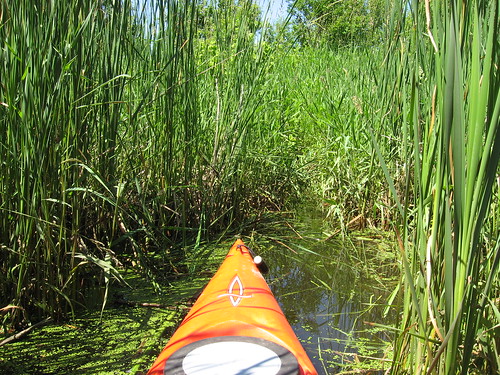
On my fast float back down the creek toward the lake, I was able to just steer and listen to the sounds of birds and the rustling of critters in the weeds along the shoreline. As the current slowed, I decided to check out the marsh on the edge. I like to poke into areas where visitors seldom venture. I went into the marshes about 30 feet, among the cattails and aquatic grasses. I found it easier to bull my way into the marshes than to go backwards out of them. It would be uncomfortable to get stuck in the marsh among the weeds and have to get out of the boat into water up to my knees.
 I spent about two hours on my cruise up to the northern end of the lake and then back into Nine Mile Creek. A chief advantage of going to Lake Alvin is the short time needed for the drive. This lake is a wonderful paddling opportunity for people living on the east side of Sioux Falls. Thirteen minutes from driveway to the dock!

Readers can go to the waterways index on the right side of the blog and check out many narratives about Lake Alvin in all of its seasons.
No comments:
Post a Comment