

With record-breaking high temperatures and a forecast of sun with moderate winds, a cruise organized by Dave and Mary Finck and Larry Braaten down the Big Sioux River was irresistible. A group of SDCKA paddlers met at Lein Park in Sioux Falls for a 12 mile cruise downstream to the Big Sioux Recreation Area on the far edge of Brandon.

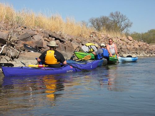
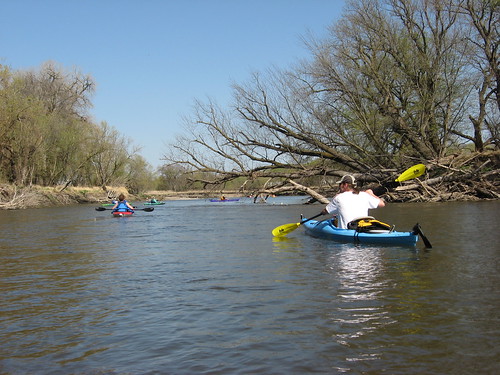
A shuttle was organized to move vehicles from Lein Park to the BSRA, where we left our cars and rode back in Dave Finck’s van. Interestingly, a SDGFP park ranger appeared at the parking area for the shuttle and checked all the vehicles for park stickers. There were 11 kayaks in the cruise paddled by SDCKA members, and, as it happened, another group of five kayaks put in at the same time and were with us some of the time along the cruise.

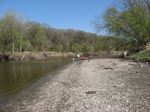
The put-in at Lein Park is about 100 yards or so from the parking area, and Dave Finck organized a carrying-chain of people to move the boats. Each person had one end of their own kayak and one end of another. I found myself gabbing and missed the chance to share the pain in that sort of carry; fortunately, I had my canoe/kayak wheels with me, and it was a simple operation to strap on the wheels and stroll along to the steep bank for the drop into the stream.

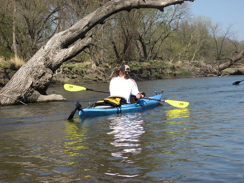
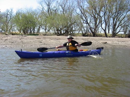
We set out on the stream about 1:45 p.m. and proceeded downstream. This section of the river runs through a relatively flat landscape. The river rolls along between banks of about 5-6 feet in height. There is a variety of bank along the route, some steep and others shelving onto a gravel and mud beach.
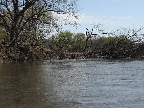
There were a number of old strainers in the water, large trees that had fallen so that they partially blocked the flow. Almost all of these strainers were easily avoided. The river flowed at a good speed, and there was enough depth throughout the course so that grounding was easily avoided. When a kayak did go aground, it was generally easy to ease out into the main channel. The river depth ranged from shallow spots of about 18 inches to perhaps five feet in the mail channel.
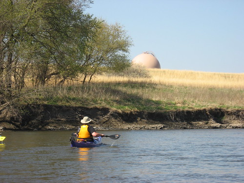
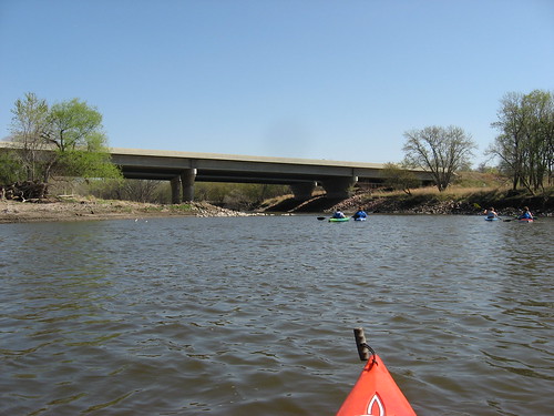
During the first eight miles of this segment, the river flows mostly east and parallels Rice Street. The old nuclear power plant is a landmark that I always notice.
Great Bear Recreation Park is easily visible off to the right, and I found myself looking up at the hills where I like to roam during the summer. Interstate 90 can be glimpsed at times off to the left.
We came across one strainer that stretched across almost all the stream. There was a four-foot gap through the branches, and most of the kayaks made it through this obstacle without difficulty. One of our party, however, had a problem moving through. She had grabbed onto a branch to steady her craft through the passage, but she held on too long and the kayak overturned, spilling her into the river. The current carried her across the river to the far bank with her holding onto her boat. Fortunately, a number of the group assisted her in getting pumped out and reentering the boat.
My kayak was the last in line to pass through the strainer, and the paddler in front of me suddenly decided to head to the shore and portage around the strainer. This seemed like a good idea to me, and I followed suit.

There is never much wildlife seen on these river cruises. We did pass a gigantic eagle’s nest in a big cottonwood tree along the left bank, and there in a high tree along the right bank was an eagle watching the flotilla pass.
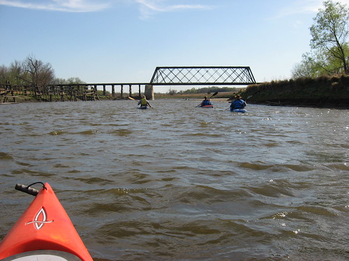
As we approached Brandon, the river took a bend to the south and we found ourselves paddling into the teeth of a moderate headwind. The smooth route east provided shelter from the wind, and this new direction south markedly increased our paddling effort.
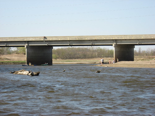
As we moved past Rice Street at the edge of Brandon, we passed an increasing number of people out along the shoreline enjoying the wonderful 90-degree sunny day. People were fishing and playing in the shallow waters. A number of people had dogs with them, dogs running after balls thrown into the water.
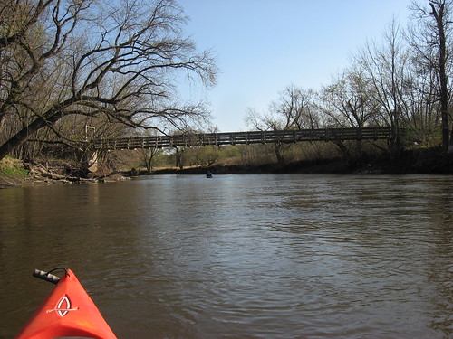
This was a tiring trip for me and for many others of our group. It was an early kayaking trip for most of us, the temperature was record-breaking, and we were paddling against a stiff wind for the last few miles. I was eager to reach the Big Sioux Recreation Area and found myself looking around each bend for the suspension bridge crossing over to the Prairie Vista trail near the archery range of the BSRA.
We arrived at the take-out and rather quickly loaded up our kayaks and departed the area. Beforehand, however, one of our group passed around a pan of delicious fudge style brownies, and I had to restrain myself for asking for a second.
With the marvel of electronic gadgetry, I was informed that the trip was just short of 12 miles and that we had spent three hours paddling with another 45 minutes in stops along the way.
2 comments:
Sweet post, Jay! Thank you for sharing your tales and images, kind sir.
Thank you for the posts. We have a new route to try now!
Post a Comment