 |
| Dave Finck at Rest Stop Put-In for Silver Lake |
In the summer of 2006, I visited Silver Lake, just 7 miles
north of Freeman, SD, with Jarett Bies, currently the president of the South
Dakota Canoe/Kayak Association. I have had vague plans to revisit this body of
water over the years and finally got around to it this morning. Dave Finck, one of my kayaking pals,
expressed interest in traveling to Silver Lake, and he offered to take his
canoe and trailer rather than load up our kayaks.
 |
| Receding Shoreline along Silver Lake |
We set out on a glorious fall day here on the northern
plains; it was about 37 degrees as we left Sioux Falls for the 45 mile drive
southwest to Silver Lake under sunny skies with only light wind.
 |
| Rest Stop Put-In along Highway 81 |
The western shore of Silver Lake is alongside US Highway
81. A rest stop with vault
toilets, a picnic table, and a turning and parking gravel apron are provided at
this site along on the eastern side.
It is easy to carry a canoe or kayak down from the parking area to the
lakeshore.
 |
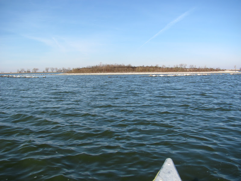
| Waters of Silver Lake |
The state provides a public access area on the eastern side
of the lake. As is common on South
Dakota lakes, there is no signage to point the way, but it can be reached by
turning east on 271st Street, just north of the lake, and continuing
one mile to 440th Avenue and then turning south for about a mile.
 |
| Public Access Area on East Side of Silver Lake |
This public access site, however, is a derelict set on a
receding shoreline with a broken pier.
The area seems as thought it has been the location for beer parties,
with broken glass and trash strewn about.
The shoreline has receded several feet, and it would be impossible to
launch a boat at this point.
 |
| Derelict Public Access Area on East Side of Silver Lake |
Launching a canoe or kayak would require wading out several feet into
deep grey mud. For the time being,
this access point is useless for boats.
 |
| Receding Shoreline of Silver Lake |
On my previous visit in 2006, we also tried first to launch
from this public access area, but the lake is open to the west and subject to
heavy wave action when the wind is driving across the mile of open water. On that visit, the waves were crashing
in on the eastern shore, and we thought it prudent to go back to Highway 81 and
enter at the rest stop.
 |
| Shallows of Silver Lake |
The drought this summer has affected Silver Lake more than I
have seen on other area waterways.
There is a band of several feet between the normal and existing
shoreline. Setting off in our canoe from the rest area along Highway 81, we had
to claw our way out into the lake through water less than a foot deep. Even up to 50 or 60 feet offshore, the
depth was frequently only 18 inches or so.
 |
| Rocks Showing in Shallow Waters |
Throughout our cruise, we rarely came across depths that
exceeded four feet. When the South
Dakota Game Fish and Parks survey crews reviewed lake in 2008, the maximum
depth was seven feet and the average depth was 3.5 feet. So, while we did not have to get out of
the canoe to drag it off a shallow spot, a common characteristic of the lake today
was shallow depth.
 |
| Flocks of Birds Over Silver Lake |
The lake is described by SDGFP as 393 surface acres, nearly
four times the size of Lake Alvin.
It is oblong in shape with an east to west width of about one mile and a
north/south length of also a mile, including a large bay located on the
southeastern end of the lake. The shoreline generally includes a thin fringe of
trees, usually only one or two trees deep. The western shore is largely open, leaving the surface
susceptible to prevailing westerly winds.
It would not take much of a breeze to create major wind wave action
across the surface.
 |
| Island in Silver Lake |
There is a low island located in the central area of the
lake, and I found it impossible to resist landing on the island for a stroll
around.
This island has no trees,
only bushes set in sandy soil.
 |
| Pelicans off Island in Silver Lake |
There were many pelicans loitering about the eastern shore of the
island; the interior seems ideally set as a rookery for geese and other
waterfowl during their nesting season.
 |
| On the Island in Silver Lake |
We walked around the island looking at the plant life,
shells, rocks, and traces of birds and fish. The water seemed deeper around the island than in some
central areas of the lake itself.
 |
| On the Island in Silver Lake |
The flock of pelicans left the island shore as we approached
and flew off to another spot on the northeastern shore.
 |
| Pelicans on Silver Lake |
There must have been nearly 20 pelicans
in the group, and I was surprised to see them still here. Temperatures during
the night have been falling to the high 20s or low 30s, and it seems time for
these magnificent birds to wing their way further south to more agreeable
climes.
 |
| The Bay on Southeastern Side of Silver Lake |
Our tour of the lake continued past the public access area
on the eastern side and into the large bay on the southwestern end.
We were able to enter the bay and
paddle a hundred yards or so before being stopped by the shallow depths.
 |
| Dave Finck Paddling on Silver Lake |
We backed around through the muddy bottom and continued our
clockwise cruise back to the “put-in” at the rest stop on Highway 81.
 |
| Contrails Above the "Fly-Over" State |
The water was quite calm and the only navigational
difficulty was the shallow water and occasional rocks that would normally have
been deep under the surface. We
were concerned about the possibility of having to get out of the canoe to drag
it through shallows; the deep mud suggested that we would sink up to our knees
in the mud if we had to exit the canoe.
As it happened, though, we were able to continue without incident for a
two-hour cruise around the shoreline.
 |
| Waters of Silver Lake |
It is always gratifying to be able to go out in a canoe or
kayak this late in the season.
The
water is cold, and soon the lakes will start to freeze.
There are only a limited number of
cruise opportunities left in the year, and many of us want to squeeze whatever
we can out of the remaining season.
By the time we got off the water around noon, the temperature had risen
to about 50.
It was a great day to
be out on the water!
For those interested in the full set of photographs from this Silver Lake Cruise, please access my Flickr Account at the following URL:
http://www.flickr.com/photos/jayheath/sets/72157631898694110/
To view my 2006 narrative of the first Silver Lake cruise, please look at the area waterways menu along the right side of the blog for the Silver Lake link.


No comments:
Post a Comment