
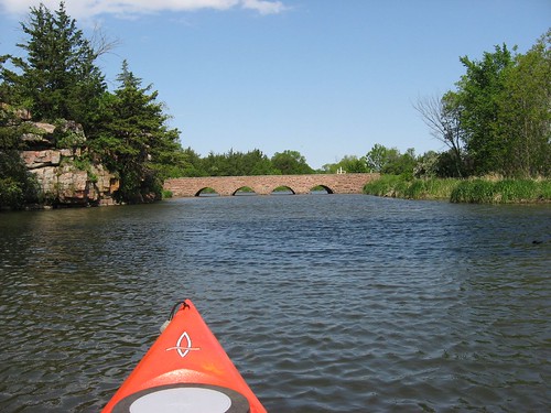
Today, Wednesday, May 16, I took my kayak to Split Rock Creek for a first cruise of the season on that body of water. As I have many times before, I went to the Garretson (SD) city park to put in just upstream of the dam located within the park. The day was party sunny with a moderate breeze and about 50 degrees at 9:00 a.m.
The park was pretty busy for a mid-week morning. The “SS Jesse James,” a pontoon boat based there, arrived while I was on the water and took on a compliment of elementary school passengers for a cruise up the creek. The Minnehaha Sheriff inmate van also arrived with prisoners who were put to work painting park tables and benches. City workers from Garretson were also sprucing up the park in anticipation of the approaching summer season. Then there were also a couple of people fishing below the dam.
The city park on Split Rock Creek is well maintained by the City of Garretson. There is a camping area, a quartzite building used to house the concession operation, playground equipment, toilets, a shelter for picnic tables, and a launching area for canoes or kayaks. The launching area is just a sand ramp; there is no dock on this body of water. The pontoon boat mentioned above uses this ramp for loading passengers for cruises up to the rapids about a mile upstream.
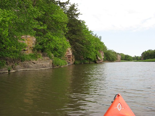
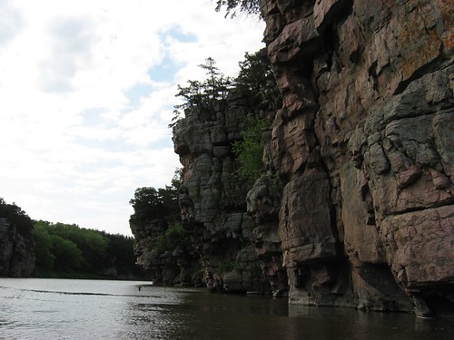
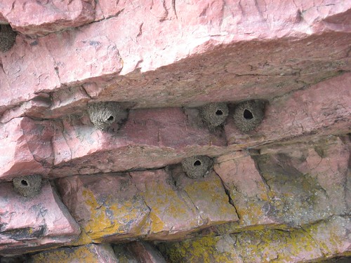
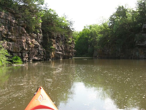
This waterway is characterized by high quartzite palisades towering above the water. Spruce trees have grown out of some of the cracks and along ledges. Cliff swallows are found by the hundreds along the high rock cliffs. These fast flying birds build gourd shaped mud nests along the cliff walls. The skipper of the SS Jesse James told me that the birds had just returned to the area within the last couple of days. They have been pretty busy in that time, and their work can be seen while cruising along the cliffs.
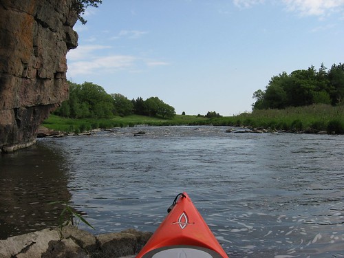
Just upstream of the launching ramp is a stone bridge over Devil’s Gulch, a waterway that winds its way up among the palisades, under a railroad bridge, to a tributary of Split Rock. On this trip, as often before, I made my way through a stone culvert under the bridge and moved on into the gulch. This is a very quiet area of high cliffs, intense vegetation, and very calm water. This is a very peaceful area for contemplation of nature and a time of silence while marveling at the types of vegetation and the magic nature of this sanctuary in the midst of a well-used park.
This waterway does not have any spots for easy exit from the water other than the launching ramp. Furthermore, it is just upstream of a dam. On this trip, both the wind and the current were against me, and I thought about how a loose kayak would quickly go over the dam. The launching area does not seem dangerous to me, but a novice kayaker might experience some anxiety about being swept over the dam. I think that I would recommend that first-time kayakers or canoeists find a lake for that experience rather than being concerned about current and a nearby downstream dam. For experienced paddlers, however, this is a very scenic area for a 60-90 minute cruise. When my sons are home in the summer, this is a spot that I always take them for a kayak cruise.
No comments:
Post a Comment