A Guest Blog Entry by Jarett C. Bies, Sioux Falls
On the Saturday before Memorial Day my wife Laura and I sought some Big Sioux paddling and we considered several options before choosing a run from Trent, SD, to Dell Rapids. I had done the trip before and she had not, so when I mentioned we could go past Dell Rapids and through the Dells of the Big Sioux River, she said, sure that sounds good.

While the day was windy, it wasn’t hot, and so we drove north to Trent (about 30+ miles N. of Sioux Falls) after calling The River of the Double Bend Campground. Deb and Morris Kirkegaard run that campground, and they said they’d be willing to shuttle our car from Trent to our stopping point down river.
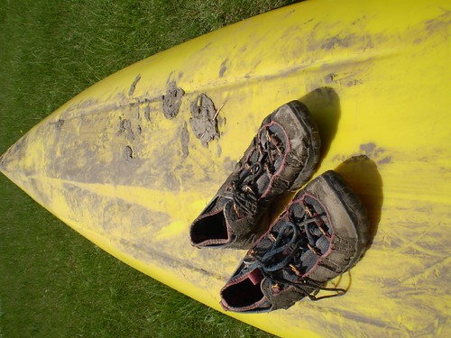
We paid them $10 for this service to cover gas and unloaded in the grass at their put-in. The access point is neither easy nor dry, and so we started our journey (at about 1:45 p.m.) with a bit of black mud in our cockpits but with good spirits.
Almost immediately after launching at Trent, one finds the remnants of a lowhead dam near the bridge that crosses the BSR entering the town of Trent. Approaching it from the water it looks scary, with tremendous swells and surges in the water’s surface, but it’s actually fun and besides getting a chilly lapful of water, most folks will have no trouble going through this five-seconds-of-rapids section.
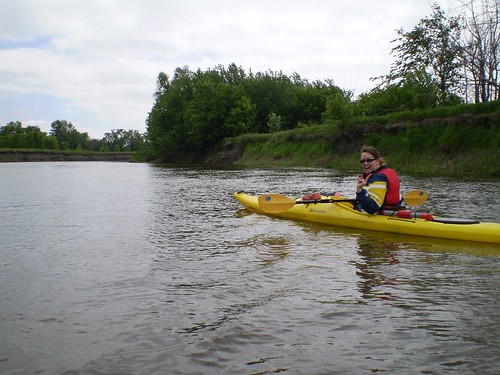
After we went through that part, the river winds were in our face, then our side, then behind us as we snaked south down the Big Sioux. Having the river to ourselves, we imagined fur traders and others who before us had made this trip. There are splendid views along the way, and the trip between Trent and Dell Rapids does feature a number of natural sandy beaches.
We stopped at one beach to stretch, and the wind’s howl was enough to leave us feeling chilled and ready to get back into the cockpit. With all its bends, the Big Sioux is not a trip for the meek; it is a long stretch, regardless of where you start and finish, and beginners should not be coddled. You will have to paddle, working hard, to get down river. This is not a mere float or excursion where resting is the focus.
We reached Dell Rapids (“Just around the bend, I swear it,” I said more than once) City Park around 6 pm. Since we were fresh at the start, I has asked Mr. Kirkegaard to drop our car at a bridge (I believe it is the Colton Road Bridge) below the Dells. I regret that choice, as after 4+ hours of paddling we were both ready to be done.
Wildlife sightings along the way had bolstered our efforts but four hours of anything is indeed a bit much. We saw several owls and a few hawks, also spotted a turkey vulture and a few deer, but early morning or late evening is the best time to see all the critters on the river.
After a snack and some rest, we put back in at Dell Rapids City Park. The journey from Trent to that point is a nice solid 4-hour paddle and is perhaps a better “starter” paddle from Trent down. But we needed to reach our car and so onward we paddled.
On a gear note, my wife recently started using some soft rubber paddle sleeves to avoid blisters. They worked really well; in the past she’s gotten nasty cuts on the webbing between her thumb and forefinger and with these grips she was able to avoid them. The “reduces fatigue” claim the product makes was something we laughed about; our long trip was tiring.
Shortly after the park, the river splits into left and right channels. If you’re doing this trip for the first time, you HAVE TO GO LEFT, otherwise, you’ll face a nasty lowhead dam and a portage. But again, the trip’s level of difficulty goes up; we hit the rapids that give the town its name with a vengeance. A shore fisherman said “You’re going thru those?” and wished us luck.
These rapids, unlike the ones at Trent, are at least 100 yards long. Both of our boats (mine 17 feet, hers 15 feet) were turned sideways and bumped rocks as we passed through. We both realized at a certain point that you have to just let the river do what it will and while we were turned around we were never turned over, so it was a thrill and over before we knew it.
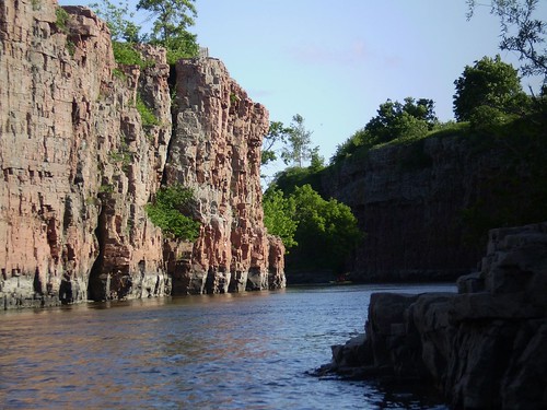
Immediately after that rush of water, the Dells of the river are visible and beautiful. It was worth it to see those towering multi-colored walls. Like the canyons at Palisades State Park in Garretson, SD, the walls fade away quickly and we were back to the same scenery we’d experienced during the four hours above Dell Rapids.

Again the twisting river led us to hope that next bend would give way to the car. Kirkegaard said it was about 30 minutes from the park to the bridge. I would clock it at twice that, but finally, shortly after the rivers reconverge, we found ourselves looking at the bridge.
I was able to crawl from my boat on the bank on the west side below the bridge, but the take-out there is murky, weedy, and not for a beginner. There was no way for me, save climbing into chest deep water, to stabilize my wife’s boat for her to take out there, so I grabbed my kayak and told her to paddle to the other side, on the east bank, where there appeared to be an easier departure point.
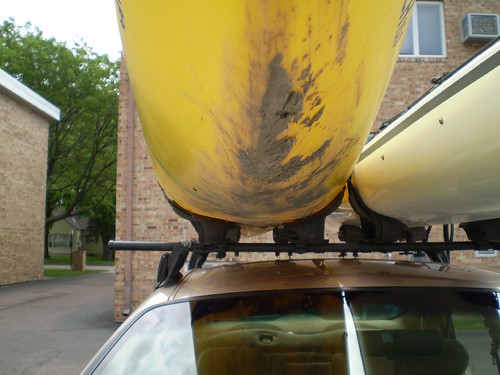
I was wrong; the bank was clearer but the vegetation gave way to ankle-deep mud. With the fatigue of the day on our shoulders, we did our best to stay calm and find a way for her to exit. Finally I just climbed into the water and man-hauled her and her yellow kayak onto a muddy bank. I was caked from toes to mid-thigh as we hauled the boat up to the car.

Folks seeking a long, adventurous paddle with rapids, beautiful scenery and a challenging take-out point will enjoy this route. Softer folks would not enjoy this endurance test. We’d do it again, albeit on a less windy day (and with a lunch packed along) but it’s not a relaxing half-day of fun. It was after 8 p.m. when our boats were loaded and we were driving back to Sioux Falls.

The Big Sioux River is close, and challenging, but alas, hit it soon; after July 4 it’s usually not as much fun as water levels go down. Here’s to hoping for June rains! As for the driving distance, it’s a nice option for the determined paddler seeking away-from-folks action on a diverse body of water.
Jarett C. Bies
June 8, 2007

1 comment:
What bridge did you get off the river at?
Post a Comment