
On Sunday, Jarett Bies and I set out on a trip along the Big Sioux River from the launching point within the Big Sioux Recreation Area located on the edge of Brandon to the state owned access point by the bridge along Grandview County Road on the west side of the river just north of the Lake Alvin State Park. The distance of this run is listed by the SDGFP as 12.8 miles, and it took us about 3 ½ hours. The current on the river was moving fairly fast and there was plenty of water depth. The skies were overcast with a vague threat of a thunderstorm that did not materialize, the winds were light, and the temperature was about 80 degrees during the afternoon paddle.
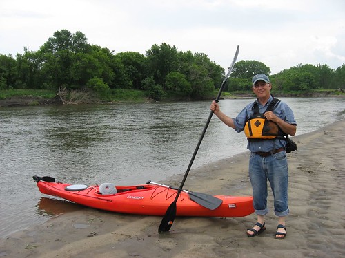
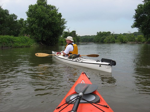
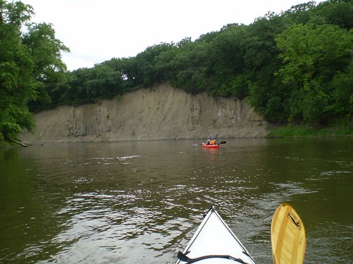
The launching point at the Big Sioux Recreation Area is decent, by river standards. We had shuttled my car down to the take-out point and left Jarett’s car there at the BSRA. The course of the river is winding, of course, and there is lots of vegetation along the high banks. There are many large trees along the shoreline and occasional tree trunks rafted together in islands of sorts along the course of the river. There are some cliffs of perhaps 100 feet along the banks as hills have eroded down to the river bank.
The only wildlife that we observed along the run were owls, hawks, some geese and ducks, and lots of smaller birds. There were some jumping fish, but no mammals were to be seen.
Scattered along the course of the river are sand or gravel bars and occasional beaches. It is easy to find a beach to stop at along the way for a stretch and a short walk, and we stopped once on this trip at such a spot. Most of the river bank, however, is pretty high, muddy, with a fast current running. I thought that there was very little litter to be seen along the river; it was a pretty clean ride.
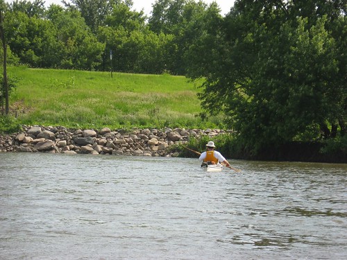
Within this 12.8 mile run, there are a few homes built within sight of the river, and we passed one where a couple of guys were fishing. Otherwise, we did not run into any other people on the trip.
There does not seem to be much opportunity to exit the river along this stretch. The Highway 42 bridge near the new Wegner Arboretum has been the site of a lot of construction and development. Although the SDGFP map indicates this as an access point, it would not be an easy take-out at this time. There is a barbed wire fence and lots of newly deposited rock fill at this point. The map also indicates an access point at the Gitchie Manitou State Preserve (Iowa), but we did not recognize any access point in this stretch of the river; so if there is a launching area at this location, it is pretty well disguised.
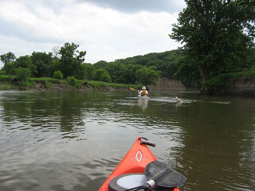
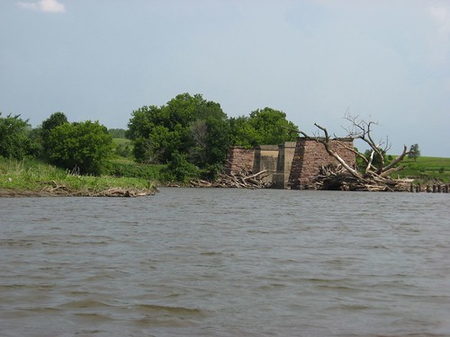
There is one hazardous point that should be noted along the river. About a mile north of our take-out spot near Lake Alvin, there is a site where a bridge had stood in the past. The big stone stanchions that supported the bridge are still there, and there is a set of wooden supports that extend along the western shoreline. There is a large logjam that obstructs three of the passageways through the stanchions and the current rushes through the remaining and open slot through this ruined structure. This is a trouble spot along the route, and I recommend great caution at this point. I made it through the slot on my first try but was pushed into the stanchion by the current and had to fend off with my hands to work around it. The current is strong enough to capsize a boat if pressed into the stanchion at the wrong angle. Jarett had trouble working his 17 foot kayak into the turn through the slot and had to make repeated tries. I was downstream along the shoreline waiting for him, and I wondered if he had run into trouble. We shouted back and forth, and after several minutes he came shooting through. There does not seem to be a viable portage around this logjam, although I suppose that a person could drag a kayak around it through the weeds and brush if necessary. Last year I paddled upstream through this spot without too much difficulty. This year, under the present circumstances, I would not attempt it. You can check out my earlier posting for this section of the river in the Big Sioux River section of this blog.
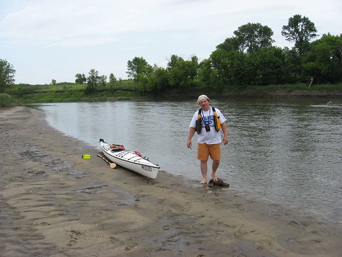
This trip concluded at the bridge over Grandview Road. There is a pretty well developed parking area and launching point. The actual launching area, however, is very muddy. This mud is deep, soft, and black. Both Jarett and I had our boating shoes sucked off in the mud as we sank 8 or 10 inches into it. There doesn’t seem to a way to avoid the mud; so, if you intend to give this part of the river a try, be prepared to wade through mud at the “take-out” point along Grandview Road.
A SD Park sticker is required for the Big Sioux Recreation Area but not for the access point along Grandview Road.
As always, the time spent on the river seemed longer than we might have anticipated; river trips always seem that way. I would recommend allocating four hours for this 12.8 mile stretch of the river, although we did not break our backs racing downstream. The landform and vegetation are always interesting along the river. There were a couple of riffles that offer a change of pace during the trip, but there was no real concern about rapids or other hazardous conditions – except for the logjam described above.
This was a great Sunday afternoon paddle. It would have been so easy to find an excuse not to go out yesterday: storm clouds gathering, a book to finish, a nap to take, general inertia. But, the older I get, the more I appreciate the need to take advantage of opportunity as it presents itself. I am seldom sorry for taking advantage of an unexpected opportunity to get out; I often kick myself for finding an excuse for inactivity.
As Jarett Bies, a former Marine, said: “This was a good op (as in operation).”
4 comments:
Jay -
Thanks for the great commentary. I enjoy reading and hearing about new parts of the river to navigate.
If you ever need a kayak partner - you have my email.
Steven
Hello,
is there a forum or notification system for local kayakers if they want to put together an event or just a spur of teh moment outing or even join you in one of these? If not could you please start a Yahoogroup or something like that so we can plan? I would like to do a James river or sioux river trip or even a short one..
Thanks!
10:52 -
That sounds like a great idea and I have been brainstorming ideas just like that.
I'll try and put something together and have Jay post it on his site.
Stay posted!
Steven
Jay & 10:52-
I have created an account for discussion.
I'm also working on forming a new kayaking organization in SD. Hence the group name.
I'll add more information later - but here is the initial link.
http://groups.yahoo.com/group/prairieriverriders/
Feel free to join the online group and start new threads. I will add features, stories, links and photos soon.
Steven
Post a Comment